Showing posts with label Napa County. Show all posts

Wednesday, November 5, 2014

Finding Refuge at Pope Canyon by Lake Berryessa

Date: May 24, 2014
Place: Pope Canyon, Lake Berryessa, Napa County, California
Coordinates: 38.624490, -122.323297
Length: about 3 miles in and out
Difficulty:  easy (under normal weather conditions).  Moderate, if going down to the creek.

We returned from our hike at Smittle Creek and crashed in the campsite. The heat was too intense to do anything. The chikas and their friend went down to the lake and submerged for hours in the brown, murky water of Lake Berryessa. The adults slouched around in various states of sleepiness.

At 4:00 pm I managed to get up and announced that we'll be going to another hike. It was hot no matter what, I argued, so we might as well find a more attractive place to spend the rest of the afternoon than the over-crowded campground where the booming noise of jet boats was pounding into our cooked brains.
It took a long time to get the children up from the lake, feed them (and us) and get ready to go. Then one of our friends who were camping with us, had decided he preferred to remain in the campsite. His son decided to stay with him. So eventually it was just us Quails with one of our friends went to hike at Pope Canyon Trail.

We did not have a proper map of the area, just a flier we got from the campground personnel. It had a simple illustration of the roads and the trail and a brief description how to get to the trailhead. Although it was unmarked, we did find it without too much trouble, because it was the only apparent trail beginning at that segment of Pope Canyon Road.
We parked the car at the small pullout, hoisted our water packs and cameras and plunged into the woods.
The trail is an old, apparently unused (or very little used) dirt road. From the road it descends towards the creek between a forest of live oaks.

It was hot under the trees but quickly got much hotter when we reached the creek and the trees disappeared as we followed the creek from above.

We didn't see any animals along the way. Not even lizards. They too, were taking refuge from the intense heat. Only crazy humans would be walking out in the sun in this weather.
The flowers, however, didn't hide anywhere.
California Poppy (Eschscholazia california)
There weren't many, but enough to keep me focused on the hike. My companions, on the other hand, have begun showing signs of heat exhaustion.
Lupine (Lupine sp.)
We stopped under a bush that was big enough to cast sufficient shade. I tried pushing the heat off my mind and explore the nearby flowers.
Coyote Mint (Monardella villosa)
There was plenty of time to take a closer look. Apparently, we weren't going anywhere from under the bush.
Coyote Mint (Monardella villosa)
Pushing on until someone succumbed to heat stroke was definitely not on our plan. Looking below, however, I suggested we should continue forward and find a way down to the creek, where we could cool off in the water. The idea was tempting enough to get the chikas from under the bush and we moved on.
Pope Canyon, view east
On the flier we had there was a short broken line that marked a trail going down to the creek. Deciding we had walked far enough we started looking for it.
Naked Buckwheat (Eriogonum nudum)
We found it, right around the cliff overlooking the canyon. The thought of soon dipping in the water had us almost running down that trail.
Pope Canyon, a view from the main trail
The downward trail turned out to be almost fully overgrown with vegetation. It sure has been a long time since anyone went down that way. We had to push our way through the thicket, often worry whether the trail would be at all passable. At least the bushes were blooming.
Yerba Santa (Eriodictyon californicum)
We did make it down eventually. There was more shade below, and also one very pleasant surprise: a spicebush in bloom!
Spicebush (Calycanthus occidentalis)
At the bottom of the trail we faced another obstacle. One that almost had us give up in despair. Between the end of the trail and the creek bed grew a field of high, sticky and thorny weeds.
After our campground rattle snake encounter we were all worried about meeting them in the tall grass. Going through these weeds was difficult, and we couldn't see a trail going down the last ledge over the creek. At that point Papa Quail and the chikas were ready to call it quits.
I wasn't ready to give up yet. Not when we were so close! So while the rest of my family sat in the shade at the bottom of the trail, gathering their energies to go back up I scouted some more in the field of weeds.
The Great Barrier Weed
My dogged stubbornness eventually paid off - I managed to find a path to the creek through the weeds and a patch of willows. I went back to my family to find that my friend was already half way up the trail. With renewed energy I run up and convinced her to go back down, and together we plowed through the narrow path in the weeds and found ourselves at last near the water.
Pope Creek, view east
It was late afternoon and the shadows were getting longer, but still haven't reached our side. We found a place to cross the shallow stream to the shady south bank. Papa Quail laid down on the pebbles and dosed off while all the rest of us stripped and entered the water.
Pope Creek, view west
The water, shallow, murky, and overgrown with algae as it was, was heaven to us. We felt the heat leaving our bodies and our minds go clearer with every inch of skin submerged. We found pockets of deeper water where we sat with just our heads poking out. Then, after we cooled enough, we went up the stream to explore a bit.
Blow Wives (Achyrachaena mollis)
The place is truly beautiful. I wish we'd had more time to explore it properly. If only it wasn't that hot!
By that time, it was getting pretty late. We needed to get back up while there was daylight still. So with much regret we got out of the water, dried off and dressed up. Papa Quail, who'd had a good rest, found the energy to lift up his camera again.
Killdeer
Going up was easier than going down. The temperature has dropped somewhat, and the shadows were longer. Rejuvenated by the creek water we made it back to the main trail and were on our way to the car.
Soap Plant (Chlorogalum pomeridianum), with a visitor
The sun was setting, so we had to hurry.

Going back
Back at the campground, the chika's friend got annoyed when the girls shared our creek's experience with him and complained how come I didn't tell him we'll be swimming. How could I tell him how close we were all to have missed this swim! All I said was that I didn't know that we would, and that much of going someplace new is about exploration and discovery. It's all about taking the chance and seeing what's out there.


Friday, October 10, 2014

A Scorching Day at the Smittle Creek Trail by Lake Berryessa


Date: May 24, 2014
Place: Lake Berryessa, Napa County, California
Coordinates: 38.574654, -122.244607
Length: about 4 miles
Difficulty: easy

Last Memorial Day Weekend we went with friends to explore Lake Berryessa. The lake, nestled in the hills east of Napa County, is a large recreational area and provides plenty of opportunities for outdoors fun for vacationers, including a few hiking trails.
We arrived at Putah Canyon campground on Friday evening. After the excitement of our arrival, which was much enhanced by the sighting of a small rattle snake right by our campsite, we had a quick dinner, pitched our tents and went to bed.
We had planned a long weekend of Nature fun and lots of hiking. Not in our plan was the triple-digit day time temperatures.
Night time temperatures were only slightly lower. It was hot and muggy and the people in the neighboring campsite had a loud domestic dispute late into the night. In short - we didn't sleep well at all. What cheered us was the sighting of a very close by osprey nest.
An osprey nesting on a power line pole, at Putah Creek Campground. 
We headed out to the hiking trail right after breakfast, hoping to put as many miles bend us before the heat became unbearable. The campground personnel suggested a few trails and we selected the Smittle Creek Trail, which is south of Putah Canyon Campground where we stayed.
This trail connects the Oak Shores Day Use Area. We left our cars at the north one and begun hiking south along the lake shore.

I didn't expect to see much green this late in spring and indeed, the grasses were in advanced drying state. The sloping hillsides were covered with live oaks and very soon we were thankful for every spot of shade we got when the trail delved into the forest.
Coyote Mint (Monardella villosa)
The grassland underneath the oaks wasn't just greenish-yellow. It was also dotted with quit a few colorful late spring wildflowers.
Yellow Mariposa Lily (Calochortus luteus)
Lake Berryessa is quite large but, like other California lakes, has lost much water in the course of the recent drought.
Lake Berryessa
We didn't see the woodpeckers, but their work was all around us to see.

Grub-hunting woodpecker holes in a dead oak trunk
The most common woodpecker in that area is the acorn woodpecker. Their larders where everywhere.
An empty acorn larder, ready to be stocked. 
Live oaks are the dominant tree species there, but other trees can be found here and there. The madrone, as usual, stands out with its bright red, peeling bark.
California Madrone
Another tree we saw there was the California Buckeye. Still in bloom, like a big, festive candle chandelier.
California Buckeye (Aesculus californica)
The temperatures were rising. Soon we were halting under every little patch of shade along the way to gulp some water and wipe the sweat off.

Frequent stops means more attention to the little things. Things that are camouflaged too well to notice on a fast walk.


Or not camouflaged at all, but too common to otherwise stop for.
Twining Snakelily (Dichelostemma volubile)
At some point we found that our friends were no longer with us. They have continued fast down the trail without realizing we weren't following them. We didn't hurry to keep up. The chikas were getting exhausted by the heat and there were just too many pretty flowers too look at closely.
Harvest Brodiaea  (Brodiaea elegans)
The trail meanders along what used to be the lake shore and now is far above the water line.
How extended drought and water overuse look like at Lake Berryessa
The exposed lake bed was reclaimed by vegetation. Not trees yet, but if this drought continues (I sure hope not!) then the forest might make its way back into the valley floor.
Pricklyburr (Datura inoxia)
By then it was very hot indeed. Had we all stayed together we might have made the decision to turn back. Since our friends have disappeared ahead we had no choice but to continue on and let the flowers brighten the mood.
Giant Blue-eyed Mary (Collinsia grandiflora)
I found there a common member of the chaparral community. It was interesting to see it all alone, in a non-chapparal area.
Chamise (Adenostoma fasciculatum)
Heat waves were rising from the ground. The whole scenery, beautiful as it was, was swimming in front of my eyes.
Live Oak forest
Looking down, avoiding the glare of the sun. Seeing the little flowers that reveled in it.
Pincusionplant (Navarretia sp.)
And the lizards who were celebrating it.

And then, all of a sudden, we were one curve away from the Oak Shores Day Use Area Area and the end of our trail. Are friends were waiting for us there and as they saw us approaching they started waiving and shouting. Seeing them, Papa Quail took our younger chika by the hand and plunged into the vegetation,  cutting through were once used to be a lake's cove over to the picnic area. The elder chika was on the trail ahead of us so I continued after her. Soon I was very thankful for it because of all the lovely clarkias that were decorating the last portion of the trail.
Woodland Clarkia (Clarkia unguiculata)
We reached the picnic area and slumped under a picnic area shade canopy. Our original plan was for all of us to return the way we came but that was not going to happen. Not in that heat. After some rest and some snack one of our friends and I started back to get the cars. A gopher snake crossed our path.
Gopher Snake
After the first trail curve my friend suggested we cut straight through the hill to Knoxville road for a shorter, quicker walk.
Cutting through the brush isn't normally quicker, but the road was pretty close and I agreed. It wasn't easy going up the hill but we did reach the road without too much trouble, and got to see some more flowers along the way.
(Leptosiphon sp.)
We got the cars and headed back to the campground. The kids run straight to the water and the adults collapsed in the shade. After I rested enough I got up to prepare lunch and I noticed Papa Quail aiming his camera to the sky. There was the osprey, getting lunch as well.
Osprey with the Catch of the Day, flying over Lake Berryessa
She had a very good reason too - a hungry youngster was waiting for her at home :-)
Osprey and young in the nest, Putah Canyon Campground
It wasn't until much later in the afternoon before we were ready to go out for another hike.


Thursday, February 6, 2014

An Impromptu Hike at Bothe-Napa Valley State Park

Date: January 20, 2014
Place: Bothe-Napa Valley State Park, Calistoga, California
Coordinates: 38.55120, -122.51997
Length: About 5 miles
Difficulty: moderate to strenuous

It being so soon after a long winter vacation, we didn't plan any big trip for the Martin Luther King's Day weekend. A one day hike was enough for us. I have planned to take my family to Angel Island so we packed up food and water for the whole day and we arrived on time to the Oakland ferry just to discover that it doesn't run to Angel Island until spring.
We stood at the depot with our full backpacks and wondered where to go next.
I was recently reminded of cedar waxwings and I recalled that the first time I ever saw these beautiful birds was at Bothe-Napa State Park, on a persimmon tree right by the visitor center. I immediately suggested that we go there.
It's been a few years since we've been there last. The chikas were very young and we didn't walk much. Now we had the opportunity to do a proper hike there.
The park is a bout 6 miles south of Calistoga on Hy 29 and it took us about an hour to drive there from Oakland. When we got there we found no attendant at the gate, a closed visitor center, and no brochures of maps available. Having gone there on an impulse we did not have the map with us and I wondered how far out we should go without one. Then I spotted a ranger coming to empty the self-registration stand and I approached him, asking for the park's brochure. He handed me a flyer with the map of the campground and the marking of the trailheads, which did not satisfy me. I kept asking questions about different trails and eventually he pulled his one copy of the park brochure with a detailed trail map from his vehicle and gave it to me.
American Robin, near the visitor center
As it turned out, The map was very useful (if the ranger happens to read this, thank you!), and not only for us. All along our hike we run into people who weren't sure where to go next. Based on this I'd say that people who plan to go hiking at Bothe-Napa Valley State Park (or at any other California State Park, I guess) would be prudent to download and print the brochure map before going.

Map portion scanned from the park's brochure. Our hike is labeled yellow.
The Ritchey Creek, along which we hiked most of the time, originates at a spring and has a year-round flow. It was nice to see running water in January of the worse drought year California is experiencing in many years.
Ritchey Creek
Although it was already late morning, it was quite cold when we started on the trail. We had planned to be under full sunlight in Angel Island and were not prepared for the deep chill of the shady woods. All of us were huddled in our light sweaters and I hugged my chikas on both my sides and urged them to walk quicker. Eventually we run into a small, but effective ascend that had warmed us up enough.
Occasionally too, the sun rays broke through the canopy and lit up patches of the forest. At that point I got warm enough to pull my hands out of my sleeves and turn on my camera. As always: the pretty bark of a madrone tree made the perfect photo subject.
California Madrone (Arbutus menziesii)
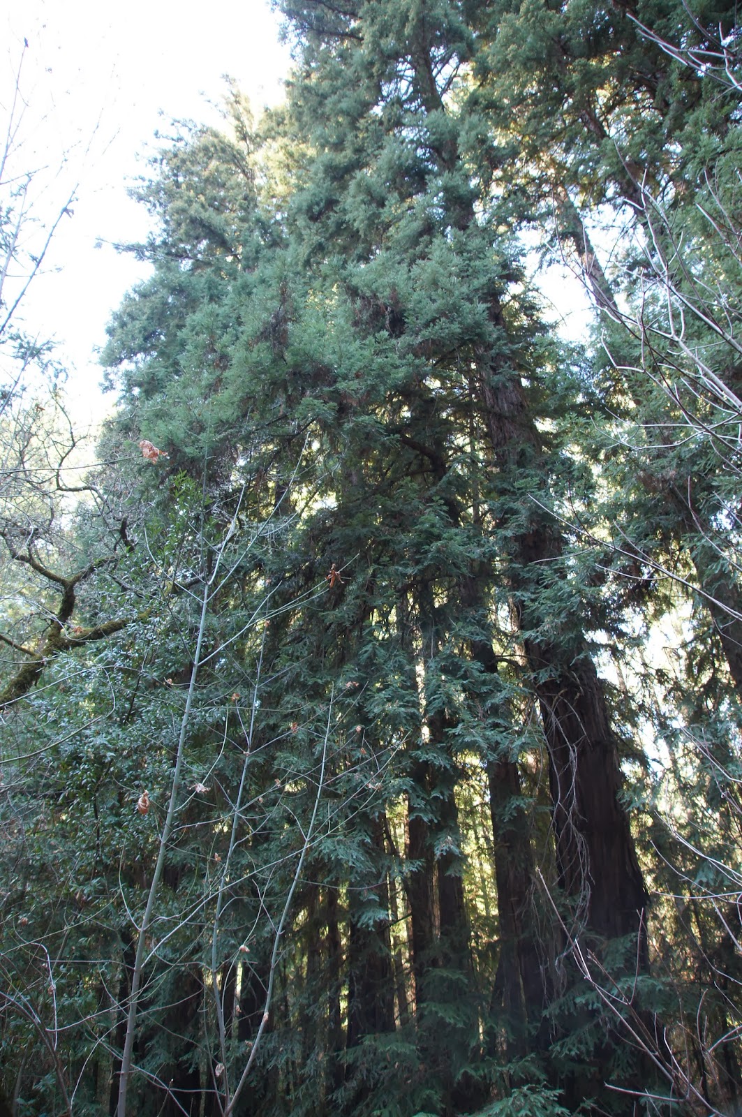
The park prides itself on the redwood trees. Although we did not see any giants, even the younger, slimmer redwoods are impressive.
Redwood (Sequoia sempervirens)
We went on along the creek going up at a gentle slope. We originally took the Redwoods Trail, which goes along the southern bank of the creek, but all the time we had in view the wider Ritchey Canyon Trail that went parallel to us along the northern bank.
At some point the elder chika announced that she saw a cat on that trail, across the creek. I lifted my binoculars to my eyes and couldn't believe our luck: for the second time in two months I was looking at a bobcat. And this one, too, was nonchalant. Walking to and fro, aware of our presence but not caring all that much. Not enough to run away, anyways.
Humans? Bah!
Papa Quail was busy photographing the cat with every move it made. Eventually it started trotting down the trail in the opposite direction of our hike. Papa Quail followed along on our side of the creek and when he got tired of photographing the cat's behind, he whistled.
And the cat turned its face to the camera :-)
Seriously? A whistle? What am I, a dog?
That truly was the turning point of the hike. Suddenly the chill was forgotten and all the whines and complaints quelled. Giddy and excited we dashed along the trail, ready to meet the next surprise. 
The Redwood Trail ands at the creek. We crossed on the rocks and met with the Ritchey Canyon trail. Then we had to decide weather to loop back to the car or go on forward. At that point I was really glad that I got the map from the ranger because without knowing where the trail was headed we would have certainly gone back at that point.
The end of Redwood Trail
We went on uphill, joined by two other hikers who had no map and did not want to stray too far. Soon, the Ritchey Trail forks. We took left (straight, really) onto the wider Spring Trail, which crosses the creek on a small bridge, and continues uphill in steep slope. At the end of Spring Trail there's the actual spring, all fenced away. At that point the trail suddenly narrows and disappears between the trees. We followed the trail in a single file all the way uphill. At the meeting point with Ritchey Canyon Trail the forest becomes chaparral and the view opens up.

This was the only true sunny spot in our entire hike. And it isn't a convenient stopping place so we didn't stay there for long. Just enough to notice this pretty hummingbird, enjoying the warmth:
Anna's Hummingbird
We started downhill on the Ritchey Canyon Trail and immediately plunged back into the woods. The trail segment all the way down to the first creek crossing is very steep and slippery and caution should be taken going down there.
Despite the drought, the forest air felt cook damp. Many of the downed wood had fungi growing on them.
The fungi, an essential component of the forest ecosystem, decompose dead organism and release the nutrients back into the ground to be used for new growth. The fungus lives its life underground or within the dead wood, out of sight. Unless, of course, it's fruiting.
Fungi fruiting bodies growing out of a felled tree.
The shade was thick and there was very little undergrowth. Of what did grow under the trees, I found this delicate plant the prettiest, even without its inside-out flowers:
Insideout Flower (Vancouveria hexandra)
After crossing the creek the slope became gentler and the trail widened again. We continued walking on the north side of the creek and Papa Quail continued searching for the little brown birds that chirped in the vegetation. Eventually, with a lot of patience and some luck, he spotted one that was staying put long enough to be photographed:
Fox Sparrow (Sooty)
We didn't run into the bobcat again. More and more hikers were coming up the trail, though. Soon we were going past the Hitchcock Site, where the area's once owner used to have a home, and past the campground.
At the Hitchcock Site
Half a mile of an easy walk later we were back at the staging area. I wasn't sorry one bit for missing out on Angel Island. It would wait for another day. We've hiked in a beautiful redwood forest and seen a bobcat: what more could I ask for?
Creek and Redwoods and what turned out to be a very nice day.
And, yes. We did stop at one winery on the way back home. We were in Napa Valley wine country after all.

Many thanks to members of the California Native Plants Society for their help in identifying plants!