Showing posts with label Surprise Canyon Wilderness. Show all posts

Tuesday, January 2, 2024

Challenge's Sweet Rewards: Backpacking Surprise Canyon, Day 3


Date: December 20 2023
Place: Surprise Canyon Wilderness, Inyo County
Coordinates: 36.115455, -117.142173   
Length: 3.5 miles
Level: extreme


It rained for a few hours during our second night up Surprise Canyon. By midnight the rain had stopped, but the wind continued intermittently throughout the night. My sleep was also intermittent and disturbed with new worries about possible flooding. Where we camped was high enough from the creek and it was safe, but I worried about the possibility of getting stuck up the canyon if the water level rose too much because of the rain. 
When I woke up for the final time in the morning, there were leftover clouds in the sky, and a lovely rainbow over the ridge on the east. The weather was cool and the air still - the wind had died down too. It was a beautiful morning. 
Rainbow

The canyon below us looked as calm and serene as it was on the morning the day before. I listened carefully to the nearby creek trying to pick up if it sounded stronger than yesterday. It might have been louder, or perhaps it was my imagination. 

We had breakfast and broke camp without needless lingering. We both were in agreement that it would be best to get down the canyon right away, knowing already that the downhill path wasn't an easy one and would take time. We also had a long drive ahead of us after being done with the hike. We packed everything, and after a short discussion, decided to stay wearing our hiking shoes rather than change right away to the muck boots with which we ascended the canyon on our first day. 
Our hike as captured by my GPS

When we crossed the creek to the north side I tried to assess the flow. It did seem slightly stronger, but not by much. As far as I was concerned, we were good to go on. I had my half a liter thermal cup full with freshly brewed tea and A.S. had a single drinking bottle full. Neither of us bothered to fill the rest of our water containers. The creek was flowing all the way down from where we camped, there wpuld be no problem getting more water if we needed too. 
Surprise Creek

The sky was slowly clearing up from the few clouds left of last night's storm. Inside the canyon it was still pretty dark though. Surprise Canyon is oriented east to west and we'd have to wait until the sun cleared the south ridge to get directly illuminated. So far we have not yet felt direct sun and I was hoping for that to happen. 
Surprise Canyon, view downhill

The first part of our descend was easy. We walked briskly along the narrow gravel trail on the north side of the canyon. I was in the lead and I paused briefly here and there to take a few photos, but hardly as many as I did on the way up. 
Notch-leaved Phacelia, Phacelia crenulata

We made a steady progress down the canyon. Meanwhile the peaks of the north ridge above us lit up with direct sunlight. There were hardly any clouds above us now. 
Surprise Canyon, sunlight on the north ridge

Fairly quickly we reached the part of the hike where we had to get through water. Too quickly, I thought. I didn't remember having to walk through much water above the Limekiln Spring on our way up the canyons two days ago. I guess the creek flow was higher this morning. A.S.'s shoes were waterproof and the flow wasn't too high, so he stepped confidently in the water. My shoes which started their hiking career as waterproof, were too warn out to keep the water out. I didn't feel like switching to my muck boots though. I sighed and followed A.S., trying to be more careful where I stepped. 
Surprise Creek

Naturally, we walked slower now. A.S. said that he was hopeful we'll get back to Chris Wicht Camp where we were parked by noon. My latest estimated time to finish the hike was at 2:00 pm. I didn't pause as much to take photos now, since we had come this way on our way up. Still, there were some sights that lured me too powerfully. 
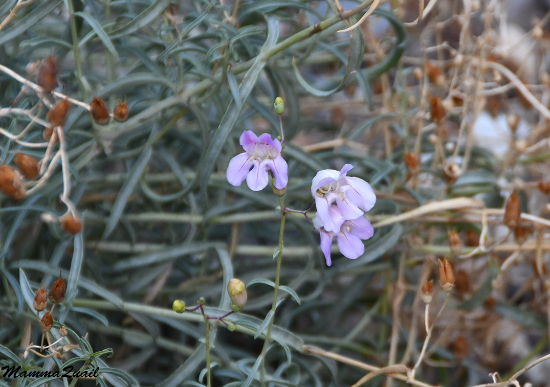
Death Valley Penstemon, Penstemon fruticiformis 

We reached Limekiln Spring and this time stayed away from the tentacles of the grapevine trap. We also weren't in any need of more water. I was alarmed to find out that my camera top display window had a crack. The lens filter also looked scratched. I wonder when did this happen because I though I was careful enough protecting my camera. 
Limekiln Spring

The trail was certainly more flooded below Limekiln Spring. It occurred to me that last night's rain was only in our campsite elevation and that higher, in the Panamint City altitude where the night temperatures were sub-freezing, it had snowed. As the day warmed up that snow would melt and keep on feeding the creek throughout the day. By then my shoes were already wet and although I did try to avoid wading it was clear that there would be no point for me to change to the muck boots when we'd reach the waterfalls section. 
Trampled horsetail over the flooded trail

Past Limekiln Spring we needed to cross again to the south side of the canyon. Neither of us kept a clear memory of how did the trail go on our way up - there were too many dead ends and false pathways. Between us though, we figured it out much quicker this time. We still had to do quite a bit of bushwhacking, but at least we saved ourselves doing it back and forth along false paths. 
Surprise Canyon

The crossing point was pretty muddy and looked considerably deeper than it was when we passed this way on the way up. I took a while to recognize the creek crossing place, A.S. had to reassure me that he certainly remembers it to be the right place.  
Surprise Creek

He was right, too. We crossed to the south side of the canyon and found the place (or a similar point) where we could climb the gravel canyon side and join the narrow, cairn-marked trail there. 
Emory's Rock Daisy, Perityle emoryi 

I checked the stream again from above. When comparing with my photo of the same little water drop that i took two days ago, it does look like the flow was somewhat stronger. It was hard to estimate by how much though, because there were other channels of water flow in that segment of canyon besides the main one of the creek. 
Surprise Creek

I don't usually get nervous about difficult trails. This one however, had a few points of challenge that had me concerned. The first of which was coming right up and that was the steep slope of loose dirt and gravel on which we were to descend back down into the canyon. For most hikers that would hardly be a challenge but after abusing my knees for years doing all sorts of sports, and after taking several damaging spills on exactly this sort of path, I was feeling apprehensive. There was no better way downhill though so I steadied my legs and walked slowly down the trail, testing each foothold before placing my weight on it. Soon I was down without any problems, having to use the butt-sliding technique only in a couple of iffy places. A.S. waited patiently until I was at the bottom then he followed me downhill. 
Surprise Canyon, view downstream from the high trail point

Now we were walking in the difficult section of the canyon between the Limekiln Spring and the top of the waterfalls. This section is difficult because of having to identify the correct path and then bushwhack our way through. Relying on our memories from the way up helped making it easier, but we were walking there at about half the pace we were walking on the higher part of the canyon. 
Wading and Bushwhacking

As the canyon walls closed in on us and the numerous channels of water flow merged with one another it became obvious that the water level was higher now than it was two days ago. The night's rain and snow enhanced the creek very nicely. I thought about how it might affect descending down the waterfalls and cascades and came to the conclusion that it will probably be ok but with much higher probability of getting wet. I looked at the crack of my camera's display window and told A.S. that I would be packing my camera inside my backpack for the waterfalls section and asked him to take photos (he used his phone for that) and for permission to use them here. 
Wading and Bushwhacking

That was still to come though. We still had to traverse a good chunk of overgrown thicket of riparian canyon vegetation to get there. It was nice to see the line of sunlight getting closer as we progressed. 

In one of the places where we had to bypass the vegetation by climbing the soft lower layer of the canyon wall I spotted a ripe coyote melon and pointed it out to A.S. He was ready to cut the fruit open and enjoy it right then and there but his enthusiasm subsided when I told him this fruit would make him sick. This beauty was for the eyes only, not a human food. 
Coyote Melon, Cucurbita palmata

We were enjoying a bit of easy walk on a dry part of the trail when we finally met with the direct sunlight. It was finally warm enough to remove my jacket. At last I could properly enjoy the gorgeous autumn colors of the canyon trees and bushes. 

Most times of the year direct sunlight isn't a desired thing in the Panamint area, but after the cold wintery days we'd had, basking in the sun was a welcomed change. We took a short water break, but I wanted to wait until we've reached the top of the high waterfall before taking a more serious break. 
California Barrel Cactus (Ferocactus cylindraceus), and Brittlebush (Encelia farinosa)

Our easy walk above the creek was over and we descended back into the bush. The line of trees leading to the waterfall section of the canyon looked much more bare now that it was two days ago. Last night's wind had done its part giving he canyon a more wintery look. 
Riparian Vegetation

I was in the lead again when I spotted the old deserted pickup truck. I suppose some future flash flood would drop it down the canyon where it might block it. Would the BLM or the park's authorities clear it if this happens? Or would they simply let Nature take its course and eliminate the human evidence in its own good time? 
Old Truck Junk

On the rocky ledge at the top of the higher waterfall we sat down to rest and eat an early lunch. It was somewhat past 11 am and I was less optimistic about finishing the hike before noon, but there was no reason to be in a hurry - we were far from being pressed for time. I told A.S. of my decision to remain wearing my hiking shoes, which were already wet from al the up canyon wading. I didn't mind that because I had dry sneakers and a new pair of socks waiting for me in the car. A.S. decided to continue with his hiking shoes as well - better traction and maneuverability this way. 

This time I remembered to go to the water and take some photos. Most of the higher waterfall was hidden from view behind a thick wall of horsetails but I had a nice view of the water funneling int the waterfall rock chute. One of these photos heads this blogpost. 
Top of the higher waterfall

After the break I took the lead. I snapped one last photo looking down the chute that was plugged with vegetation on the north side. Then I wrapped my camera well inside my jacket, stuffed it inside my backpack, and started descending carefully between the vegetation and the smooth rock of the canyon's north wall. 
Top of the higher waterfall

A.S. caught me on camera as I was making my way to the rock ledge, where I eventually sat down, tossed my hiking poles ahead of me, and butt-slid my way to the bottom of the waterfall. 
Going down alongside the higher waterfall

When he reached the bottom A.S. took a phot looking up. The bottom part looked like a mild cascade but up the chute it is pretty steep and the flow was fast and strong. I was glad we didn't have to climb this one inside the water. 
Bottom of the higher waterfall

A couple of cascade stretches later we reached the top of the middle and most formidable waterfall. When I looked down I saw four hikers looking at us curiously, as if wondering how we'll get down from there. In fact, I was asking myself the same question - this waterfall, now running faster than it did two days ago, was the second challenge point for me. I wasn't very trusting of my balance and I already mentally resigned to having to butt-slide this one down. A.S. saved my grace again by going first, testing the best route down the waterfall. I followed suit, and made it down on my two feet all the way. We both got soaked to the knees in the pool at the bottom of the waterfall, but what of it. It felt nice. 
Middle Waterfall

We passed a few minutes chit-chatting with the four hikers we've met at the bottom of the waterfall. One of them, I assume she was relatively local, said this was the highest flow she'd ever seen in Surprise Canyon. they were day hikers and didn't plan to go to Panamint City. Later we saw that they didn't continue any higher than where we've seen them. I retrieved my camera from my backpack and snapped a few dark shots before realizing it was in the wrong settings. 
Surprise Canyon

Soon we were back in the realm of pathfinding and also some more (albeit lighter) bushwhacking. Somehow we ended up walking along the south side of the canyon when we passed the bottom waterfall, and I missed taking photos of that one. 

I did get notice a dry rock chute that looked like once it was a running waterfall, but the stream got diverted to the north side of the canyon. 

Below that we had some more wading and bushwhacking to do but we were getting close to the end now. Not much longer we would end the hike. 

One big surprise I had n my Surprise Canyon hike of 2016 was sighting an American dipper bird there, very far away from the nearest dipper habitat. I wondered how it found this stream in the first place, and I learned that apparently, this individual was known to the local birders. I was hoping to see it again on this hike but I didn't. I don't know what is the lifespan of a dipper. It likely had passed away without sharing the location secret with any of his kin. My romantic hear however, told me that it was just hiding somewhere in the bush, waiting for the noisy humans to go away. No dipper then, but lots of lovely fall colors at the bottom of the canyon. 

Attempting to find an easier path through the cattail and cottonwood I led us to the north side of the canyon where I found a faint trail above the stream. 

We walked easily on that trail for a while, watching the four hikers we've met earlier struggling a gravel slope on the south side. When it was time to cross the creek again to reunite with the main trail however, we found that it was impossible. The stream hud cut a deep furrow in the creek bed, the sides f which were muddy and crumbling, and very unsafe.  Should we go back and try crossing higher? 

Eventually I decided it would be better to continue on the north side to the facility ruins at the Chris Wicht Camp and cross there. I hoped it would be easier there. 

From the facility ruins we had a clear view of the camp site and of my car, still waiting there, undisturbed. Now we needed to get down to the creek and across it to the other side. A.S. captured a photo of me descending a short flight of stairs that ended in a slipperry gravel slope and a high ledge. There was and old, rusty cable there and I used it to balance myself down the gravel slope. Then I sat on the ledge and cvarefully lowered myself down to the bottom.  A.S. followed suit. 

Crossing the creek below the ruins was a non issue. We then found a path up the south side to the main trail and all of a sudden, we were done with our hike. I took a goodbye photo of Surprise Creek fall colors and went to the car. 

We were relieved to take off our backpacks. It was 1:00 pm - right between A.S.'s estimation of our arrival time, and mine. We took a few more minutes at the Christ Wicht Camp to rest and snack. I changed my pants, socks and shews. A.S., who didn't have spare shoes changed only his socks. We then faced the third point of concern - driving out on a really bad dirt road that may have been even more damaged by last night's storm. 
Trail's End

Thankfully the car was up to the challenge. There was n significant creek flow we had to cross and the car went up the scary step with only minor protests. It took me an hour of slow and calculated driving to get us out to the ghost town of Ballarat at Panamint Valley, and from there an easy 20 minutes drive to Trona, where we stopped to eat a late lunch and have the pleasure of using a real toilet and to wash our hands and faces in a real sink. In Trona I yielded the wheel to A.S. and I was grateful that he was willing to drive all the long way back to the Bay Area. 

    A few times that day I asked A.S. how did he like this trip, it being his first backpacking experience. This trip was immensely challenging to me, and I'm experienced. This was hardly a suitable trip to initiate a novice on. A.S. told me different things at different times on the trip. It was hard on him too - he said he had certainly pushed his limits on this one. He said that he was close to a breaking point a few times on this trip but he was glad to have stuck on and pushed through, and that all and all, he mostly enjoyed the trip and that he was glad that he came along. With light cynicism he added that it was god for the trip to have been this hard because from now on all the other trips he'll go on would seem a piece of cake in comparison. He also admitted that next time I'll invite him on a backpacking trip he'd take care t interrogate me better for the details ... I contemplated that and answered in truth that I didn't know what I could have done to be better prepared fr this trip. I have talked with the park ranger, and I've read other hikers' accounts, trying to find the most recent ones. We were well prepared for the cold - more so than we needed, since we didn't reach the heights of Panamint City, and we were prepared for wading in the water ,and for treading up and down the waterfalls. We weren't prepared for the amount of bushwhacking we needed to do - none of my information sources indicated more than 'light bushwhacking here and there', nor for the deteriorated state or the nonexistence of a real trail for a large part of the hike. Considering how much work was going up from where we had camped to Panamint City, I don't think we would have made it there in one day no matter how early we would have started, certainly not on a short December day. Come to think of it, we made the best decision to camp where we did rather than to try and push it farther up the canyon. The bottom line was that I didn't think I could have prepared any better for this trip. I didn't hide any information from A.S., all the surprising challenges were just as surprising to me. 
    I told as much to A.S. It might not have been fair on my side to invite him on a trip that I knew would be challenging (although I did not know just how challenging it would be), but I was glad that he had joined me. It is very possible that had I've been there on my own I might not have reached Panamint City. 
    A.S. had seen enough of this trail. I however, was left again with the taste of missing out. My original plan was to spend some time exploring the Panamint City area. I was glad that we did get there and saw some of it, but I felt it was too short and not satisfying. I don't really know if I'd go up there again - I want to, but I'd have to be better prepared and plan for a longer trip with shorter daily hikes that would suit my physical abilities. I probably won't bother with muck boots - they're too heavy for their worth. A second, old pair of light hiking shoes would be a much better choice for the wading in the water section. And I would definitely bring a machete next time around, and a tube of cortisone ointment. But who knows? Maybe by next time Surprise Canyon will prepare other surprises for me. That's how desert hikes go. 

Many thanks for A.S. for the photos he allowed me to use on this blog, and for joining me on this trip and being a great company! 


Monday, January 1, 2024

Visiting the Ghosts of Recent Past: Backpacking Surprise Canyon, Day 2

Do Not Open, Devil Inside


Date: December 19 2023
Place: Surprise Canyon Wilderness, Inyo County
Coordinates: 36.115455, -117.142173   
Length: 7.8 miles round trip
Level: very strenuous


Our first night up Surprise Canyon was uneventful. I was thankful that my legs didn't give me any hard time during the night. Other than my usual amount of tossing and turning and the one obligatory answer to Nature's call in the middle of the night, I slept relatively well. It wasn't very cold either, which made me regret carrying all the heavy duty cold weather gear that weighs a ton. Then again. we camped much lower than we had expected, and likely the night in Panamint City would have been much colder. 
Dawn view down Surprise Canyon

I got out of my tent and went down to the creek to wash my face and to fetch water. When I came back up I saw that A.S. was also outside, going through his morning activities. 
Our campsite up Surprise Canyon

It was a cool morning but not cold enough to merit lighting a morning campfire. The evening breeze had died down too. We sat on flat rocks near our stove and had our morning hot beverages and breakfast. packing for the day's hike to Panamint City was simple enough - most of our heavy gear we were leaving at the campsite. We packed a reasonable amount of water for a day's hike, strengthen our tents in anticipation of stronger wind later that day, then set out up Surprise Canyon on our way to Panamint City.  
Our hike as captured by my GPS

Starting our day's hike we simply went back on the same trail we had stepped off of yesterday, and resumed walking up the canyon. 
Surprise Canyon

The beginning was easy. The trail was clear and without complications. We made nice progress at a good pace, and I paused only when seeing the beautiful wildflowers. Surprise Canyon provided surprising bloom in mid-December, at quite cold temperatures.  
Death Valley Penstemon, Penstemont fruticiformis 

The Death Valley Penstemon I've seen yesterday already, and it was new to me. The desert paintbrush I've seen before, but seeing it bloom  in winter, up the Panamint Range was truly surprising. 
Desert Paintbrush, Castilleja chromosa

The trail followed the creek, which was flowing still, quite higher than the Limekiln Spring. Now after checking my map again, I noted another spring up the canyon, a short distance into the park's boundary. I checked my navigator: we had crossed into the area of Death Valley national park. Soon we will reach Brewery Spring. 
Surprise Creek

A.S. spotted a small bird perching on a large rock by the trail side, far away ahead of us. With some sneaking and maximal zoom I managed to take recognizable photos of that bird - it was a canyon wren. It didn't let us come any closer - it flew away into the vegetation when we continued forward. 
Canyon Wren

The trail descended from the canyon side down to the creek bed. For a while we were walking alongside a thicket of willows and other riparian bushes. The path was clear enough but too many branches grew across the trail and we ad to move them aside to pass through. The branch moving movement became more and more frequent, until we found ourselves, similar to yesterday, doing some active bushwhacking to make progress up the trail. 
Willows in Surprise Canyon

The willows are much taller here. The boughs form a canopy over our heads and we walk through a vegetation tunnel. I suppose asking for the tunnel to be sufficiently tall was too much because we do need to stoop as we walk to avoid getting smacked on our heads. Even so, many branches are in our way and we have to move them or move around or over or under them to get through. I feel my arms accumulate scratches and A.S. gets hit by a branch under his eye. 

Ignoring my pains and inconveniences, I mush admit that this vegetation tunnel is very beautiful and impressive. One more of the many surprises that Surprise Canyon presents us, in the middle of the vast desert, shown only to those who venture up the canyon's trail-non-trail. 
Creek Clematis, Clematis ligusticifolia 

The trail leaves the tunnel but doesn't become any easier because the willows still wall us on the left while the canyon wall flanks us on the right. We still need to push away willow branches but at least we can walk upright for a while. Then the trail curved sharply into the vegetation again. I was in the lead and I stopped. I was tired of bushwhacking so I looked for an alternative route on the canyon side. There was none. What we did find was a makeshift bench and a small, single tent sized campsite right by the trail. I thought that this was a poor location to camp but was happy to make use of the bench. We sat down for a breather and a snack before going on again, into the vegetation once more. 
What we saw after we turned the curve was that the trail turned into a brook. The main creek flowed nearby, but some of the water spilled over into the trail. It wasn't high but it was very wet and muddy. Not anticipating any wading today, neither of us had our muck boots, so we had to walk carefully, hopping along the sides, stepping on protruding branches and on clamps of vegetation, sometimes bridging the trail with our legs to avoid wetting our shoes. A.S. was wearing new, waterproof shoes but my shoes, which were waterproof when I purchased them years ago, were too worn down to keep the water out. 

The vegetation canopied  over us again, narrowing our path so much that we had to struggle and push through. Then, all of a sudden, we reached the source of the water - Brewery Spring. Right there the willows closed in on the trail from all sides like a sphincter. The only way through was on our hands and knees and the way ahead looked dense with vegetation. I was exasperated. I didn't feel like crawling through, not knowing if the path even continued beyond the thicket I could see ahead of us. Here, even a machete wouldn't have helped, only a chainsaw, and we had neither. 
Brewery Spring

A.S. saved the moment, volunteering to go first through the bushes and scout ahead. I was very thankful and waited patiently as he crouched down and duck-walked under the thick overhang vegetation. In a short distance he vanished from my view and I heard his voice, not far away, saying that he found a cave. Soon after he called me to follow him, saying that there was an exit on the other side of the vegetation tunnel.  
Cave

At this time of my life I'm not very bendable, especially not in my knees. I couldn't duck-walk my way through so I went down o9n my hands and knees and crawled through the narrow path in the vegetation. When I was finally through I struggled back on my feet and looked at the low tree arch I had just crawled under, realizing I'd have to do it again on the way back down the canyon. 

There was no more water past Brewery Spring, and thankfully, no more bushwhacking or crawling through vegetation. A few steps away I realized that I can no longer see the hole where we just crawled through so I took a photo of the place, hoping that it would be easy to find on our return from Panamint City. 
Willow Plug

The canyon stretched ahead of us, curving between the mountain slopes of the Panamint Range. For a while the walk was easy enough, on a reasonably clear path on the dry creek bed of large pebbles. Cheered up, we picked up our pace and marched up the creek. 
Surprise Canyon

We were near 5,000 ft high now. It was cloudy and cold, but there were wildflowers blooming here and there. Hardy beings, these desert plants are. 
Brittlebush, Encelia farinosa 

My hope for an easy hike for the rest of the way to the ghost town dispelled when we soon reached a part of the creek that was greatly affected by the latest floods. The trail became obscure, then disappeared altogether. Once again we needed to search for the path of least resistance to progress up the canyon.  That meant climbing mounds of scree, bypassing piles of flotsam and digging footholds in barriers of layered soil and lightly packed gravel. It was all passable and doable, but it slowed us down considerably, and it was tiring. 
Surprise Canyon 

We pass another cave and go near to take a look. It's short and flat-floored and looked like it's been used as someone's shelter sometime in the past. Was it natural or carved by people? I didn't know. 
Cave

At some point A.S. and I had different ideas on where the path of least resistance was. A.S. climbed a ridge of piled up rocks and large pebbles and walked along it while I continued below. Eventually I noticed that where I was walking looked like a deeply rutted vehicle route. It was what remained of the road that used to run up the canyon from Panamint Valley to Panamint City. How did they build the road over the lower, waterfalls part of the canyon, I've no idea. 

A.S. joined me and after some struggle up the deteriorated road remains we were once again on an easier part of the creek bed. Ahead of us the clouds gathered, and it looked like a storm was brewing. It was cold and breezy, but the exertion of the hike had warmed me enough to keep my jacket off. 

We stopped for a water break and A.S. questioned me on the distance to Panamint City. It wasn't too far now, I thought. According to what I remembered from my reading, perhaps half a mile away. I had forgot to pack my enlarged map printouts so I couldn't measure more accurately. It looked like we've been walking forever now, so it must be near, right? 

I didn't sound very convincing. I didn't want to commit to any actual number. Before we continued on, A.S. asked politely for permission to voice a complaint. He them proceeded with, "what on Earth were you thinking?" To which all I could do was to shrug and answer the truth - that I did my best to prepare and gather the relevant information before the trip. That I had no reason to believe it would be this challenging. 

A.S. said something about the ghost town not being real and that he'll believe it when he sees it. We hoisted our backpacks again and moved on up the canyon. 
Lupine, Lupinus sp. 

It was farther than half a mile but not by much. Soon we started seeing more serious remains of human past settlement and activities. 

Unrelated to the human relics, there were many more trees growing on the mountain slopes and inside the canyon up at this height, nearly all pinyon pines and junipers. 
It was A.S. who saw first the old Panamint City smelter's chimney, far ahead, below the eastern wall of the Panamint Mountain, and we booth whooped with delight. 
Panamint City smelter's chimney

Half an hour of trudging through the large pebbles A.S. said that the chimney didn't look any closer. I took the lead. Fired up by the sight of the chimney I marched on, probably faster than I hiked all day. I did pause briefly however, when I saw a bush that still had some flowers on. 
Mexican Cliffrose, Purshia mexicana 

The cloud that hang low over Panamint Mountain lifted as we neared Panamint City. For a few short moments the western slope of Panamint Mountain was lit with direct sunlight. 

Eventually even A.S. had to admit that we were close to town. We started joking around about checkin in the local hotel and checking out the local pub.  Once upon a time, both were functional establishments in Panamint City. 


Panamint City had been in ghost town status for a while, and accordingly it was losing bits of itself with every storm draining down Surprise Canyon. We came upon more and more relics from this once living, inhabited town. 

Many of the junipers we saw were already bearing berries. In contrast, the pinyon pines were just growing out their cones. 
Single-leaf Pinyon, Pinus monophylla, female cones

At last we were passing by the old mining town's smelter. The chimney loomed on our right, built of red bricks, some of which were missing. Behind the chimney on the hillside was an old green structure, which was where I assume the ore was processed. 

Getting to the chimney meant scrambling up the hillside. Both A.S. and me were tired and hungry. Without discussion, we directed ourself to an old cabin that we read about, that was named 'Panamint City Hotel' by other hikers who have taken shelter there in the past. 

On the way there I spotted numerous other houses in various states of disrepair. We were walking on the creek bed still, where once might have been this town's main street, surrounded by ruins and junk. The wind was now whipping at our faces and the clouds descended again, darkening everything. Honestly, Panamint City is the first ghost town I've visited that actually felt ghostly to me. I shivered, and not only from the cold. Suddenly I was glad to not have stayed there last night. 

A.S. lingered a bit behind me to take photos of the ruins while I scrambled up the creekside toward the 'Panamint City Hotel' cabin. On the way I noticed electricity cables connected to nothing on one side and to an old car battery on the other, broken water pipes (where did Panamint City get its water from? A seasonal spring uphill, or shuttling water from the springs down the canyon?) There was also a patch of irises, their blade-like leaves looking lush and healthy, none yet blooming. I thought that in its prime, Panasmint City had families living there. These irises were likely the descendants of once a tended to garden. I took many photos of all that I saw, but there's no reason to load all of them here. 
    In front of the cabin were three improvised benches arranged in a three-sided square with a large fire pit in the middle. the ranger I spoke with before the trip said that fires and wood gathering were forbidden at Panamint City but it was clear that people did build fires in that place. I sat on the bench facing the cabin, took off my backpack and donned my jacket, wool hat, and mittens, and waited for A.S. who was making his way up the slope toward the cabin. 
'Panamint City Hotel'

When A.S. joined me we went up to the cabin's front porch where we hoped was a bit more protected from the wind chill. It was, but only slightly. We sat down on the bench fe found there and ate our lunch. Prior visitors had left their mark on the place, adding strange, sometimes ghastly decorations, weird sculptures, bone structures, old relics and graffiti. When we were done with our lunch we left our backpacks on the porch and ventured inside the cabin. 
Inside 'Panamint City Hotel'

On my call to the park prior to the trip the ranger warned me against staying the night inside the cabin. She said it was infested with rodents and that the area was positive for the deadly rodent-carrying hantavirus. Careful, we both covered our mouth and nose with cloth when we entered the cabin. There were mattresses there, evidence that at some point people did sleep in there. There were other evidence  of hikers use: a display of used camp fuel canisters, a first aid kit, a guest book (no pen though), empty plastic bottles, and a pile of firewood adjacent to an iron fireplace. There was also a thick layer of dust everywhere, and abundant rat feces on everything. 

I looked inside every room in the cabin, including the bathroom where I found the toilet taped shut with a sinister comment written on it: Do Not Open Devil Inside. I sure would believe that statement. I chose the toilet photo to head this blogpost - I think it's a true representation of what I felt being in Panamint City ghost town.  

Outside the clouds thickened and the wind strengthen. We didn't want to stay any longer in Panamint City. It was time to return to our campsite. We left the cabin and started immediately down the canyon. 
Single-leaf Pinyon, Pinus monophylla, male cones 

A.S. noticed anther cave on the southern slope of the canyon, just outside Panamint City. We didn't go there to check it out but we did notice that a primitive wall was built at the cave's mouth, partially blocking the entrance. It must be that someone used this cave too as a shelter. 

I looked down the canyon and I could see a bit of Panamint Valley all the way down, visible at the bottim where the south and north canyon walls meet in the image. 
Valley View down Surprise Canyon

I zoomed my lens to maximum. Yes, it definitely was the Panamint Valley floor that I saw. And also the outline of the Inyo Mountains west of it. The valley seemed very far down. Tomorrow we would descend the canyon to get there. 
Panamint Valley View

We walked down on the creek bed. Among the pebbles I saw a squer, red brick. Could be from the smelter, or from another building that was buit with these bricks. 
Red Brick

Further down the crick I saw another brick. This one had its corners rounded. It was on its way to become yet another pebble, one of the many that lined Surprise Creek bed.  The bricks were of clearly softer material than the rock pebbles. They didn't take long to weather. 
Rounded Red Brick

There were other bricks, in various stages of rounding. Generally, the farther the bricks were found from Panamint City, the smaller and rounder they were. It was interesting to see the weathering process as a function of distance down the creek. The further down they were, the longer the creek floods had to weather them, shape them into pebbles. 
Red Brick Pebble

A.S. pointed out to me another interesting thing - a dead barrel cactus with its insides exposed. It loked like something else was hiding inside but it was just the shrivelled core of the cactus. 

Goung down the creek was certainly faster than going up, not only because gravity was working with us rather than against us, but also because we remembered mostly where the path of least resistance was, and didn't need to do much pathfinding. 

After we past the large section of the flood-impacted section of the creek we stopped for a brief water break. We chatted a but, estimating when we would be back at the camp and wether we'll get there before it started raining. We felt some few rain drops already but so far it didn't develop into anyactual rain. When we got up to resume our hike I lifted my backpack and immediately dropped it with a sharp cry of surprise - a huge tarantula had climbed my backpack while we were sitting. After my initial surprise I took a closer look at the beautiful creature: it was a very large specimen, very likely a male, either in search of a mate or after the act of mating. He looked old and tired. I felt sorry for him as I prodded him off my backpack with my hiking pole. Offended and defensive, it curled between the pebbles. I assumed it climbed on my backpack attracted to the warmth left by my back and I felt bad about leaving him exposed to the cold again. What could I have done, though? 
Tarantula 

A but further down the canyon A.S. showed me where he had seen feces of bighorn sheep. I knew they lived in the area and I kept looking for them, but we weren't so lucky as to see any. 
Surprise Canyon

We kept on going, down and down and down. It seemed like we were walking a long time now but the creek stretched forever. The droplets intensified into a light drizzle for a minute, but ceased before either of us got noticeably wet. 
An old, used fire ring we found on the way

Eventually we reached the detectable trail and followed it down. Walking became easier for at least a little while. We still hat to go through the willow tunnel of Brewery Spring, though. I wasn't looking forward to that. 

There was no avoiding the willows though. eventually we came to the place where the willow thicket plugged the canyon and we had to go into the vegetation tunnel. This time I did it differently though. A.S. went in there first as he did on the way up. I followed suit but instead of going on my fours I took off my backpack and sat down. I pushed my backpack before me and butt-scooted after it. A.S. saw what I was doing and pulled my backpack away, moving it with him and allowing me to butt-scoot through the vegetation more efficiently. 
The Willow Plug

We also walked faster and more sure-footed on the flooded trail section. It was better when we knew this was the actual path and didn't have to second-guess if we were even on the right track. 
Flooded Trail

We sat briefly on the bench at the small campsite below Brewery Spring The day wasn't getting any younger though, and we wanted to get to the campsite before any serious rain started, and definitely before dark. There was one place where we did get momentarily confused as to where we should walk but we were quick to resolve the confusion and get back on the right path. 
Surprise Canyon

We reached our campsite with very little daylight to spare. A.S. had to lift his tent again since one of his tent poles fell down. I went quickly to the creek to fetch water. In a short time we were seated by a lovely campfire, cooking and eating dinner and chatting about today's hike and of other things. 
Sunset Colors

We turned in somewhat earlier than the night before. In my tent I took my clothes off and checked my body. During yesterday, but mostly today's hike I managed to accumulate numerous scratches on my arms and legs from the vegetation that we struggled through, and my knees were decorated with purple bruises from my crawl through the willow tunnel. The areas where I was marked by the plants were red and very itchy. I sighed and tucked myself into the sleeping bag, hoping that the itch would subside after a restful night. 
I fell asleep almost immediately, but I was woken shortly after by the sound of pounding rain. The storm that was brewing all day finally broke.