Showing posts with label spring.wildflowers. Show all posts

Sunday, May 7, 2017

No Roses, No Wood, and One Fantastic Spring Ride: A Detour through Rosewood Boulevard


Thistle Sage, Salvia carduacea

Date: April 18, 2017
Place: Rosewood Blvd. from North Edwards to Boron, California
Length: about 12 miles
Level: if driving, requires a AWD or a 4X4.

"It's not the destination, it's the journey."
I don't know to whom to credit this quote, the drive described here is the very realization of it. Yes, this post is not about a hike, but about a certain drive we did during our spring break road trip. An unplanned drive that turned out to be a very rewarding journey.

Long car rides are a necessity when going to see places. These rides are often tedious and boring, sometimes unpleasant (read that, chikas?) and always tiring. On days when we have long stretches of driving we get an audio book to listen thin the car, and we also try to break the day with short hike stops to stretch and relax, and to check out places. On Tuesday April 18 we were driving from Bakersfield to Yucca Valley by Hwy 58 and we had planned to stop in Barstow for lunch and a hike in the area.
The Kern/San Bernardino county passes near the town of Boron. There the road changes from a 4 lanes freeway to a 2 lanes road and a due east traffic slowdown is expected. As we approached Boron we did indeed slow down, and then came to a dead stop that lasted a long time. Our navigator indicated a crash on the road right past the narrowing place.

 We stood in a standstill traffic for half an hour, during which Pappa Quail stepped out, took the cameras from the back of the car and went to the divider to photograph the desert globe mallow and some other wildflowers that I saw blooming there.
Desert Globe Mallow, Sphaeralcea ambigua
After half an hour of no progress we decided to make use of our 4X4, restarted the car, and drove across the divider to the opposite lane going back westward. After one failed attempt to find a bypass west of 58 we drove north all the way to North Edwards where, as Pappa Quail found on the map, was the beginning of Rosewood Boulevard that stretched for many miles east and connected to Hwy 395 east of Boron where we hoped was past the traffic jam.

Red spot is where the crash that caused the traffic jam was. The blue line is Rosewood Blvd.
I should say that my mental image of a 'boulevard' did not exactly match what we saw when we found Rosewood Blvd. The pavement ended after a few yards and then we were driving on a sandy dirt road that stretched ahead as far as our eyes could see. The 'boulevard' was flanked by a seemingly endless forest of creosote.
Creosote, Larrea tridentata
This was the road we were supposed to bypass he traffic jam by. 
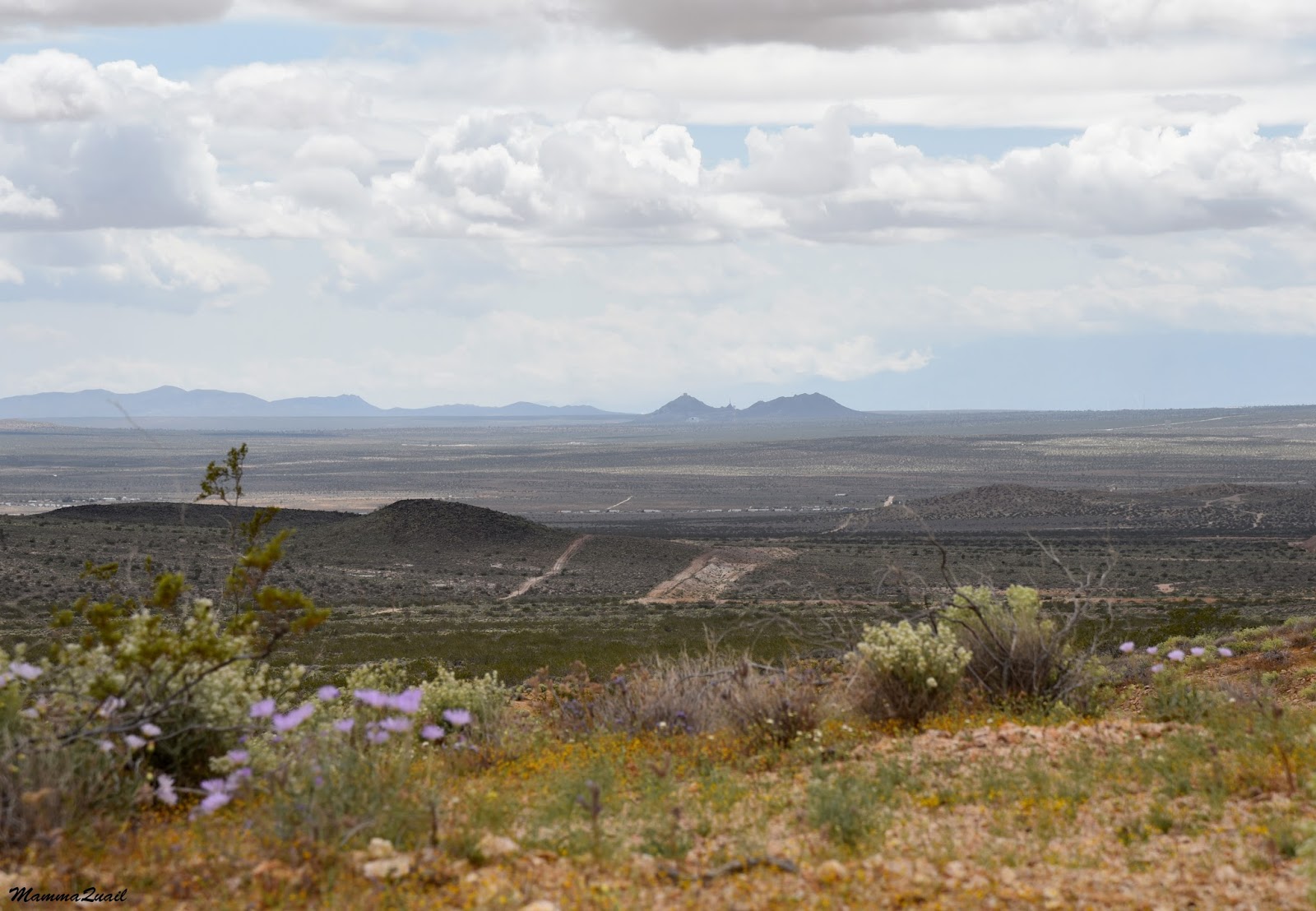
We started out with a good speed, by I was at the wheel so we didn't cover much distance before I stopped, grabbed my camera and exited the car: the area between the creosote was dotted with sage flowers I was not familiar with: the thistle sage. To get a good appreciation of just how beautiful these flowers are, just look at the header photo.
Thistle Sage, Salvia carduacea
Once outside of the car I noticed there were plenty of other flowers blooming there besides the sage. Desert dandelion bloomed in abundance in the shade of creosote bushes.
Desert Dandelion, Malacothrix glabrata
In the open spaces between the creosote tiny little flowers dotted the ground. Many of them were yellow and blended in very nicely with the light brown gravel.
Field Primrose, Camissonia campestis
Grandma Quail joind me in search of flowers. It wasn't hard work at all: they were everywhere underfoot. We had to take good care not to trample any.
Pygmy Poppy, Eschscholzia minutiflora

Soon Pappa Quail and the chikas were out of the car too. Some of the plants were familiar to them as well, at least their genera.
Bajada Lupine, Lupinus concinnus
We stayed there in that spot long enough to realize that this traffic bypass won't save us any time.
Small-flowered Blazing Star, Mentzelia albicaulis
Eventually we did get back in the car and moved on. We were making slow progress on the dirt road, halting occasionally to do some "drive by shooting" of wildflowers at the edge of the boulevard.

Then the road conditions worsened. From a smooth, sandy path, the terrain changed into uneven surface of sharp rock flakes. Not wishing to add a flat tire to our delay I slowed down to a crawl. At times, Pappa Quail left the car and run ahead, clearing as many obstacles as he could manage and patiently directing me around those that he couldn't move.
I had not the mind to photograph that area, but I did take a quick shot of a white bush nearby.
Winterfat, Krascheninnikovia lanata 
It was a tiring bit of driving, and I sighed with relief when we were back safe on sand. We couldn't relax for long, however, because soon we were driving into a large flock of sheep that covered the ground thickly, not sparing the dirt road. Once again I slowed down to a crawl, slowly advancing on the sheep, which got lazily on their feet and scurried away.
Once we cleared the flock I could breathe again.  I could also resume my roadside wildflower appreciation.
Yellow Pepperweed, Lepidium flavum 
The space between the creosote, vacant for the greater part of the year, was now covered with a mat of little annuals. In some laces the cover was continuous, forming a complete carpet of wildflowers.

In other places the ground wildflower cover was looser, and in smaller patches. I stopped he car when I saw this little white patch near the road.
Parry's Linanthus, Linanthus parryae
The wind blew strong, whipping my hair into my face and in front of the camera's lens. Getting a clear close-up of the linanthus in these conditions was very challenging indeed.
Parry's Linanthus, Linanthus parryae
Among the linanthus bloomed little pink flowers which I didn't see from the car. I snapped a few shots of them too and escaped back into the car.
Purple Mat, Nama demissum 
The day, which started sunny and bright, was darkening fast: the ferocious wind was blowing heady clouds from the north. Everyone in the car turned weather forecasters and predicted rain. I increased the speed a s much as I could, hoping to get ahead of the storm.

The burst of speed didn't last very long. Soon I was out of the car again, trying to get focused shots of plants whipping in the wind.
Freckled Milkvetch, Astragalus lentiginosus 
Thanks the fast sequence mode in my camera I managed to get 1 focused image out of twenty ... There was a lot of erasing I needed to do afterwords.
Nevada Gilia, Gilia brecciarum 
We were slowly and steadily gaining altitude. The terrain was also changing and we were driving again through a rocky area and even the sandy stretches were more gravel than sand.
The vegetation changed as well. Creosote was still prevalent, but no longer the dominant shrub. Other, more crowded shrubs filled the scenery, and the air was sweet with the smell of alyssum bloom.
Desert Allysum, Lepidium fremontii
Suddenly I stopped hard: near the road grew an indigo bush, the first of many that we've seen along the remaining miles of Rosewood Blvd. I didn't know its name at the time, and I had never before seen it in bloom. The color was so intense and so vibrant!

I got out of the car again, encircled the bush and took many photos. I didn't hurry back in even as the rain finally caught up with us.
Mojave Indigo Bush,  Psorothamnus arborescens
The indigo bush wasn't the only vibrant colored bush in the area: here and there a hopsage bush added a dash of crimson to the scenery.
Hopsage, Grayia spinosa 
We approached a hilly area. The dirt road that was Rosewood Blvd went right up the hills and straight down on the other side. Not wanting to put the car and my nerves to the test I used a circumventing paths made by unadventurous drivers before me.

The natural garden that grew on these hills was absolutely beautiful. Pappa Quail too was quite impressed and prompted me to take some wide shots of the cushions of green and colorful bloom that adorned the desert.

The promise of rain carried by the wind turned out to by just a short sprinkle. Certainly not the kind of wetness that would deter me from going outside to explore the flowers.
Desert Pincushion, Chaenactis stevioides 
The wind, however, kept beating ferociously.
Mojave Aster, Xylorhiza tortifolia var. tortifolia 
I was fantasizing aloud about the possibility of hiking or backpacking the boulevard sometime in the future. Pappa Quail, always the practical, reminded me that the area didn't look like this for the most of the year. I dare adding that it doesn't look like this even in the springtime of most years. Superbloom like we've seen only comes once every ... well, I don't really know about this place, but certainly not each year.
Atop a hill
We went up and down another hill, and then I stopped again, for I've seen something I haven't quite expected to see. Not in April. Not in the desert. It was a mushroom. There were several mushrooms there, still growing.

The storm had passed, the clouds dissipated completely, and a brilliant sunshine illuminated the last strestch of our drive through the boulevard.

We sped on. It was already past lunchtime and we were all hungry. Besides, the vegetation dwindled and the bloom seemed well past its peak along that part of the boulevard. The dirt road was in better condition there, so I could push the gas pedal a bit further down.
And then we met the pavement. Or at least what was left of it - a short, 10 yards relic. 

As I got out to photograph this joke of a road I flushed a jack rabbit out of the bushes. The hare shot across the plain at incredible speed. I was fortunate to have captured its hind side as it sped toward the horizon.

We were eager to move on now so we didn't make any more stops until we finally reached Hwy 395. We did stop there briefly to turn on the phone navigator, and I took the chance to look at one last wildflower - a shy buckwheat that was blooming hidden in the thorns of a larger bush.
Buckwheat, Eriogonum sp. 

Once on real pavement it took by a few minutes to reach Boron and Hwy 58. As we approached the intersection we saw the huge line of vehicles in a standstill, this time in the west bound direction. We made it to the intersection without any problem and once we turned back east, the road was clear. To this day I don't know what had caused that traffic jam. It took us nearly two hours to bypass it via Rosewood Boulevard. It's possible that we would have gone by the traffic jam sooner, but there's no doubt that our side track was way better than sitting motionless on the road, staring at the rear end of the same car in front for all that time. This misfortune that delayed us on the way to Barstow turned out very fortunate indeed, for we have seen a part of the desert that we had never seen before, and we have seen it at its best. Next time we go by that road we might just take the Boulevard intentionally, just to experience that beautiful journey all over again.


Friday, July 1, 2016

Around the Foundation Stone: The Mary Bowerman Trail at Mount Diablo

Pink Spineflower (Chorizanthe membranacea). May 8, 2016

Date: March 1st, 2013 and May 8, 2016
Place: Mount Diablo State Park, Walnut Creek, California
Coordinates: 37.880975, -121.917156
Length: 0.9 mile
Level: easy

The Mary Bowerman Interpretive Trail is a short an sweet trail that encircles Mount Diablo's summit. The views from there are unmatched, and the local Nature is one of the best in the Bay Area. I consider this trail a must to any Mt. Diablo visitor, and try my best to bring my visitors there.

Most of the photos in this post are from my latest hike there last May. It was overcast most of the time, and very windy. The bloom, however, was no less than spectacular.
Three years ago I took my good friend Anenet to this trail. It was a sunny March day and we had a fabulous time. I include some of my photos from that hike as well, as they show the great views that can be seen from the mountain top on a clear day.

Going clock-wise, the trail begins with a nice, wide trail under a canopy of small live oaks. Being on the north-facing slope, that trail segment is the most vegetation-covered.
California Live Oak (Quercus agrifolia). May 8, 2016
Right away I noticed the red flowers that bloomed in the spaces between the trees - the Canyon Larkspur. Clearly they like the cooler side of the mountain because they were completely absent from the rest of the trail.
Canyon Larkspur (Delphinium nudicaule).May 8, 2016
A mule ear-looking plant bloomed on the slope next to the larkspur. I didn't think much of it at first but I photographed it anyway. The bright yellow bloom stood out beautifully against the dark background and in the company of the red larkspur.
Later on, as I was identifying the plants I documented that day, I realized this was an endemic plant - one that grows only in that region, and even named after it: the Mount Diablo Helianthella.
Mount Diablo Helianthella (Helianthella castanea). May 8, 2016
Poison Oak and is a common companion of the live oak and sure enough, it was present there en-force. It makes a nice background for the festive silver leaf lupine.
Silver Bush Lupine (Lupinus albifrons). May 8, 2016
Mount Diablo has that 'volcano look' but is not a volcano. In fact, the rocks there are real melange of origins and geological times and phenomenons. I tried to follow some of the descriptions offered on posted signs but couldn't keep up. Either way, Diablo's rock formations, whenever uncovered by vegetation, are beautiful.
Pine (Coulter?). May 8, 2016
The north side of the trail is a nice path, partially paved and partially boardwalk. A wide place of the boardwalk has an observation deck and benches. A good place to appreciate the view whenever it is clear.
View to the northeast, March 2013
On my last May hike, however, it wasn't clear so I had to settle with a short range view.
Yellow-flowering bushes covered the slope, giving it a happy, fresh appearance despite the fog cover.
Interior Goldenbush (Ericameria linearfolia), May 8, 2016
A short distance down the trail from the observation deck there is another viewing platform, this time on the solid ground, and equipped with a coin-operated telescope.  The view from that point can be quite spectacular, and on clear days it is possible to see the white tops of the Sierra Nevada high peak (Lats photo).
Another, much closer peak, seen from there is Eagle Peak - the second highest in Mt. Diablo State Park. It, too, wasn't visible on the foggy May 8th.
Eagle Peak, March 2013
Because of the fog, my attention on that hike was reserved 100% to ground level wildflowers. 
Plactritis sp. May 8, 2016
Moving on to the eastern slope of the mountain the serpentine rock changes into the sedimentary chert. Many small plants find their home in the rock crevices.
Sickle-leaved Onion (Allium falcifolium). May 8, 2016
Along the eastern ark of the Marty Bowerman Interpretive Trail the vegetation becomes chapparal and then thins out on the way south. The rock foundation becomes exposed areas of serpentinite - the California State Rock.
There, near the southern tip of the loop trail, there is a patch of gravel-covered rock that is bare of trees and bushes but in season is covered with pretty geophyte and annual wildflowers. Of these the bitter root is probably the most noticable.
Bitter Root (Lewisia rediviva). May 8, 2016
Of the annuals the serpentine springbeauty is the one that stands out, bright pink color against the reddish-gray stones.
Serpentine Springbeauty (Claytonia exigua), May 8 2016
Mount Diablo is of the highest peaks in the Bay Area. Some winters it even gets some snow. When that happens Papa Quail and I get the chikas in the car and head out to the state park and up the narrow mountain road only to stand for a long hour in a traffic jam with all the other Bay Area residents who had the very same idea as us. Last time this had happened we turned around and went back home to schedule a trip to the Sierra Nevada mountains.
The last of the Snow: March 2013
At the southern tip of that trail there's a large buttress of chert - a sediment rock. The trail doesn't go there but that doesn't stop many hikers from climbing up there and feel on top of the world.
March 2013
On my May hike there was no snow, but the mountain was green and shrouded with fog.
We turned the southern tip of the trail and started back north on the western ark of the loop.
May 8, 2016
Exposed masses of red chert, the thin sediment layers twisted by past quakes.
Chert Rock,  March 2013,
The western ark of the trail is exposed to the sunlight (when it isn't overcast or foggy) - not a place one expects to see ferns. But ferns do grow there. A species of fern that has evolved to withstand drier conditions than other ferns can.
Coffee Fern (Pallaea andromedifolia). May 8, 2016
It was on the exposed chert where the beautiful rock cress grows. The plants I've seen last May had barely one or two flowers open, so I post the photo I took on March of 2013 of this plant at the same place.
Brewer's Rock Cress (Boechera breweri), March 2013
The rock cress has succulent leaves, evolved for drier conditions like the higher southwestern side of Mount Diablo. A different adaptation is seen with the Jepson's Morning Glory hair-covered leaves: protection against water loss and a mechanism to catch collect the fog droplets and direct them to the ground.
Jepson's Morning Glory (Calystegia malacophylla ssp. pedicellata). May 8, 2016
I don't know how often it rains up there, but I'm pretty sure that fog is a common occurrence. The ability to utilize fog as a source of water is characteristic of many Northern California coastal plants.

When the Spaniards moved into Alta California they built a chain of missions and presidios along the coast and they forced the Native Californians into the missions to convert them and use them as slave labor. Many of them tried escaping but very few succeeded, as the Spaniards were on horse back and armed. One band of Native Californians, however, managed to escape the grounds of Mission San Jose (Fremont) and got as far as Suisan Bay by nightfall when the chasing platoon caught up with them.  The Spaniards surrounded the fugitives and waited until morning to snare them, but during the night the Indians had slipped away through the thicket and disappeared to freedom. Returning empty handed, the Spaniard captain announced that the Indians had been helped by the devil, escaping through the devilish thicket or, 'Monte el Diablo'. When English-speaking settlers arrived the name transferred to the nearby mountain and stuck.
View southwest, May 8, 2016
My friends and I progressed to the north. The fog was slowly lifting and every now and then we got some rays of sunshine breaking through.
Serpentine Bedstraw (Galium andrewsii ssp. gatense). May 8, 2016
The sunshine pulled the butterflies to the open. Not many, but a few fluttered among the flowers.
Western Pygmy Blue, May 8, 2016
I too, was enjoying the flowers. It was good to see the mountain so green and colorful after the long, dry drought years.
Owl's Clover (Castilleja exserta). May 8, 2016
Many of the thistles growing in the Bay Area are exotic and invasive - brought over from the old world with the European settlers. They are very beautiful, and although some are good to eat, I usually pass them by, not granting them too much attention. Along the western ark of the Mary Bowman Trail grows the native cobwebby thistle. There were several open inflorescences in a patch I saw but I chose to post here the unopened bud, showing the 'cobwebs'.
Cobweb Thistle ( Cirsium occidentale). May 8, 2016
Further up the trail I saw the beautiful broomrape flowers. Living off roots of other plants this parasite grows above ground only on flowering time.
Clustered Broomrape (Orobanche fasciculata). May 8, 2016
The northwestern side of the peak had suffered a large wildfire a while back. The trail charred remains of the chaparral.

Being a sort of isolated high peak, Mount Diablo is a kind of an ecological 'island' and is home to a number of plant species that are unique to this park. Some are named after it. The most famous of them is the Mt. Diablo Globe Lily that we had seen at Mitchell Canyon earlier on that day, but there are others, too, like this humble phacelia that grows near the summit.
Mt. Diablo Phacelia (Phacelia phacelioides). May 8, 2016
After some struggle the fog cleared altogether and the sunlight washed the slopes and brightened everything around. 
Chaparral is a hardy community, evolved to thrive in fire-ridden zones. These bushes that had been burned to the ground by the fire were now recovering well, growing lush and strong from their underground root crowns.

Underneath the burnt-renewed chaparral were dense patches of wildflowers. In this part of the trail - chia.
Chia

And not only small wildflowers were blooming - also a few height-reaching plants that towered above our heads. 
Golden Ear-drops (Dicentra chrysantha). May 8, 2016


All and all it was much greener there on my May 2016 hike than on my March 2013 hike. The boon of the long rainy season we've had this year. 
Coulter Pine (Pinus coulteri)
Several cultures around the world hold a belief that the world was created beginning with a solid grain or rock, a "Foundation Stone", that appeared first in the chaos. Needless to say, there's no agreement about the earthly location of this foundation stone. For the Bay Miwok the grain around which the wold was created is the summit of Tuyshtak: Mt. Diablo's original name.
Today the foundation stone of the Bay Miwok's world can be seen inside the little visitor center that now house what used to be an airplane beacon.
Be humble when visiting, as it is a holy site.
The visitor center at Mt. Diablo's summit

The museum has a flat roof with an observation deck with telescopes. past-times air was much cleaner before the era of industry and pollution. Mount Diablo's summit had a direct view far and wide. But even today, on clear days, one can see all the way to the grand, white peaks of the Sierra Nevada. 
Snowy Peaks of the Sierra Nevada, view from Mount Diablo, March 2013