Showing posts with label 2012 Winter trip. Show all posts

Friday, June 7, 2013

A Hidden Treasure: The Carrizo Plain and Soda Lake

Date: January 1, 2013
Place: Carrizo Plain National Monument, San Luis Obispo, California
Coordinates: 35.24169, -119.90700
Difficulty: easy

The morning of the first day of this year was a bit glum for me. We were on our way back home to the Bay Area. Papa Quail was ready to go straight home but I wanted to get just a little bit more nature into our last vacation day. So after some convincing we pointed our car to the Carrizo Plain National Monument, which was on our way. Sort of.
Our first port of call was the Overlook Hill (35.239594, -119.907884). It's very short walk to the top and the view is impressive.  The sheer empty vastness of the place can make one dizzy. The wind was blowing strong and I just felt like flying over and high into the clouds.
The Carrizo Plain is a large basin nestled within the Transverse Ranges in eastern San Luis Obispo County, between the Elkhorn Hills and the Caliente Range. The runoff water from these ranges collect at the bottom of the basin in Soda Lake. Soda Lake is seasonal and, having no outlet, has high salts content. When its water evaporate, a thick salt plain is left behind.
A view from the Overlook Hill to the southeast across Soda Lake
Our second stop, very close to the first, was at the Soda Lake Trail (35.24168, -119.907393). The trail, a little less than a mile in and out took us to the lake  where we could closely observe this fascinating habitat, look at the vegetation and look for birds.
Alkali shrubs and weeds grow on the salt-crusted plain surrounding the lake
We were there at the dead of winter and the place bore no resemblance to the lovely pictures of colorful pastures of wildflowers that I saw on the monument's website.
The bleak grayness was broken by the birds. There were many little birds chirping happily all over the place. Mostly sparrows. Some of them of species we have never encountered before. Big check mark for Papa Quail :-) 
Sage Sparrow
Here's a bug eater: the Loggerhead Shrike. It also catches larger pray such as lizards and impales them on thorns.
Loggerhead Shrike
A splash of bright color: the bright yellow Meadowlark. It is quite difficult to photograph these birds in a shrubby area. They don't like to be exposed for long.
Western Meadowlark
The Soda Lake of Carrizo Plain is an alkali wetland, one of the few in California that's left in natural condition. Its water support brine shrimp which in turn support the bird population there, both regular and migrant.
The salt crust left after the lake water evaporated.
The area is managed by the Bureau of Land Management and at their web site there is a warning to visitors not to rely on satellite navigators. I totally agree with that - heed this warning! better to rely on updated paper map and, unless you have a high clearance AWD, stick to the main road.
We didn't know that at the time (and even if we did I'm not sure it would have stopped us from trying), so we headed along a dirt road (subject to flooding) with our 2WD to the northeastern area of the plain.
There was a flooded area near the path, but the road itself was dry.
Reflections along the road. In the background: the Elkhorn Hills.
Our third and final stop was at the Wallace Creek Trail (35.267494,-119.827143). There Papa Quail photographed this cute sparrow:
White-crowned Sparrow
The Carrizo Plain is another place ripped by the San Andreas Fault. Wallace Creek os offset to the fault and information boards along the trail explain the geological history of the area.
A view of Wallace Creek
There, at the top of the hill that overlooks the creek, Papa Quail met another new one (for us): The Lark Sparrow. Later he also spotted a roadrunner that was a bit too quick to be in focus. By the time I got my eyes to the place where he was pointing too there was only a cottontail rabbit there, running quickly away.
Lark Sparrow
The squirrels, however, didn't run away.
Nelson's Antelope Squirrel
This trail is also pretty short. It doesn't end anywhere, just sort of disappears. At that point the chikas, who were at the end of a long road trip, were also at the end of their tether. We turned about and headed back to the car, stopping to photograph the only plant we saw that was actually flowering: a Milk Vetch, which turned out to be a pretty rare one.
Salinas Milk Vetch (Astragalus macrodon)
On our way out we saw this raptor hovering above us. Papa Quail was quick to pull his camera and scored another new one (for us): the Ferruginous Hawk.
Ferruginous Hawk
This brief visit to the Carrizo Plain National Monument was our concluding hike of our big desert winter vacation, during which we've been to places we've never seen before and seen many birds we've never seen before, and imbibed in the beauty and splendor of the Southern California deserts.
And also the Bighorn Sheep :-) 


Sunday, June 2, 2013

Winter and Spring at The Big Morongo Canyon Preserve

Dates: December 13, 2012 and March 13, 2013
Place: Big Morongo Canyon Preserve, Morongo Valley, California
Coordinates: 34.0504, -116.5698
Difficulty:  West Canyon and Yucca Ridge trails are moderate. Everything else: easy.

The Big Morongo Canyon Preserve is one of the places we found out about by having some time to check out a green spot on our road map. Is was close to our way north and we had the time so there we went.
The preserve isn't large and the entire trail system can be easily done in a short time. The thing is, though, it is far better to take it slow, because then one gets to see what's growing there. On our December visit we spent about three hours in the preserve and in that time walked all the loops except for the Yucca Ridge Trail.

The map is downloaded from the Big Morongo Canyon Preserve site.

We were there on the last day of the year, that is, in the dead of winter. Except for the conifers, all the trees were naked. We didn't expect to see any wildflowers at that time of year and indeed, there were none. Even the shrubs looked still and dry.

It was nice to walk around and take in the scenery. It was fairly cold when we started, but the sky was clear and the sun soon made us take our jackets off.
The different loop trails go through a number of different sections, including low brush, forest, marsh, the canyon itself and the hills above. Each of these sections is a different habitat and walking through all of them is getting to know and appreciate the diversity that can exist in a single, fairly small area.
A pair of Yucca on the hill. 
Big Morongo Canyon is nestled between sedimentary hills that border Joshua Tree National Park from the northwest. While the hills themselves are dotted with low shrubs, the canyon itself is thickly forested.

There is water in Big Morongo Canyon. Spring water that sustain all the canyon vegetation. Tall trees and all.
We've also seen the remains of a fire that was there some time ago. Many burnt trees were standing or lying fallen along the Desert Willow Trail.

This preserve is a home for numerous bird species and a stopping point for many more migrating ones. It was the birds that we were looking for, but it was not a good time to see the migratory species and the locals didn't readily present themselves.
California Towhee standing on the remains of a burnt tree. 
We kept on walking, looking for the birds. It was on the last loop we did: the West Canyon Trail, that we saw a group of bluebirds hopping and chirping happily on the hillside.
Western Bluebird
At that point we were in some hurry. The sun was setting and we still had quite a bit of driving to do. We were headed to the town of Mojave were we would stay for the last night of our winter vacation.
Sunset light in the trees at The Big Morongo Canyon Preserve
I was fortunate to return to Big Morongo Canyon Preserve a couple of months later, this time with my botanist friend. although spring was just in the beginning, the transformation was very impressive. All the photos below were taken on March 13, less than three months after my winter visit there.
A Western Side-bloched lizard , basking in the late morning sun
We arrived at Big Morongo Canyon at the end of a cold wave, looking for spring wildflowers. We were lucky to have started our hike at the hillside of the West Canyon Trail (wanted to see if the bluebirds were still there. They weren't.) because that's where the flowers were.
Suncup (Camissonia pallida)
There were not many, and all of them very small. But still, lovely dots of lively color on the bare desert ground.
Mojave Lupine (Lupinus soarsiflorus)
And we ere happy to see them all.
A mat of tiny poppies between bare shrubs
The trees were a different story. All the deciduous trees that were bare two months before were now bursting in lively flames of bright greens.
Budding trees in the Big Morongo Canyon
Coming down into the marsh area of the preserve we saw no more flowers, just a lot of green vegetation. We did get to see all those birds that eluded us during our winter visit :-)
Nuttall's Woodpecker, female
The tiniest of them:
Costa's Hummingbird, male
And the awe-striking raptors too:
Sharp-shinned Hawk
The amazing change I've seen in this place in less than three month has once again reinforced my desire to  revisit the same places, because each time its like being the first time there.

Being so close to the famous Joshua Tree National Park this little preserve might be overlooked by most visitors of the region. I would strongly recommend visiting there. But then again, it might be just for the best to not overrun the place with too many people.

Many thanks to Papa Quail for his help in identifying the birds, to my friend עננת for identifying the lizard, and to members of the California Native Plants Society for their help in identifying plants!

Wednesday, May 29, 2013

One Palm, Two Palms, a Thousand Palms and More ... at the Thousand Palms Oasis Preserve


Date: December 31, 2012
Place: Thousand Palms Oasis Preserve in the Coachella Valley Preserve System, Thousand Palms, California
Coordinates: 33.8375, -116.3102
Length: about 3.5 miles
Difficulty: Easy (in mild weather).

The morning of last day of 2012 was very relaxing for us. It was also our last day in the Southern California deserts winter vacation. We took our time packing and ate our breakfast in leisure.  All of yesterday's clouds were gone and the sky was clear.
7:15 am at Palm Springs, California. Mount San Jacinto under the setting moon. 
After the excitement of the day before we decided to take this day easy and spend our last vacation day in the area of Palm Springs checking out two of the local wildlife preserves. The first one we visited was the one we observed from Carrizo Canyon, all the way across the Coachella Valley: the Tousand Palms Oasis Preserve.
The quaint little visitor center is operated by docents who dispense information to visitors. We were also greeted by the sound of bird songs from the palm trees all over the place. Some even showed themselves :-)
House Finch, male 
At the visitor center we got a trail map and recommendations of hiking trails. The maps are free, but donations are very much appreciated. One thing that visitors should be aware of is that there's no drinking water there. It is important to remember to bring enough with you.
Based on the docent's recommendation we took the trail to McCahun Grove and the Moon Country Loop. The weather was perfect: sunny with soft wind and mild temperatures. Perfect hiking conditions.

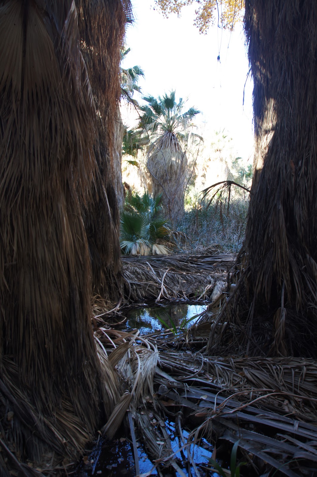
Our hike started at the Thousand Palms Oasis. It sure feels like there are thousand palms there. At least a thousand. Probably more.
Washingtonia fan palms need fresh water, and lots of it. Wherever these trees are found, water is close by. The sight of these palms, therefore, has always been a blessing for desert travelers. Even today, when we are never too far from a source of drinking water, these trees provide a refreshing coolness in the desert heat.
Thousand Palms Oasis
Often the oasis water is not visible above ground. In this place it is, and there's much of it. The ground water seeps up through the San Andeas fault, the major fault that runs along California. It begins at Salton Sea and runs up the Coachella Valley, right through the preserve, delivering precious water to support desert life. (Although we did not know it at the time, we would meet the San Andreas Fault one more time before returning home - at the Carrizo Plain and Soda Lake National Monument).
Oasis water
Inside the grove the trail is on a boardwalk. The intensity of sunlight that pierces in patches the deep darkness of the palms' shade plays tricks on the eyes and on the camera. Outside the palm grove everything becomes very bright indeed.

The hills are almost bare. The wash bed, however, is rich with vegetation. About the oasis the ground was completely covered with plants, as tall as an adult person.
And the birds were taking full advantage of it, too:
It is an easy walk to the McCahun Grove, another group of palms surrounding a lovely pond of clear water. 
We stayed there for quite a while. I found it hard to separate from this enchanting place. Having been raised in the desert myself probably had something to do with it :-)
The palms provide shade and shelter. Also food:
White-crowned Sparrow
Eventually the chikas got bored with their game of hide and seek and so we left the grove and continued our hike. A vista point at the beginning of the Moon Country hills provided us with great view of the mountain range to the east beyond which lies Joshua Tree National Park. I just love the reddish hues of those rocks!
The most common shrub there is the Creosote bush. Probably the second most common is (if judged by the scratches I collected there) the Cat-claw Acacia. In this picture, a home for the Bewick's Wren.
Bewick's Wren
A little further up the trail we met another wren: the Rock Wren. It blends so well with the rock color that I had to crop the image to bring out the bird.
Rock Wren
The Moon Country Trail runs along the ridge of a low sedimentary hill that separates the wash from the main valley. A bit further away from the oasis the water become scarce and the shrubs are separated by the length of their roots, showing the bare ground between them.
People who are not used to the desert might find it monotonic, but I see character in every wrinkle of the ground and inspiration in every shrub that grows in defiance of the harsh conditions.
It is the deafening desert silence that I can hear my own spirit speak.
The hill continues but the trail descends into the wash and loops back towards the oasis.
The ground is marked by the tracks of the last flash flood which happened, who knows when. The ground was completely dry.
It was a lonely walk back. We've seen no animals, nor any other hiker on the Moon Country Trail loop. As we neared the oasis, though, we were once again surrounded with bird songs.
A grove of Tamarisk, an aggressive, invasive species that spreads in the California deserts on the expense of native plants.
After a lunch picnic at the Oasis we bade farewell to the Coachella Valley, and with a final look at the Santa Rosa and San Jacinto Mountains we were on our way north east to our nest destination: The Big Morongo Canyon Preserve.