|
| California Buckeye, Aesculus californica |
Date: January 31, 2017
Place: Mt. Diablo State Park, Clayton, California
Trailhead Address: 176 Regency Drive, Clayton, California
Length: Approximately 5 miles
Level: strenuous
There are waterfalls on Mount Diablo, and all of them are seasonal. To see them flowing one has to go there in the rainy season. I tried hiking the Falls Loop trail last October, but the rain was still on, and the trail was such a deep and sticky quagmire that I gave up pretty quickly.
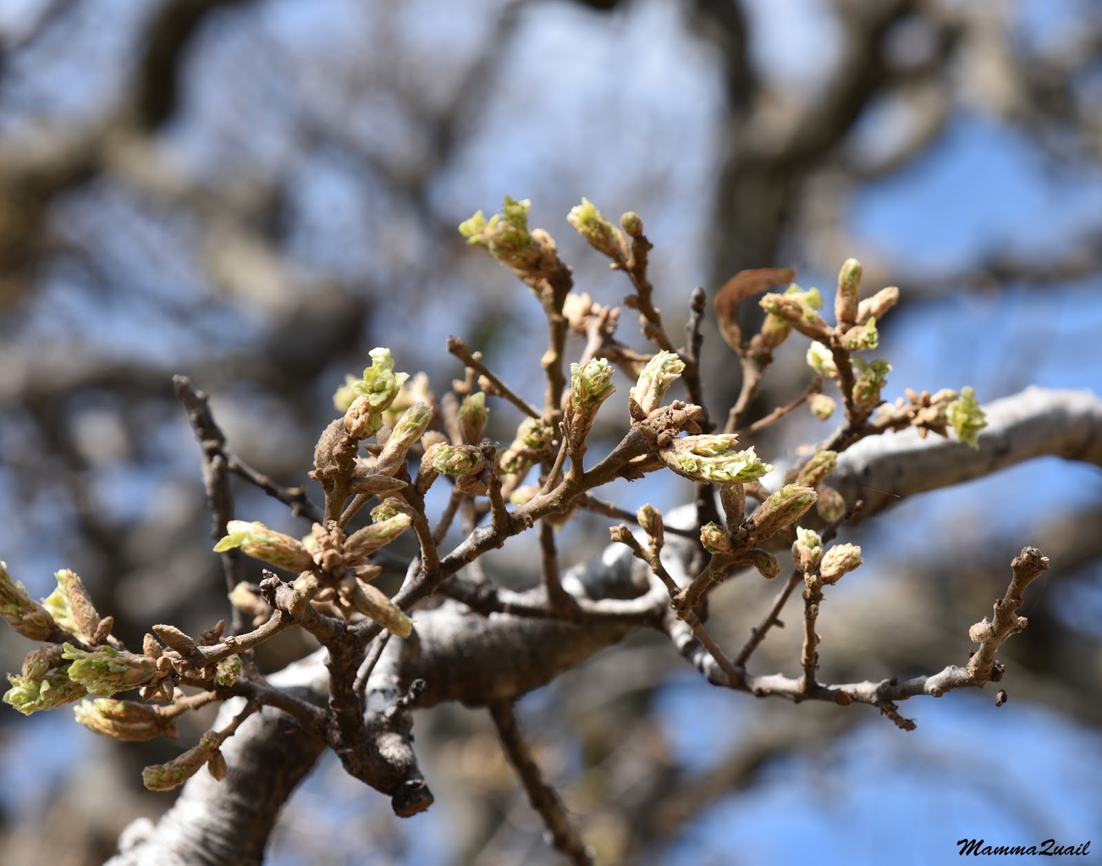
What I do remember from that short attempt are the nut-heavy buckeye trees, already stripped of their leaves but wearing their fruits like holiday ornaments.
 |
| California Buckeye, Aesculus californica, October, 2016 |
The passed season has been good to the buckeye - all the trees were heavy with fruit and many had double, triple, and even quadruple fruits hanging off each branch. I couldn't recall when was the last time I'd seen them so fruitful.
 |
| Buckeye nuts |
The rain was heavy in Northern California so far, as if to compensate for the long drought of the last four years. I was busy with my own things and was just beginning to get back into my usual routine, when last week the rains paused for several days.
The last day of January was expected to be a fabulous day. I had planned to go hiking that day, my original destination being the Hayward Shoreline, but as I was packing my things it dawned on me that today would be the perfect time to go and see those Mt. Diablo waterfalls, just before the rains resume again. Once that thought occurred to me, it immediately turned into a decision. I packed my breakfast into my backpack and got in the car.
The shortest path to the Falls Loop is at the Regency Gate at the north side of the park, in Clayton. By the time I got there I had less than 3.5 hours before I needed to be driving back to pick up the chikas from school. Not wasting time on trifles such as breakfast, I hoisted my backpack, extended my poles, and hurried down the unofficial path leading from the dead-end of Regency Drive to the park's boundary.
The sound of rushing water welcomed me. I went down to Donner Creek and observed with much satisfaction that the creek was flowing nice and strong. With this flow, the waterfalls must be running too.
 |
| Donner Creek |
The direct route to the Falls Loop is by Donner Rd, along Donner Creek. On my October hike attempt there the road was to muddy to walk on. It still had muddy areas today, and in parts had little rivulets running right through it in tiny canyons of their own carving, but it was passable.
The deciduous trees were all bare still, deep in their winter slumber. The only green foliage seen on the huge oaks were those bright green balls of mistletoe hanging from the branches like huge nests of some mighty wren.
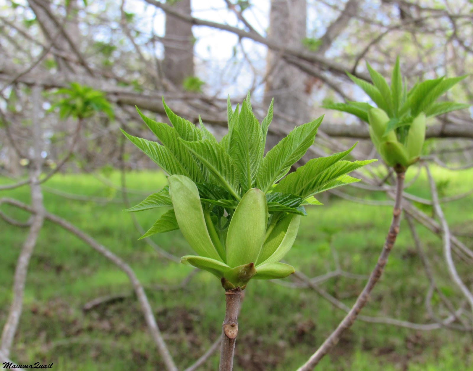
The buckeye trees were now completely bare, having let go of their ornamental nuts. It would take some time before I see these green up again. Or so I thought as I walked past the first group of them.
 |
| California Buckeye, Aesculus californica |
But every population has its hasty members, and as I continued along the creek I noticed one buckeye that had started budding out. The next tree over had its new spring leaves already stretching out (header photo). These two trees were the only buckeye I've seen budding that day. These were the early risers.
 |
| California Buckeye, Aesculus californica |
I saw a few yellow dots in the green grass that covered the hills -they were early buttercup blossoms, the first flowers I saw on the hike.
The trail led my uphill in a mild slope. I was walking southeast and the late morning sun was in my eyes. The peak of Mount Diablo towered in the background, looking hazy and aloof under the brilliant sunlight. I walked mostly with my head down, protecting my eyes from the glare of the sun.
Walking with the head down has its advantages, like seeing things that are very close to the ground. In this case - a fallen, rotting log, covered with turkeytail mushrooms.
 |
| Turkeytail |
About 1.3 miles I reached the Donner Cabin site. In the 19th Century the area belonged to a rancher named Donner (no relations to the Donner of the fateful Donner Party after which the
Donner Memorial Park was named), and here is where he used to live. All that is left there now is a small patch of cobblestones and a large patch of cultivated daffodils. Many of the daffodils were blooming and their scent had filled the air and my nostrils.
 |
| Daffodils |
Past Donner's Cabin the road begun to climb much more steeply, and the natural avenue of buckeye, pine, and oak trees was quickly replaced with high and dense chaparral of chamise, toyon, and manzanita. The manzanita was already blooming, and the ground below the bushes matted with their fallen white petals.
 |
| Common Manzanita, Arctostaphylos manzanita |
The toyon bushes added their own flash of color to the local decor: their beautiful red berries standing out on the deep green background.
 |
| Toyon (Heteromeles arbutifolia), and Coulter Pine, (Pinus coulteri) |
In the shade of the chaparral I found another species of early spring flowers: the delicate white milk maids. They were not many, their season was just beginning, but I saw them along all the higher part of my hike.
 |
| Milk Maids, Cardamine californica |
The road leveled off a bit, and in good time too, because I was already dripping sweat. I arrived at the intersection of Donner Canyon Road with Meridian Ridge Trail and the beginning of the Falls Loop.
I looked all around. The view was stunning. Although northward, the town of Clayton was under fog still, I could get a good appreciation of how high I had climbed. And more climb was ahead of me still.
 |
| Looking up (southward). |
There were plenty of birds about, but none was rendering itself to the camera. At least I could enjoy their songs.
I made the choice to turn right and hike the Falls Loop clock-wise. The trail continued in a steep uphill slope but after a short distance I saw the left turn to the narrow Falls Loop Trail, so well tucked away between the bushes that I might have passed it by if not for the trail sign that was planted there.
I went on that trail. It was narrow and the chaparral was so high there that it towered well over my head, effectively blocking most of the sunlight. In the deep shade of the vegetation I nearly forgot the heat of my ascent and as my sweat cooled off my body I begun to shiver.
I kept looking under the chaparral, searching for the red spot of budding Indian warrior bloom. There were few, and soon I had spotted them, also at the beginning of their blooming season.
 |
| Indian Warrior, Pedicularis densiflora |
I found more surprises when I looked down on the ground. Little surprises.
 |
| Asterella Liverwort |
The trail kept leading me up higher and higher and soon I warmed up again from my uphill efforts. Every now and then I also passed trail sections that were exposed to the sun. In some parts also the view opened up before me and I could see the canyon etched in the mountain side, extending almost up to the top.
Far away, in a darkened area of the canyon I noticed a white vertical line. I had to use my binoculars to figure out what it was.
It was a waterfall. The first waterfall I saw on my hike. It was flowing, and it was very far.
Soon, however, I came upon another waterfall that was much closer -right by the trail. The water cascaded down noisily, splashing me as I poked through the vegetation to get a closer look.
I didn't have time to sit down and appreciate that cascade fully, so I continued up the trail and across the two tributaries that connected just below that cascade.
A bit higher up the trail I saw another early spring flower: the tiny white bloom of the miners' lettuce.
 |
| Streambank Sprinkbeauty, Claytonia parviflora ssp. parviflora |
Up and higher I went up the narrow trail. at times it was really, really narrow. So narrow that I had to place one foot right in front of the other to fit in the path. The slope of the mountain was steep, rising sharply to my right and dropping deep down to my left. For the most part there was thick vegetation on either side, but every now and then the trail would go on a rocky ledge, exposed to the air and the sunlight. On those times I could see how much higher I had ascended and how far down would I fall I'd lose my footing. The trail, at least, was reasonably dry. I could see how hazardous this path could be when soaking wet.
A small group of people was coming down the trail toward me. I pushed myself to the mountain side to the trail, making them as much room as I could to pass by. They halted briefly and we had a quick, light chat, exchanging our observations before continuing on. Just before going on I observed this lovely juniper growing right at the edge of the cliff.
 |
| California Juniper, Juniperus californica |
The trail leveled off and I wondered if I'd arrived at the highest point of my hike. More people were coming down the trail toward me, in couples or singles. All other hikers I'd met on the Falls Loop Trail that day were hiking it counter-clockwise and for a moment I wondered if I was breaking some rule by hiking it in the opposite direction to everyone else.
I didn't think about it for long for a moment later I looked upon another waterfall, the deepest I've seen on that hike.
I was hoping the trail would take me right to the waterfall but after some more walking I realized that that one view I'd had of it was the only one I'd get - the trail took me well above the fall and there was no more clear view of it.
I consoled myself by appreciating the fresh bloom of the California laurel trees that I came across when I crossed the creek.
 |
| California Laurel, Umbellularia californica |
When I first read a description of this trail a while ago I also read a warning of the impassability of it when the water flow is high. Indeed, I had to cross several tributaries of the Donner Creek on my hike, and it wasn't always easy, even after a week of dry weather.
On my next creek crossing above the large waterfall I saw a smaller, narrower cascade. There were many of those along the way, but I was happy to see each and everyone of them. Waterfalls make me happy.
After that creek crossing, for a short segment of that trail, I found myself on the south-facing slope, bathed in bright and warm sunlight. A light, invigorating breeze caressed my face and dried my sweat. A rocky ledge protruded from the cliff side and a sole, crooked Coulter pine grew at its edge. It was the perfect spot to have a lunch break.
I was pressed to be back in time to pick up the chikas from school so I only allowed myself a 10-minute break, but I enjoyed every second of it. The fog had lifted off Clayton and I could see the entire canyon below, all the way to town. Although the fog was gone, the air was still hazy and the town dimmed and disappeared into a murky grayness that became continuous with the sky.
With much reluctance I finished my lunch and resumed my hike. Soon I came in view of yet another waterfall.
A single hiker crossed my path. He was the last hiker I saw that day, and he informed me that he'd seen no others on the trail, confirming my feeling that everyone else that hiked the Falls Loop had done it counter-clockwise. I thought it didn't matter because the falls are pretty either way.
I continued my hike, enjoying the green scene and the wonderful atmosphere of early spring.
 |
| Polypodium sp. Fern |
Throughout the entire loop trail I came across lots of diggings and rough trails broken through the chaparral, and much slope erosion due to heavy footfall. It wasn't humans who did it but it was humans who brought it about. That damage was done by feral pigs, originated from domesticated pigs brought here by the European settlers that escaped and established themselves in the wild.
 |
| Pig damage |
After much winding along the steep mountain side the trail finally begun descending down. Once again I faced north and the view of the wide sky spread before me, unhindered by no other mountain peaks.
 |
| Trail view |
Mount Diablo is geologically complex, comprised of many rock types and evidence of many processes that had contributed to shape the mountain we see today. Most of this geology is covered up with vegetation, but here and there it pokes out from under the cover :-)
One of the prettier rocks that make up Mount Diablo is the Franciscan Chert. Its earthy broun and fine layers make it stand out in the scenery when exposed. On the eastern arm of the Falls Loop there is a big mass of this beautiful chert, almost bare of plants.
And on a different spot not far from the chert - a different type of rock, bearing rosettes of dudleya plants, all swollen with water.
 |
| Canyon Dudleya, Dudleya cymosa |
Further down the trail I looked back and saw a double waterfall. The trail had taken me over the top one without allowing a good view of it. The bottom one was completely hidden from my sight until I was well removed from it.
I took a couple of close-up photos of these falls. Clicking the images will enlarge them for a better view.
Down and down the trail I went. By that time I was in a real hurry, knowing that I would likely be late to pick up my chikas from schoo. I just hoped I wouldn't be late much. I therefore hurried along, stopping very little and taking much fewer photos.
The Falls Loop Trail came to an end at the intersection with the Cardinet Oaks Road, another wide dirt road that connects with the Donner Canyon Road. That trail segment is only half a mile long, but is quite steep. It was there that I understood why everyone else was hiking the loop counter-clockwise. It easier to go up a steep grade than to go down it as I had to do. Once again I learned that a downhill grade doesn't mean easier or faster hike. By the time I turned right back onto the Donner Canyon Road my thigh muscles were throbbing with ache.
I suppose it would have been easier if I hadn't been in such a hurry. I couldn't afford the time to stop either, and only halted briefly to photograph a beautiful woolly Indian paintbrush that had started its spring bloom.
 |
| Woolly Indian Paintbrush, Castilleja foliolosa |
I passed the Donner Cabin site and then the trail leveled into a mild descent. Although I had walked this trail on my way up it was only on my descent that I noted the beautiful avenue of oaks that stood by the trail. I really should go back there in May and see them all with foliage,
I had passed my personal deadline by 15 minutes when I made it back to the Regency Gate. Taking a farewell look at the swollen Donner Creek I rushed uphill to my car and drove off at a speed that must have left some tire marks.
I was only 15 minutes late for picking up my older chika but she was upset with me anyway.
 |
| Donner Creek |
The north region of Mount Diablo State Park is quite different from its western slopes, the side I usually visit. The high water flow, the deep canyons that wrinkle the north slopes, and the abundant vegetation make this part into a magnificent wonderland island that stands out in the openness of the East Bay hills. Usually
I visit this area later in spring, to see the bloom of the Mount Diablo Globe Lily, but there is so much more to see there, and it is beautiful year-round. Next time I'll plan to be less constrained with time and explore more of those north side trails.
Many thanks to members of the California Native Plants Society for their help in identifying plants!