Place: Mitchell Canyon, Mt. Diablo State Park, Clayton, California.
Dates: May 8th and 12th, 2012
Early May is the flowering season of the Mount Diablo Globe Tulips, or fairy lanterns. This beautiful, shy flower is endemic to Mt. Diablo, meaning, they cannot be seen anywhere else in the world. They grow in Mitchell Canyon area at the north part of Mount Diablo State Park and, being seasonal geophytes, they spend the greater part of the year as a bulb underground. A few years ago I learned about this flower and every May since then our family have been holding a pilgrimage to Mitchell Canyon to see them in bloom.
This year, our quail family hiked with the Redwood 4H hiking project. Several days before that I went with a friend of mine to explore the trail and prepare for the project hike. The photographs presented here were taken on both dates.
People who have never been to Mitchell Canyon before should keep in mind that there is no car access there from the main area of the park. To get there, one needs to drive through the town of Clayton and enter the park by Mitchell Canyon Road. The entrance is unmanned and visitors who do not hold a state parks membership pass need to self-register (make sure you have a pen in the car), place the fee in a tiny envelope (provided at the gate) and slide it through a very narrow slit (exact change in paper bills is highly recommended).
The staging area has limited parking space, but in all the times I've been there, I never had to park outside. There is a small visitor center that is open on the weekends, flush toilets (in a separate building) and a beautiful, shaded picnic area by the creek. The trailhead is right by the visitor center. It is an interpreted trail - there are numbered stations along the way and the brochures are available by the green cattle gate at the trailhead.
At the trailhead we met some wildlife. Here is a bold ground squirrel:
 |
| California Ground Squirrel |
and a gopher snake slithered away as we passed:
The plant community of the Mitchell Canyon area is riparian, meaning the main vegetation grows by the creek's banks. The most common trees there are live oaks, many of which are ridden with mistletoe, a tree parasite.
Some of the oak trees appear to grow apples-like things. These aren't fruit, of course, but galls: growths caused by another parasite, an oak wasp. The wasp lays her eggs in the developing leaf bud, which is then stimulated to swell by chemicals similar to plant growth hormones secreted by the wasp's larvae. The gall provides the larvae with food and protection until they reach maturity. Old galls are grayish-black and the exit holes of the wasps are often visible.
Each gall usually hosts 1-3 wasp larvae.
|
|
An opened oak gall with a larva inside.
|
Another common tree in Mitchell Canyon is the Coulter pine, which stands out in its blueish-gray hue and its huge pine cones. The Coulter pine grows in the drier parts of California ad Mt. Diablo is as north as it's found.
|
|
Coulter pine bearing cones
|
By the way, if you get the chance to try Coulter pine nuts, by all means, do. They are very very tasty.
Early May is a great time of year in Mitchell Canyon. The creek is flowing nicely and almost everything is in bloom.
Buckeye tree in bloom:
And here are some of the other flowers we've seen along the trail:
Our prize, however, waited for us, as usual, by station number 7 of the interpretive trail. That was, of course, the Mt. Diablo globe tulip. Isn't it gorgeous?
 |
| Mt. Diablo Globe Tulip |
This pretty flower belongs to the lily family and is also called Mt. Diablo fairy lantern or Mt. Diablo globe lily in some web sites I've seen. It's scientific name is Calochortus pulchellus.
This year we've experienced some crazy weather in the bay area. Perhaps that is why the fairy lanterns seemed smaller than in previous years.
On the other hand, there seemed to be many, many more of them this year. the entire hillside was dotted yellow.
|
|
Globe tulips on the hillside
|
After a mile, by station number 9 of the interpretive trail, there is a solitary bench. A perfect spot to have a mid-hike snack. There we took a right turn to White Canyon trail, and almost immediately took another right turn onto the narrow Globe Lily trail. This trail is not marked on the attached map but is well marked in the field. This trail loops back on the hillside, where close relatives of the Mt. Diablo globe tulip can be found:
|
|
Mariposa lily (Calochortus venustus)
|
The hillside is more arid and the prevalent plant community there is the bushy chaparral.
|
|
Chaparral on the south-east facing hillside
|
A member of the chaparral community is visited by a bumblebee:
 |
| Yerba Santa (Eriodictyon californicum) |
Chaparral too, can be a multi-story dwelling:
 |
| Pipestem clematis (Clematis lasiantha) |
At a shady spot at the bend of the trail we saw a colorful patch of flowers: a mixture of red Indian Paintbrush and yellow Mt. Diablo Globe Tulips.
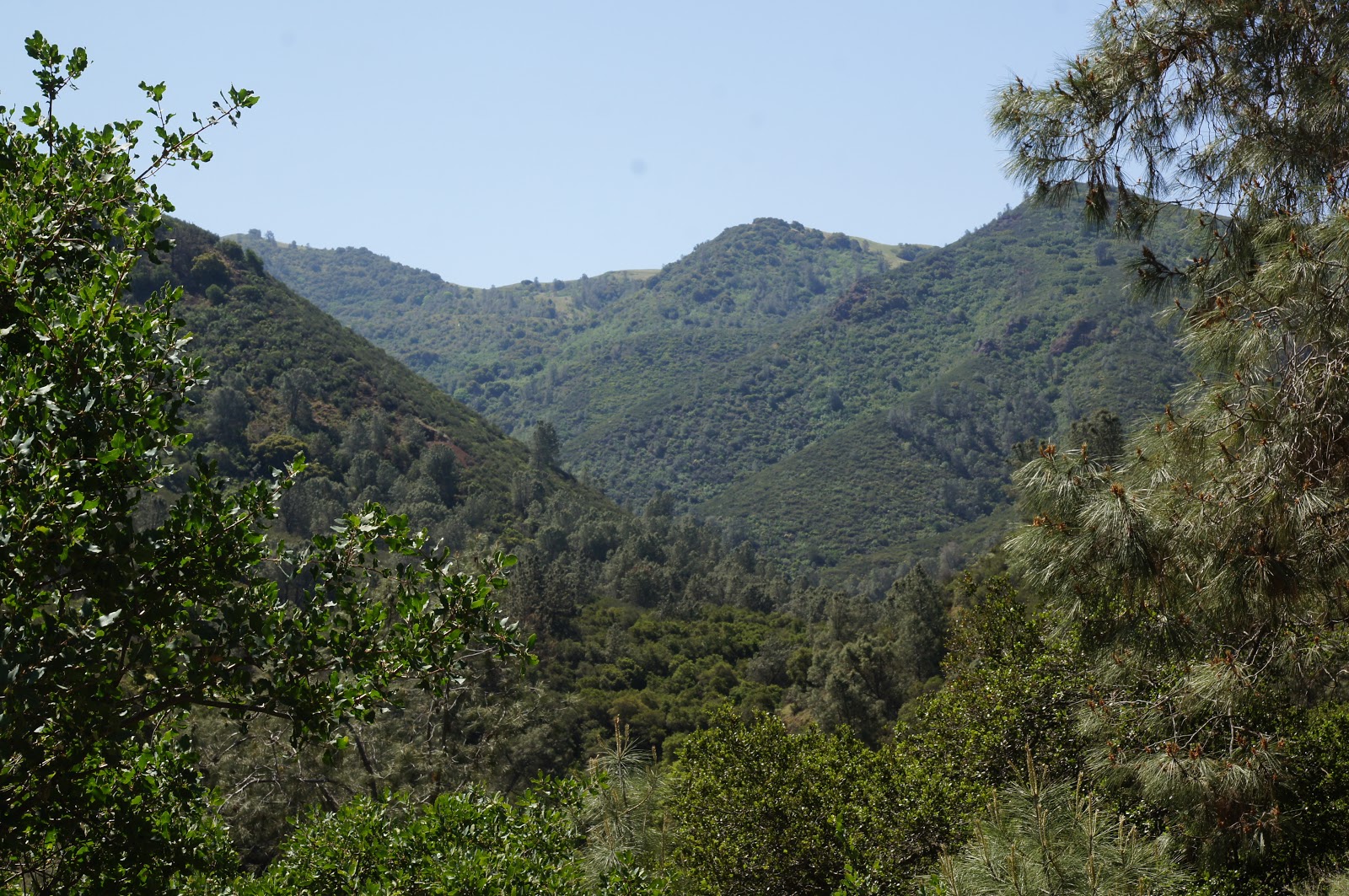
Beautiful view from the the hillside. This is the view to the south. In temperate climates, the north-facing slopes are usually much greener with vegetation as they are less exposed to the drying sun.
A view to the west:
 |
| A view to the west |
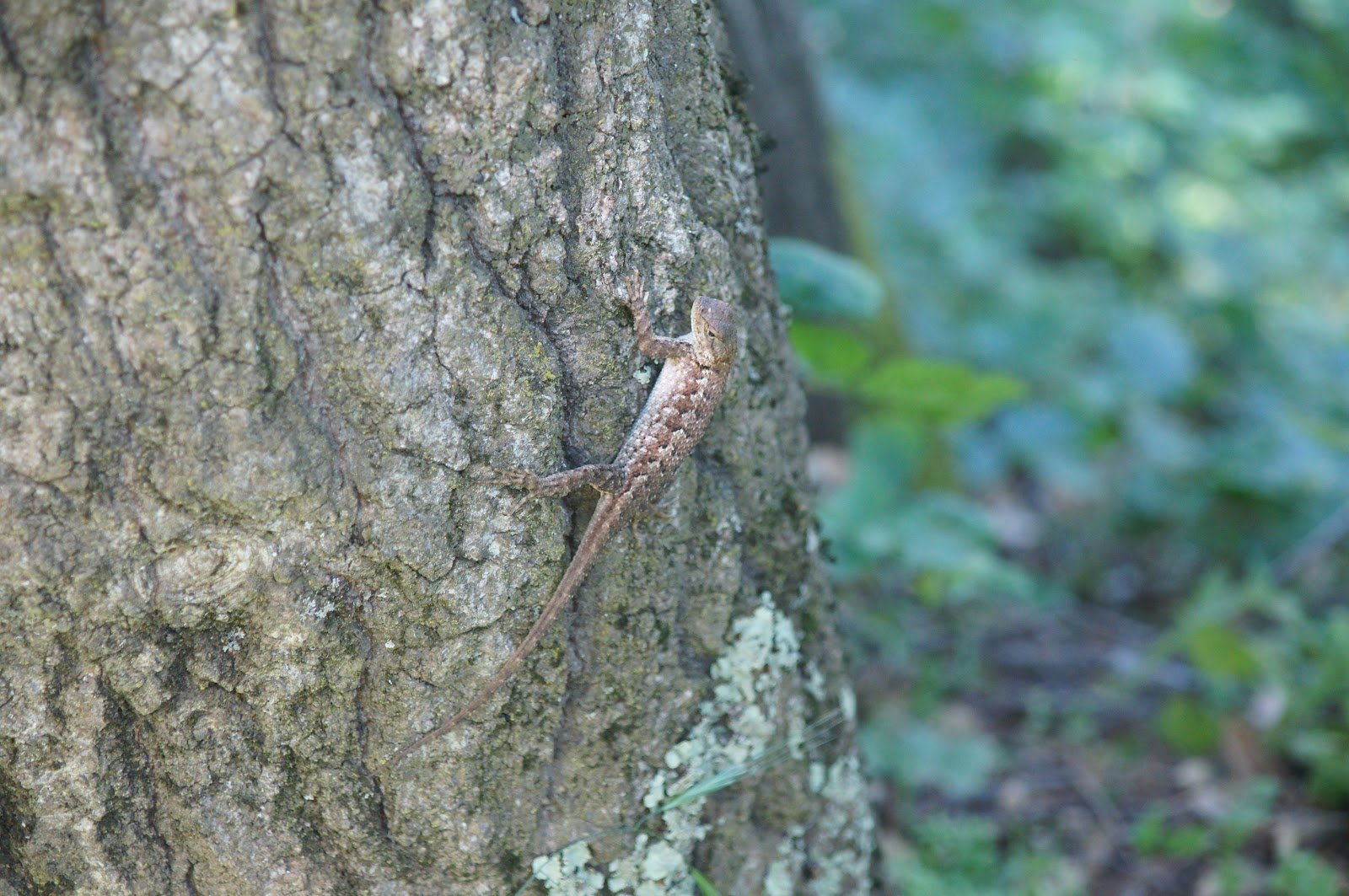
The globe lily trail is only half a mile long. Too soon it curves downward and meets again the Mitchell Canyon trail. There is a nice, shaded bench there too, at the junction point. On the way back we saw a couple of local lizards:
 |
| Lizard on a tree |
And another one:
|
Another lizard
|
On the way out I photographed the Clayton quarry, overseeing Mitchell Canyon Road:
 |
| Clayton quarry |
The entire hike was just about 2 miles long. It took me and my friend, at a slow pace, about two hours, and the group of 4H children (the youngest of which were 5) about 2.5 hours with multiple interpretive stops. We finished the project hike with a lovely picnic and then all the children went down to the creek to dip their feet and paint their faces with the ocher mud.
Now I need to wait another year to see the fairy lanterns lighting Mitchell Canyon again.
One last word. Mount Diablo State Park, the only state park in the east bay, is under risk of closure due to budget cuts. The park is already understaffed and the few rangers together with volunteer docents keep the place running primarily for us, the east bay folks. So if you are considering places to visit this summer, show your support and visit Mt. Diablo State Park. Lets show our support and save this most majestic place from closure!