Friday, April 27, 2012

The Hawk's Nest: Conquering Mission Peak

Date: June 3, 2011
Place: Mission Peak Regional Preserve, Fremont, California
Difficulty: strenuous

Mission Peak, view from Lake Elizabeth, Fremont

For several years the triangular peak towering over the city of Fremont has tantalized me, teasing me and calling me to ascend it. Early last summer I finally preempted one Friday morning and conquered it.
I parked my car in the tiny lot at the east-most end of Stanford Ave. Fremont. I was lucky to find a spot just vacated by someone else. Normally, as I found out on subsequent visits, the lot is full as are all the curbs of the nearby streets.
I met my first bird on that hike right at the trailhead, standing on its manmade nesting box:

Tree swallow

 The trail that begins at this parking lot is the Ohlone Wilderness Trail, which ends at Del Valle Regional Park in Livermore. Mission Peak is merely the first lag of this trail.
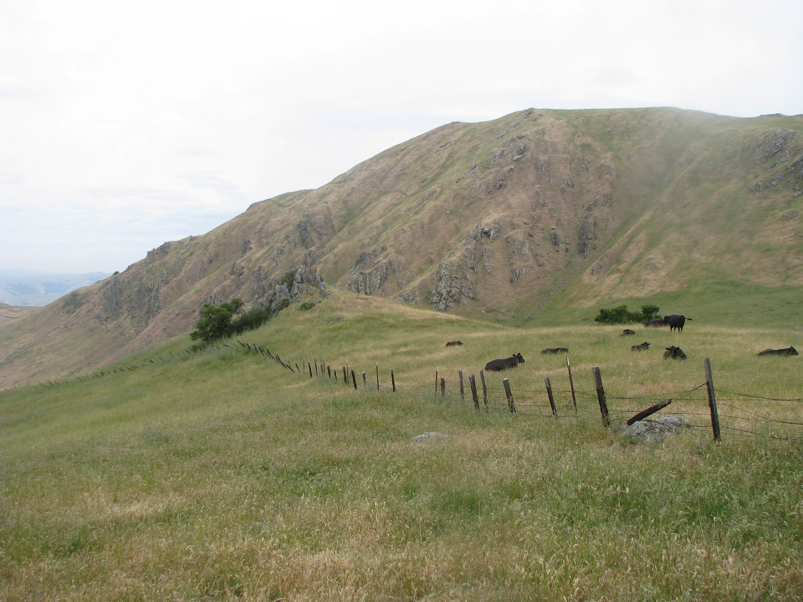
This trail, gravel-packed and wide nearly all the way to the summit, is also highly used by people who ascend it for exercise. I therefore decided to go up Peak Meadow Trail, where I was all by myself.


All by myself except for a number of cows that looked at me blankly. I crossed the cattle gate and left them behind. At that point the trail became much steeper and I had to stop for a breather every now and then.
Last spring was pretty wet and the hills were still very green and spotted with wildflowers.


It was a clear, quiet day. A perfect day to go flying.
A red-tail hawk
I turned right onto Horse Heaven Trail and kept ascending, crossing a cute little creek in my path. There were plenty of flowers around.
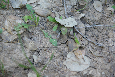
Bellardia trixago


A flower?


No. These are already the seeds of Blow-Wives (Achyrachaena mollis)!


Water flowing from McClure spring:


It is a beautiful but very slow ascend. Soon I meet the Grove trail but despite the soreness in my legs I continue onward, onto the Peak Trail. It doesn't look very far now.


Finally, I reached the summit. I removed my small backpack, had a good stretch and sat down to eat my breakfast and appreciate the view.
It took me 2.5 hours to reach the peak, and when I arrived I saw that someone already beat me to it:

A horned lark

The view to the north-east. You can see Mt. Diablo in the horizon:


And the view to the south-west:


After some time I got cold so I got up, shouldered my pack and headed down the north side of the Peak Trail, which connects to the Ohlone Wilderness Trail. On the way down I encountered the first non-domestic mammal: a busy ground squirrel.


I headed westward and downward on the Ohlone Wilderness Trail and soon found myself among quite a few people, most of them chatting in pairs or in small groups. The single ones were absorbed in their headphones. No one else seemed to be carrying a camera.
I found that going down was more difficult for me than going up, and that the gravel made it even more difficult.
A cattle fence along the path and on one of the fence posts I saw this cutie:

House Wren

I but further down the trail was keenly watched by a single coyote:


And the day's best treats were still to come. Soon after the coyote I saw this beauty sitting on a bush:

Lazuli Bunting, male
I was almost all the way down when a commotion in the nearby grass caught my ear. I turned and saw two ground squirrels messing up with a something. That something turned to be a rattle snake!
The squirrels kept harassing the snake and chasing it away. It kept snapping at them, rattling noisily the whole time. But what I found most amazing was that people were going up and down the trail without paying the slightest attention to the unfolding drama so close!

The last lag of this hike I had to run so to not be late to pick up the little chickas from school. All and all it was an amazingly rewarding hike of nearly 5 miles with nearly 2700'' elevation gain. It took me about 4 hours from start to finish.
It was nearly a week before I could walk normally again.  


Friday, April 20, 2012

A Morning Stroll in Garin/Dry Creek Pioneer Regional Park


Date: April 20, 2012
Place: Garin/Dry Creek Pioneer Regional Park, the East Bay, California
Difficulty level: moderate. 

Dry Creek Pioneer is south of Garin Regional Park, by the hills east of Union City and south Hayward. There are several nice trails in that park and this morning I hiked, for the first time, its southmost trail of Tolman Peak.
I parked by the Dry Creek park entrance (no fee required there) and started walking on May Trail, but almost immediately I turned right onto High Peak Loop Trail. I started at 9:15 am and it was already hot. I regretted not bringing my hat and was grateful for every tree along the trail.
The hills east of Union City are mostly grassy with occasional patches of trees, which are usually found on the north-facing slopes and along the narrow grooves between the hills. The trees are nearly all oaks, but by the water there are also quite a few laurels and maples.


The grassy areas are populated mainly by invasive weeds from the old world and are managed by cattle grazing. Cattle can be seen scattered on the hills and by the trails and one needs to be careful not to step in any 'pies' and to make sure to close all the cattle gates passed. My trail quickly left the trees and I found myself under the sun. A lovely pond below the trail looked particularly inviting. I saw a duck snoozing on a float in the sunshine. I continued hiking, resisting my desire to go down to the water.


High Peak Loop Trail takes a sharp left turn but I continued straight onto Tolman Peak Trail. The trail goes very near the creek, which right now is flowing very nicely. Many wildflowers bloom colorfully right beside the trail, including California Poppies.


I also saw a lonely fig tree, just emerging from hibernation.


A large tree becomes a growth platform supporting other vegetation.


Just like a multi-story garden.


After a little under a mile, Tolman Peak Trail takes a left turn. I chose to continue along the creek on the South Fork Trail and ascend the hill from the south. A small group of cows by the side of the trail followed me with wary looks as I passed them.

The trail begun to go up and soon became narrow and shaded. There, in the most remote part of my hike, I run into the only other hiker on that trail that morning.

On that trail I met some true royalty! Queen ants descended after their mating flight and looking for a suitable place to start their new homes. Here's one:


The hills comprise mainly of soft sandstone that is easily weathered and gives the hills their round, rolling appearance. I love to see patches of exposed rock, broken layers separated by tree roots and painted with lichen and mo
ss. The deeply shaded areas under the oaks are lushly greened with many fern species and the tree trunks are co

vered with green moss 'fur'.
A fallen tree becomes a feasting ground for fungi, of which only the fruiting bodies can be seen:
Between the trees and the grassland there is a strip of bushes and shrubs, their
grayish-green interrupted with patches of purple:
Lupine flowers.


And venturing out in the sun, the notorious poison oak, in full bloom.


Sweating and panting I reached the tree line and continued to climb on the grassy trail to the hilltop. The view from up there is spectacular. From Fremont to Hayward in the East Bay and from Redwood City to San Francisco in t
he west, Mount Tamalpeis in Marin County. The Bay Area is Beautiful!


I lone bench was waiting for me there, at the junction with Tolman Peak Trail. Unfortunately it was surrounded by mucky water, so I quickly took my photographs and left before the mosquitos could discover me. A few turkey vultures circled the sky above my head. No, I am not dead yet!


I went down Tolman Peak Trail, back to the creek. The same group of cows I saw before was now blocking my trail. As I was descending I wondered what to do about them, but as I approached they saved my the worry and bolted down and away.

I went back to High Ridge Loop Trail and May trail to the park entrance. I arrived there at 11:45 am, completely drenched with sweat. So hot!

The trail was about 3.5 miles and I walked it in 2.5 hours in a slow to moderate pace. A very nice hike it was, and the perfect season for it too!


Tuesday, April 17, 2012

A blog of love


This is a hiking blog. It is a blog of my love of the Earth. My love of the great outdoors. My love of Nature and its rich, dynamic beauty.

I love hiking by myself. To be completely immersed in Nature. To allow my spirit expand to the horizon without hindrance. To be able to stop for as long as I like and inspect a bug or a flower bud or an interesting rock. When I am alone, I am silent and fully receptive to the sounds of the wind, the water and the birds. Sometimes I can even hear the trees.

I love hiking with my family and my friends as well. More eyes notice more things. Children's eyes notice everything. Being outdoors makes me happy. Being outdoors with people I love can increase that happiness a great deal.

Twelve years ago Papa Quail and I moved to the San Francisco Bay Area and settled in the East Bay. It didn't take long for me to fall in love with the East Bay and all of its wild beauty. From the peaceful shoreline to the hills skyline, down to the creeks and lakes and all the way up to the highest point - the summit of Mount Diablo. It's signature topography, covered with a mantle of rich and diverse vegetation and teeming with wildlife, as well as ideal weather year-round, the East Bay is a true heaven for Nature lovers and recreational hikers such as myself.

I opened this blog so I could share my hiking experiences. Mostly in the East Bay, but also in other places I travel to with my family. If you are already a hiker, perhaps you can share your thoughts as well. If you are not, well, it's never too late to get out there and enjoy the love of Nature!

Lake Chabot: West Shore trail to Goldenrod-Cascade Trail loop.

Hike date: April 17, 2012
Place: Lake Chabot Regional Park, the East Bay, California
Coordinates: 37.71501 -122.10203
Difficulty level: moderate to strenuous. 
Trail is highlighted on the map below, which I downloaded from the Anthony Chabot Regional Park page of the East Bay Regional Parks District site.

Lake Chabot Regional Park is one of my favorite places to hike. It's proximity to my former home in Castro Valley has made it an easy getaway whenever I found the need to escape life's rat race, if only for a little while.
My first time at the park, nearly twelve years ago, was also the grandest. Together with Papa Quail and another friend I hiked the entire loop trail around the lake. I've been wanting to repeat this hike ever since and Earlier this week I found myself with the time and the energy and I was finally set on doing it.


Or so I thought. When I came to the park after dropping off the Quail Chikas at their school I found out that the 9 mile loop is temporarily closed and I was not prepared to do the 13 mile loop. So I hiked another trail, Suggested by the ranger at the entrance booth, which proved to be a fantastic choice.


I began my walk at 9:15 am, starting at Lake Chabot Marina and heading north, along the West Shore Trail. The weather was overcast and chilly, but after five minutes of walking my sweatshirt came off and into my backpack. The West Shore Trail runs right besides the lake, is paved with asphalt all the way to the dam (about 1.8 miles) and is easy to walk.


After crossing the dam I turned onto Bass Cove Trail, which is a wide dirt trail shared by bikers and equestrian. On that morning I was all alone on that trail. All alone, save for the birds, of course. And there were many of them. There were the usual water fowl: ducks, Canada geese, coots and cormorants. There were also plenty of bush birds chirping all around me. There is also a firing range on the other side of the park. I heard them, too.


The park is really green and lush right now. After last week's rains the trail was quite muddy and little brooks crossed it every now and then. I was glad I opted for closed shoes.

After a 1/3 miles on Bass Cove trail I turned left onto Goldenrod trail, which climbs uphill towards Grass Valley staging area, right above the Oakland Zoo. This trail is steep and walking it was quite strenuous. On top, though, there is a lovely view of the San Fancisco Bay.


The Goldenrod trail tangents the point where Grass Valley Rd curves into Skyline Blvd. There is a small parking lot there and an easy access to the trailhead. At that point I turned right onto the Jackson Grade trail that took me all the way down to the Grass Valley Creek. There, by the stone bridge, there is a bench and I sat there for a snack and a short rest. Then I turned right onto the Cascade Trail and entered a truly magical place.


Did I mention already that everything is green and lush right now? Well, the cascade trail is also aflame with magnificent spring blossom.


So many flowers are blooming there right now! Numerous species of ferns are unfurling their leaves under the oaks and laurels. Some places are covered with 'snowflakes' of fallen Madrone petals. Sweet honey smell emanating from blackberry vines in full bloom filled the air with promises of delicious harvest yet to come.


Intoxicated like the bees, I made my way slowly, stopping often to take a photograph and being careful not to step on any of the giant slugs that crossed my path:


At one point I stopped to photograph a tree root running through a nice conglomerate rock when I noticed this cute little guy curled right underneath, an aquatic garter snake:


The creek itself was flowing with so much water! On some stretches, the creek flowed slowly and lazily. On others, it was cascading noisily down some narrow rocky passages. Past the junction with the Columbine trail, the cascade trail becomes somewhat challenging. I had to crawl under a fallen tree, ford the creek twice (a long stick I found along the way was really helpful there!), and push through the bushes at one point. It was all worth it, though, because this part of the Grass Valley Creek is the loveliest point on the entire trail!


At its end, the creek enters Lake Chabot and I met Bass Cove Trail once more, going south, back to the marina. Heading back I took the time to photograph more flowers and birds, and the image of the peaceful lake nestled between the hills. I arrived at the marina at 1:25 pm. Walking at a moderate pace it took me a little over 4 hours to hike a little over 9 miles of some really gorgeous trails.

And as a last comment, anyone who'd like to hike just the Goldenrod-Cascade trail loop can begin at the trailhead by the Grass Valley Rd/Skyline Blvd curve. I strongly recommend wearing closed shoes and long pants on that trail because it's narrow and it's very difficult to avoid contact with poison oak, which is highly abundant there, and grows right into the trail in many places.

Spring 2014 update: the Poison Oak on this loop trail had been completely cleared away. I mean, completely. There's not even a sample left to show people what to avoid ...