Date: April 20, 2012
Place: Garin/Dry Creek Pioneer Regional Park, the East Bay, California
Difficulty level: moderate.
Difficulty level: moderate.
Dry Creek Pioneer is south of Garin Regional Park, by the hills east of Union City and south Hayward. There are several nice trails in that park and this morning I hiked, for the first time, its southmost trail of Tolman Peak.
I parked by the Dry Creek park entrance (no fee required there) and started walking on May Trail, but almost immediately I turned right onto High Peak Loop Trail. I started at 9:15 am and it was already hot. I regretted not bringing my hat and was grateful for every tree along the trail. The hills east of Union City are mostly grassy with occasional patches of trees, which are usually found on the north-facing slopes and along the narrow grooves between the hills. The trees are nearly all oaks, but by the water there are also quite a few laurels and maples.

The grassy areas are populated mainly by invasive weeds from the old world and are managed by cattle grazing. Cattle can be seen scattered on the hills and by the trails and one needs to be careful not to step in any 'pies' and to make sure to close all the cattle gates passed. My trail quickly left the trees and I found myself under the sun. A lovely pond below the trail looked particularly inviting. I saw a duck snoozing on a float in the sunshine. I continued hiking, resisting my desire to go down to the water.

High Peak Loop Trail takes a sharp left turn but I continued straight onto Tolman Peak Trail. The trail goes very near the creek, which right now is flowing very nicely. Many wildflowers bloom colorfully right beside the trail, including California Poppies.

I also saw a lonely fig tree, just emerging from hibernation.

A large tree becomes a growth platform supporting other vegetation.

Just like a multi-story garden.

After a little under a mile, Tolman Peak Trail takes a left turn. I chose to continue along the creek on the South Fork Trail and ascend the hill from the south. A small group of cows by the side of the trail followed me with wary looks as I passed them.
The trail begun to go up and soon became narrow and shaded. There, in the most remote part of my hike, I run into the only other hiker on that trail that morning.

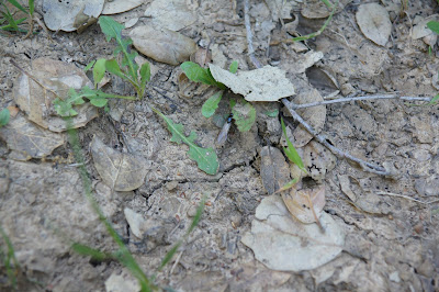
On that trail I met some true royalty! Queen ants descended after their mating flight and looking for a suitable place to start their new homes. Here's one:


The hills comprise mainly of soft sandstone that is easily weathered and gives the hills their round, rolling appearance. I love to see patches of exposed rock, broken layers separated by tree roots and painted with lichen and mo
ss. The deeply shaded areas under the oaks are lushly greened with many fern species and the tree trunks are co

vered with green moss 'fur'.
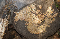
A fallen tree becomes a feasting ground for fungi, of which only the fruiting bodies can be seen:
Between the trees and the grassland there is a strip of bushes and shrubs, their
grayish-green interrupted with patches of purple:
Lupine flowers.


And venturing out in the sun, the notorious poison oak, in full bloom.

Sweating and panting I reached the tree line and continued to climb on the grassy trail to the hilltop. The view from up there is spectacular. From Fremont to Hayward in the East Bay and from Redwood City to San Francisco in t
he west, Mount Tamalpeis in Marin County. The Bay Area is Beautiful!

I lone bench was waiting for me there, at the junction with Tolman Peak Trail. Unfortunately it was surrounded by mucky water, so I quickly took my photographs and left before the mosquitos could discover me. A few turkey vultures circled the sky above my head. No, I am not dead yet!

I went down Tolman Peak Trail, back to the creek. The same group of cows I saw before was now blocking my trail. As I was descending I wondered what to do about them, but as I approached they saved my the worry and bolted down and away.
I went back to High Ridge Loop Trail and May trail to the park entrance. I arrived there at 11:45 am, completely drenched with sweat. So hot!
The trail was about 3.5 miles and I walked it in 2.5 hours in a slow to moderate pace. A very nice hike it was, and the perfect season for it too!


It looks lovely at spring time.
ReplyDeleteand the photos are really beautiful.
Thanks, my friend :-)
by the way - is there away to bet informed when you reply to my comment?
Thank you!
DeleteAbout your question - I don't know. I am still figuring this platform out myself. I bet you'll be able to find that out before me :-)
Mamma Quail,
ReplyDeleteYou inspire me.
Love,
Laurel Leaf
Thank you for your words!
Delete