Wednesday, May 25, 2016

On A Second Impression: Rediscovering Henry W. Coe State Park

Date: April 25 and 30,  2016
Place: Henry W. Coe State Park, Morgan Hill, California
Coordinates: 37.186655, -121.546874
Length: 9 miles
Level: strenuous

A few years ago I found out about Henry W. Coe State Park and immediately booked a camping trip there for my family, plus a good friend who came to visit us at that time. It was late in November, and the park was cold, bare and dreary. On top of that, some of us got bitten by ticks. To sum it up, our first experience there wasn't the greatest, and I was in no hurry to return there.
In the last couple of years, however, I've been thinking that it might be time to reconsider my opinion of this park. I've met people who've been there and loved it, and I've been seeing photos online. and still, I kept putting it off.
Until I was looking for a group campsite for our 4H Camping Project and found that the only available site for the date we had was at Henry Coe. A clearer sign that this I couldn't expect, so I booked a group site and headed there to check it out.
Manzanita Point Campground is 2.5 miles removed from the parking lot. Campers are allowed to drive two cars only to the campsite, everyone else walks.
I left home at dawn to avoid passing San Jose in the morning rush hour, so I arrived at Henry Cow very early. The place appeared deserted. Only one other car was parked by the closed visitor center. I parked next to it and walked around the place, looking for the trailhead.
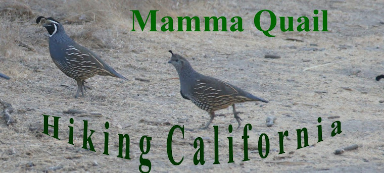
California Quails were running near the roads and scattered away as I approached, not recognizing me as one of their own :-) 

California Quail, male
There were a few people at the small campground. A couple sitting by their morning campfire pointed me to a nearby tree where acorn woodpeckers were nesting. They also directed me to where the trailhead was. I thanked them and went to the trailhead without stopping to photograph the woodpeckers. That as it turned out, was how I got my woodpecker jinx for that day: from then on, every time I saw an acorn woodpecker it flew away exactly when I was clicking my camera. I, therefore, have no decent woodpecker photos from that hike, despite having seen many of them.
My hike at Henry W. Coe as captured by my GPS
The moment I stepped onto the Corral Trail I knew this was going to be a much different experience than my first hike at this park: a way, way better one. I also knew it will be a very slow one - there was so much spring bloom to appreciate!
Common Verbena (Verbena lasiostachys) 
Very early the trail delves into a loose oak forest that covers the hillside. It was a chilly morning and despite the sunshine I was shivering with my sweater on. I tried passing the shady areas quickly.

The shade and cold didn't hold any bloom back and under the oaks were all the little blue flowers i could think of.
Baby Blue Eyes (Nemophila menziesii) 
Ant not only in the shade. The grassy hillside beyond the grove was covered with purple patches like a drunken quilt.
California Gilia (Gilia achilleifolia)
It was so cold that morning that I didn't see any butterflies until much later that day. On my following trip there with the 4H Camping Project it was plenty warm and there were butterflies fluttering all over the place. It was then that I got to photograph some of them.

The flowers themselves were enough to make me happy. It was spring galore.
White Blue-eyed Mary (Collins bartisiitolia) 
After a little over half a mile I came upon an intersection. I could chose to merge with Manzanita Point Road and walk it all the way to the campground, but I chose to continue on Springs Trail which was longer, but went through the wilderness for almost 2 miles more before meeting Manzanita Point Road once more.
All the way to the campground I was going in and out of oak groves, spaced by large areas of open grassy slopes.

It was about mid way to the campground that I first noticed the irises. There was a group of them under the oak trees and they were very short. If not for their intense blue color I'd probably have missed them. At first I thought these were just stunted versions of another iris species I was familiar with from other places in the area, but as it turned out, these were ground iris - species that's normally short. All the irises I saw at Henry Coe that day were of that species, and that was the only place I've seen them as of yet.
Ground Iris (Iris macrosiphon) 
Out of the woods and in the open I was walking on a high ridge, with a wide view to the west. By then I was already warm and I welcomed the breeze that blew over the crests and canopies.

The grassland was almost all old-world invasive grasses. the most common being the wild oats, with other grasses poking over the see of oats here and there.
Bromus in Wild Oats Field
The 2-miles long narrow Springs trail I was hiking on ended at Manzanita Point Road, so the rest of the way I was walking on a wide dirt road that was partly shaded by large, well-spaced oaks.
Patches of clover and other flowers gave their colors to this part of my hike. There were also small manzanita bushes here and there: a prelude to the giant manzanita grove that was down at the point.
White-tipped Clover (Trillium variegatum) 
There was a group of wild turkey walking along with me. I didn't see them at first: they were in the vegetation, but I could hear them alright. They were very loud with their gobbling. They sound was was getting nearer with every step, until they finally emerged into the open: Athos, Porthos and Aramis, I called these trio of male turkeys.
There was a D'Artagnan there as well who' s trying to join them but they kepy chasing him away.
They walked on the trail just ahead of me, and I was keeping a respectful distance from them, until they eventually slipped into the vegetation again and merged with the shadows.
Wild Turkey
At the nearer edge of Manzanita Point Campground there is a little, turkey pond called Bass Lake. It is tiny, but I spent a good half an hour circumventing it. I couldn't imagine this dirty pond having any fish in it, but it sure gave beautiful reflection of the trees around.
Bass Lake
On my second visit there with the 4H group we met many other young people around the lake. They were all busy fishing, fly-fishing mostly. A few even managed to catch fish. Tiny, little fish that were immediately released back into the pond.
I don't fish. I focused on the wildflowers around the lake, one of which was another species that was new for me: the large-flowered Leptosiphon .
Large-flowered Leptosiphon (Leptosiphon grandiflorus) 
Manzanita Point campground is large and widely dispersed in the open oak forest. After circumventing the lake I continued to check the campsite I'd reserved for our 4H group. Then I had a dilemma to salve.
The area of Manzanita Point Campground 
My dilemma was simple: should I go on or go back? I had originally planned to hike down to Coyote Creek and walk along it to China Hole campground. The problem was that I took much time to hike the 2.5 miles to Manzanita Point, meaning that if I went on with my original plan I would have to up my pace significantly in order to finish on time to pick up my chikas from school.
But when else would I have this wonderful opportunity to explore this park before spring was over?
So I moved on. I turned right (south) on the narrow Madrone Soda Springs trail and started downhill.
Madrone Soda Springs Trail 
That was my downhill segment of the hike. Naturally it was the fastest one too, but sure enough, I found myself slowing down for wildflowers.
Chaparral Clarkia (Clarkia affinis)
Still, I didn't take many photos on that part of the trail. On my next resist, however, hiking with the 4Hers, I completed documenting what I has missed, including the lovely mariposa lilies.
Yellow Mariposa Lily (Calochortus luteus) 
I wasn't down Madrone Soda Springs Trail on the second hike, just down and up China Hole Trail, but the wildflowers display was very similar. And then there were the butterflies too. Amazingly enough, they posed for me :-)
Checkerspot Butterfly on a Yellow Mariposa Lily
In my mind I had sectioned the trail into segments and gave myself a time limit to finish each one. To  the bottom of Madrone Soda Springs trail I arrived 5 minutes late. I convinced myself that I could catch up extra time by hiking faster and taking less pictures.
Yeah, right.
Coyote Creek
The next trail was named on the map the 1 Mile trail. It is, in fact, 1.2 miles, but who counts. That entire trail goes along the lovely Coyote Creek, and I was walking up the current.
I yearned to take my shoes off and wade in the water but I hadn't the time so I kept pushing on.
Blue-eyed Grass (Sisyrinchium bellum) 
That part of the trail is mostly shaded, but there were plenty of sunny spots too. Like on higher elevations - wildflowers everywhere.
Royal Larkspur (Delphinium variegated)  
The morning chill was gone and replaced with mid-day warmth. I was hot from the quickened pace and welcomed the shade of the trees and the coolness of the creek.

Even with the tree cover I couldn't quite call it a forest. The woodland star didn't mind.
Hill Star (Lithophragma heterophyllum) 
The trail crosses the creek several times and I was beginning to slow down. For the first time on that hike I started thinking that my choice to continue may not have been the wisest.

When I finally arrived at China Hole I was already 15 minutes behind my allotted time, and I was still facing the uphill part of the hike. All I allowed myself was to click a few photos and start up China Hole trail without delay. It was particularly sore because China Hole is the most beautiful place along this hike.

And that's why when I returned there with the 4H group I dragged everyone downhill back to China Hole. The second time around I did take my time. I took lots of time, to properly enjoy the place and its charms.
China Hole at Coyote Creek
There is a nice river beach there, and a water hole deep enough for swimming and even for mild rock diving. As expected on a beautiful weekend, there were many other people there too. It was challenging to get some people-free shots of the place. I had to get a bit further upstream for that, where I could at least crop out the other solitude-seekers from the photo.
China Hole at Coyote Creek
On my second hike there was plenty of time, not only for China Hole but also for wildflower viewing. As always, I used the opportunity and the captive audience to share my love of the local flora with the kids.
Lupine (Lupinus sp.)
Either visit, eventually I was facing the big uphill hike back to Manzanita Point. There is, actually, a walk-in campsite at China Hole, and that might be a choice for me on my next visit there, but on both my April hikes the time came to say goodby to the beautiful Coyote Creek and hit the trail again.
Larkspur
Back on my solo hike I started up at a quick pace. The trail isn't steep but it's on a constant grade, and the day was getting hot.
A view of China Hole from the trail.
By then I was seriously worried that I'll be late to pick up the chikas from school, so I made very few stops on the way, mainly to drink and to catch my breath. Nearly all the wildflower photos from this trail segment I took on my second hike with the 4H group.
White Globe Lily (Calochortus albus) 
But even without stopping for photographs, it was impossible to ignore the spring splendor of the hills. The patches of color, the fluttering of the butterflies.
Swallowtail enjoying Larkspur flowers
The bottom part of the China Hole Trail is open grassy slopes dotted with beautiful, majestic oak trees. The trail laced its way between the trees and I would stop for a quick drink of water in the occasional shade. 

I was alone most of that first hike, but at that place, about a third way up the trail, I run into the couple from the campground as they were hiking down to China Hole. We chatted for a few minutes. They were very confident that I'd make it back to the parking lot on time. I was much less confident, however,  in my ability to drive through San Jose in an hour. No level of fitness can help there.
Owl's Clover (Castilleja densiflora) 
So after wishing that couple a wonderful rest of the day I picked up my pace even more, and soon I was high up, making my way between high chaparral walls. 

I was focused on getting up fast. I've seen power walkers take headphones on their walks, but I never do that, as I much prefer the sounds of Nature. But when I in need of a power walk, I tend to run marching rhythms in my mind, usually the same one over and over. This time it was the late Ronnie James Dio blaring inside my mind,  "Maaaan on the Siiiilveeer Moooountain!"

I was on the roll, marching on and on. Only a flower could stop my on my march. A humble chaparral flower under the chamise bushes.
Skullcap (Scutellaria tuberosa) 
Since I already stopped I also took the moment to appreciate the view, with was absolutely fantastic.
Coyote Creek, a view form above. 
A far away mountain in the background: the prominent Fremont Peak in the south.

Finally the trail started leveling off, and in a good time because the fast pace and the up-slope had left me winded.
I then entered giant manzanita rhealm.
Manzanita bushes can grow to a respectable size, i've seen that in many other places. But I've never before seen so many giant-size manzanitas, tree-size really, all grouped in one place. I was now walking in a tunnel made of these big beauties, appreciating their sleek, dark red trunks and thankful for the shade they provided.
Manzanita Avenue
As I was nearing Manzanita Point the manzanitas were replaced by oaks and pines, and the shade became deeper. Under the trees were some shade-adapted plant species, many of them were also blooming.
Creeping snowberry (Symphoricarpos mollis) 
Some were new to me, like this unassuming California Tea (which I have no idea if it's actually drinkable. 
California Tea (Rupertia physodes) 
I made it back at Manzanita Point Campground and had to sit down for a little bit. Then I was facing a new dilemma: I was already more than half and hour behind my allotted time and I still had 2.5 miles to get back to the parking lot. But perhaps I'll get there faster if instead of taking back the same Springs/Coral trails I'd hike Manzanita Point Road?

The way by Manzanita Point Road, at least up to the meeting place with Corral Trail would be shorter, but it also meant going more uphill, and my muscles were already protesting loudly. I walked up to the intersection with the Springs Trail, decided I didn't feel like going uphill again and started down the narrow Springs Trail where I had came from in the morning.
A few minutes after making that choice I looked at the time, swore, and turned around back to Manzanita Point Road. I'd have to go uphill by the shorter route because it was way too late to go down Springs Trail.

It was the better decision. The uphill part was over quickly and then I was walking on the ridge with a beautiful view of the high plateau. A fantastic carpet of California poppies matted the grass and the sight was magnificent.
California Poppy ( Eschscholzia californica) 
A small movement in the grass grasped my attention: a young ground squirrel was giving me the eye. He seemed very skittish, but didn't go underground.
California Ground Squirrel
I went on, already resigning to the fact I was going to be late for school. Then I heard the sound of an engine and I saw a small motorized cart coming toward me. The ranger at the wheel stopped briefly and asked how I was doing and I said fine. He bade me a good day. I wished him the same, and then he drove away. 
Darn it, I could have asked for a lift to the parking lot! Silly me. Now I had to keep on walking. 
I came to the last intersection and took the Corral Trail again back to the parking lot. 
Oak and Pine together
By the time I got to my car I was already swaying with exhaustion and limping in pain. And I was facing the biggest challenge yet: the grueling drive back home through the San Jose rush hour traffic.

In the end I was late, but not by much. The chikas were a bit miffed but forgot all about it after I fed them lunch. My muscles took more time to forget this crazy race against the clock but by the following weekend when it was time to go back there with the 4H group I was fine again and ready to go back down to Coyote Creek.

Henry W. Coe is a beautiful park. I really shouldn't have waited so long to get a second impression.


Monday, May 16, 2016

Forest Springtime at Huddart County Park

Coastal Redwood (Sequoia sempervirens)
Dates: March 17, 26, and April 24.
Place: Huddart Park, Woodside, California
Coordinates: 37.440388, -122.291514
Length: 2 miles
Level: easy

Huddart Park has been on my wannagothere list for a while before I actually made it there for the first time, and then it rained.
But spring was just around the corner and one March day I went there again, this time to another trail. I stopped at the gate and asked the attendant what was the status of wildflowers.
"Not much. It's just beginning," he said.
Everywhere else in the coastal region spring bloom was at its peak so I was a bit bummed to hear this. He had recommended a nice, family-friendly loop trail and I was more than happy to take his recommendation.
I went on my hike without high expectations and what I discovered was that the attendant was wrong, or simply not updated. A marvelous bloom was on, with the wave of early bloomers already over the peak and the second wave was peaking. On the following week I returned for the second time with a group of families. Then a month later I was there again, hiking the same trail with another hiking group. I t was good to see the transition from spring flowers to summer's.
My hike at Huddart Park as captured by my GPS. 
A small trail segment lead me from the parking lot to the Bay Tree trailhead where the trail delved right away into the forest. On the east side of the park the forest is dominated by redwoods. Young, thin redwoods, stretching up, hungry for sunlight.
 

The thin trees allowed quite a lot of sunshine through. Much more than other, older redwood forests I've been to. Accordingly, there was a lot of forest undergrowth, and much of it was blooming.
The pinto violet was growing in the more shaded areas.
Pinto Violet (Viola ocellata)
The Indian warrior, however, populated the sunny spots. On my March hike I caught the tail of their bloom.
Indian Warrior (Pedicularis densiflora)
These Indian warrior i've seen in March were the last of the season. So, apparently, were the hound's tongue. They were blooming in abundance still in March, but by April they were all in fruit.
Grand Hound's Tongue (Cynoglossum grande)
But in March the irises were just beginning, and in April the forest was full of them. Beautiful, proud, majestic.
Douglas Iris (Iris douglasiuna) 
April brought also the white globe lilies. These beauties I always enjoy finding.
White Globe Lily (Calochortus albus) 
Passing through the grove of thin redwoods I made it to a beautiful grove of laurel trees, no doubt these trees are what gave the trail its name.
California Laurel (Umbellularia californica) 
From that point all the way down to the creek the redwoods were few and far between. Down on the ground, the delicate woodland star joined the forest's spring fest.
Common Woodland Star (Lithophragma affine)
Here and there were fallen trees along he trail. These trees are food for fungi.

Further down the trail - wood rose were blooming. Their delicate flowers shining between the thorns. Here is the humble wild original of all the fancy domestic cultivars that are the pride of gardens world-wide.
I like the wild rose best.
Wood Rose (Rosa gymnocarpa) 
Spiny scarlet balls on the underside of the rose leaves grabbed my attention: these are galls - a growth caused by an insect that laid her eggs inside the plant's tissue.
Galls on Wood Rose
Bay Tree trail ends in a wide lawn and a picnic area. The perfect stop for a group to rest and regroup. A common buckeye butterfly was in agreement and landed right next to us, allowing the children to look at it from relatively close distance before fluttering off to a more distant spot. 
Common Buckeye
The lawn is introduced grass, of course. With it - more exotic plants that thrive in old world style lawns. 
Fleabane (Erigeron karvinskianus), non-native
Usually I disregard these invasive wildflowers. I already know them from overseas and they don't seem as interesting to me as the local flora. This time,however, I did give them more attention. They are beautiful, no doubt. Even the tiny, delicate fieldmadder.
Blue Fieldmadder (Sherardia arvensis), non-native
Besides, documenting them helps me remember what grows where.
Strawberry Clover (Trifolium fragiferum), non-native
From that picnic area I continued north on Richards Road Trail that stretches along the creek. By that trail, just a few steps away from the lawn, I found a few checker lilies that in March were in full bloom. That discovery made me very happy - the fritillaries are well camouflaged and aren't easy to see.
Checker Lily (Fritillaria affinis)
Down by the creek there are redwoods once again. Young, thin redwoods encircling the left over stumps of the old growth trees that were logged off a century ago.

The trail was very damp, even muddy at places. The remains of a rainy day earlier that week. I walked slowly, circumventing the occasional puddle. Under the redwoods bloomed their associate, the redwood sorrel.
Redwood Sorrel (Oxalis oregana) 
On my April hike the sorrel was accompanied by the delicate starflower.
Starflower (Trientalis borealis) 
The creek I was walking along had a nice water flow. Right before going on the bridge to cross to the other side there is a small trail that leads to the water. It was a perfect place for a long stop where the children (and adults too) could take off their shoes and wade. My elder chika who joined the group hike found some ocher stones and offered to practice her face-painting skills on the other kids in the group.
West Union Creek
Both my solo hike and my group hikes were short and easy paced. Another time I will explore further up that trail, but on these hikes I stayed on the west side of the creek and took the left turn onto Crystal Springs Trail, going back uphill to the trailhead.
Trillium (Trillium sp.) with fruit.
The trail going up is short, but it is sweet and full of interesting surprises. Some very small - it takes close attention to see them. In the case of those fungi in the photo below the color contrast certainly helped.


On my March solo hike a deer crossed my path on the way up. It was going fast between the trees, but I was able to catch a blurry image of it before it scurried away.
Black-tailed Deer
But the nicest surprise along that trail was about mid-way up: a small patch of fairy slipper orchids, well hidden in the vegetation. My March group got to see them too, but by April they were finished. Got to go back next spring to see them again. 
Fairy Slipper (Calypso bulbosa)
The road leading from Woodside to Huddart Park is narrow and winding and it is very popular with bicyclists. The practical meaning of this is that it's a very slow drive to get there. The slow speed comes with a special bonus: the ability to spot and appreciate the roadside botanicals. And in the case of sighting a columbine patch - to make a special stop (hard to find a pull-out there!) and inspect it closely.
Crimson Columbine (Aquilegia formosa) 
Huddart Park has a nice trail system and I only got to explore a bit of it. The We are very fortunate here in the Bay Area, to have so much Nature, so close by. I promised myself I'll go back there soon to explore some more. Soon.