Monday, February 22, 2016

A Forest in Shrouds: The Dead Sequoia Loop at Sequoia National Park

Date: January 11, 2016
Place: Sequoia National Park, California
Coordinates: 36.74969, -118.973005
Length: 2 miles
Level: moderate

After completing the obligatory walk around the Grant Grove, my friend and I were up for a more serious hike. We didn't have the time for anything too long so we headed to the end of the parking lot where the trailhead for the 2-miles long Dead Sequoia loop was.
Our hike, as captured by my GPS, superimposed on satellite image. 
 We changed our crampons for snowshoes. It was my friend's first time walking in snow shoes, but after a few steps she was striding along like she was born in them. 
The trail was groomed, but the snow park was pretty high. A few people went down the trail before us - we were following other snowshoe steps - but we didn't actually see anyone.  
Heading out to the woods
The thick layer of snow was a sight for sore eyes. Particularly when the sad evidence of the long drought were everywhere.
Drought Casualty 
But the forest is resilient and life, even deep in winter, was all around us.
Lichen

And the most majestic are, of course, the giant sequoia. While most sequoia I've seen are single-trunk straight up trees, some divert from that theme, like this tree in the photo below. This one shows reiteration: the upward parallel side branch that grows when the tree's main apex is compromised. It can, potentially, take over as the main trunk if the original primary one is too damaged.
Reiteration
The needle-like conifers ton't hang on to the fallen snow for too long. The broad-leaf trees were keeping their snow mantle for some time longer, even without the leaves.
Snow-bearing Dogwood
Snowshoeing is a slow business. Our hike was even slower because we kept stopping to look at stuff. At some point I heard a loud call and see a fish of red go past me. It was a pileated woodpecker! I reached for the binoculars only to find out that we had left it by a fallen log we had to climb over about half a mile before. My friend was ready to go back and fetch it but I argued agains it. I hated the thought of leaving it there, where it would become a piece of trash, but it was already getting late and I feared of getting stuck on that trail after dark. So we moved on.
As we were coming round the loop, starting to head back up again, we came upon a sinister scene: the remains of a forest fire.
Sequoia at the edge of the fire
Wildfires are a natural occurrence in California forests and is an integral part of the forest's life cycle. The prolonged drought, however, combined with the boring beetle infestation, had created conditions for monster fires. And indeed, many such fires raged through California over the last summer. One of those minster fires was the Rough Fire that begun late in August in the area of Kings Canyon National Park and lasted for over two months. I was thirty miles south of there when it started and the column of smoke was already immense. Over the period it raged the Rough Fire burned over a 150 acres and has caused the closure of Kings Canyon National Park.
On our Dead Sequoia Hike, my friend and I were snowshoeing at the edge of the Rough Fire Area. We walked solemnly between the burnt trees, smelling the ashes that were still hanging in the air, months after that fire was put out.
Giant Sequoia: resistant but not invincible. 
Giant Sequoia are resistant to wildfires. They have a thick, tannins-packed back that is a very effective fire-attenuator. The giant Giant Sequoia survive many a forest fire throughout their lives. They are pretty resistant, but they are not invincible. A massive fire can destroy them :-(
Dead Sequoia. 
They say that trees die standing. It certainly was the case where we were. We were walking through  forest of dead charred trees.
Rough Fire Aftermath
The brunt trees were still shedding ashes, drawing circle shrouds on the pure white snow.
Ashes to Ground. 
But the forest itself was not dead. Beneath the snow, underground, there is a seed bank, waiting to germinate. It will be years before the forest be restored. Until then it would be the time of herbaceous wildflowers and low shrubs to enjoy the sunlight.
And then again, I was very happy for any tree that had survived. Particularly if it was sequoia.
Alive 
The last part of the loop was a steep climb and I was glad to have spent a few dollars more for the heel-raise bar of the snowshoes. It made the climb much easier and faster.
Higher up we were out of the fire zone and back in the realm of living trees. Baby trees that would never have survived had the fire reached them were tucked under a thick blanket of snow, waiting for the spring melt.
Tucked-in for winter
Just where the loop closes we saw the leftovers of an old snow fort. A snow fort is a human-made pile of snow with a cavity dug inside. It is a good to know survival skill in case one gets stranded in the wilderness during winter - the snow insulates pretty well inside that think. I know that from a personal experience, after having slept in one on one very cold Wisconsin winter night. (And no, that wasn't for survival. Friends I built it with had dared me to join in for the night :-)  )
Crumbling Snow Fort
We continued uphill on the trail spur that connected back to the parking lot. The light was already failing and I had to use the flash to photograph the only evergreen broadleaf I saw along the trail - a healthy and beautiful manzanita bush. 
A winter evergreen. Manzanita. 
As we were approaching the sequoia duo that marked the edge of the parking lot I noticed a dark object on the snow. The object looked familiar. Could it possibly be ...
Yes, it was! My lost binoculars had miraculously made it all the way up the trail, hitching a ride on another hiker until the strap knot loosened and released, waiting for us on the snow. I picked it up gingerly, inspecting it from all side. It was my binoculars alright, with all the right markings. There was no one around to ask or thank, so I gave a silent thanks to the forest spirit, retied the knot and slung the binoculars around my neck. 
The home stretch
We had planned to drive to Hume Lake after the hike but by the time we had finished it it was obvious we would not make it in time. So we settled for a short drive north until we found a spot with a view and sat there to watch the sunset. 
Sequoia Sunset 
That was the last of our Western Sierra for that road trip. That night we were heading southeast, rounding the southern tip of the Sierra and driving all the way to Ridgecrest. On the morrow we would wake up to a completely different scenery - that of the eastern California desert. A scenery of harsh, naked rocks and of alien-looking formations such as the Trona Pinnacles


Tuesday, February 16, 2016

The General and Associates: The Grant Grove of Giant Sequoia

The General
Date: January 11, 2016
Place: Sequoia National Park, California
Coordinates: 36.74969, -118.973005
Length: 0.4 mile
Level: easy

The day after our 'must see' visit to Yosemite National Park my friend and I were heading up the mountains again for another must see: to the Giant Sequoia of Sequoia National Park. There area Giant Sequoia in Yosemite too but the nice groves are inaccessible during winter. Sequoia National Park, however, where the main road goes right between the giants, was open. Or at least that's what the web site info.
It was a glorious morning. Sunny and beautiful Monday. A regular work day in off-season January, and we had the road from Fresno to Sequoia NP all to ourselves. Without any traffic delays we were quickly up at the snowline. The mountainside scenery was absolutely gorgeous. But all that forest beauty was laced with the brown bodies of the trees that died of thirst and boring beetles. We were looking at the aftermath of 4 years of drought.
A stop on the way up
My original plan was to drive directly over to General Sherman: the biggest sequoia in the park, but at the Grant Grove Visitor Center I was informed that the Generals Highway was blocked off.
"You'll have to drive down and around, and come all the way back up from Three Rivers," said the gate attendant.
I wasn't going to waste two hours of daylight on unnecessary driving, so we settled for seeing another giant sequoia: General Grant.
The access road to Grant Grove slopes down with a steep grade. It was icy, too. We made it carefully to the parking lot and I prepared my camera while my friend stood gaping at the nearby sequoia trees.

Young Giant Sequoia (Sequoiadendron giganteum) flanking the Grant Grove parking lot
The Grant Grove trail is short and paved. It is also sloped and when we were there - covered with icy snow. So back in crampons we were.
We did the loop slowly, and not because of the snow. Every tree in that grove merits special attention. Particularly when seen for the first time. My friend craned her neck so much that it ached. She also took photos with her phone, some of which I've used in this post. I credit her as Mama Chukar - an Old World bird introduced in California.
Giant Sequoia (Sequoiadendron giganteum) 
A fallen giant lies on the ground. It is completely hollow inside and beaten to sleekness a path inside the tree connects to the other side of the trail.


Naturally, we went inside. The wood was smooth from the multitudes that have passed there before us.

Some visitors decided to leave a more personal mark in the tree. A cut section was etched with carved graffiti. Some of the carvings were dated and pretty old. I didn't spend too much time on these but did catch the years 1880 and 1885 carved in the wood.
I honestly don't like this practice. It feels sacrilegious to me.

We didn't want to short-cut our loop so we walked down the tree tunnel back to where we entered and moved on.
A gap between the trees, and there was General Grant in full view, the sunlight beam directly on it. And from that distance I could get it all inside one photo :-)
General Grant
Fresh snow always remind me of whipped cream. I have to resist the urge to lick it.


The snow was pretty high everywhere except for the trails where it had been (mostly) removed. The Grant Grove trail also features benches for the tired. We declined.
Fresh Upholstery 
Giant Sequoia and white fir aren't the only trees in that forest. There were a few broad-leaf trees about, all stack naked. A single leaf on the snow revealed the identity of one of them: a dogwood tree.
Fallen Dogwood Leaf
We circled around General Grant, but there was no getting the whole of it into one photo. Even the 'smaller' sequoia posed a serious challenge for my camera. I was fine settling for nice canopy shots.
A halo of white fluffy clouds
Nearing the end of the loop we came upon the Gamlin Cabin. This old log cabin was build by a logging prospector who also raised cattle in the area. Later on, it was used as the first headquarters of the new Sequoia National Park.
I was fascinated by how the walls had been built by latching logs but the roof beams have been nailed together. I wondered if the roof might not be the original but found no one to ask.
The Gamlin Cabin
Early January days are awfully short. When we finished the short Grant Grove loop the sun was already leaning heavily to the west. I caught it trying to sneak away behind the trees. Those trees, however, were giant sequoia. There was still some tome before the sun would touch the lesser tree tops.


That meant we had time for another trail.  So we put on our snow shoes and headed out to trod the Dead Sequoia Loop Trail.


Saturday, February 6, 2016

Wearing White: the Bridalveil and Yosemite Falls in Winter

Date: January 10, 2016
Place: Yosemite National Park, California
Coordinates: Bridalveil Fall: 37.716700, -119.650960, Lower Yosemite Falls Trail: 37.746135, -119.592792
Length: Bridalveil Fall: 0.5 mile in and out, Lower Yosemite Fall Loop: 1 mile
Level: easy (wear chain crampons when icy)


Yosemite is high on the 'must see' list of California visitors and winter is no hindrance. Usually. Rock slides that block access to El Portal entrance to Yosemite Valley are not all too uncommon, and such a slide happened at the time we had planned to go there. We arrived at Mariposa after an afternoon birding hike at the San Joaquin NWR and we were very happy to find out that the rock slide has been cleared, thanks to the round the clock effort of the CalTrans road crew.

The Valley is the only accessible part of Yosemite NP that is open throughout the year. While it can be accessed also via Groveland on the north and Oakhurst on the south (chains required), all other parts of the park are effectively closed from the first major snowfall until late spring snowmelt.

We didn't plan any major hikes in the Valley, just a round of sight seeing. Normally I wouldn't have posted such a trip here, but Yosemite in the snow has a special appeal and, under snow even the shortest trails can be hikes :-)

Whenever we bring first timers to Yosemite, our first stop is the Tunnel Viewpoint. From that spot the entire Valley spreads before the eye. That breathtaking view that awed every generation of humans to have seen it, from the native Miwok to the first western settlers until today's visitors, amny of which travel thousands of miles around the globe to admire the place.
And it is breathtaking each and every time I go there. Any time of day, any day of the year. 
Yosemite Valley, view from the Tunnel Viewpoint
Curved by ice-age glaciers, Yosemite Valley lies 3000 feet below the surrounding granite walls. All the water coming down its watershed collects into the Merced River. The tree cover of the Valley floor effectively hides the numerous man-made structures. The river would normally be invisible too under the tree cover, but on a cold winter morning an aura of white fog gives away its curves.
Fog over Merced River
After the first stop of viewing the Valley from the Tunnel Viewpoint, the next natural stop is the Bridalveil Falls.
As expected at any time of year in Yosemite, we were hardly alone. But it wasn't as crowded as in other times of year. There is a short, 1/4 trail from the parking lot to the waterfall and it was entirely covered with snow.
The trail to Bridalveil Falls
The chikas wanted to build a snow man. I told them they'll get some time for that later and we continued on to the falls.
We walked slowly but steadily, until the trail started sloping up. Now, it's not much of a slope, that trail. But at that point the trampled snow had also turned icy and our pace slowed considerably.
Snowed Bridalveil Creek
Just before the waterfall, the last 4-5 yards before the overlook the slope steepens. Thankfully there are rails to hang on to, but even so we (and everyone else there) were skidding down with every careful step.
I brought up the rear. After watching everyone struggle up the icy trail I jumped the rail and stepped on the snowy rocks on the side. Not necessarily a recommended maneuver but favorable under the circumstances.
The view of the falls, of course is spectacular.
The Bridalveil Falls run year-round, the flow intensity changes with the seasons. It drops down a height of 188 meters and diffuses into mist at the bottom, hence the name bridal veil.
On sunny afternoons the sun is just at the right angle and the mist displays a solid, gorgeous rainbow that looks almost tangible.
Bridaveil Falls
The sun was getting higher and the day grew brighter. A jet passed above our heads, accentuating the sky's blue clarity.
Blue Sky
We spent a good amount of time watching the waterfall and putting off the inevitable: having to come down the short distance of an icy slope.
The chikas saved the day when they figured that sliding down on their bottom was the best and most fun way to go about it. So Papa Quail, our friend and myself quickly shed off the years and went down on our behinds. We even stayed until the elder chika scampered back up the trail to slide down one more time. By then, however, more and more people were attempting to go up to the viewpoint so we cleared the trail for them and continued on.
A little before the parking lot the chikas stopped to build a little snowman and suddenly Papa Quail turns to me and asked, "Didn't we pack the crampons?"
My answer was a face palm.

Our next destination was Yosemite Falls. We stopped briefly on the road to get a view of the falls from the south side of the Valley.
Yosemite Falls, view from the Valley's south side
Before going to the falls we stopped for lunch. An important message that is displayed everywhere in the Valley and emphasized to the umph degree at the eating places is to not feed wild animals. It's bad for them to get hooked on human food and it's bad for humans when wild animals actively seek human food. The local birds, however, can't read. If judging by their behavior, too many park visitors can't read either.
Brewer's Blackbird, male
By the time we finished lunch the sun disappeared behind clouds and immediately it felt colder.  The temperature, in fact, was higher and the snow has melted from most of the trail.  Whatever snow cover was left was being scrubbed off by small plows that were piling it on the side.
Still, there were plenty of ice cover on the trail and this time we were wearing our crampons. Not the big, spiky ones, but the flat chains ones.
Yosemite Creek
We walked the Lower Yosemite Falls Trail loop that forms a U shape between two intersections with the main Valley road. While seeing the falls is the main objective of this walk, the woods and the creek add the perfect set for lovely hike.

And while even in winder one is never alone in Yosemite, it wasn't overcrowded and I didn't feel overwhelmed by the noise and the pushing. We walked slowly, taking the time to enjoy the snowy forest and the relative stillness to the fullest.

The arms of the U go on both sides of Yosemite Creek and tat the curve there is a bridge across the creek with an observation deck and a spectacular view of the lower falls.

My first visit to Yosemite was in the months of August, 15 years ago. The shortest trail arm was crammed with people going in and out, just to see the falls. When we got there we saw a tourist sitting with the back to the falls and complaining loudly about all these waterfalls the tour guide was dragging them to, and here's just another such waterfall ...

Yosemite falls total height (upper and lower combined ) is about 740 meters, making this waterfall the highest in Yosemite NP and one of the highest in the world. It is a seasonal waterfall and will run dry by the end of summer. The best time to see it is late spring, at the height of the snowmelt. It is pretty impressive even in winter and a nit to be missed sight to see. It's definitely not just 'yet another waterfall'.

The upper fall isn't visible from the bridge but it can be seen from other points of the trail. It's hard to tell from that distance and angle that the upper fall is twice as high as the lower. There is a trail ascending all the way to theta of the upper fall. I hiked that trail once, 13 years ago. It is a worthy hike and definitely one to do again, hopefully in the near future (after the snow melts).

Near the main trailhead there is a view of the entire Yosemite Falls, upper and lower. Magnificent and impressive. A certain must see.
Yosemite Falls
Winter days are short. Painfully so when there's so much to see and the morrow is already planned at a different place. And then there are promises to keep too, so after completing the Lower Yosemite Falls loop we crossed the road into the meadow and the chikas started to build their snowman with much enthusiastic assistance from the grown-ups.
The meadow was already littered with many such snow figures. It seems that every artist had tried to make a unique monument. My chikas were no different. They made a snowman with a statement.
(Later when we drove past the place it was toppled down. I believe someone had kicked it.)
Dress me up! I'm Freezing! 
Our last stop was at Curry Village. From there we thought to walk to Mirror Lake. The chikas were very tired and upset by then. We managed to get to Tenaya Creek where I sent Papa Quail with our friend to a brisk walk to Mirror Lake while I sat with the chikas to wait for the shuttle back to Curry Village.
Tanya Creek
The iconic rock seen up close from Mirror Lake is Half Dome. I've been there many times before so I wasn't sour about staying behind. Anyway, the view of Half Dome form the bridge across Tenaya Creek was very beautiful. The rays of the setting sun lighting up just the dome itself through a light veil of cloud.
Granite mystique
After we were reunited back at the car there was barely any daylight left and no point of hanging any longer in the Valley. We drove slowly out, saying goodbye to the magnificent rocks, stopping just to photograph this handsome fellow that meandered near the road.
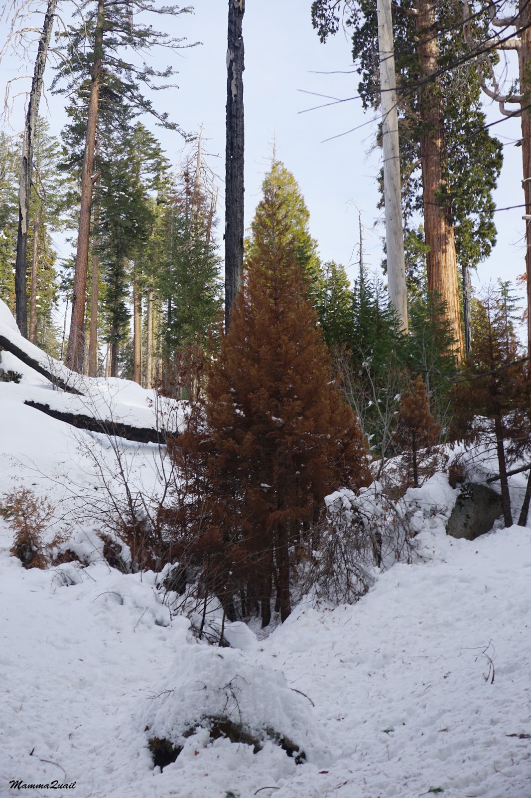
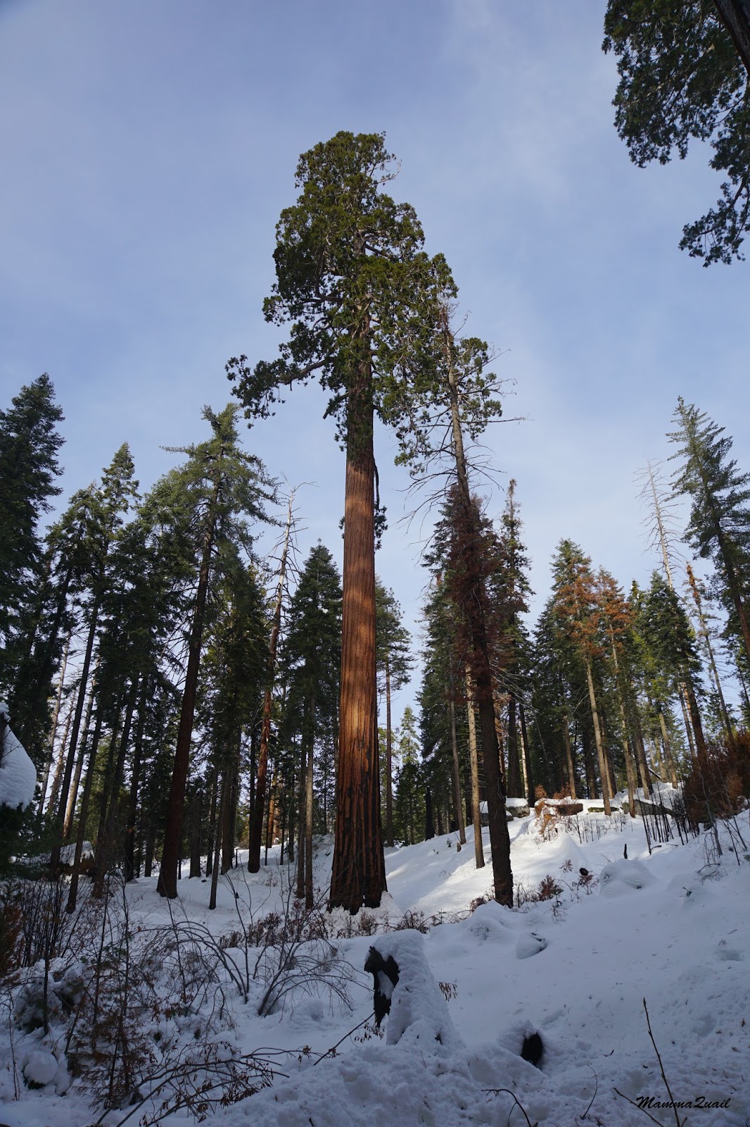
A buck
One last look and we were on our way to Mariposa. There we had dinner and split: Papa Quail took the chikas in on car and drove back home to a week of routine: school, work and pet care. My friend and I took the other car, which was loaded with camping gear and provisions for a week long trip and took off south to Fresno. On the morrow, while the chikas were in school, my friend and I would visit the winter wonderland of Sequoia National Park.


Tuesday, February 2, 2016

Winter Visitors at San Joaquin River National Wildlife Refuge

Sandhill Cranes
Date: January 9, 2016
Place: San Luis National Wildlife Refuge, San Joaquin River Unit, Vernalis, California
Coordinates: 37.615504, -121.211687
Length: 4.5 miles
Level: easy

First time visitors to California usually arrive with some kind of a check list of 'must see' places. Naturally, Yosemite National Park would be on that list. Since my friend arrived without such list I made it for her. And so, two days after she arrived, we were on our way to Yosemite.
We left home about noon time, the day before we planned to be at Yosemite. We had planned to spend the night in the town of Mariposa, so we had plenty of daylight to spare - a perfect opportunity to visit the San Luis National Wildlife Refuge.
On previous trips we visited the two main units of the refuge: the San Luis and Merced units. This time we stopped at San Joaquin River unit.

This NWR is well hidden between fields and orchards. Only an inconspicuous brown sign tells its presence. Good thing we pulled the coordinates ahead of time. We were delayed on our way there by an envoy of sandhill cranes that waited for us in the field right outside the refuge's entrance. No complaints here!
Sandhill Cranes
A packed gravel parking lot surrounded by high bushes didn't reveal much of what was there to see. Little bush birds chirped everywhere. Sparrows, mostly. I saw a family of quail behind the bushes but when they saw us they immediately flew away.
Golden-crowned Sparrow
After convincing the chikas that this isn't going to be a long trail the stopped protesting and we started our hike. 
There is a single trail in the SJRNWR, and it is a hiking trail, comprised of three connected loops. We could have hiked just one or two of the loops but ended up hiking all three.
Our San Joaquin River NWR Nature Trail hike as captured by Papa Quail's GPS
The sky was clouded and heavy moist hang in the air. It was a very wintery scene all around.

I looked back to the west, where we came from. It looked as if the mountain range we had just crossed was getting soaked. I wondered if we were about to get wet as well.


The sight of bare trees can be gloomy, but bare trees make it easier to see the birds. Papa Quail was making the most of it.
Downy Woodpecker
While the trees were sleeping off winter the annuals were coming out to play. The bright green of early growth was almost blinding against the backdrop of winter gray.

The primary reason for us to visit the SJRNWR was to see birds. In particular, the large flocks of migratory birds that overwinter in the Valley. Most of the trail, however, doesn't go by the water, and other than the cranes before the gate, all the birds we saw were little bush birds, quail (that kept disappearing in the vegetation), and representatives of the raptors patrol.
Red-tailed Hawk
When we arrived at the river we didn't see any of the large migratory birds there either. They were all in transition - flying high above our heads.
Snow Geese
Nearly all the arrowheads we saw in the sky were geese. Mostly snow geese, some white-fronted geese. One flock, however, looked a little different. A closer inspection revealed their identity: these were tundra swans.
Tundra Swans
We didn't plan to hike the entire trail but only the third loop is close to the river so we hiked that part too. Other than the river view, it wasn't much different in scenery than the previous loops.

My younger chika got miffed about not sighting as many birds as her older sister. She settled for finding pretty mushrooms on the trail.

The San Joaquin River is nice and wide. As wide as allowed when most of its tributaries are diverted to agricultural use.

The waterbirds we expected to see there were obviously somewhere else at the time. All we saw were a few coots moving lazily about in patches of dead water hyacinth.
The water hyacinth is an aggressive invader of the Sacramento River Delta. In this case, it was pleasing to see it die off.

We continued walking along the river until we completed the third loop and turned to go back. Still not seeing much avian life, the hike was now all scenery.

When it comes to scenery, it take special love to admire the winter face of that place when its augmented by a thick cover of clouds that darken the atmosphere.
Just as I was thinking these thoughts the rain begun. It was a soft, thin drizzle, fitting the general glum that hang in the air. It was also enough for me to hide my camera under my sweatshirt and refrain from taking any more photos.

We made it quickly back to the car. By then the rain had subsided and the rabbits were out and about. We looked at them for some time and then called it a day and drove on to Mariposa.
Cottontail Rabbit
I chose to visit at the San Joaquin unit of San Luis NWR because a few days before I saw some lovely photos of geese and ducks that were taken there and shared on a birding forum. We didn't get to see any of it when we were there. Oh well. We simply have to go back there another time.

But we did see the cranes and that made it all worth the while.