|
| Clouds gathering over the Big Whitney Meadow |
Date: August 4, 2017
Place: Golden Trout Wilderness, Lone Pine, California
Coordinates (of Rocky Basin Lake): 36.443895, -118.312227
Length: about 10 miles
Level: strenuous
On the fifth morning of my trip to the
Golden Trout Wilderness I got out of my tent after a long, dark, and restless night. It rained on and off throughout the night but the morning was precipitation-free. The clouds, however, still hung low in the sky, in reminder that the next rain isn't a far-fetched idea. I could see some blue patches between them and was ok with that.
 |
| Rocky Basin Lake |
There was no indication that anyone else had visited the rocky Basin that night. Not that I expected anyone too. This place was probably the most desolate corner of wilderness I have visited on my trek. I took my tent down and hang its different parts on the trees and bushes around me, hoping to dry off some of the wetness. They were still pretty damp when I eventually folded everything into the stuff sack.
 |
| My Tent's Footprint |
On last year's backpacking trip to Mineral King I started each morning with a quick dip in the lake we were camped at. This time I had no inclination to go in the water, although I sure needed a bath. The shallow, dark water of the Rocky Basin Lake and the visible muddy bottom weren't very appealing. I also didn't feel like eating any breakfast but, understanding the importance of eating I cooked myself some hot miso soup and sipped it slowly in good timing with the sunrise.
At that time I was already quite efficient in getting organized and soon I was on my way down from the Rocky Basin Lake.
 |
| My hike from Rocky Basin Lake to the Cottonwood Pass |
Even on the way down I had to look for the cairns that marked the best path. The piled granite rocks that gave this area its name looked eerie in the dim morning light.
 |
| Rocky Basin |
White as bones, the rocks made a special background to the dark-green trees and the lighter riparian greenery by the creek. Patches of fireweed pink and arnica yellow were the only lively colors along the thin green line that marked the path of the water alongside which I was walking.
 |
| Fireweed along the creek |
I didn't linger on my way down. Not even at that cute place that impressed me on my way up the day before, where I saw the giant mushrooms. I gave is a queen goodbye glance and moved on down.
Sure enough, at the bottom of the trail I now found the trail junction that I had missed yesterday. There, on a rock, was a soggy yellow piece of paper with a note saying that the fellow (whomever wrote the note) had gone all the way up to the lake but didn't find the people he/she was looking for and continued on to the Big Whitney Meadow to look for them. I suppose the note was left there in case those people might eventually come this way so I left it there untouched and turned on the trail leading to the Big Whitney Meadow myself.
 |
| Barigan String Creek |
The trail leading to Big Whitney Meadow looked identical to the last part of the trail that took me to the Rocky Basin Lake yesterday. A thin forest of pines and junipers, and an almost bare soil, dotted with little silvery circles of lupine.
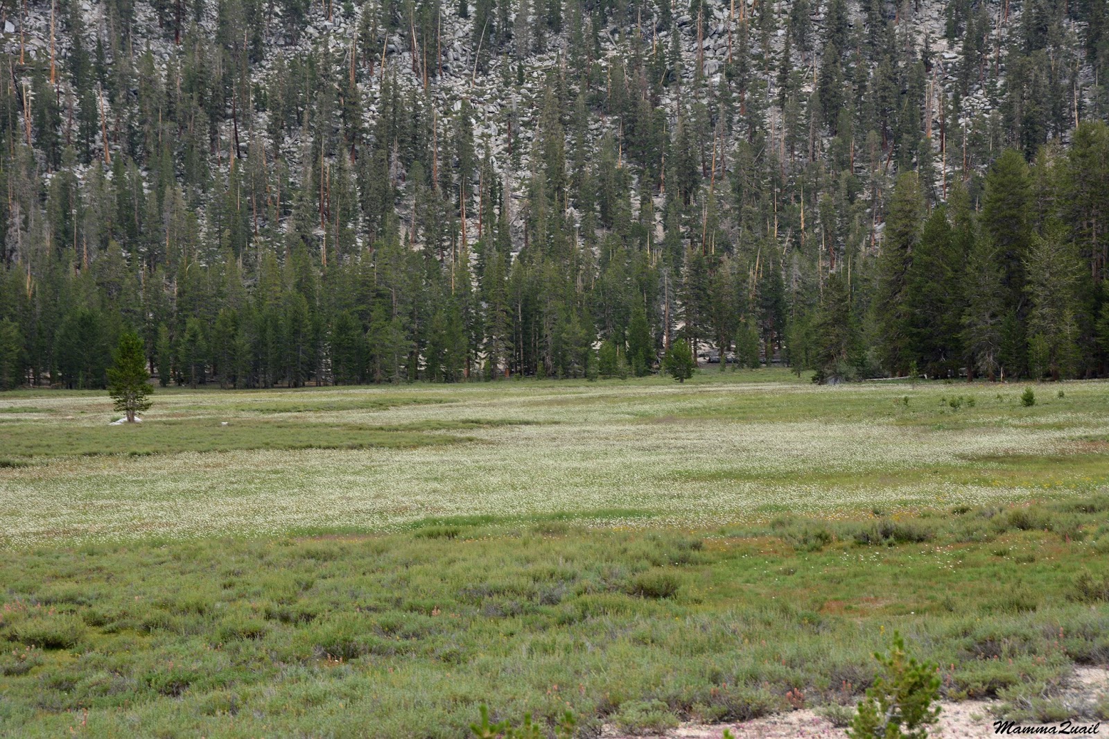
The ascend to the ridge south of the meadow was short and mellow and didn't take me long. The trees at the top blocked the sweeping view I might have otherwise had of the meadow below. It was enough, however, to tell that the title 'big' was an understatement. The Big Whitney Meadow was HUGE.
At the edge of the forest I had a better view of the meadow and could appreciate its size and beauty. As I broke my camp that morning I was resolved to head out that day, and I thought that if I didn't feel good enough to go up the Cottonwood Pass then I would stay at the Big Whitney Meadow. I was glad to see that it looked like a nice place to camp.
But it was still early when I got there, and so I started my journey across the meadow to the base of the trail to Cottonwood Pass.
 |
| Big Whitney Meadow |
As I descended into the meadow I was welcomed by the wonderful sight that I've seen at the Horseshoe Meadow on my first day of my trek - the colorful carpets of wildflowers.
 |
| Mimulus Mat |
The day was dark with clouds that promised rain later on. I wasn't worried about rain, though. Although I was s far going downhill and lost quite a bit of altitude when I got to the meadow, I was already feeling fatigued again. I got to the junction with the Cottonwood Pass Trail and sat down to rest and to eat something. Right then, in the corner of my eye I caught a glimpse of a hiker far away behind the curve and my heart skipped a bit. It was the first human I sighted since that backpacker I met on my way to the Natural Bridge 3 days ago. I wondered what I would say if that person came by me, but he/she didn't. Eventually I got up and begun my way across the meadow.
 |
| A green and white carpet below, a gray blanket above. The Big Whitney Meadow. |
There are two main channels of the Strokes Strings Creek in the Big Whitney Meadow, and a few more little tributaries. At the time of my trek there, a good area bordering the creeks was muddy or downright flooded. I changed to sandals.
 |
| Strokes String Creek |
Between the green wetlands and creek banks there were expanses of gravely flats and low-grade slopes. On the light cream gravel background the wildflower fields stood out in color and beauty.
 |
| Pumice Alpinegold, Pumice hulcea |
My general feeling improved as I continued walking across the meadow area. It could have been the lower altitude, or that I ate a little before that, but I thought it might have been because I was on the last part of my trek. And that thought disturbed me deeply.
 |
| Lupinus sp. |
I had 7 days and 6 nights in my calendar for this trip, had I wanted, and I was carrying more than enough supplies for this duration. Based on my previous backpacking trip I assumed I'll take as long to do the loop trail I had been doing. I also though I that I might want to hang for a day or two in one of the nice, secluded wilderness spots. As it was, I was nearing the end of my planned route on my fifth day, and I was almost eager to finish it. It didn't sit well with what I had thought of myself and of my wilderness experiences.
 |
| Monkeyflower, Mimulus sp |
When I set out that morning from the Rocky Basin Lake I was fairly sure that I'd have to stay one more night in the wilderness. I didn't think that in the state I was in I'd have the stamina to backpack a 10 miles lag, and one that included a high mountain pass too. But it was still around noontime when I got to the half point of the Bog Whitney Meadow, and I didn't feel like stopping there, even though it was a really nice spot to camp.
 |
| Crossing the Big Whitney Meadow |
The weather also had its influence on me. Not just the glum of the overcast sky, but the thought of passing another night in a hot and stuffy little tent while being rained on did not appeal to me either. And it bugged me that the discomfort of rain was a factor in my choice to cut my trip short. I thought of myself to be more tolerant of environmental discomforts.
 |
| Artemisia sp. |
These dismal thought bubbled in me every now and again but the logic part of my mind (hi Spock!) always brushed them aside: I was backpacking in the wilderness because it is (usually) a joyful experience for me. If I wasn't enjoying it (this time), there's no point in forcing it. Certainly not for the sake of covering all my time allocation.
 |
| Pine Nursery |
I share my rumination here because my thoughts and feelings were a large part of my personal wilderness journey. Also because this blog is, in a way, my personal memoirs album. But I don't want to leave the impression that all I did in that trip was suffer. Not by a long shot. As always when I'm out in the wild I took great pleasure in the beauty of the area and in the little (or big) treasures it had.
I also had to take great care not to trample them :-)
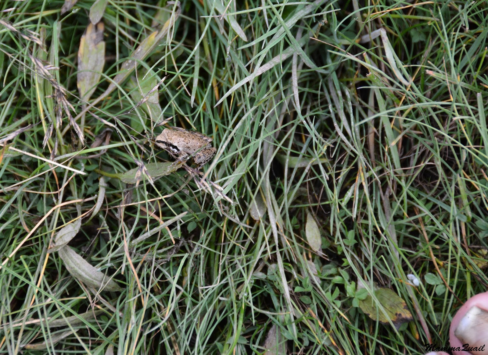
 |
| Tree Frog. My big toe in the bottom right corner as a size reference. |
The mountains northeast of the Big Whitney Meadow grew closer and loomed larger. The trail lead directly to he tallest peak ahead and I assumed that the pass would be to it's south side. To get there I needed to swish through a flooded segment f the trail.
 |
| Wetland |
Almost too soon I came upon a higher, drier area. For a few seconds I wondered if I had crossed the meadow entirely, but I realized it couldn't have been the case. There was more to Big Whitney. Significantly more.
 |
| Dandelion, Agoseris sp. |
It was a hilly 'island' of forested dry land, and for a while it felt as if I was back on the Sat Lick Trail of yesterday.
 |
| Babayaga Hut |
It didn't take long, however, to pass this grove. Once again I was walking down a mild slope of gravel, matted with beautiful tiny wildflowers. I couldn't get enough of those.
In between the multitudes of monkeyflower and arnica I spotted here and there some rarer blossoms and I took the effort to document them to the best of my ability.
 |
| Mt. Whitney Draba, Draba sharsmithii |
The second part of the meadow stretched before me. It was less wide than the previous one, but much wetter. A line of rocks was laid across the creek but the flooded area was wider. Since I was wearing sandals I didn't care much about getting my feet wet, but the water was really cold there. Assuming (correctly) that that was the last creek I'd have to ford that day I took the time after crossing to change back into my hiking boots.
 |
| Strokes String Creek |
Even at a good distance from the creek where the soil was drier there were patches of wetland vegetation, and they appeared thriving.
But a little further away and the vegetation changed again to reflect an even drier soil.
And little by little, I begun to go up.
At the northeastern edge of the meadow I sat down for a snack break and contemplated my next move.
It was still early in the afternoon and I felt a bit better so I decided to start up the trail toward the Cottonwood Pass. I told myself that I would go slowly, and if my feeling worsen I would go back down to the meadow and camp there.
 |
| A yellow carpet below the Cottonwood Pass Trail |
As I started slowly up the trail I also thought that I could camp for the night at the Chicken Spring Lake, that was on the ridge only half a mile away from the pass, right by the Pacific Crest Trail (PCT).
 |
| A green and white carpet below the Cottonwood Pass Trail |
But I think that even then I already knew that if I'd made it up to the pass I would prefer to go all the way down its eastern side. It would have taken a significant change in my mood and in the weather to make me decide to stay for another night up on the ridge.
There could have been other reasons to make me stay up on the ridge but I preferred not to think about them, and thankfully none materialized.
 |
| Up to the Cottonwood Pass |
It felt as if I was walking very slow but in fact I made a very good progress. I walked at a steady pace and didn't feel any need for rest stops. I did, however, stopped by a small creek that crossed the trail but that was to chat with a couple of backpackers that were descending down from the pass to the Big Whitney Meadow. They were the first people I had talked with in three days and although the chat was pleasant, the conversation felt weird.
 |
| Filling up on water on the way up to Cottonwood Pass |
I took my first actual break about half way up near a huge boulder that I had to circumvent because the trail was blocked below it by a large, recently fallen tree.
As I munched my snack I heard calls from somewhere above. It didn't take me long to spot the caller - a Clark's nutcracker. It was quite far and I didn't have a good birding camera with me, but I still got a passable image of the bird, the first and only I'd seen all day.
 |
| Clark's Nutcracker |
Because I walked slow I had the opportunity to give each flower along my way a close attention. Not too close, though. It is hard to stoop down with a heavy backpack on.
 |
| Mountain Monardella, Monardella odoratissima |
Fortunately some of the bloom was conveniently at my height.
 |
| Oceanspray, Holodiscus discolor |
The trail switchbacked for ever, or at least it seemed that way to me. Still, I was gaining altitude quickly. Thankfully, I didn't feel any worse.
I turned the corner of the slope and the thick, green line that was leading to the tip of the ridge appeared before me. I was nearing the top.
I went on upward. A small squirrelt darted from the trail before me. One of the very few I've seen that entire trip. I raised my camera as quick as I could but the squirrel was quicker. I consoled myself with a picture of some beautiful Indian paintbrush shrubs in full bloom.
 |
| Indian Paintbrush, Castilleja sp. |
Every now and then I would turn around and gaze back to the west. I'dmonitor the progress of the clouds and of course how much altitude I had gained. Eventually I came to a point where the trees were parted enough to give me a less disrupted view of the Big Whitney Meadow below. I could see that thick clouds were already covering the entire meadow and that it was raining down there, right where I had been only a couple of hours before.
 |
| A view down to the Big Whitney Meadow |
I looked up and saw that the clouds were gathering over my head too. It was only a matter of time before it had started to rain on me as well.
In the north corner of my view a saw a prominent mountain, very far. I photographed it with my strongest zoom: there were lines of snow along its slopes, leftovers from a very wet winter.
I kept going, now urged to keep ahead of the rain. The slope of the trail had softened, alowing me to increase my gait. I did pause to look at the wildflowers still.
 |
| Fleabane, Erigeron sp. |
I photographed everything in bloom, not only the prettiest ones. Some were harder to get because they were further away from my trail. Some looked very unique and later I found out that they really were limited to that region of the mountains.
 |
| Southern Sierra Chaenactis, Chaenactis alpigena |
I made it to the top of the green line of willows and found that it wasn't quite the pass yet. The trail turned to the north and I was walking through a high meadow dotted with round rocks and covered with wildflowers.
On my left in the trees there was a horse camp and the people there were busy tying tarps to the trees in preparation for the imminent rain. They didn't notice me, or didn't show they did, and I just went on moving up the trail. I could see the actual mountain pass ahead.
It really was a lovely area and on a different time I might have stayed there longer. As it was, I wanted to get to the pass and go down the other side as quickly as I could.
 |
| Rocky point near Cottonwood Pass |
Any thought of maybe staying the night at the Chicken Spring Lake disappeared in an instant when precipitation begun. It wasn't rain though. Not right away. It was hail. As quick as I could I pulled my raincoat and the backpack cover out and covered everything. One last photo of the pass and the camera went right into my pack. I also wore my wide brim hat over the coat's hood because it provided some extra protection against the little ice bits that short down from the sky and pummeled me mercilessly.
 |
| Last look at the pass before the hail storm |
It was only after I crossed the junction with the PCT and made it to the eastern side of the pass that the hail (which had changed to a mostly regular rain by then) had slowed enough that I risked getting my camera back out. I kept it tucked under my coat though, getting it out only now and then for quick shots.
 |
| View East from the Cottonwood Pass |
It was also at that spot that the battery of my GPS exhausted so i took a minute to replace it. That's why there are two parts to my marked hike that day.
 |
| My hike from Cottonwood Pass to the Cottonwood Trailhead |
It was all downhill from there. I think that at that point I dropped the idea of staying for another night in the wilderness. I wanted to get all the way out to the trailhead and drive out. Mentally, I was done.
 |
| A view east down to the Horseshoe Meadow |
My feet carried me fast downhill. All sense of fatigue had left me and I raced down. There were over three miles separating me from the trailhead and it was already later in the afternoon.
 |
| Larkspur, Delphinium sp. |
But even there and as rushed as I felt, there were flowers worth stopping for. Liker this little clover that was so tine that if it wasn't wet everywhere I might have lied down on my belly to take a better photo of.
 |
| Carpet Clover, Trifolium monanthum |
A bit furthere down - a pretty example of the familiar California corn lily in full bloom.
I also run into a large group of backpackers that were making their way up - they were on the long route to conquer the summit of Mount Whitney- the tallest mountain in the contiguous U.S.A.
 |
| California Corn Lily, Veratrum californicum var. californicum |
I made it all the way down in top speed and there I allowed myself a brief rest stop. I munched on some trail mix and visualized in my head the nice, juicy fruit I'd get when I get to Lone Pine. I fantasized on a large plump peach.
 |
| At the eastern bottom of the Cottonwood Pass Trail |
There was a creek in the way and I had to cross it twice. I didn't need to change shoes for that - there were rocks and logs laid across. A couple of hundred yards away I found that I had dropped my GPS and had to go back to the creek where I found the little device unharmed on the ground by the water.
I expected to go into the Horseshoe Meadow at any moment but the trail remained inside the woods, skirting the meadow from the west. When eventually I did get a full view of the meadow I begun my trek at, it was right at the junction that pointed toward the trailhead parking area. I stood there for a few minutes and looked at the pretty meadow and the now familiar carpet of purple monkeyflowers. I wanted to finish the trek but now I felt a tinge of regret.
 |
| Horseshoe Meadow |
But that trip was now over. I turned my back on the meadow and made my way to the parking area where I unloaded my backpack, got into my car and drove down back to Lone Pine.
My trek at the Golden Trout Wilderness was done. I had walked about 40 miles in 5 days. I fulfilled a long time desire (to see the Kern Canyon) and I got to see a beautiful and very remote part of California at its best time in years. I was all alone most of the time.
Botanically speaking this trip was a huge success. The vegetation was absolutely gorgeous, including the forests, meadows and the dense wildflower carpets. Although I did not realize it at the time, many of the wildflowers I've seen were rare or endemic to that region and I was very fortunate to have seen them. On the other hand I hardly saw (or heard) wildlife, which I thought was strange. Not that I expected wild animals to pop in my way with every step but the dead emptiness and silence (not even birds!) that was there for most of the time, had certainly contributed to my sense of desolation. Come to think of it, it might have been the outcome of 5 years of drought in an already arid place that caused it, but it was still strange.
My biggest surprise was my own feelings during this trip. I honestly didn't expect to have the doldrums while being in what I believed (and still believe!) to be my element. Looking back at this I think that I probably did have a mild form of altitude sickness, and that at the time I took the right measures to control it, enough to be physically good to complete the trek and go over the mountain pass but it was not enough to lift up my mood.
I learned a lot from that experience and while I realized that I do prefer going with others, I would not refrain from going by myself again. I would prepare better, though, and I would likely chose a destination more popular where I would be more likely to come across other backpackers on my way.
I am now looking forward to my next backpacking trip :-)
Post Edit: My
next annual backpacking trip was also a solo one, also unintentionally, but for which I was far better prepared :-)
Many thanks to members of the California Native Plants Society for their help in identifying plants!