Sunday, July 31, 2022

Death Valley's Sweet and Easy Backyard Hike of Shoshone Nature Trail


Date: November 25, 2021
Place: Shoshone Nature Trail, Shoshone Village, California
Coordinates: 35.974878, -116.269928
Length: 2.5 miles
Level: easy
 

The day after we moved in Death Valley National Park for the rest of our 2021 Thanksgiving vacation we decided to dedicate to birding east of the park's boundaries. The elder chika was still a bit down from her illness earlier that week and needed one more day of easy walks. We spent the morning wandering around Ash Meadows Preserve east of the park looking for birds there, but didn't see much. We also checked out a bit of Death Valley National Park that is a tiny island of parkland nestled inside the Ash Meadow Preserve area, called Devil's Hole. Devil's Hole is a huge underground cavern that is fully flooded and is home to endemic fish species. We could only look at the cave from outside the fence that surrounded the hole. 
After Ash Meadows we drove to Shoshone to hike a Shoshone Nature Trail that I read about in the local Audubon Society chapter's website. Before the hike we dropped into the local diner for lunch and while we were outside the diner we saw a cute roadrunner checking out the place's front yard.
Roadrunner

The trailhead was right behind the diner so after our lunch all that we needed was to get our water bottles and cameras and head out toward the river.
Our hike as captured by my GPS

 Just like in Ash Meadows, it seemed right away that we were there at the wrong season for birding. Unlike Ash Meadows however, this place had other nice aspects that made our hike there a very nice one. One problem we had that hike though, was that the trail markers did not seem to fit the markings on the map I had of the trail, so the loop we ended up hiking didn't match the recommendation on either the Audubon Society page or the AllTrails entry. 
Shoshone Nature Trailhead

We started on a short bit of trail leading from the road to the Amaragosa River. I don't know the name of the mountain range east of Shoshone, but it was a very beautiful mountain range, with nice, even, and very colorful sedimentary rock layers that were very visible from afar.

Pappa Quail and the elder chika who were looking for birds all day found a couple of bluebirds on a tree branch a bit farther away and stopped to take photos. Bluebirds are always fun to see, even if they're common and can be seen also in the Bay Area.
Western Bluebird, male

My camera isn't suitable for far away birding so I enjoyed the bluebirds through my binoculars. I was also fascinated by the red balls of mistletoe that decorated just about every other tree in the area.

A bit further down the trail my family borders found a sparrow. They saw a few phainopepla too but these were too far away and wouldn't cooperate with the cameras.
Juvenile white-crowned sparrow

West of the Amaragosa River there are a couple of short loops in the trail and we veered off to one of them. i let my family go up ahead and I took the view of the area east of us. Most of the vegetation was yellowish-gray but there was a thin green line of lusher vegetation that marked where the river, the water lifeline of the area, was.

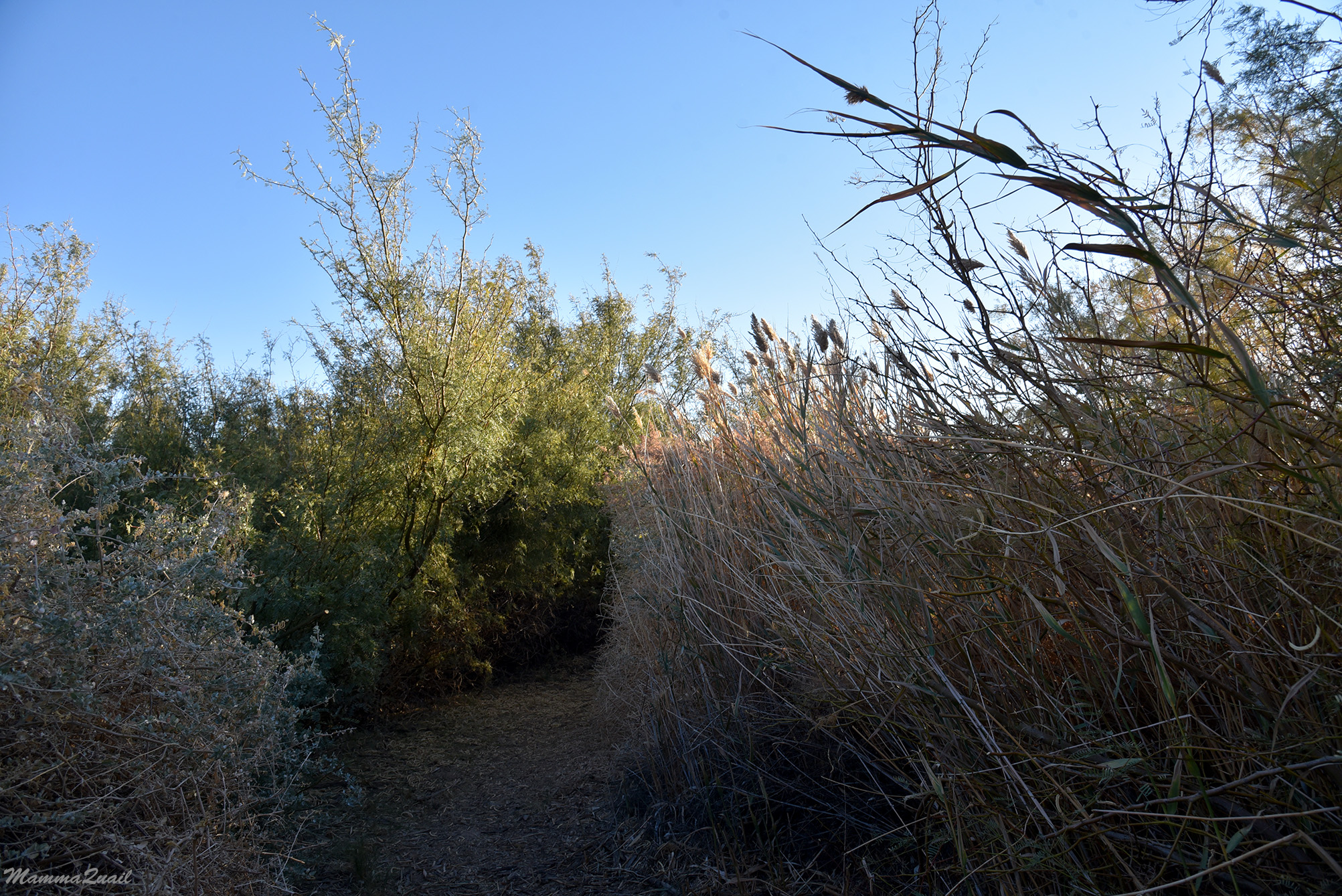
On the nature loop we took the trail plunged into a thicket of small mesquite trees and large holly bushes. It was nice to have some shade on the trail because even the November sun is intense in that region, and it was good to have some respite from the wind that had picked up in the afternoon. In some places we had to stoop down to go under the boughs that hanged over the trail.

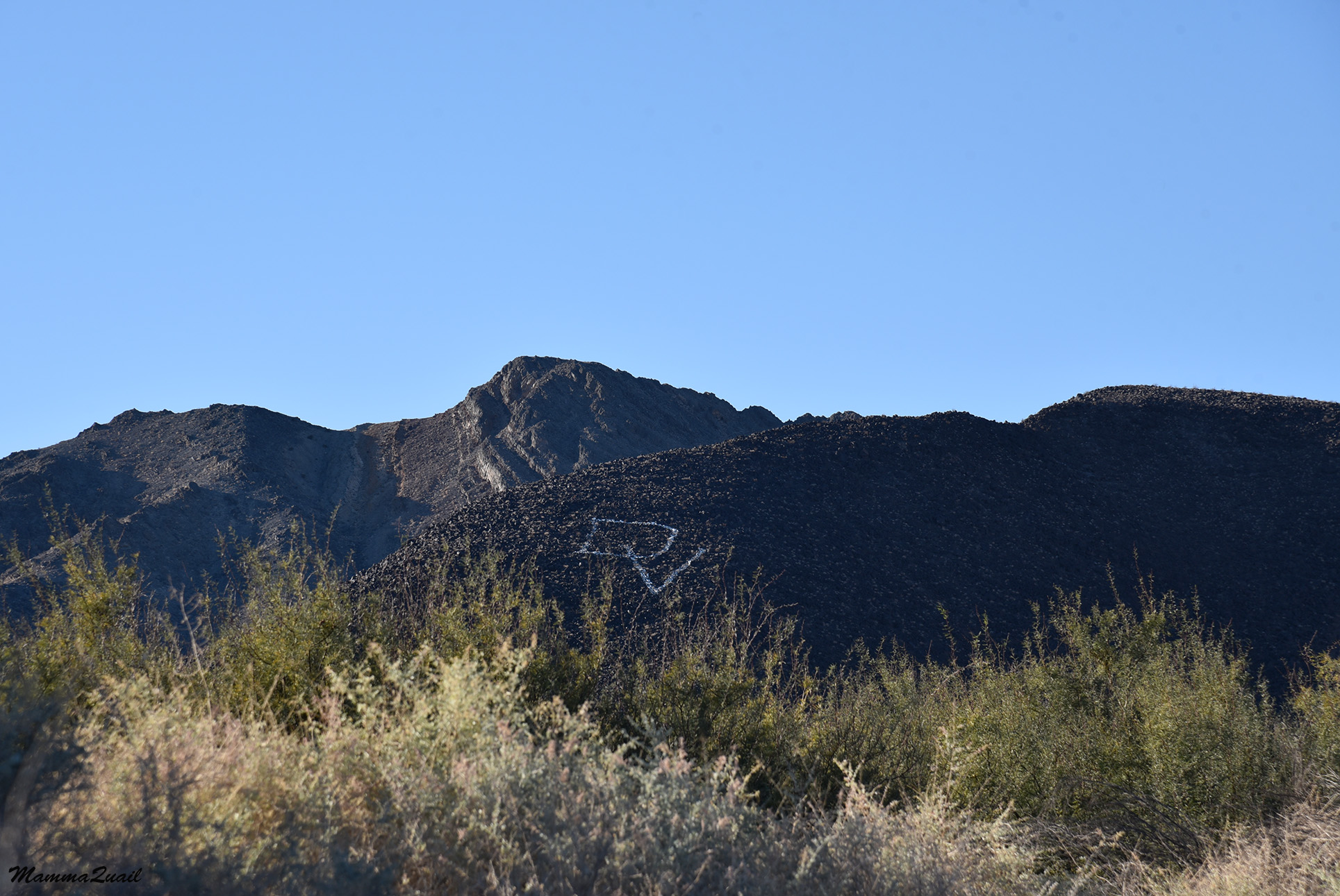
When we got clear of the vegetation we had a nice view of the Amaragosa Range to the west. A large DV letters were chalk-painted on the mountain side. I assume it stands for Death Valley. Only yesterday we hiked at the 'Hole in the Wall' on the other side f those peaks.  

Large holly bushes flanked our trail and every now and then I picked myself a leaf and munched on it. These plants do well on saline soils because they have a mechanism to secrete the salt out of the leaves. The leaves therefore, taste salty. They are also bitter, so I only chewed one at the time. 

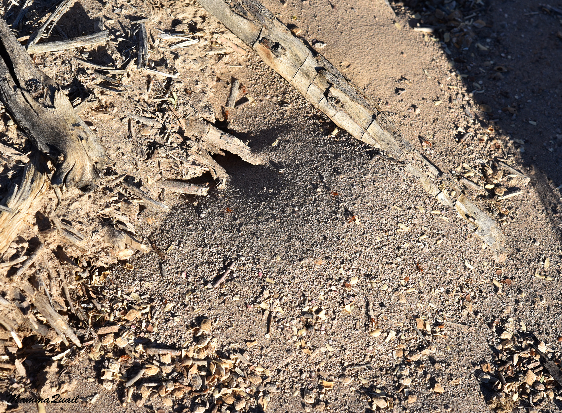
My young chika waited for me to catch up with her and pointed at the ground where there were a few active anthills. Small wildlife is still wildlife, and ants are fascinating. 

We completed the loop and resumed our walk to the river, then turned to follow it north. All that time we didn't see any birds other than bluebirds and sparrows, and an occasional phainopepla. The view was nice, though. I imagine that in spring the wildflowers are pretty there. 

It wasn't very late in the afternoon but it was the short-days time of the year and the shadows were getting long already. My shadow stretched long to the northeast over the river side grasses. 

The grasses were very pretty, even when completely dry. I don'y know to identify grasses very well and I didn't try to identify these. I don't even know if they are native or exotic to the area. I did like the fluffy look they gave the river bank.  

Amaragosa River has some water holes that had water in them still, but for the most part it looked dry. It might also have been so because of the drought. California fan palms indicated the presence of fresh water. The vegetation was too thick to see any there. At some point we crossed the river and continued north along the eastern bank. 
Amaragosa River

The map I had with me marked a return trail that loops back along the road. When we reached the road again about a mile and some north of where we started, we saw no trail going back. After some looking around behind a resort where said trail was supposed to be, and not finding anything, we backtracked our steps to the river trail. 

We thought to go back on the same trail we came on, but Pappa Quail found another trail that loops back further east of the river, so we took that trail. We had to go a bit further north before the trail curved south, and I got to see the other side of that pretty fan palm we saw earlier on the hike. 

The mountains to the northeast were significantly smaller than the Amaragosa mountains, but they looked very pretty and inviting. We didn't have the time to explore them that day but I did look at them wistfully and hoped I could go back there one day. 

The trail finally curved south and we plunged into tall vegetation again. Among the river bank plants there I recognized the common reed, a highly invasive species I'm all too familiar with from the Middle East. 

I saw a lush and healthy young fan palm nestled among the mesquite. I guess that one too indicates the presence of fresh water close to the ground. 

California Fan Palm

Nearing the end of November, I didn't expect to see any wildflowers on this hike. I was surprised therefore, to see a rabbitbrush blooming. But if there was anything that would be blooming there in this time of year, of course it would be of the aster family. 
Rabbitbrush 

The trail separated from the river and led us closer to the low hills on the east of the preserve. Not meandering through vegetation anymore, we picked our pace and were getting near the southern crossing of the river again. 

On our way back we crossed the river at a different point. The crossing was right over one of the water holes, and it was in fact, the only tie I saw the river's water on this hike. I figure it flows really nice after a good, rainy season. Certainly well enough to support all the vegetation we saw there. 
Water Hole at the Amaragosa River
 
The way back was a quick one. We took the south arm of the second trail loop, where we came upon a few more bluebirds and sparrows. When we finished the hike there was enough daylight to get back to our campground, but our dinner we cooked under lantern light already. At the end of the evening Pappa Quail and the chikas entered the tent right away but I stayed outside. The wind was too strong to have a campfire so we didn't have one. I walked around the campground that was slowly quieting down, and looked up at the magnificent night skies, enjoying once again the brilliant stars and the stunning Milky Way that we're part of, but don't get to see anymore in the urban area where we live. 


Thursday, July 28, 2022

Treasures Found Inside the Hole in the Wall at Death Valley National Park

The Hole in the Wall


Date: November 24, 2021
Place: Death Valley National Park, Lone Pine, California 
Coordinates: 36.409619, -116.694238
Length: 1.4 miles
Level: moderate

The day before Thanksgiving of 2021 we drove to Death Valley and found a campsite in the Texas Springs Campground, not far from Furnace Creek. The previous day we explored Saline Valley and Cerro Gordo, and did a couple of short birding walks, but didn't do any hiking because the elder chika was sill recovering from her cold. After setting camp at Texas Springs Campground and eating lunch at Furnace Creek we went exploring the Hole in the Wall 4WD road and hiking trail. 
The 'Hole in the Wall' is a gap in a ridge of sheer rocks that looks like a large wall from outside, broken through by a wash coming down the western slopes of Schwaub Peak and Pyramid Peak. From CA-190 (at location 36.404896, -116.782781) a gravel road, suitable for most cars, splits off east, following the wash bed through the Hole in the Wall. 
The 'Hole in the Wall'

The rocky pillars that made the 'Hole' were very pretty and I I looked at the with fascination. Right after passing the 'Hole' I noticed movement on the north slope and pointed it out to Pappa Quail and the chikas. There on the slope, was a small herd of bighorn sheep consisting of one ram and three ewes. 

We stopped immediately and looked at the sheep as they made their way slowly up the slope, munching a the plants as they walked, ignoring our presence. 
Bighorn Sheep

After feasting my eyes on the bighorn sheep I tooled at the other side of the 'Hole' where the erosion created an interesting pattern of holes in the rock.

After going through the Hole the gravel road becomes much more challenging, highly unrecommended to low clearance, non-4WD cars. We had a very slow and careful drive to the end of the grave road, passing a few dispersed campers on the way. There was a small group of campers at the end of the road and when I asked them, they pointed at what looked like a flimsy continuation of the dirt road that went up a side creek as a hiking trailhead. It wasn't the trail marked on the map but we took it anyway, wishing to explore the area for a short time.

We filled a backpack with water bottles and took off on foot, walking up the dirt road where even most standard SUV won't go.  
Our hike as captured by my GPS

Bloom time in Death Valley can be a very spectacular sight. November however, is not the bloom time and I did not expect seeing any wildflowers. What I did see though, where many healthy-looking cacti, waiting on their preserved waters for spring to roll around. 
Cottontop Cactus

The disintegrated dirt road dropped into a small wash and disappeared there. We looked for any sort of continuation on the other side but didn't see any. After a short debate we decided going up the wash, similar to what I did with my young chika at Malpais Mesa two days before

The beginning of the ascent was easy enough. Not seeing any birds around, Pappa Quail and the chikas were striding up the wash at a fast pace.  

As usual for me, I fell behind the others There weren't any wildflowers, but the rocks themselves were more than enough to slow down for. The richness of color patterns and their beauty was very captivating. 

I'm not a geologist, not by a long shot. But I am fascinated by the hard bones of the Earth and I do try read the story written in the rocks I see. The rock in the photo below, for example, is a conglomerate - a rock formed by binding many smaller stones together with finer sand/silt that got cemented hard by pressure. 

Before long the wash became narrower and steeper. We climbed small ledges or bypassed them on the side slopes if the climb demanded too much effort or in paces where the wash was blocked by thorny plants. For the most part however, it was a straight forward ascent. 

The Amaragosa mountain range is made of sedimentary rock. A close look at the wash-exposed ledges revealed some very fine sediment layers of very pretty colors. The colors indicated different mineral composition of the different layers. It looked like a slice of a fancy layer cake. 

Other than cacti, the other clearly living shrubs were mostly desert holly. These look very nice when bearing their red berries, but this time they were bare of any berries. In other desert areas they would blend perfectly in the backdrop of the grayish soil but here they stood out against the rust-colored stones. 
Desert Holly

The wash ended as a thin line depression up a craggy slope. Naturally we started looking for the easiest way up the ridge that separated us from the wide, big wash on the other side, along which we planned to return to our car. 

That ridge was low enough and didn't pose much challenge except that it was covered with loose, dislocated stones and we needed to watch our footings closely. Many of the stones strewn on that slope were very beautiful and interesting.

In some cases I could even tell where the stone piece belonged to. Nit necessarily the exact break place but the rock layer that it was part of before breaking off.
Layers

In most cases however, I had no clue where the original rock was that the stone I photographed came from. I many cased I also had no idea what caused the pattern of that particular stone. I took many stone photos on that slope. Just like on my wildflower hikes, It was a challenge to select the photos to post here from the multitude I've taken that day.

When we reached the top of the ridge we got a really nice view of the mountain ahead, the one we were not going to summit. Not that day, anyway.


We also had a great view of the wide wash below us. We needed to get down there and we had some disagreement as to the best way down there. Pappa Quail and the chikas who stood at a lower point than where I was, went down some more along the ridge and found a way scrambling down the rocks. I chose to get down from where I stood, where I believed I saw an easy path downhill.

I think their choice was a better one because after getting down the first part of the hill I found myself on a much steeper slope, which was covered with unstable, loose stones. In short, I had to get down on my behind and slide carefully between sharp thorned cacti and stones that easily dislodged under the slightest of pressure.

It was a very slow way down for me, and it also cost me the pair of jeans I was wearing. Thankfully the new hole wasn't too noticeable until later.

When I reached the washbed at the bottom of that slope, I stood up and looked around me. I didn't see the rest of my family. I assumed they were further downhill, probably behind the curve of the wash. Up the wash I saw Pyramid Peak. The loop trail that's marked on the map goes up the wash then around the peak. It would have been too long a hike for the time we had that afternoon.
Pyramid Peak

I started walking down the wash. Walking on a washbed is more energy-consuming than walking on a hard surface because each steps sinks into the pebbles. After a few minutes I was under the place where I last saw Pappa Quail and the chikas. They were nowhere to be seen. I passed the big rock and saw the trail they must have taken down. It was indeed easier than the path I took. I spent the rest of the hike debating whether I should tell Pappa Quail that he was right.

A little bit further around the curve I saw the elder chika who came toward me, waving her arms. Apparently they were worried for me, seeing how long I took to get down to the wash. Behind her I saw Pappa Quail and the young chika sitting by the side of the wash. On the way to them I saw a pretty cholla cactus shining in the afternoon sun.
Cholla Cactus

I joined my family and we continued toward the trailhead at a faster pace. The sun was already very low and we wanted to get out to the road before nightfall.

The way back was easier. The road wasn't any better but we already knew where the hard parts were and how to negotiate them. When we neared the 'Wall' we were already in the deep shade of the ridge, in the place that would see sunshine again only tomorrow morning. Nearing the 'Hole in the Wall' from the inside, we saw the sunlight shining through the 'Hole'.
Hole in the Wall, view from inside

As we neared the 'Hole' we looked again for the bighorn sheep. There was no guaranty they'll be there - after all, they can move quite a distance in a few hours. They were there though, but on the other side south side of the 'Hole'. We could see them well enough but they were pretty high up the slope and the light was already too low to get any good photo of them, so I finish with one of their photos that we took earlier when we drove into the 'Hole'.
Bighorn Sheep

 On the west side of the 'Hole in the Wall' we were once again in the realm of sunshine, for at least 40 minutes longer. So we drove off to Zabriskie Point and watched the sunset from the second most famous place in Death Valley National Park. 
Zabriskie Point


 Yes, I did tell Pappa Quail that he was right.