

Date: June 20, 2021
Place: Sequoia National Park, Three Rivers, California
Coordinates (of Pinto Lake camp site): 36.484609, -118.580192
Length: 9.5 miles
Level: strenuous
The morning of the fifth and last day of my Mineral King backpacking trip I woke up at the crack of dawn after a less than satisfactory sleep. Usually I like to lie in the sack for some time and float gently into wakefulness but this time I got up and out right away. I wanted to break camp and get going before the large group of men camping near me wake up. By the time I was ready to go sunlight was already painting the western peaks above the Cliff Creek canyon.
 |
| Sunrise at the Pinto Lake camp site |
The Cliff Creek canyon opens to the northwest so it would be a long while yet before sunlight reached the valley floor, or the trail, which is on the west-facing slope.

I set out early enough that the group camping near me were nearly al asleep yet. One of them was outside though, at the edge of their camp, looking downstream. He didn't notice me and I slipped quietly into the path and took off down the trail.
 |
| My hike from Pinto Lake to Mineral King as captured by my GPS |
The light was very low still but my camera was sensitive enough to take photos of things with good contrast, like this pretty penstemon at the beginning of my hike.
 |
| Mountain Pride, Penstemon newberryi |
Even in low light conditions I could get some nice photos of the wildflowers I saw blooming along the trail.
 |
| Lewis' Flax, Linum lewisii |
The morning got brighter as I moved along, but the sun remained hidden behind the eastern ridge for a long time still.
 |
| Dusky Onion, Allium campanulatum |
This part of the trail I was familiar with. All that I would walk that day I already have hiked on my 2016 trip with my friend. This second time around I was by myself and I took the time to immerse myself in the lovely wild High Sierra nature surrounding me. I also didn't restrict myself from taking as many photos as I wanted. That was a lesson learned at that 2016 trip when I accidentally left my camera on for the first night and had to limit my use of my spare camera battery to stretch it for the following four days. Since that trip I habitually remove the camera battery for the night to prevent such a mishap.
 |
| Paintbrush, Castilleja sp. |
The trail going downstream from Pinto Lake camp site is the same one I descended with from Black Rock Pass the day before. From Pinto Lake it continued downstream in a relatively mild slope with an occasional steeper drop over a short distance. For the most part the walk was easy, treading on stable, packed dirt.

I ket moving between stands of trees and pen areas where the largest plants were bushes and low shrubs. Nearly everything was blooming all around and I was giddy with joy over this beautiful display. It was easy to forget that this display was much earlier in the season than it would on a non-drought year.
 |
| Western Labrador Tea, Rhododendron columbianum |
The alternation in vegetation communities showed itself in the huge diversity of wildflowers that I was seeing there. In the more forested, shaded areas, there were fewer undergrowth plants and their flowers normally smaller and their colors less brilliant.
 |
| Feathery False Lily of the Valley, Maianthemum racemosum |
In the wetter places, especially where a runoff trickle coming down the slope was crossing the trail, there were plenty of wetland flowers, growing in rugs of bright colors.
 |
| Shootingstar, Primula sp. |
I could hear birds chirping in the trees but didn't get to actually see many of them. So when I saw a grouse crossing the trail I got very excited. Of course by the time I had my camera on and up it was already moving into hiding between shrubs and rocks. Still, I managed to get a fairly recognizable image of the shy bird.
 |
| Sooty Grouse |
 |
| American Robin, Juvenile |
The line of sunlight was slowly descending down the slopes of the west ridge. It would be a while still before I would be in direct sunlight. From my view point away from the trees I could also see that the trail was once more high above the creek - I must have missed the falls or cascades where the creek and valley had dropped so quickly. I knew that the trail would soon match that drop, getting closer to the creek again.

Meanwhile though, I was enjoying the views from my high place above the valley, and the wildflowers that didn't demand proximity to the creek.
 |
| Bigelow's Sneezeweed, Helenium bigelovii |


The line of sunlight in the opposite slope was getting lower, and so was I, going down more and more into the depth of the canyon. I figured we'd meet at the bottom.

It did get brighter though, even under the shadow of the mountains, making it easier to capture nice photos of even nicer flowers.
 |
| Blue Witch, Solanum umbelliferum |
As I was getting lower in altitude I was also seeing more and more of the plants that I recognized from the first day of my trip, at the lower part of the Farwell Gap trail, coming off Mineral King. Morte than anything, this familiarity reminded me that today I was rounding it back home.
 |
| Scarlet Gilia, Ipomopsis aggregata |
All the time I was descending at a relatively mild grade. Then I found myself at a view point very high above the creek still, at the top of a direct downward switchback section. It was time to get to creek level again.
 |
| Cliff Creek |
The way down the switchbacks was a joyful descent through a pretty rock garden. The trail was part small scree and part packed dirt and it was dry all the way downhill.

\lovely larkspur bloomed in the stable, packed dirt sections. Not in patches, just one here, one there. Luckily some close enough to the trail for close up observation.
 |
| Larkspur, Delphinium sp. |
The more rocky sections of the trail featured the saxifraga, a delicate rock hanging plant. If seen many of them along the Farwell Gap trail but wasn't able to take a clear photo then. This I fixed now on the Cliff Creek trail.
 |
| Pink Alumroot, Saxifraga rubescens |
Between the larger rocks there were gray-leaved bushes that I happened to brush against every few steps. It was certainly easier to take photos of the delicate, tiny flowers now, since I finally crossed the sunlight line. I was near the bottom of the valley by then.

It was also there, between the large, broken rocks that I saw the first of the Lewis' monkeyflowers. I saw more of these pretty pink monkeyflowers in the rocky area at the bottom of the switchbacks descent.
 |
| Monkeyflower, Erythranthe |
Across the canyon I saw a nice, long cascading creek, dropping from the high regions of the west ridge directly to Cliff Creek below. I remembered that waterfall from my 2016 trip and I enjoyed seeing it now as well.

At the bottom of the switchback the creek was not visible on the surface. I remembered that too - the water was still flowing, but it was flowing under a thick layer of scree. I sat down to rest and snack, and to filter the water that I collected earlier up the trail.

There were no more sharp drops in elevation the rest of the way to the Cliff Creek crossing. I had about three miles to get there and I picked up my pace. The walking was much easier now too, once I was off the scree area. The water emerged from beneath the rocks and the vegetation got very dense all of a sudden. In parts it was almost like walking through a jungle.

I was also seeing mariposa lilies again. I saw many of them throughout the rest of the hike but I love this photo that shoes more of the visiting pollinator than the flower itself.
 |
| Leichtlin Mariposa Lily, Calochortus leichtlinii |
For the most part the trail was close to the creek but occasionally I found myself walking at some distance higher than the water, in drier areas of sagebrush and loose stands of conifers.

Delving once more into the shaded, wetter areas along the creek I saw the flower I anticipated to see there - the large and beautiful Richardson's Geranium. I remembered seeing it along that part of the trail from my 2016 hike and I was happy to see it again.
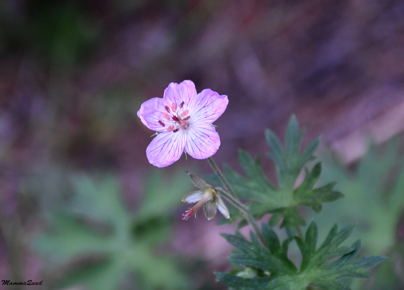 |
| Richardson's Geranium, Geranium richardsonii |
Here and there I was crossing little bogs full of standing, or barely moving water. Around that time I also had to apply the mosquito repellent as well. These little bogs were home to many, many scentbottle orchids.
 |
| Scentbottle, Platanthera dilatata |
AT first I thought to have a break near the Cliff Creek crossing but when I got there I saw that the crossing area was crowded with other hikers so I decided to cross immediately and move on. I did however, have to fill up my water bottles. I was facing a long uphill stretch on a sunny slope and I also knew it'll be some time before I encounter surface water again.
 |
| Cliff Creek |
This time around I didn't need to switch to sandals in order to keep my shoes dry. The creek was running low and the large stones that were strategically placed across the creek were well spaced so I could stone-hop all the way across. I filled my bottles and sat down to filter. On the rock face near where I sat a fat little spider was running back and forth on the rock face.
 |
| Spider |
on he other side of my sitting place bloomed mountain penstemon. I didn't see too many of these penstemon during this trip and it was nice to see the few that I did.
 |
| Regel's Mountain Penstemon, Penstemon roezlii |
The pretty face Triteleia is a flower I'm very familiar with from lower elevations, including the bay Area. Like the crimson columbine, I am never tired of seeing it wherever I go hiking.
 |
| Pretty Face, Triteleya ixioides |
I finished filtering my water and admiring the organisms of my immediate surrounding, got up to my feet and begun the long uphill trudge to Timber Pass.

Here too, I knew what was coming ahead. Knowing it however, didn't diminish a tyhing from the slow and beautiful experience of hiking that trail.
 |
| A green bee visiting a Mountain Mint, Monardella odorotissima |

Shortly after the initial ascent the trail curved to the southeast and I stepped out of the forest and into a bright and sunny open clearing full of wildflowers, low shrubs, and little willow trees pretending to be shrubs. The trail leveled a bit and the uphill became somewhat easier. I picked up my pace.

When I had the option I looked below - the creek down there was Timber Gap Creek, a tributary of Cliff Creek. The trail I was ascending would follow this little creek all the way to its humble beginning at over 9,500 ft elevation.
 |
| Timber Gap Creek |
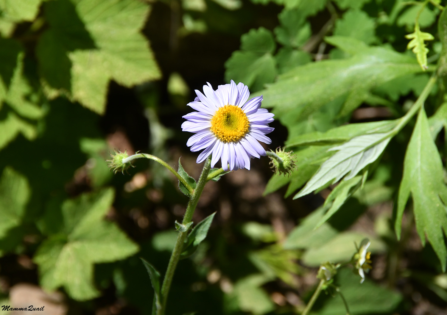 |
| Fleabane, Erigeron sp. |
The twinberryhowever, I identified right away even though it wasn't yet fruiting. The little double flowers were easy enough to recognize.
 |
| Twin Berry, Lonicera involucrata |
I was surprised to see so many ferns in the hot dry open area. I remembered that on my 2016 trip I did see some surface water in this place but I didn't remember exactly where. The frens didn't appear stressed or dry at all, but were lush and healthy-looking.

Eventually I did come across a little trickle that crossed the trail I was ascending on. Right by the water I found also bog orchids in bloom. No matter how small and unassuming they look, orchids are still royalty among wildflowers.
 |
| Bog Orchid, Platanthera sparosiflora |
Up, up, up. After a nice stretch of a mild grade the trail steepened again. Thankfully it also returned under the forest again so I got to ascend under a good shade. When I emerged to a rocky clearing once more I saw that I got much higher yet. I remembered this rocky clearing as the place where my friend and I sat down for a lunch break. I stopped and looked behind me at the view of the mountain on the northeast. That mountain was on the north end of the ridge where the Black rock Pass is.
 |
| View northeast from Timber Gap Trail |
I didn't stay very long in that clearing. It was about lunch time, but I wasn't very hungry. I consumed a small snack and moved on up the trail.
 |
| Butterfly |
The trail remained steep, with only an aoccasional switchback to eas up the ascent. It was also getting hot and I begun to drip sweat all over. Ahead of me I could already see the high part of Timber Gap Creek but the map told me I had to hike a mile and a half and nearly a 1000 ft more uphill yet.

Naturally, i slowed down. On a tiring, hot, uphill trail, everything is an excuset to pause and breathe, certainly pretty spider webs covered in pine pollen.

Any flower, even the tiniest one is also a reason to stop and admire to the point of stable pulse.

I was also drinking a lot and I was glad to see that the trail was getting closer to the creek and that the creek was still trickling at that high elevation.

As it turned out I didn't need to get to the creek because a little side tributary crossed the trail and I filled my bottles there. I also found there another monkeyflower to admire.
 |
| Primrose Monkeyflower, Erythranthe primuloides |
About half an hour later I was once again in a wide, open forest clearing. This time however, the trail didn't level at all but continued the steep grade. I turned around to look back and was once more astounded at how much higher I got in a relatively short time. Still, it seemed there was no end to that uphill slope.

The open clearing was a gorgeous meadow of mixed shrubs and annuals, many of them in bloom. There was no one dominant plant there, but a rich diversity of species. Butterflies were in clouds over that meadowy slope and I managed to capture a few on camera.
 |
| Checkerspot Butterfly |
That gorgeous meadow was also the place where on my 2016 trip my spare camera battery eventually run out. All of my photos beyond that point from that previous trip were taken by my old phone and they look like that too. Now in this trip I had the chance to make up for that and take better quality photos of the rest of the hike.
 |
| Timber Pass Trail |
I was hoping to see more sooty grouse along that trail but that one bird that evaded me earlier that day was the only grouse I saw on my entire trip. I did keep on the lookout though, and meanwhile I was taking many photos of flowers. They don't run away.
 |
| Crimson Columbine, Aquilegia formosa |
I try not to post photos of humans in my blog so readers here might get the impression that there weren't any on that trail. The truth is that I encountered quite a few other hikers and backpackers along Timber Pass Trail. It is the most popular trailhead in the Mineral King area, and at times it did feel to me like a highway. Still, for the most part I was alone on the trail, enjoying the solitude that the wilderness provides.
 |
| Mountain Butterweed, Senecio integerrimus |
I reached the Timber Gap creek crossing and found it bone dry. Only a few ferns and monkeyflowers indicated that water had been there, not so long ago. I was glad that I filled my bottles in the little trickle that I passed a mile or so ago.

 |
| Sierra Arnica, Arnica nevadensis |
The trees were closing around me and I was walking along a narrow strip of sunlight that soon changed to a string of small forest clearing in a relatively loose conifer forest. The low vegetation changed one more into a forest floor community, and the butterflies were replaced by different buzzers that I found interesting as well, but much more difficult to photograph.
 |
| An Orange Bee |
It was in the forest that I got yet another chance to photograph better the ground level pine wood lousewort that I had a hard time photographing previously.
 |
| Pine Wood Lousewort, Pedicularis semibarbata |
Closer to the high point of the pass the forest thickened. The trees were much bigger and closer together and shade deepened. I welcomed the cool shade and paused a bit t drink and recuperate.
 |
| Timber Pass Trail |
I also looked carefully below the trees. I was looking for the coralroot orchid - this was it's habitat and it is hard to miss because of its perfect camouflage colors. I did find some individuals, though not in peak bloom yet. They were just beginning their season.
 |
| Summer Coralroot, Corallorhiza maculata |
A small movement on a nearby log caught my attention. There was this hairy bee there, doing something that I couldn't quite figure out. Perhaps it was looking for food or minerals between the wood cracks.

The shaded forest floor flowers are tiny. There's nit enough sunlight there to support much growth and large spectacular spring displays. Those tiny beauties however, are very nice too look at and require stooping over to get a close up view.
 |
| Torrey's Collinsia, Collinsia torreyi |
After what seemed forever I reached the Timber Pass high point. There's a large plateau and packed dirt clearing. It isn't marked on the map as a camp site but it is clear that people have camped there on a regular basis. I probably wouldn't have chosen this site for camping in this time of a drought year because there was no surface water nearby. Perhaps when there is snow on the ground still it is more suitable. The Pass however, is a great spot for a mid hike break and as I half expected, there were other people there as well. I found myself a more secluded fallen log and sat down to have my lunch and to gather my energy for the last lag of today's hike and of the entire trip.
 |
| Timber Pass |
I had a good, long break at the top of Timber Pass, but eventually it was time to move on. The rest of the hike would be downhill, without any particular challenges other the last act of unwrapping my car. Almost as soon as I begun walking again I emerged from the forest and had the expansive view of the upper Kaweah River at the east side of Mineral King valley. Down there, way below me, was my starting point, five days ago.
 |
| Mineral King |
Going down from Timber Pass was in striding, almost galloping pace. Still I would pause to look at wildflowers, and taking photos f the view around me.
 |
| Pussy Paws, Calyptridium umbellatum |
I already knew what plant species I would find along this part of the trail and when I did, it was like meeting old friends.
 |
| Pine Violet, Viola pinetorum |
 |
| Leichtlin Mariposa Lily, Calochortus leichtlinii |
In a couple of places on the way down, little streams crossed the trail on their way down to join the Kaweah. These little streams created little wetland niches for riparian plants (and also for mosquitos, but that's a different story).
 |
| Elephanthead Lousewort, Pedicularis groenlandica |
The longer, drier parts of the trail had their own botanical treasures growing along them. It was on this last lag of my trip that I saw the morning glory once more.
 |
| Bindweed, Calystegia sp. |
Although the descent trail was going mainly to the east, there were a few short switchbacks along the way. Each time I turned west on one, I had a nice view of the downstream part of the Mineral King Valley, with the parking lots and the National Park's structures. This was the way u and down from this Sierra Nevada paradise.
 |
| Mineral King |
A small bird was perched on the top of a small tree ahead f me. The tree was growing below the trail so I was almost level with the bird. It turned out to be the very common dark-eyed junco. It surprised me, because juncos are usually hiding in the vegetation or under the trees, not perching high and exposed to all sky predators to see.
 |
| Dark-eyed Junco |
When it comes to wildlife, nothing is too mundane or boring to see. The bushes along the trail had silky nests of communal caterpillars. I don't know what species of butterfly or moth they were, but there were lots of them in that area.

Two thirds of the way down the Timber Pass Trail meets the monarch Lake Trail. On my 2016 trip with my friend we ascended up the Monarch Lake Trail and returned from Timber Pass. Now as I was returning from Timber Pass I waved (mentally) to the uphill going trail and turned right and westward, going downhill toward Mineral King.
 |
| Mineral King, east view |
A sole backpacker was coming down the Monarch Lake Trail. This was his way down from the wilderness. He caught up with me and we chatted for a few minutes. He too had gone up the Farwell Gap and Franklin Pass route, he told me. But he had shorter time available so he went uo to Columbine Lake and over the Sawtooth Pass, and now he was closing his loop. That was one of the loop options that I considered, but I had the luxury of a day more.
 |
| Broad-leaved Lotus, Hockasia crassifolia |
The guy was much faster than me, even on a downhill trail. He passed me and continued trotting down the trail, and I followed at a much slower pace. Now that I was so close to the end I felt once more the reluctance to finish the trip. Closing the loop meant also exiting the wilderness and returning to the urban life that I was happy to take a break from. I consoled myself with the thought of going on ge Mount Shasta expedition on the following weekend, less than a week later.
 |
| Western Thistle, Cirsium occidentale |
From one of the switchback corners I had a clear view of the formidable Sawtooth Peak, lite a tiny white sharkfin poking the sky in he far horizon. I waved at it, this time not mentally but literally.
 |
| View of Sawtooth Peak through Monarch Creek vale. |
The creek coming down from Monarch Lake falls into the Mineral King valley in a series of very pretty cascades. On the first day of my 20216 trip my friend and I wend down to an overlook for a close up look at the cascades. This time I settled for a magnified photo from the main trail.

The gentle fragrance of oceanspray bushes perfumed the rest of my way down the trail to the Timber Gap trailhead.
 |
| Oceanspray, Holodiscus discolor |
The Timber Gap trailhead wasn't the end of my hike though. I still had to go up the road to the Farwell Gap trailhead, where I was parked. At the very end of my trip I was sluggishly walking on asphalt, avoiding the occasional car and nodding to happy families that were making their way to the river access for a dip in the cool water. I was amazed at how they all looked so perked and refreshed.

The Farwell Gap trailhead is on the other side of the Kaweah and as I crossed the bridge I paused and took a long look south toward Farwell Gap. The circle was closed. I had completed a beautiful, 5-days backpacking trip in my favorite part of the Sierra Nevada. Still, I sampled only a very small portion of what this place has to offer. There are many beautiful places for backpacking in California, and specifically in the Sierra Nevada mountains, but Mineral King is the one place where my heart is, and I would go back there for sure, it's only a matter of when.
 |
| Kaweah River at Mineral king |
I found my car undisturbed and thankfully unchewed by the marmots. Patiently, I unwrapped the car, drove it off the tarp, and placed all my stuff inside. I also was relieved to change my shoes into sandals. The last bit to do was to pick up my cooler and bag of extra food from the trailhead's bear box, and I was on my way down the road to Three Rivers, heading back home.
That trip was a blessing on its own right, even without the objective of training for the Mount Shasta ascent. Doing it however, did fulfill that goal completely - my fitness was prime and the altitude gave me no problems at all on Mount Shasta. I couldn't have asked for a better training ground than my beloved Mineral King.
That was a great trip! So many beautiful flowers... the picture of the lily with the wasp inside is wonderful. The "green bee" is very impressive.
ReplyDelete