Tuesday, December 30, 2014

Inside and Out - Hiking Sentinel Cave at Lava Beds National Monument


Date: July 5, 2014
Place: Lava Beds National Monument, Siskiyou County, California
Coordinates (of Sentinel Cave): 41.708361, -121.511222:
Length (of Sentinel Cave loop):  0.8 mile
Difficulty: easy to moderate
Comment: Underground hikers must have flashlights in there.

Whenever we have visitors from afar I offer to show them California's beauty. And who would resist such an offer?  When my sister came with her family last summer they I planned a southern cascade tour with them that included Lassen Volcanic NP, Crater Lake NP and MacArthur Burney Falls SP. In between that tight schedule I managed to squeeze day at Lava Beds National Monument.
It has been nearly a decade since last time I was there. The remoteness of that place has so far eliminated it from other tips we had done in Northern California, but this time I was able to secure it in our schedule.
It might have been the promise of a 50°F place in the middle of a very hot July that won the overall support of this 200 miles diversion from our main route.
The Modoc Plateau, as viewed from atop Sentinel Cave
Lava Beds National Monument is east of I-5, a tad south of the Oregon border, in a geological area called The Modoc Plateau, after the Modoc Native Americans.
When we arrived there it was nearly lunch time so we stopped for a picnic at Captain Jack's Stronghold.
The first thing I saw when I left the car was these bright yellow flowers near the parking lot.
 Smoothstem Blazingstar (Mentzelia laevicaulis)
It was only after taking care of lunch that I got my camera and went to look at the blazing stars.
Nearby were milkweed plants in full bloom. These too had attracted my attention.
Mexican Milkweed (Asclepias fascicularis) 
And not just mine.
Mexican Milkweed (Asclepias fascicularis) and Parnassius butterfly
The milkweed attracted more than flies and butterflies. The plants I saw were covered with aphids: small sap-sucking insects who tap into the plant's phloem and drain its precious bodily fluids. I was surprised to see how well the milkweed plants looked considering that their stems were nearly completely covered with these yellow buggers.

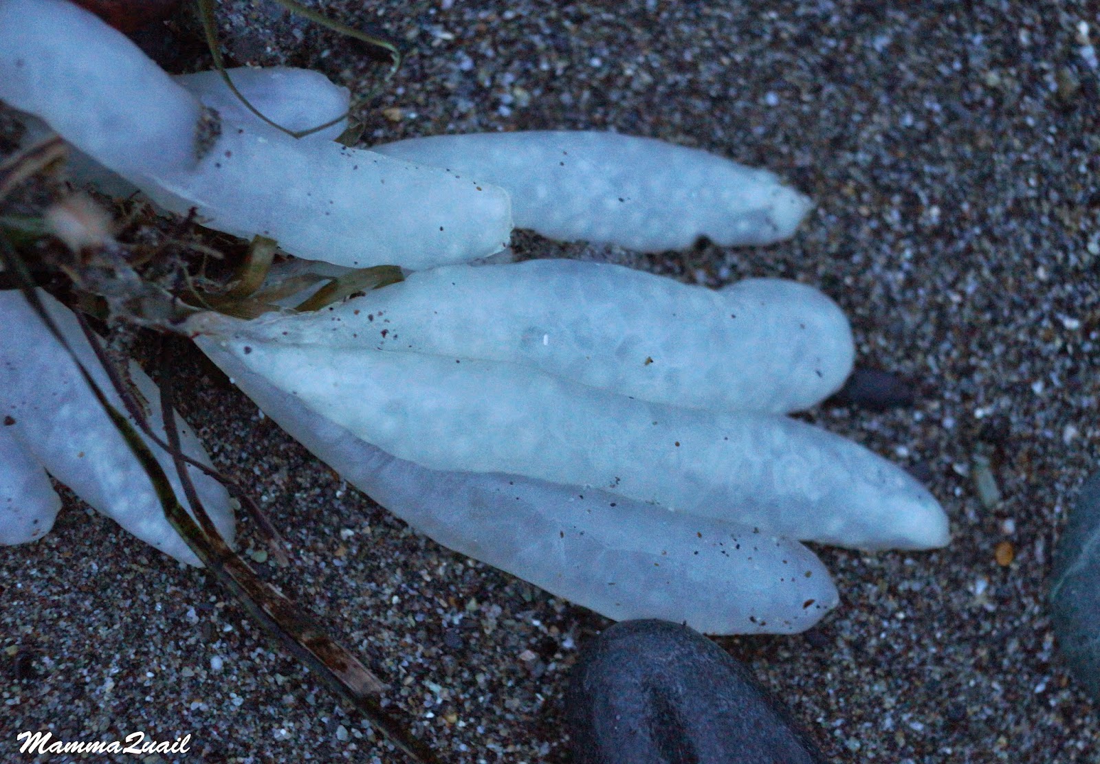
After lunch we headed south to see the caves. We went down the Mushpot Cave which is lit and nicely paved for easy access. Mushpot Cave is a very nice lava tube. It is well lit and is arranged for easy access. The park also offers guided tours in that cave.
'Stalactite' rock formation at Mushpot Cave, formed by lava that cooled in mid-drip
From Mushpot Cave we continued along the main cave loop road. Along that road loop and the surrounding area there are several accessible lava tubes. All of these caves belong to the same lave tube system. They are the remains of a large lave river that flowed across the Modoc Plateau when the nearby volcano erupted years ago. The lava that came in contact with the outside air cooled and solidified, forming a crust inside which the lava river continued flowing, splitting into rivulets and spreading as a large delta. When the flow ceased there were empty tunnels left behind - the lava tubes.
We were looking for a lava tube that was easy to walk through and Sentinel Cave seemed a good one to choose.
The entrance of Upper Sentinel Cave is right by the road - we parked the cars, took our flashlights (that cave isn't lit) and headed underground.
Upper Sentinel Cave Entrance
Papa Quail lingered behind to photograph a busy family of scrub jays  at the cave's entrance.
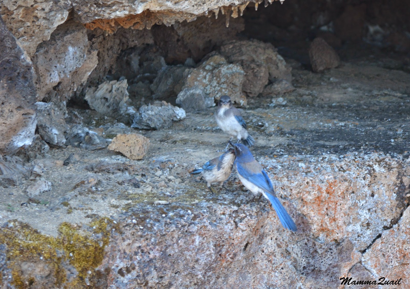
Scrub Jays
Us Quails had visited lava tubes before, and I even posted here about the Subway Cave near Lassen Volcanic NP. So the chikas knew what to expect. For their cousins, however, it was the first time, and they were absolutely thrilled!
My sister, (and all of us really), was very relieved to go underground. Outside the temperature s were in the 90's but inside the lava tube it was 50 degrees. before long everyone in our group had donned the sweaters I made them take along.
Rock formation inside Sentinel Cave
We walked slowly in the darkness, illuminating our way with flashlights. Sentinel cave isn't a very long tube and isn't difficult to traverse. The trail inside is mostly level although narrow at parts.
I didn't take many photos inside the cave. The lava tube experience isn't captured well in photographs anyway.

Emerging on the other side of Sentinel Cave we were once again exposed to the blazing sun. It is amazing how quickly the cave's coolness dissipates in July's noon.
From the far end of the lava tube, or Lower Sentinel, as it's labeled on the park's brochure, there is a nice and easy little trail leading back to the cave loop road. The trail is completely exposed to the sun and the view from there is that of the Modoc Plateau, with peaks on the horizon and a prominent cinder cone butte nearby. There is a trail to the butte's crater that Papa Quail and I hiked on our first visit to Lava Beds years ago. I looked at it longingly. There was no chance of convincing anyone of our party to go up there in that heat.
Cinder Cone
Our hike back to the road was as slow as the walk through the lava tube. There was a lot to see along that short trail. Nice flowers, for starters.
Fleabane (Erigeron sp.) and a hoverfly. 
Hot as it was in July, blooming season was on in full force. Modoc spring starts later than the coastal area and summer is shorter. There's a lot for the plants to accomplish in that short time.
Desertsweet (Chamaebatria millefolium)
And where flowers bloom, there go the insects. Flies, bees and butterflies were fluttering all over the place. Butterflies are one of the hot reasons to visit Lava Beds NM during summer. They are magnificent and they are everywhere!
Leanira Checkerspot (Closyne leanira) on yarrow flowers
One of the common butterfly species at Lava Beds is the Leanira Checkerspot. I learned they come in more than one pattern.
Leanira Checkerspot (Closyne leanira)
There were many other insects buzzing around beside the butterflies. But I didn't expect to see a dragonfly there, in such a dry place. But there is was - sitting atop a tall bush. I had to get Papa Quail to photograph the bug with his big zoom lens to get a decent photo.
Where's that lake I've been looking for? 
Papa Quail had been busy too. As always, he was after the birds. There were many of them out and about as well.
House Finch (male)
It takes a lot of patience to get a good photograph of a little bush bird. I always admire Papa Quail's ability to catch the birds at the split-second in which they sit still.
House Finch (female)
The only so called tree in the area is the juniper. Most of the junipers there act as pushes, but some can be bigger. They too, are a good perch and hideout for birds.
Kingbird
The lava tubes system in that area is huge. Some of these caves have collapsed and can be seen from above ground as large basalt-cobble trenches.

The black rock rubble is an excellent hideout for squirrels. Not all of them hide, though.
The sentinel at Sentinel Cave
It's a short trail from the cave to the road. Many plants there were blooming - but nearly all of them hiding shyly under bigger shrubs. Some, though, have too conspicuous a color to hide with any effectiveness.
Indian Paintbrush (Castilleja affinis)
To see others I had to bend deeply because they were too close to the ground.
Penstemon (laetus?)
But the biggest and most pleasant surprise was a species of mariposa lily I was not familiar with. Beautifully pink, the sagebrush mariposa lily had its flowers sticking only a tad higher than the tall, dry grass. I almost missed it.
Sagebrush Mariposa Lily (Calochortus macrocarpus)
Almost missed the first one, that is. Seeing my excitement, the chikas got busy and found me more mariposa lilies to photograph. There were many of them along the trail and once I was aware of them, I could see them all around.
Sagebrush Mariposa Lily (Calochortus macrocarpus)
Eventually even that trail ended and I arrived at the car well after everyone else in our group. We had planned to see one more cave but on the way there one of my chikas fell asleep so I remained in the car with her while the others descended underground one last time. 

One day really isn't enough time to see all the wonders of this lovely and remote park. I love its remoteness, but that also means it'll be some time before I go there again. Perhaps I need to snare more unsuspecting visitors and convince them that this is exactly the part of California they must see. And I have backing for this claim too - my sister and her family had a wonderful time at Lava Beds National Monument :-)
We spent the final daylight hour after leaving Lava Beds at Tule Lake National Wildlife Refuge and then drove south to Redding. The following day, which was our last day of that road trip, we took our visitors to see Burney Falls. From there it was a long and tiring drive home where we would spend only a couple of days before embarking on yet another road trip to Kings Canyon National Park, and all that because my sister claimed that I promised she could see bears in nature.


Thursday, December 25, 2014

An Alternative to Skiing: Winter Hiking at Hope Valley Wildlife Area.


Date: December 23, 2014
Place: Hope Valley Wildlife Area, South Lake Tahoe, California
Coordinates: 38.778331, -119.924538
Length: about 1.5 miles
Difficulty: easy

For many winters I have been driving past this place on my way to a certain ski resort nearby without a second glance. This year that resort fell from grace for me, so while the chikas and their friend were attending what would be their final ski lesson there, me and my friend passed the time in a lovely hike at Hope Valley Wildlife Area.
A lopsided pine near the trailhead
There is a small parking lot west of Picketts Junction (89/88), on the north side of CA-88 with a pit toilet (but no picnic tables) and a sign saying that the area is funded by the State Wildlife Conservation Board and the Department of Fish and Game, and is operated and maintained by Alpine County.
A fellow hiker that was there told us that usually at this time that sign is nearly buried in snow, but when we were there there was very little snow on the ground. It was a reminder for me, the Bay Area resident, that all the rains we've seen so far aren't enough to call the California water situation normal. Not yet. The Sierra Nevada isn't getting the snow cover it should  at this time.
But there was some snow on the ground. Enough to make the place look extra pretty and to slow us down for fear of slipping.
Granite boulders in the snow.
The trail is an old paved road going north, eventually connects with CA-89 by Luther Pass. My friend and I walked slowly, carefully treading the snowy-icy patches. Soon we arrived at the Carson River Bridge and stopped to appreciate the view.
Carson River
A little further north there were no trees by the trail and we got a magnificent eyeful of Hope Valley, stretching westward and crowned by the snowy Waterhouse Peak.
Hope Valley, view west
Hope Valley doesn't continue too far east of the trail. There it bordered by CA-89 but I liked the three peaks peeking over the forest.

The display of colors on that slope were absolutely fantastic!
Pines, junipers, aspens, those reddish bushes (possibly red-stemmed willow), yellow grass and snow.
As we continued walking we approached trees again. First, there were some isolated junipers.

A little further north I found a juniper that dropped its load of berries on the ground. The deep blue contrasting nicely with the mat of juniper needles.

At that point three other hikers descended from the trail. They stopped and we all had a nice conversation at the end of which we took their recommendation and left the trail in favor of walking to the grove of aspens on the slope to the west. 

The deciduous  aspens stand out among the evergreen conifers. In that area the conifers were mostly pines.
Pine cone in the snow
Going off trail was slow. The snow, little as it was, slowed us down even more. After we reached the aspens we started descending carefully down the slope back to the valley and towards the Carson River.
The slope was covered with low shrubs and grass that formed round moguls under the snow. We had to be very careful with our footing because the grass was even more slippery than the snow.

Every now and then we came upon a group of large granite boulders, rounded by the elements. All of them were decorated by lichen.

Some very pretty lichen.

We continued south and soon we were walking along a little tributary of Carson River.

?

When we reached the river we discovered we couldn't approach it. Not at that place. The area flanking the river bank was a flood zone. Some of it was frozen solid, but there was a lot of open water as well. We had to take a detour.

We slowly edged our way southeast. At last, we reached Carson River.
Picketts Peak overlooking Carson River
The river flowed lazily between partially snowy banks, curving and meandering on the valley floor.
Carson River
We were now walking east along the river bank. At that point we had increased our pace to make sure we were back on time to pick up the chikas and their friend.
Carson River
There were at least two pine species there, by the river. I photographed the cones and one of these days I'll identify the species :-)

A small cone, but the pine itself could be pretty large. That one in the next photo is topped by a robin.

We made it back in time to pick up the kids from ski school. Next time I come to this area it will be to hike some more. And as for skiing, I'll soon find a new favorite resort to explore.


Wednesday, December 10, 2014

Thanksgiving on the Beach: Tolowa Dunes State Park

Date: November 27, 2014
Place: Tolowa Dunes State Park, Crescent City, California
Coordinates: 41.869259, -124.211796
Length: we walked 1.3 miles. The trail continues much longer.
Difficulty: easy

We had much to thank for, last Thanksgiving Day. On that day specifically I thanked for a fantastic hike at Lake Earl Wildlife Area that was very rewarding to us.
That hike had taken much longer than we expected and had missed lunch time by a couple of hours. By the time we were done with our belated lunch there wasn't much daylight left. Certainly not enough for a long hike.
There were ominous clouds hanging in the west but the promised rain hasn't started yet. We decided to go once more to Tolowa Dunes and take a walk along the beach.
Our hike, superimposed on a satellite photo of  Tolowa Dunes SP
There are several beach access points at Tolowa Dunes SP, and we chose the one at Kellogg Rd which was enough removed from town but not too far to drive to. We parked right by the beach, donned heavy sweaters and headed towards the strandline.
The beach access at Kellogg Rd, Crescent City
 We saw evidence of a seafood feast that was held there prior to our arrival. Most crab shells were damaged, but this one remained nice and whole. There is such a thing as a civilized gull, I guess.
 
After some aimless wandering we decided to take the trail on the dune crest. The trail is like a trench in a sea of grass.
European Beachgrass (Ammophila arenaria), invasive
The grass was very impressive. And very hard too, with sharp, pointy tips that poked through my pants and irritated my skin. It was so tall that it was easy to lose sight of one-another when the trail dipped into the dunes or curved a bit.
The wind was strong and the grass moved constantly, wave upon wave, towards the horizon.

This grass is an invasive species that took over the beach dunes. I wonder how these dunes looked like before: were there other plants to bind the sand down, or was it free to blow in the wind? Maybe the Tolowa people have the answers.
On superficial glance, it seems that nothing else grows on these dunes. But a closer inspection reveals a few other species, mainly in more exposed  areas. Among them are the beach strawberry,

Beach Strowberry (Fragaria chiloensis)
and beach morning glory, with its cute heart-shaped leaves.
Beach Morning Glory (Calystegia soldanella)
We didn't walk very far. The hour was late and the clouds were gathering. The sky was darkening fast. After about half a mile we descended to the beach.
A sea of water and a sea of grass in eternal standoff
We didn't see much in the way of wildlife. But there was a large group of western gulls hanging on the beach right where we emerged from the grass. (Come to think of it, these gulls may have been the reason Papa Quail chose that point to go to the waterfront.
Gulls on the beach
We strolled slowly along the water back to the parking lot. Ocassionally, a gull or two would take flight, circle above for a minute, then land back on the sand. A trio of southbound pelicans glided over the waves.

The shore was strewn with pebbles and seashells, rotting seaweed and pieces of driftwood, and some human junk. My family was ahead but I was walking slowly with my eyes on the ground, searching for something interesting. I found it in the form of a bunch of 2-inch long gelatinous-looking (and feeling) things.
Washed ashore
I knelt down and took a closer look. These white things were egg pods. Squid egg pods.
Squid females deposit their eggs, one pod each, anchoring them on seaweed. Apparently a group of squid have lost their offspring when that piece of seaweed detached and washed ashore.
Squid egg pods
Looking for interesting things on the beach isn't just my thing. There was another person there on the beach that day, revering the ocean. I arched my way around him, but as I was getting near the parking lot I turned around and saw him walking almost next to me. He showed me a pretty seashell and told me it was a fossil. It looked thicker than regular seashell, but otherwise, I wasn't able to tell the difference.


He went on and I staggered behind, hiding my discomfort in a piece of driftwood that was covered with white spots.


All dead barnacles. Like some pox disease.

At last I was alone at the beach. It was almost dark and the foretold rain has finally began to edge its way ashore. I gazed one last time at the approaching storm cloud, then turned around and rushed to the car. I managed to quell the general impatience that was building up there while waiting by telling them that I had a surprise for them to look at.

It was an egg pod that was separated from the rest and I took it with me to show the chikas. They got very excited and argued all the way back to the hotel who would have the honor of holding the squishy thing.
At the hotel room I cut it open for them, and tried to get a decent photo. Next trip I think I'll bring along my stereoscope. Or at least, a magnifying lens. It kept them busy enough while the adults were preparing Thanksgiving dinner.  There was indeed a lot to thank for that day.
Squid eggs with embryos