Tuesday, November 16, 2021

The South Approach: Climbing Mission Peak from Ed R. Levin Park


Date: April 25, 2021
Place:  Ed R. Levin County Park and Mission Peak Regional Wilderness
Coordinates: 37.457823, -121.863109
Length: 9.6 miles
Level: strenuous

Last April I signed up for a Mount Shasta climbing expedition. Reading descriptions of the climb and a phone call from the organizers at REI Adventures instilled in me fear of that super strenuous trip and ensured that I would prepare accordingly. That meant mostly proper training regime. 
I was already fairly fit with a satisfactory weekly training routine, but I needed to up that as well as include some activities planned specifically toward the high altitude backpacking trip I planned to do. 
One of the obvious things I needed to add to my schedule was frequent hikes at a strenuous level. The Saturday after signing up to the expedition I went hiking with my family to Loch Lomond Recreation Area. It was a lovely hike but not a strenuous one. Pappa Quail, who supported me from beginning to end, offered to take on shuttling the chikas to all their activities so I could go on a long hike. Naturally, I chose the one that tickled me for a long while: to go up Mission Peak from the south, beginning at Ed R. Levin Park in Milpitas.  

My hike as captured by my GPS

I've climbed Mission Peak many times, most of them from either the Stanford Ave. entrance or the Ohlone College entrance. Once I ascended it from the east, beginning (and ending) at Sunol Regional Wilderness. The south route was the last direction of ascent remaining for me to do, and now I had a great opportunity to do it. I took my underwater camera on this trip, the one Pappa Quail had bought me before traveling to Hawaii on January of 2020. I wanted to see how good it would be on a regular hike because at that time I thought I'd be going up Mount Shasta in the snow and I was leery about taking my good camera where it might get wet. Besides, the weather forecast predicted rain for the day and I didn't want you risk my good camera getting wet. 
I chose not to do this hike as a round trip, so on Sunday morning while the chikas were still in their beds Pappa Quail and I snuck out of the house and drove in two cars to Ohlone College where I left my car at the parking lot. Pappa Quail then drove me to Ed R. Levin Park and left me there with my backpack, hiking poles, and my underwater camera. 
Sandy Wool Lake

It didn't rain when I started walking but it was overcast, windy, and cold. It wasn't windy enough to disperse the blow wives parachute seeds.

Blow Wives

Most of the trail from Ed R. Levin Park isn't very steep. I started right away with a quick pace, aided by the cool weather. There weren't many people about, and I assume that the forecast caused that too because Ed R. Levin is a pretty popular park.

Trail

The past winter has been a non-winter with very little precipitation. as a result the grass of the East Bay hills which is usually knee-high, was very, very short. As a result, even the normally tall Ithuriel's Spear was short as well.  

Ithuriel's Spear, Triteleia laxa

The oak trees are more resilient to the variation in annual precipitation. There were many oak trees along the trail, many of them truly majestic. 

I walked at a fairly quick pace, not stopping to photograph much. Perhaps it was because I wanted to make good time on this hike, or perhaps it was that I carried a lesser camera with me. Maybe it was the impeding rain. Either way, I was making good progress and I was happy about it. 

For the most part, the trail from Ed Levin Park isn't very steep. Still, I was gaining height quickly, and the view opened up more and more. I wasn't even a quarter f the way up but it already looked like a long way down. 

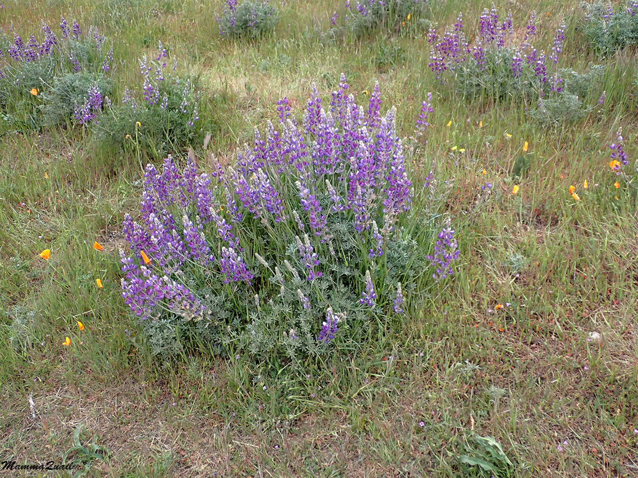
Although the grass wasn't as tall as it would have been after a wetter winter but it was tall enough to hide many of the wildflowers that did bloom along the trail. It wasn't the big superbloom that the East Bay hills display most springs, but there was some color between the green grass blades. 

Sky Lupine, Lupinus nanus

Not in carpets, but the state flower was well represented throughout the hike. The California poppy doesn't like overcast weather, so most of the poppies were closed. I found a few brave  (or mutant) flowers that were fully open despite the cold and overcast weather.

California Golden Poppy, Eschscholzia californica

I could only imagine how this slope would have looked on a sunny day with all those poppies fully open. I didn't go back to check.

As i was going up, I was also going north, and contouring around the mountain curves. Below me were the salt ponds and the sloughs of the Coyote Creek delta. I identified the old Drawbridge ghost town but it was hard to see any details without my binoculars (which I didn't bring on this hike) and I couldn't zoom enough with the little underwater camera that I did bring along.

Then the trail curved eastward and also upward at a mush steeper slope. Huffing and puffing I made it all the way to the ridge where I indulged in a short break. Then I went past the ridge to the east, passing into Alameda County and descending a little into a narrow green valley that looked completely empty. While there were a few people on the hike up, in that Valley I could see no one. 

I couldn't see the peak I was going to from the at valley, but I did see Mount Diablo way ahead, hovering over the wavy line of the Mission Peak ridge.

If wildflowers were fewer than normal for the season on the trail up, then in the valley below the summit there were hardly any. A few tiny tarweed flowers. That's all. Pretty disappointing, although not entirely unexpected.

Tarweed, sp?

I felt the need to take a longer break to rest and eat but it was cold and windy, and I didn't see any good place to sit. I crossed the summit valley to the north and as I came around the peak south of Mission Peak (the one with the antennas) I finally saw Mission Peak itself, alone and aloof under the clouds. 

I came upon a protected area with some rocks so I sat down to have my lunch break. It was then that I finally saw other hikers on that trail - a group of youths that were descending Mission Peak and seemed to have taken the wrong route because after heading down in my direction for some distance they stopped, debated between them, then changed direction and went down the other way.

Mission Peak

I finished my lunch and headed up to the peak. Mission Peak is a popular trail for fitness seekers and physical challenge lovers. I have a friend who go up there on a regular basis. Nearly all of them take either the Ohlone College route or the Stanford Avenue route. One can always expect people to be on the peak at any given time during daylight hours. This day was no different, although there were fewer people there than I've seen on previous hikes to the peak. I still had to wait a few minutes for other hikers to get down from the telescope pole so I could take a people-free photo. 

BTW, that pole isn't standing on the actual summit. That is found a few yards to the south, on the pile of rocks where people sit for a rest. It's marked by the geological survey sign. 

By the Summit of Mission Peak

The wind was blowing hard at the summit so I didn't linger long there. I did take a moment to look around and appreciate the view.

View of South Fremont and Milpitas

I kept taking shots of the view as I started descending northbound. To the east, under the thick layer of clouds, lay the mountains of the Ohlone Wilderness. Last time I was looking at this view from this angle it was white with snow. Looking at it now I conceived the idea of backpacking the Ohlone Wilderness Trail as part of my Mount Shasta training.That trip would come to pass later in May.

View of Ohlone Wilderness and Mount Rose

I continued descending to the north, on the trail leading to Ohlone College. Looking north I could see the hills of Vargas Plateau, dwarfed by Mission Peak.

Looking down onto Vargas Plateau

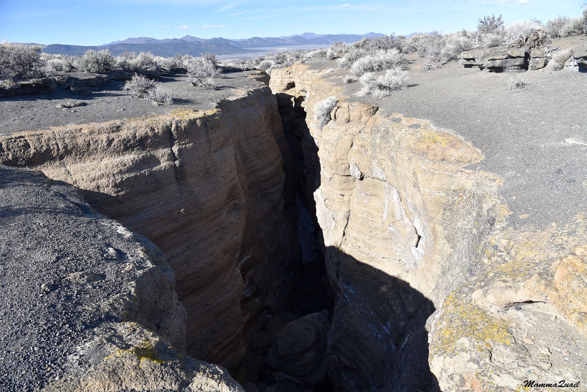
On the mountain's shoulders there were exposed rocks that were conglomerates of fossils, evident of the underwater past of the sediments that make up Mission Peak.

Fossils


Silver Bush Lupine, Lupinus albifrons

The wind was gentler as I went down to the treeline again. On the other hand, the air got colder and little droplets of rain started falling. I hurried down the trail, but did stop occasionally to look at interesting sights.

I didn't take many photos on the way down. I described that part of the trail on a previous post. At that stage of my hike I was getting too cold and eager to finish and get back home. There's a big rock down that trail, about two thirds of the way down. I stop there each tie I take this route, and I did so coming down on this hike as well. I didn't stop for long - only to take a sip of water and to adjust my jacket. I did see a sole turkey hen roaming near the trail. She got away from me slowly, eying me warrily all the time. 

As I was getting ready to continue I was passed by a small group of young hikers, all happy and cheerful. The last of the hikers in that group was holding a bouquet of freshly picked wildflowers. At the sight of that I lost it and yelled at her. She didn't reply, or even looked back at me. I don't think she understood how wrong this was.

Wild Turkey

Now upset, I continued down he trail.

Just as I got within sight of Ohlone College the sky opened up and the rain started pouring down. I wrapped my jacket around myself and hurried down the trail without stopping.

Caught in the rain

Upon completing this hike I have now made it up Mission Peak from all directions. I entered the covered parking garage and shook off the rain from my jacket with a satisfying sense if achievement. 


Saturday, November 13, 2021

Into the Narrows: The Rock Fissures of Black Point


Date: April 9, 2021
Place: Black Point at Mono Lake, Lee Vining, California
Coordinates:  38.028010,-119.084704
Length: 3 miles
Level: moderate
 

At the tail of our spring break in the canyons of Utah we returned to California by route 395 and the Eastern Sierra with the goal of checking out a few places on my constantly updating 'must see' list. On of these places was the Black Point butte on the north shore of Mono Lake. Usually we visit the South Tufa area where the spectacular rock formations are and the chance of observing interesting desert birds and other wildlife. Once we did go to see the North Tufa Mono Lake Park, which was nice, but we haven't done much exploration of any other part of the Mono Lake area. 
Black Point came on my list after a visit from a friend and her family. They did a big road trip around California. I helped them plan their trip and they added to it a great deal of their on sightseeing and exploration. When they returned from their travel they shared their own findings with me, and Black Point was one of their discoveries which immediately inspired me.
After our little exploration of Hot Creek we drove to the little parking area of Black Point. The road there becomes a sandy single lane dirt path at northeastern edge of Lee Vining, a short distance past the North Shore County Park. The path goes around the north side of Black point, then curves south and ends in a tiny parking space east of the butte. There was one care already parked there. We parked near it and stepped out to a gorgeous and outlandish scenery. 

According the the description I got from my friend and the accounts of other hikers that I later read online I knew not to expect any established trail. Indeed, there wasn't any. The features that I was specifically interested in were volcanic fissures, and the instructions of finding them were simply to get to the top of the hill and look for them west of the summit. 
Our hike as captured by my GPS

There were numerous tracks of human footprints ascending directly uphill. We chose that which looked most direct and followed it. 

The slope wasn't all that steep but going up was more physically demanding than it appeared. Going up the soft cinders felt like hiking up a sand dune. I paused every now and then to look at the view which opened up with each step I took uphill. 

Mono Lake view southwest to the Sierra Nevada 


A flat salt-crusted island was visible close to the north shore. There must have been quite a wind there because a dust devil was dancing on the salt flat. 

Little lizards were sunning between the shrubs and scurried away as we past them. They were numerous, and also very quick to run and hide.

Black Point is one of those hills that whenever you think you see the peak and you get near it, it turns out that there's another would-be peak a bit higher. We encountered a few of those on the way up but eventually we did see the real peak before us, and we headed there. 

Once we got to the rocky part of the hill the climbing became much easier. on the other hand, because there was no trail we needed to find the best way to get to the peak on our own. We had different opinions on the matter so we ended up splitting, each of us ascending by a different route. 

View northeast

The first one up was the elder chika, my mountain young goat. I came up second, far behind her. Pappa Quail lingered behind to stay with the younger chika who took her time getting up the hill.

The view from the peak was fantastic. What surprised me was how high I felt on the peak of that relatively small butte looking at the majestic eastern peaks of the Sierra Nevada range. 

The volcanic nature of the hill was evident everywhere. I liked the nuggets of what looked like granite embedded in the volcanic ash rock. 

Standing on the peak of Black Point I looked around for the fissures. There was a big dark line to the west that looked like it could be that. I called my family and we climbed down from the peak and headed west to that dark line where it looked like the ground had opened up. 

The Fissure

It wasn't a straight-forward walk to that dark line we saw from the peak, but when we arrived there we saw that indeed that was a large fissure in the volcanic rock. 

Fissure

We approached the fissure where it was shallow and the walls were collapsed at several points so it was easy to go down and take an inside look.

There was a dark lizard on the wall. I photographed it, but Pappa Quail and the elder chika both got better photos than me. And they didn't even get down the fissure. 

Northwestern Fence Lizard

The fissure got deeper and I tried going down directly but my way was blocked by a large boulder. There was a steep drop on the other side and I didn't want to risk trying to descend there so I climbed back up above the fissure line. 

It didn't surprise me that Pappa Quail wished to stay up but I expected my chikas to show more enthusiasm about these cool geological formations. Apparently they were too tired and didn't feel like going down the fissures. In fact, they kept asking when will we get back to the car already. I told them they could go down already, but Pappa Quail convinced them to stick with us until I was dome exploring. I didn't argue, I simply dropped down the big fissure at the first passable entry point. 

The dirty white bottom I saw from above turned out to be old snow. I was excited to see the leftover snow so late in the season. It showed that the inside of the fissure was keeping the cool temperatures much longer than the surrounding area. I had to watch my step though. Although old, the snow was still slippery. 

I moved further into the fissure, not worrying about how I'll get back up. I figured I could always backtrack and exit the way I entered. As I moved forward the fissure got deeper and narrower, it's walls closing in on me. 

It was getting late in the afternoon but there was plenty of sunshine outside. Inside the depth of the fissure it was fairly dark, however, and only a narrow stripe of bright sky was visible above my head. 

Looking up

One of the strange things that I saw inside the fissure was the stucco-like partial coating of the fissure walls. It looked human-made, but was completely natural. 

I inspected this 'stucco' closely. Later I asked about t at the California Geology Forum page and was told that this was tufa, a calcite deposit that precipitates when calcite-rich water evaporates. That implies that Black Point fissures were once below the surface of Mono Lake. 

From a side view it did look like something that was added on the pre-existing fissure walls. 

Pappa Quail called me from above. The chikas were really eager to get off the hill. I started looking for a way out. There were plenty of dead-end corners in the fissure, but soon I came upon another collapsed area where I could climb up and exit the fissure with little effort. . 

Looking along the fissure from above I could see that I would have needed to get out soon enough anyway because it became to narrow for me to walk though. It did seem to get wider later on but my family were already turning to walk down the hill. 

We didn't go back to the summit of Black Point but circumvented around it in the general direction of the parking area. 

Going down was much quicker, naturally. The difficult part was finding a less thorny route between the desert shrubs. 

Soon I was at the lead - not a normal place for me. Perhaps it was the lack of wildflowers, or that Pappa Quail and the elder chika actually encountered birds on their way downhill. 

Brewer's Sparrow

There weren't that many birds there, but enough to make my two birders pleased, and the elder chika glad that we did go there after all. 

Northern Harrier

Even I saw some of the birds but I trusted my family borders with their big zoom lenses to capture the photos. 

Rock Wren

I came down the hill facing east where the peaks were low volcanic buttes devoid of snow. Mono Lake to the south was belted with a wide salt band at its north shore. I felt compelled to go down to the water but I didn't think that Pappa Quail and the chikas would want to remain in the area any longer. 

Mono Lake

Earlier that day the plastic gravel protector at the bottom of our car came loose and was dragging on the dirt road. Pappa Quail showed his MacGyver skills and tied the thing with a piece of wire we found on the ground where it happened. Now however, he wanted to secure it better. When we got back to the car he pulled his multitool and slid under the car. He said he didn't need my help so I announced that I was going down to the waterline and invited the girls to join me. The young chika grabbed her book and sat down in the sand near the car, making her statement. The elder chika perked up when I mentioned that there should be birds in the water. 

We walked down   a wide belt of mostly dry vegetation, stepping on a narrow path that previous visitors had etched in the land. 

Between the dry grass belt and the was another wide belt of black volcanic cinders, contrasting beautifully with the white of the salt sediments and the blue water. What astonished me though, were the many dead plants, all of one species, that stood at the cinder belt like outworldly ghosts. I asked about these later at the California Native Plants Society page, and learned that these were giant blazing star, a common annual wildflower. Their bloom season would be later in the summer, but it was early April and these were all dead and I didn't see any new germination. 

A Blazing Star Cemetery
 
 I inspected them closely. The dry casings of once lovely green plants with big yellow flowers. The blazing star is an annual plant, but these looked like their lives were sucked out in an instant, living the empty dry body behind them like an old molt cast aside by a dragonfly nymph turned adult.
Giant Blazing Star, Mentzelia laevicaulis 
 
When we approached the salt belt it no longer appeared as a uniform salt field but showed much texture of sediment varying in size and shades of white, off-white, and gray. The contrast with the black sand and the blue water was striking.

As the water sources to Mono Lake are still being diverted by the city of Los Angeles, and after this year's drought, there was quite a lot of freshly exposed sediments near the waterline, the smallest of which looked like popcorn.

The elder chika went directly to the water in search of birds. I got distracted by the hoards of brine flies that sat right at the edge of the water. They moved in waves as I stepped near, and settled down a couple of yards away.

Brine Flies

Gentle waves rippled the water, diffracting around the tufa deposits that poked through the surface. The calm movement and the near complete silence permeated my soul.

There were only a few birds in the water, all of them grebes, and none of them very close. They were in breeding plumage and swam about in pairs. The elder chika took a few photos and said she wanted to go back to the car.

Eared Grebe, breeding

I took a long goodbye look at the waterline, this time to the west where the remains of Sierra Nevada snow shone white in imitation of the brilliant white salt deposits on the lake shore. This place was truly magical.

On our way back to the car I noticed something I didn't see on our way to the water - there were numerous anthills dug in the crusted sand. The anthills looked freshly dug, but no ant was visible outside them. I assume they are of a nocturnal species. I also wondered what do they eat. Perhaps dead brine flies?

Anthills

We got back to the car. Pappa Quail was still underneath it so we dawdled around a bit more until he finished securing the gravel protector to the body of the car. The sun was getting low and the chikas were hungry. We got into the car and drove back to Lee Vining where Pappa Quail convinced the chikas to stop for a short visit of the North Tufa Park to see if there any birds there. The sun was down when we finally arrived in town where found only one eating place open for business, and even there we arrived almost before closing time.


Many thanks to the members of the California Geology Forum for the information about Black Point.

Many thanks also to the members of the California Native Plants Society for their help in identifying the blazing Star.

A post edit: upon reading this post Pappa Quail commented that I forgot to mention that the wire we found didn't quite work to fix the gravel protector so I had to sacrifice the low E string of my guitar, and that did do the job. 


Never miss an opportunity to visit Mono Lake. Seriously.