
 |
| Marble Mountain |
Date: August 4, 2023
Place: Marble Mountain Wilderness, Yreka, California
Coordinates: 41.567294, -123.144440
Place: Marble Mountain Wilderness, Yreka, California
Coordinates: 41.567294, -123.144440
Length: approximately 6 miles
Level: strenuous
Level: strenuous
It rained a little in the beginning of the night. When I woke up in the morning however, there was no more rain. I went down to the creek to get more water and while I was filtering my chika got out of the tent and went about her morning routine. Soon my friend and her daughter emerged from their tent as well.

We ate our breakfast by the creek then broke camp and started up the trail. There was no sign of the clouds that cooled us off last evening. The sky was clear and as soon as we emerged from the forest into the open the sun shone brightly right down on us. On the evening before I found out that I didn't have the charger cable of my navigator. Seeing that today's navigation would be an easy one, I decided to not use my navigator to record this hike, and save the remaining battery for the next day's hike.
 |
| Red Rock Valley Trail |
The Red Rock Valley trail continued uphill in the same manner as it was below the campsite where we stayed for the night: intermittent forest patches and open meadows with lots of wildflowers.
 |
| Angelica, Angelica sp. |
Many of the wildflowers in these meadows we've already seen on the day before, but it was lovely to see them again. Occasionally I would identify a plant that we haven't seen yet on this trip. One of the meadows we crossed was yellow with one particular wildflower species - the st john's wart.

I got a close up of one st john's wart that bloomed closer to the trail. There are a couple of native species of st john's wart in the area. This one however, was an invasive, non-native species.
 |
| St John's Wart, Hypericum perforatum, non-native, invasive |
The Red Rock Valley we were ascending on didn't look anything like the granite valleys of the High Sierra. It was long and wide, and narrowing very gently towards a cirqueless end. The main difference was in the surrounding mountains, which appeared gentle as well, even if not glacier-rounded. There was little exposed rock even in the higher elevations. Nearly all the mountain slopes were forested.

We met our first creek crossing. It was narrow and we hopped across without any issues. We still had plenty of water so we didn't stop there, but we kept in mind that we'd have to fill up before leaving the valley because we weren't sure if there was any water later on when we'd reach the ridge.

We heard bells from somewhere ahead. It sounded like cattle bells. We didn't see any cattle though, nor cow pies on the trail. There were lots of wildflowers and the insects were very active among them. Thankfully, none of the insects were interested in us.
 |
| Mating on Horsemint, Agastache urticifolia |
A bit further up the trail we started encountering cow droppings by the trail. The bells sounded louder now, and soon enough, we came upon a herd in the trees. Some of them were very close to the trail and we weaved our way carefully between them. Apparently, grazing rights were leased in this wilderness area.
 |
| Cow |
Nearly all the forest around comprised of conifers. Stood out were the pandos, (a stand of a single genetic entity) of quaking aspens, shimmering in the gentle breeze.
 |
| Aspen Pando |
The higher we ascended, the meadows grew larger and the forest patches smaller and more distant. The trail was pretty narrow, but not overgrown. It was clear that it was in regular human use.
 |
| Red Rock Valley Trail |
At no point during this hike did we see any red rock that might have rendered this valley its name. We did see many wildflowers, though.

I was so happy seeing all this bloom that I kept snapping photos of everything, including of very familiar and very common wildflowers, like the yarrow, which I see on nearly every hike in California.
 |
| Yarrow, Achillea millefolium |
There were plants that were already past their bloom time and have gone to fruit. some of the fruit were no less beautiful than the flowers.

So far, cows were the only large animals we've seen on the hike. We did see however, many invertebrates along the way, some of which were very cool to watch, like the ground burrowing bees. There was an entire colony of them, going in and out their little individual nesting holes, which they dug right on the trail.

I suppose it is easier to dig a hole and to fly in and out of it in a patch of ground that was clearer of vegetation. We took care not to step on the little bee burrows as we walked up the trail.
 |
| Red Rock Valley Trail |
Other fascinating insects buzzed around us. Some humored me and paused their movement enough for me to take their photo. Most of them I didn't identify, but I think this one is a fly.
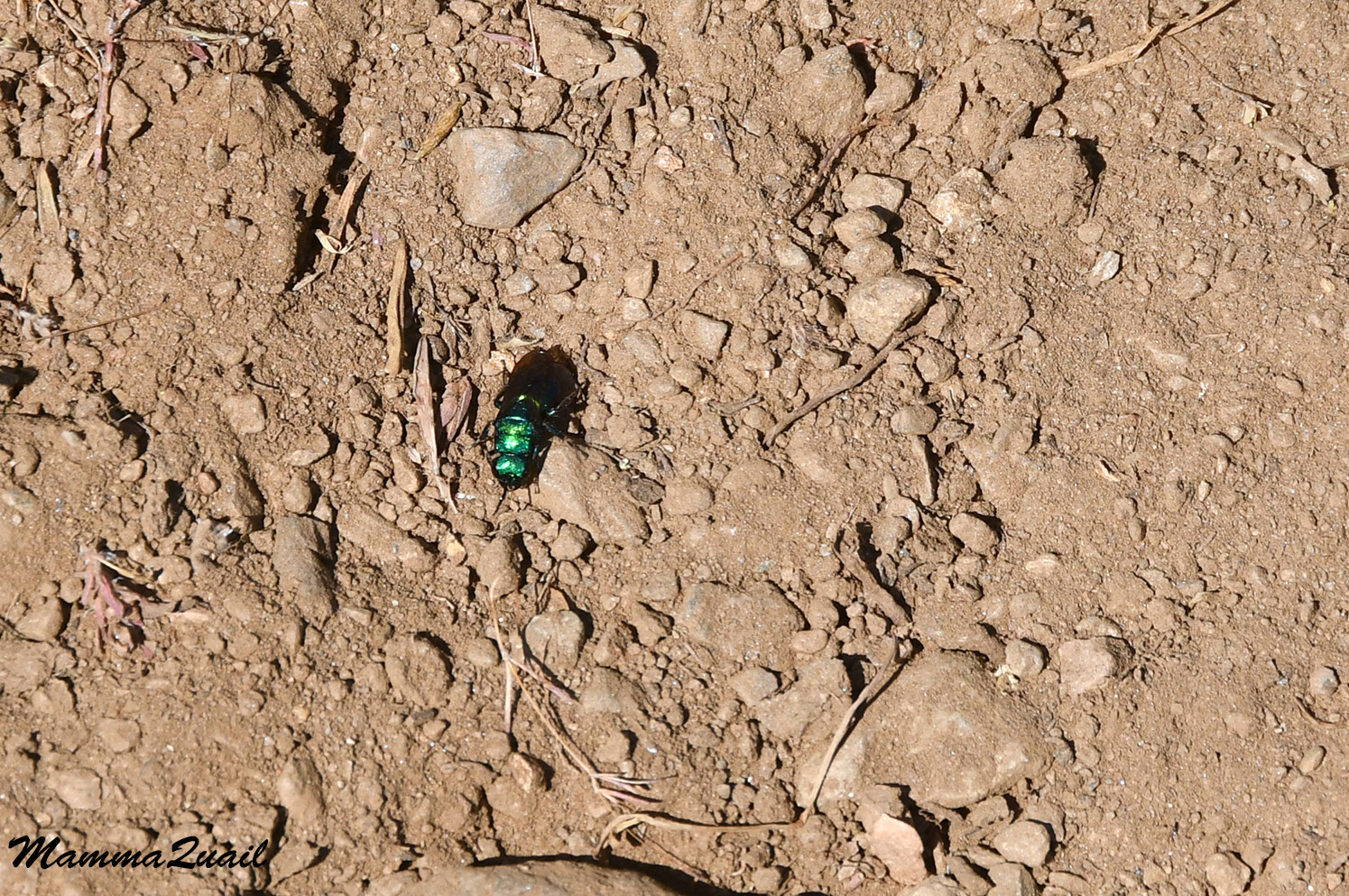 |
| Iridescent Fly |
A sweet, minty smell was in the air. I looked around and sure enough, there it was - the mountain monardella shrubs, in full bloom. I considered picking some for tea later on but I didn't. I assumed there will be some growing near our campsite that evening.
 |
| Mountain Monardella, Monardella odoratissima |
We stopped occasionally, to hydrate and to rest a bit. Not in top shape and with pains in my left hip I was the slowest one in our little group. On one of our breaks we enjoyed the company of a little chipmunk that munched on its meal not to far from where we snacked on ours.
 |
| Chipmunk |
The high part of Red Rock Valley was a large, open meadow, flanked by dark conifer stands that extended all the way up to the ridge. We were headed up to that ridge, where we would join the Pacific Crest Trail (PCT) for a few miles before descending into the Sky High Lake area where we had planned to camp. We came upon a little creek and stopped to refill our bottles, anticipating this might be the last surface water we'd see before reaching Sky High Lake.
 |
| The top of Red Rock Valley |
We sat there by that little creek for a while, enjoying the noontime heat until it became too much, prompting us to get up and move on. Then the girls found an empty wasps' nest and we paused briefly again.

My friend and I pored into our maps, trying to figure out of the blue lines and dots marked fresh water along that segment of the PCT. There was a pond marked on the map at the higher end of the valley, but looking in that direction, we saw none. The vegetation looked like it was already drying up.
 |
| Butterfly |
As evidence of water there until fairly recently were the many cornlilies all around us. Most of the cornliles didn't look very happy. Many were drying up in the edges and the greener plants were overridden by herbivore invertebrates. Ants were picking off aphids and mites from the large cornlily leaves.

My friend pointed out to me the large plants that towered over the lower meadow vegetation. They were budding out, but none blooming yet. I recognized them from other mountain hikes I've done, but the name didn't come to my mind at the time. I later remembered - these were monument plants. I was sorry to miss their bloom, it is quite striking. We were there to early for that, though.
 |
| Monument Plant, Frasera speciosa |
The great red paintbrush we saw all along the trail, but here in the upper meadow they seemed lusher, healthier, and more vibrant red.
 |
| Giant Red Paintbrush, Castilleja miniata |
We did come across one last creek before the final ascend to the ridge. Since we had already filled our bottles recently, we didn't stop to refill again. Perhaps we should have, because the final ascend would drain us more than we had expected.

After the last creek crossing the trail became considerably steeper. It was also the hottest part of the day. I felt hot and tired, but continued plodding on, not wanting to hold us all up. At some point we noticed a pond, way down below. That was the pond we saw on the map bud didn't locate while being down there. It didn't matter though. From above it looked that it wasn't easily accessible.
 |
| Forest Pond |
There were many more wildflowers on the way up, and I used the little photo pauses to also catch my breath and to do small stretches of my hurting hip.
 |
| Crimson Columbine, Aquilegia formosa |
All and all, this part of the hike was very beautiful and enjoyable, including the heat and the uphill effort.

Even the thistles looked different here, not the common western cobwebby thistles I was familiar with from my hikes in the Sierra Nevada.

When I raised my head from the wildflowers I was suddenly aware of a large peak with unique appearance that loomed on the northern horizon behind the ridge line we were aiming for.
 |
| Marble Mountain |
I zoomed my lens to maximum. This - was Marble Mountain. The white belt below its peak was the marble rock. We planned to be hiking the marbles tomorrow.
 |
| Marble Mountain |
Nearing the ridge, we were among trees once again. Not a continuous forest but a stand here and there, interspaced with open areas. We welcomed the intermittent shade. The ground vegetation too was thicker and greener here, with evidence of recent moisture, probably left after the high altitude snow patches have melted.
 |
| Monkeyflower, Erythranthe sp. |
Here too, the invertebrates were very active. I noticed what seemed to me at first as a mating activity. A closer look however, revealed predation - a fly of some sort was gnawing on a small bee.

The people we met at the trailhead yesterday have told us that the bloom up by the ridge was magnificent. There were absolutely correct. It was a wonderful celebration of colors all around.
 |
| Rose Meadowsweet, Spiraea splensens |
Even the smallest of wildflowers were worthy of my attention. There are many species that I chose to omit from this day's hike post because they are represented in the other days, or that their photos weren't all that good. If I'd included everything, this post would be much heavier, and it already quite big.
 |
| Smooth Willowherb, Epilobium glaberrimum |
The festival of mid-summer colors would not have been complete without the numerous butterflies that were busy among the flowers.
 |
| Butterfly |
From high up the trail we got a view of a are rocky buttress in the valley we were just exiting. It looked a bit reddish, and my friend mused that this might be the 'red rock' after which the valley was named. I wasn't sure I was buying that, but it was the closest think to a red rock we'd seen so far. The great red paintbrush flowers were a real red color and livened up the entire trail side.
 |
| Red Rock Valley Trail |
The great red paintbrush was particularly prominent with the pale mountain monardella as its background. The swallowtail butterfly added its unique touch to this magnificent Nature's composition.

My chika requested one more rest stop. We were close to the ridge and the PCT junction now, but she needed a break. It was hot and we all drunk more water, and looked behind us at the Red Rock Valley we just ascended through.
 |
| Red Rock Valley |
Right where we were sitting, somewhat hidden in the other vegetation, were primula flowers of a species that loves the high mountains. Marble Mountain isn't as high altitude as the High Sierra, but its wilderness peaks are of the highest in the Klamath Mountains.

At last, we reached the PCT - the Pacific Crest Trail. Having had a recent break we didn't stop again, except to appreciate the bold squirrel that stood guard on a rock nearby.
 |
| Golden-mantled Ground Squirrel |
The PCT is the longest continuous trail in United States. It runs from the Mexican Border to the Canadian Border, running through California, Oregon, and Washington. It takes an average of three months to hike it continuously. Most through backpackers do it south to north, but there are those who do it in the other direction. Not everyone can take that long from their regular lives and hike it in chunks.
 |
| Pacific Crest Trail |
I personally, never had the desire to hike this particular trail on a continuous trip. Even when I hiked parts of it on this and other backpacking trips or day hikes, the PCT segments I hiked were part of other loop trails.
 |
| Pacific Crest Trail |
The part of the PCT we were hiking on now started almost level, which was a great relief. We picked up our pace. Even the steeper segments were at a reasonably mild slope. It was also much more forested along the ridge which the PCT followed, although in some places the forest was burnt.

From the ridge we had a view to the west, and it was spectacular. The Klamath Mountains extended as far as our eyes could see, and the valleys between them looked very deep and narrow. Our plan was to go partly into one of these valleys.
 |
| View west from the PCT |
Of all the butterflies I've seen on this hike, the hardest to photograph were the yellow ones. They were the most active, and the most skittish of all. I was very pleased therefore, that one of them cooperated with me and stood still for a brief moment.

The wildflower display was just as gorgeous up on the ridge, especially in the exposed areas, out of the forest. Almost every step I've encountered species that I was seeing for the first time on this hike.
 |
| Davidson's Penstemon, Penstemon davidsonii |
We reached the place where the map indicated there was a spring. We counted on this spring to fill our water but we couldn't find it. We didn't have much water left and the day was still hot. We were seriously concerned that we would run out of water too soon. Shadow Lake, a little lake just below us on the east was the nearest source of water. The problem was that getting there meant going down (and up) a very steep trail leading to it from the PCT. My friend volunteered to go down there and get water, and her daughter joined her. My chika and me, who were already tired, stayed behind and kept our eyes on their backpacks.
 |
| Pacific Crest Trail |
It took our friends almost an hour to get the water and come back. The trail was very steep and slippery, they said. I filtered water as they rested from the effort. During that time a caravan of horses passed by us. They had two dogs with them, and one of the dogs defecated on the trail. After they moved on I took a stick and pushed the poop off to the side so no hiker would step in it.
 |
| Pacific Crest Trail |
Other than the horse riders, we came upon several PCT backpackers, nearly all of them through hikers - those who do the entire trail in one go. Some were on a shorter trip in the area, just like us. A couple of them went down to the lake where our friends had just been to fetch water. In the height of summer, the PCT does feel a bit like a freeway.

We resumed our hike, trying to make up the time lost while getting water. The ranger at the National Forest office in Yreka had warned me that the trail might be blocked by fallen trees but we haven't encountered any on our way up Red Rock Valley. There have been some, but all of them removed by the time of our trip. On the PCR however, we finally came upon logs that were blocking the trail. In fact, we run into the team of volunteers that was working on removing them. The logs past them were not yet removed so we had to hop over or move around the trail block.
 |
| Clearing the PCT |
There were a few more fallen logs blocking the PCT after we passed the clearing crew, but none were difficult to pass over or around. We moved on at a good pace.
 |
| Spreading Dogbane, Apocynum androsaemifolium |
I was still in the lead, but I walked faster now, pausing only briefly to photograph wildflowers, most times even clicking the camera with barely a slowdown.
 |
| Elderberry, Sambucus mexicana |
It was nice to see familiar flowers that I knew from my trips Sierra Nevada and to Lassen Volcanic National Park.
 |
| Scarlet Gilia, Ipomopsis aggregata |
Another sight that captivated me each time we stepped out of a wood stand was the spectacular mountain view to the west. It was hard to detach my eyes from the striking elevation differences between the height of the mountain ranges and the depths of the narrow gullies, and the shimmering blue haze that floated over that fairy tail landscape.
 |
| West View from the PCT |
Always the educator, I kept pointing out curiosities to my hiking mates. Being in the lead, I was most of the times the first to spot interesting things. Often these were things that only I considered interesting. Sometimes they too, paused to take a closer look.
 |
| Caterpillar nursery |
Even common sights, such as the parachute seed head of a composite plant, were an attraction. I had to argue a few seconds to photograph this hawksbeard seed head before the younger hikers with us had the pleasure of blowing the seeds away.

When we reached the trail junction of the PCT with the Sky High Lake we took another short break to drink and to check the maps. Sky High Lakes area is a popular campground in the Marble Mountain Wilderness and we hoped to get there sooner rather than later, before other backpackers filled all the suitable campsites. When we got to the trail junction however, it was clear that we won't make it on the earlier side of the day to Sky High Lakes. We were simply too slow. That is, I was too slow. By the time we were ready to go downhill my hip had already been screaming at me with jolts of pain for a few hours now. I didn't talk about it much, after all, there was nothing to do about it at the time except for taking some pain killers (which I did but didn't hep much), and to keep a manageable pace, which is what I've been doing anyway. It sucked and I was very dismayed, but I tried to not let it show so to not bring everyone else's mood down. I simply admitted to having aged, which wasn't really the reason, as I am not all that old.

From the trail junction we had a bit more of uphill walk to do, and from the saddle, just before dropping below the eastern side of the ridge, we had yet another spectacular view of Marble Mountain, closer now, and with its marble belt fully in view.
 |
| Marble Mountain |
The upper part of the Sky High Lakes trail was in and open, fully sunlit rocky area. Many of the wildflowers there were completely different from those we've seen on our way up Red Rock Valley and the earlier segment of the PCT.
 |
| Cobwebby Paintbrush, Castilleja arachnoidea |
There was a good diversity of plants there, and new species of familiar genera. I didn't do much exploration there because our stop was a short one, but it was lovely to see.
 |
| Arrowleaf Buckwheat, Eriogonum compositum |
In a short distance however, we dropped back below the tree line and into the shade of conifer stands. It was no longer intensely hot, but we welcomed the shade.
 |
| Sky High Lakes Trail |
Naturally, we came across different flora in the forested area. I found it interesting to see wildflower species that were different from those I've seen in the upper region of Red Rock Valley. The differences could have been in soil composition, relative moisture, slope direction of sun exposure, or other factors. Either way, I was thrilled to make first time sightings on this trip even this late in the day.
 |
| California Jacob's Ladder, Polemonium californicum |
Some of my sightings were lifers, too. One of them I knew right away that it was completely new to me - the cliff Lewisia. Excited with my find I accidentally knocked off my lens shader ring and it rolled down the slope to the side. Groaning, I started taking off my backpack so I could climb down easier, but before I could remove even one strap my friend's daughter was already skipping down with the agility of a mountain goat. She fetched the rogue shader ring and handed it back to me. We hardly lost any time over this. I thanked her and once again felt the pinch of lamentation over the depletion of my own youth agility. The flower was well worth it though, and I was very fortunate to be in company with my friend and our daughters.
 |
| Cliff Lewisia, Lewisia cotyledon |
Once again we hiked a pattern of intermittent forest stands and open meadows. The meadow areas were alight with wildflowers, but most of these I've already seen ealier that day, and I paused much less frequently for photoshoots.
 |
| Sky High Lakes Trail |
The butterflies were a different matter though, especially those butterflies I was seeing for the first time today.
 |
| Admiral Butterfly |
The trail dropped continuously down and at the top of the large open area below the main forest stand we paused to take a look. We didn't see the lakes yet but my friend pointed out to me where Shadow Lake was - behind that rocky ridge on the top left of the photo. We were going to stay far below that level tonight.
 |
| Sky High Lakes Trail |
We kept trotting downhill. I pushed away the thought of my pain and simply darted ahead wanting to finally reach a campsite and take off my backpack load.
 |
| Oregon Checkermallow, Sidalcea oregana |
All of our moods rose when we saw the three lakes complex below. There was still a distance to get there, but it was all downhill and the destination was in sight.
 |
| Sky High Lakes |
We walked through one last stand of conifers on the way down and we stopped there for a short break. Our spirits were high. We chatted a lot, laughed a lot, and played word games.
 |
| Sky High Lakes Trail |
I even found more wildflowers in this forest stand. This always makes me happy.
 |
| Little Prince's Pine, Chimaphila menziesii |
We haven't seen much vertebrate wildlife on today's hike. We did hear birds on the way but the birds weren't out in the open. On the way down I saw a group of sparrows in the willows, but they wouldn't stand still. I still tried.
 |
| Sparrow |
We reached the first of the Sky High Lakes complex, the Frying Pan Lake. The lake was small and beautiful. There was one good campsite nearby , and it was already occupied by other backpackers. We moved on to Little Sky High Lake.
 |
| Frying Pan Lake |
Little Sky High Lake is the west most of the complex, and the trail leading to it was overgrown with vegetation.
 |
| Asters |
We couldn't see any suitable camp sites near Little Sky High Lake but we went there anyway, wanting to take a closer look at the area.
 |
| Little Sky High Lake |
There were a few other people near the lake and one swimming inside it. I thought it would be nice to take a swim too, later in the evening, if I wasn't too tired.
 |
| Little Sky High Lake |
We found no suitable campsite near Little Sky High Lake so we continued on to the main Sky High Lake, which was the biggest, and the east most of this lakes complex. We walked the entire length of Sky High Lake in search of a campsite.
There were several suitable sites but they were all taken already.
Eventually we split forces - My friend and her daughter went higher into
a nearby conifer stand to look there, while I continued along the lake.
My chika started with me first, but then decided to join my friend and
her daughter, leaving me alone.
 |
| Sky High Lake |
All of the lake side sites were occupied. My friend eventually found a nice place,inside the forest stand where we eventually built our camp, intending to stay there for two nights. The camp wasn't right by the lake (which isn't a good thing anyway) but wasn't too far either - merely a couple of minutes walk, and a water access point that was fairly private.
 |
| Sky High Lake |
The lake was our source of fresh water. It was also the habitat of rough skinned newts. There were many, many of them there.
 |
| Rough-skinned Newt |
The rest of the evening was very nice and relaxing. We cooked dinner, then took our plates up to a nearby sitting rock to it facing the lovely view of the meadow and the mountains, and to observe the beautiful sunset.
 |
| Sunset |
After dinner we took turns going down to the lake to fill water and to wash up. I was too tired and cold to go in for a swim and a quick skinny dip (it was already dark and no one else was around) had refreshed me a great deal. I slept well that night.