Thursday, September 20, 2012

The Whispering Giants: A Slow Stroll in Muir Woods National Monument

Date: September 15, 2012
Place: Muir Woods National Monument, 20 minutes drive North of San Francisco, California
Difficulty level: very easy (lower trail is stroller-friendly).

Whenever we have visitors from out of state we take them to see 'the big trees'. For us it is always the choice between visiting Henry Cowell Redwood State Park or Muir Woods National Monument. Both of these places are home for groves of impressive redwood giants and our choice often depends on which traffic jam we are willing to tolerate going there :-/
This time we went to Muir Woods, Papa quail's cousin, spouse and baby, and me.
Traffic was much easier than I expected but the weather didn't seem promising: a thick fog blanket covered Mount Tamalpeis and the area hills. I drove down the narrow and winding road from highway 1 to Muir Woods without seeing any of the scenery: it was all fogged out. By the time we were down and found parking though, most of the fog had cleared and as we entered the park it was all gone and forgotten. The day developed to be beautiful and sunny.
Although a mid-week morning, there were quite a few people there already, enough that we needed to park at the once-removed lot. Tour buses were coming in every minute and groups of people poured through the gate, briefly stopping to pose for a photograph under the sign.
The welcoming tree - redwood by the gate.

There are pretty sights even before entering the gate. The running brook banks covered with lush ferns and a grove of young redwoods, still slim, right behind the restrooms building at the parking lot. 


California holds the record for the largest tree (Giant Sequoia), the oldest tree (Bristlecone pine) and also that of the tallest tree
(the record is 379 ft) - the Coastal Redwood (Sequoia sempervitens). Although not record-holding for oldest, the Coastal Redwood can be very long-lived still. This log on display in Muir Woods was nearly 2000 years old at its death.


Coastal redwoods grow naturally along the Pacific coast from Santa Cruz, CA in the south to Curry county, Oregon in the north. They like the foggy weather and need the ocean mist to thrive.
A grove of young redwoods on the hillside.
The largest trees grow down by the creek, on the valley floor. From the moment we entered the park, our necks automatically stretched back to look at the high canopy.


Redwood tops
 I was unable to capture the entire tree in a single photo frame.

Redwood bottom
At the end of summer, the creek had little water in it. We saw a little fish swimming there nonetheless :-)
The creek runs through it


A fern by the creek:


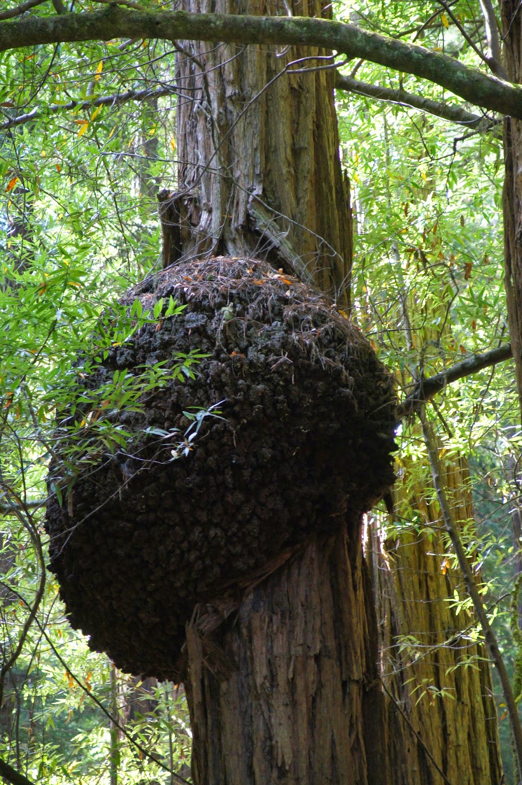
We saw tree roots exposed by the trail, shiny from the multitudes who touched them while walked by. The first part of the trail is made of board walk and has clear signs requesting not to step off the trail - redwood roots are shallow and delicate, and the steps of so many people can damage them and shorten the lives of these trees. Trees to topple over during storms and mud slides. One can truly appreciate the redwood size when its trunk lies on the ground. 
A fallen redwood
This tree (not a redwood) also fell over and its branches now grow upward like little trees on their own.
A natural bridge
The redwoods are very desirable in the lumber industry for their strength, beauty and fire-resistance. They are cultivated and logged in various places in Northern California and were also successfully introduced to other parts of the world. Luckily, the giants areas are currently protected.
Many of these giants have a hole at their base. Some of these are large enough to walk inside. 
'and he lived under the name of Sanders'
 Many trees had young shoots growing en mass from their root crowns. Some of these shoots will mature into individual trees with their own root systems. The tree in the middle will eventually die and leave a vacant space surrounded by its matured, genetically identical offspring. 
Little Redwoods at the base of a large one. They're genetically identical.
Some of the redwoods also had growths. Unlike animal growths, these are not dangerous to the tree.  Most of them are relatively small:

But this one has really grown out of proportions:

We took our time strolling underneath the trees, Normally, we would climb the hillside trail to go back to the visitor center, but that trail isn't stroller friendly so we turned back on the boardwalk on the other side of the creek. We had an interesting encounter with an elderly tourist who didn't speak a single word in English, who was fascinated with our cousin's baby and photographed him with much enthusiasm, People can sometimes be a curiosity just as much as nature, I guess.
The trail is about 1.5 mile long and the entire walk, including some baby care stops, took us about two hours. If you ask me, I could have stayed there the entire day and not get tired of these magnificent trees!
Dwarfed by the giants


Monday, September 10, 2012

Wood Between the Worlds: Crystal Lake and Horseshoe Lake

This is my second post about our camping trip to Juniper Lake on last Labor Day, September 1-3, 2012.

Those of you who recognize the reference to C.S. Lewis' The Magician's Nephew are not mistaken - this is exactly how the forest of Lassen Volcanic National Park looks like. I got that impression a few years ago when we hiked the loop trail of Hat Mountain (sadly, now burnt) and once again on this trip, when we hiked to explore two of the smaller lakes adjacent to Juniper Lake. The serenity of the fir and pine forest and the clarity of these small lakes under the brightness and warmth of the lazy late summer sun worked together to give a truly magical feeling. Just slip the ring on and step into the lake and one is immediately transported to an enchanted world.

Crystal Lake.
Difficulty level - moderate.
We arrived Juniper Lake campground on Saturday before noon, just in time to claim the last remaining campsite. The weather was perfect: sunny and warm with very little wind, but a tad too cool for a dip in the lake. So after eating lunch and building our tent we decided to go on a short trail leading to another, smaller lake – Crystal Lake.
From Juniper Lake campground to Crystal Lake
We walked from the campground on the dirt road that goes along the eastern shore of Juniper Lake and after a few hundred yards we found the trailhead to Crystal Lake. This trail is very short – only 0.4 mile long, but it’s all a sharp incline, to a total of 400’ elevation gain. Almost immediately the chicas started complaining and we had to stop several time for them to catch their breath. I assume that the overall elevation we’ve been at (6800’-7200’) contributed to their fatigue. 

Lassen Peak peeking from behind the trees on the trail to Crystal Lake
 After many prompts we reached our destination and all woes were forgotten. We stood by a small and clear mountain lake that sparkled like a gem nestled in the dark green of the firs. With renewed energies the girls removed their shoes and waded in the water.
The water was so clear and cool. It was irresistible.
The rocky cliff over the southern shore of Crystal Lake

 Crystal Lake is very close to a summit and no creek leads into it. Like many other such lakes in the area, its water is all snow melt. But though isolated, it does have fish, and people to go fishing there.
We sat there for a long while, enchanted by its quiet beauty.


Crystal Lake
The way down was much quicker and without complaints. We returned to our campsite for dinner and fire.
Crystal Lake is a lovely place with just a short walk leading to it. An easy family hike for an hour or so.  Definitely make the time to walk there if you’re in the area!

Mount Harkness, view from Crystal Lake.
Horseshoe Lake
Difficulty level: easy.
Labor Day Monday was our day to go back home, but I couldn't bring myself to leave the area right after breaking camp, so I convinced my family to go on another hike - to Horseshoe Lake. After eating breakfast under a raid of hungry grey jays, we drove 2 miles north on the dirt road to the trailhead, at the north point of Juniper Lake.
A grey jay, waiting to jump the breakfast table.


The trail is very obvious: clear and wide. Impossible to miss. It begins with a mild ascension through a fir/pine forest that soon opens up into large clearings carpeted with Manzanita shrubs. After a small plateau the trail descended back into the forest.
Mid-way to Horseshoe Lake
We didn't see many animals along the way, although we did hear many song birds. This cute chipmunk was posing for my camera a little bit.
Chipmunk
It took us an hour to hike the 1.4 miles to the trail intersection by Horseshoe Lake. There is no direct access to the water there so we needed to decide which way to turn so we could get to the lake shore. After consulting the map we headed left (southward) and before long cut straight through the trees to the inviting shore and sat down to admire the view and to eat our snack.
There were little forest flowers where we sat. Cute spots of color.
An aster?  A fleabane?
Yellow monkeyflower
Horseshoe Lake is named that way because of its horseshoe shape. From where we sat, however, there was no way to tell the shape of the lake. It was no less beautiful though, and its calmness and the surrounding forest gave me once again an urge to slip on the magic ring and step into the water and into another world altogether.


At the south corner of the lake we spotted a red area. A close-up photo revealed little flowers sticking out of the water like tiny red snorkels.
Lake painted red

We were already pressed with time so we didn't go near these flowers. Instead, after having our snack and appreciating the scenery we turned and headed back to our trail.

When we returned to the Horseshoe Lake trail junction I noticed that the sign said 1.3 miles to Juniper Lake, and I wondered how this works if the sign at the Juniper Lake side says 1.4 miles. I had no one to ask though. We soon discovered, however, that the trail compensated for the missing 0.1 mile by the incline. Normally, this trail's incline would be easy, but for us it came a day after a pretty strenuous hike and our muscles were still sore. The adult quails did fine and so did the older chica, but for the younger one it proved to be too much. She was weeping miserably all the way back to Juniper Lake :-(
There are picnic tables right by the water. We took our watermelon out of the car (and it was still cold from the night), opened it and had a quiet, relaxed picnic by the water. After that we returned to the car and drove off, back to civilization.

I would strongly recommend this place to people who like camping in relative seclusion. That doesn't mean I would be happy to find a Yosemite-style crowd next time I go there ...
Sunrise at Juniper Lake


Saturday, September 8, 2012

Remote and Serene: Juniper Lake and Mount Harkness, at Lassen Volcanic National Park.


Sunset at Juniper Lake

Place: Juniper Lake, at Lassen Volcanic National Park, California
Coordinates: 40.44904 -121.29668
Dates: September 1-3, 2012
Difficulty: strenuous 

Lassen Volcanic National Park is probably our favorite camping place in California. Not as popular and crowded as Yosemite, yet no less spectacular in its beauty. Although we've been hiking there for years now, we somehow managed to miss the park's more remote south-eastern area, of Juniper Lake. Last Labor Day weekend we finally went there for a three day camping and hiking vacation.

Saturday: Settling in.
We arrived Juniper Lake Campground just before noon on Saturday, in time to claim the last remaining site which, not surprisingly, had the smallest flat area suitable for a family-size tent, and the closest proximity to the pit toilets. The campground at Juniper is primitive indeed as it provides only the most basic facilities and no potable water. We did bring plenty of drinking water and also a filter, just in case (we didn't need to use it) and we counted on the clear lake water for washing the dishes and ourselves.
There was a lot to wash too: the last 7 miles of the road leading to Juniper Lake are packed gravel dirt road. The layer of dirt that covered our car had provided the chicas with much entertainment and us quail parents with plenty of no-nag time to settle in.

Dirty car art
 Our campsite was pretty close to the lake but thick vegetation separated us from the water, and it took me some time to find the path going to the waterfront. When I did, though, it was a very rewarding sight indeed.  
The last rays of the setting sun illuminating the dome of Lassen Peak behind the lake and the trees.
These rocks protruding into the lake are an excellent seat for meditation as well as a stepping stone for fetching water. I took every opportunity to go to the lake shore and fill the pail so I could spend some quiet moments of appreciation.
On our first afternoon we hiked to the nearby Crystal Lake, a beautiful short hike which I'll describe in the following post, as well as the hike on Monday morning to Horseshoe Lake. The rest of this post I am dedicating to the long hike we did on Sunday, to the summit of Mount Harkness and down along the southern shore of Juniper Lake.

Dawn at Juniper Lake. The morning moon is taking a bath in the water :-)

Sunday's hike: Mount Harkness

The Mount Harkness trail, map section scanned from Earthwalk Press' Lassen Volcanic National Park Hiking Map & Guide. Please ignore the mileage labels, they are inaccurate. Our trail is labeled in yellow. We started and finished at the campground.


Mount Harkness trailhead
The morning was very chilly and we took our time warming up, eating breakfast and getting ready for the hike. We arrived at the trailhead (which is right at the campground, no driving needed) at 10:10 and started ascending.


Mount Harkness is about 8040 ft high, and the trail elevation gain is about 1200 ft, spread along 1.9 miles. No let up. Fortunately the chicas were in a more agreeable mood for hiking. In fact, they were quite excited about climbing a new volcano.

Mount Harkness as seen from the northern shore of Juniper Lake


The slopes of Mount Harkness are covered with a fir forest. The forest, thick at the bottom, thins out with increased elevation and the forest floor becomes covered with vegetation - mostly flat Manzanita shrubs.

The Spacious fir forest on the mountain slopes
The forest floor was heavily littered with dead logs and fallen branches - plenty of fuel for fires. Indeed, while we were there, there was a large fire raging in the central region of Lassen Volcanic National Park, a fire that went rampant for days and by the time we were there had already jumped the road and was heading towards the town of Old Station.Luckily, it didn't reach the eastern region of the park where we were.

Mats of Manzanita cover the forest open areas.


The prevalent tree in that forest is the red fir. It is tall and slender with drooping branches and many are covered with a beard of lichen.

Red fir tree
The lichen adds a bright shade of green to the dark fir foliage.
Lichen beard


Mount Harkness is a shield volcano, similar to the Hawaiian ones. One practical meaning of this is that its slopes are reasonably gentle. Still, it took us 2.5 hours to reach the summit. The trees in the higher regions are sparse, separated by wide openings carpeted with still flowering shrubs.
The mountain shoulders are covered with blooming shrubs.


 There were three dominant shrub species, growing in large patches of distinct color. The yellow mats are the blooming rabbitbrash goldenweed, the silvery-blue patch belongs to the lupine and the darker silvery-green was the mountain monardella, which gave off a strong scent of mint.
Walking up we disturbed two bucks and a doe that ran across the clearing in search of a different shelter. I managed to catch the doe on camera:
A doe crossing the clearing
Right by the summit there were even fewer trees. I found this one interesting:
The top of Mount Harkness is a cinder cone with a shallow crater ringed with trees. We arrived there just before noon and had a long break and lunch.
The crater
 There were many butterflies fluttering about, most of which were too quick to photograph.
Butterfly visiting a pale mountain monardella
Butterfly visiting the rabbitbrush goldenweed


There is a small watch building at the top of Mount Harkness where rangers watch for forest fires. As I mentioned earlier, there was a fire raging in the park while we were there. Although not in our area, the smoke did spread out and lowered visibility considerably. Still, we got to see and photograph really lovely view.
10500 ft tall Lassen Peak overseeing the park
Juniper Lake, view from Mount Harkness

We could faintly see Mount Shasta in the far horizon but it didn't come out well in the photos. We did, however, got a nice view of Cinder Cone, just below Prospect Peak's slope line. As nice a view as we could get through the smoky air.
Cinder Cone
The lone ranger at the watch as there on a ten day shift and was eager for company. He explained about the fire watch and the progression of the current fire. All the nice central area of Lassen Volcanic National Park is now all burnt. Hikers and campers - do be careful with your fires!
We hiked down north-westward on the trail leading to Werner Valley. This trail is considerably steeper and rocky and evidence of past eruptions were displayed all around us.
A pile of broken volcanic rock
A volcanic rock bulging from the ground
In some places it looked like the trail is meandering through a building waste dump. Though much prettier, naturally.


A yellow pine chipmunk
we encountered along the way
Red-breasted nuthatch
All along the hike we could hear many birds around, but they were hidden well. We did see plenty of squirrels and chipmunks though.


The trail down reaches a 4-way intersection and we took a right turn, going down to the south shores of Juniper lake. It was nearly two o'clock and the day has already turned hot. There was no one else around so we took advantage of our isolation and took a nice, refreshing dip in the lake. The water was colddddddd!
Juniper Lake, view from its south west corner
We hiked back to the campground along the southern shores of Juniper Lake, on the easiest trail of our hike. At that point we were all tired and hungry, but we did stop to appreciate some of the water fowl on the lake.
Common merganser
At 4 pm we arrived at the campground. It was a good, long hike and I could feel it well throughout my body. A perfect day on a perfect trail. I couldn't ask for more! 
Juniper Lake, a view from near the campground.