Date: November 11, 2018
Place: Emerald Bay State Park, South Lake Tahoe, California
Coordinates: 38.954780, -120.110441
Length: about 6.5 miles
Level: moderate
On the second weekend of November we were planning to go on an organized group hike at the Sutter Buttes near Yuba City. Three days before that trip broke out the Camp Fire which decimated the town of Paradise, killing dozens of people and leaving thousands more homeless. The smoke was so heavy and reached so far from the area of the fire that for nearly three weeks the air was hazardous to breath in large regions of Northern California, including the Bay Area.
So we altered our destination to one of the few green spots left in the map of California air quality, and that was Lake Tahoe. Late fall isn't the high season in that area - it's too cold for summer outdoors activities, and no snow cover yet for skiing and snow play. But by the time we got there the little vacation town of South Lake Tahoe was full of people who were looking for breathable air.
The air was certainly good, although very cold. Below freezing temperatures welcomed us when we left our hotel room early on Sunday morning, heading out for the day's hike. It was already mid-morning and the sun was high when we started our hike, yet there was ice on the trail still.
Our hike was at the Emerald Bay State Park. Pappa Quail and I have hiked there many years ago before the chikas were born and I remembered it as a lovely trail and wanted to hike it again. We parked at the Eagle Falls trailhead area and crossed the road to the Rubicon trailhead.
 |
| The trail we hiked as captured by Pappa Quail's GPS |
At first we climbed the large rock that's by the trailhead to get a good view of the bay (header photo). Emerald Bay is a small bay, connected to the main body of Lake Tahoe by a narrow opening, appearing almost as a separate lake. The entire area surrounding Emerald Bay is protected nature area - state parks and the national forest.
The trailhead is high above the lakeshore and as we started down on it I kept hearing my chika in the back, "Are we going to all of this back up?"
 |
| Fall Colors uphill of the Rubicon trail. |
The first part of the trail is a wide gravel path. It was bright and sunny and soon we were warming up and shedding our top layers.
The happy sound of running water came from little brooks trickling in the trailsides. Looking closer at these happy streams it was evident that winter was already in the air - the sides of these brooks were frozen still.
 |
| Frozen |
I was therefore much surprised to see flowers, a few late bloomers braving the chill.
 |
| Larger Mountain Monkeyflower, Erythranthe tilingii |
Less surprising were the birds. Many birds overwinter in the high mountains, and we could hear them all around us. Sometimes they were visible too.
 |
| Pacific Wren |
Descending through the forest we passed some sheer cliffs. They look inviting for climbing, though not by me ...
Close to the lake surface we connected to a paved road leading to a boat campground below. There we needed to decide: left or right? Turning right would take us to Eagle Point and the hike would be over sooner. We turned left toward Rubicon Point and followed the road.
I was surprised to see that many broadleaf trees wore their fall colors still. I expected them to be bare already. Some were indeed (like the aspens in the photo above), but the willows glistened in fall gold, shimmering in the light breeze and bright sunlight.
At the boat camp we took a short break. The chikas and I walked out on the dock but the sharp, cold wind chased us back into the protective woods.
 |
| Emerald Bay |
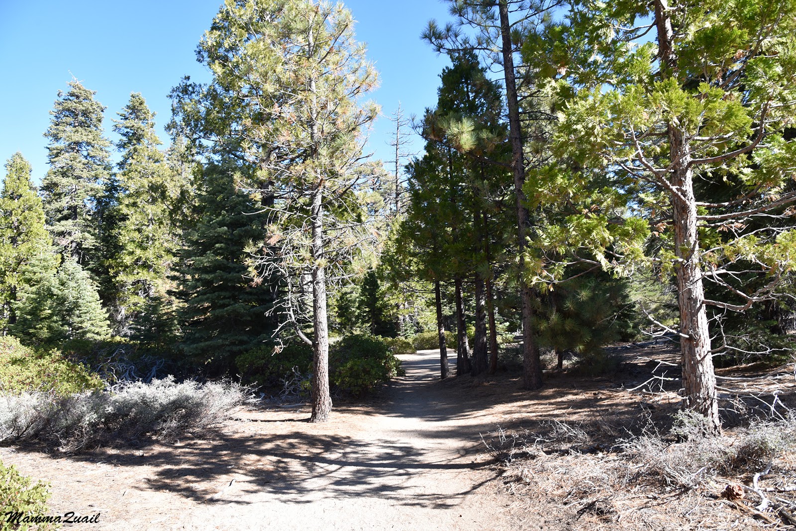
The paved road ends at the campground. Beyond that point the trail is a level dirt path that meanders between lovely conifer trees and manzanita bushes. We headed northeast toward Rubicon Point.
 |
| Trail |
The forest by the lake was teeming with birds. Woodpeckers, jays, and LBB's (little bush birds) were very active that day. Pappa Quail and the elder chika were ecstatic.
 |
| White-headed Woodpecker, male |
Both of them kept stopping and going out of the trail and around trees to try and get the best shots of the woodpeckers.
 |
| White-headed Woodpecker, female |
Smaller birds filled the air with their chirps. Many chickadees flew in and out of
 |
| Mountain Chickadee |
We decide to not go all the way to Rubicon Point and settle for reaching Emerald Point at the entrance to Emerald Bay. At some point, however, we find that there is no official trail leading from the main trail to Emerald Point. There were some narrow foot paths leading into the bushes in the right direction and while I tried following one of them Pappa Quail and the chikas focused their attention on a smaller relative of the woodpecker family.
 |
| White-breasted Nuthatch |
I probably could have bushwhacked my way to Emerald Point but that wouldn't have done so I returned to my family and we turned around and started back the same trail we came with. In the distance, near the shore we didn't make it down to, I saw a wild rose with completely red foliage all glistening in the sunlight and convinced Pappa Quail to photograph it for me.
 |
| Fall-colored Rose |
As we walked back I turned around and snapped a farewell shot of the lovely shoreline and the Emerald Point which we did not reach.
 |
| Emerald Bay |
We returned to the Boat Camp, passed it, and continued southwest along the shore. On one of the trees ahead of us sat a raven and heralded our approach of Vikingsholm.
 |
| Raven |
Vikingsholm was a resort built in 1929 in the shape of a Nordic castle. Now it's a museum owned by the State. It was closed for the season.
 |
Vikingsholm
|
I was especially attracted to the living roof of the building.
 |
| Vikingsholm |
Emerald Bay has an island. A tiny island, but one with a a tea house. Or the remains of what used to be one.
 |
| Fannette Island |
The shortest trail down from the Rubicon trailhead where we started leads directly to Vikingsholm. The beach there is readily accessible and by the time we got there after our walk to Emerald point there were quite a few people on the beach. It was somewhat challenging to take a human-free photo there.
Pappa Quail took photos of birds of blue color along the hike there. There were the impressive Steller's Jay in their brilliant blue plumage,
 |
| Steller's Jay |
and western bluebirds of which only the males wear the bright colors whereas the females are drab.
 |
| Western Bluebird, male |
After hanging around Vikingsholm for some time we were ready to continue our hike. Ignoring the chikas hints that we should ascend by the direct route up we crossed the little bridge over Eagle Creek and continued eastward along the shore.
 |
| The lagoon of Eagle Creek |
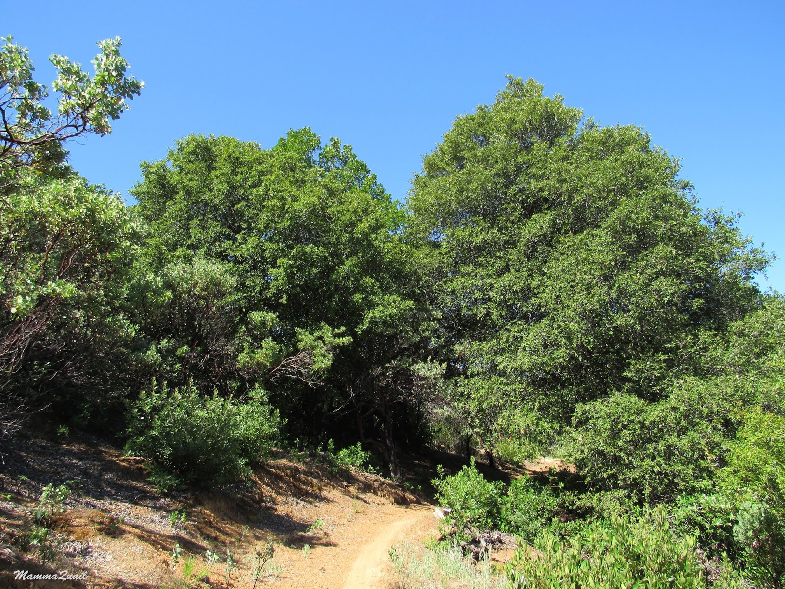
We didn't stay by the shore. Following the trail we ascended higher and higher above the water as we move east, then north toward Eagle Point. We were now walking awn the north-facing slope, out of the sun. All the broadleaf trees were bare, and we were cold again. The little creeks we passed along the way were frozen. papa Quail and the chikas increased their pace and I brought up the rear, snapping photos as I walked and ploughing through the fog of my own exhales.
 |
| Trail |
I did pause to admire the golden carpet of fallen leaves that covered the trail in one place, contrasting beautifully with the gray rocks.
 |
| Trail |
Between the trees I could glimpse the water below. Then I had to stop and stare: a patch of pure emerald was visible in the water. I knew it was a patch of sunlight penetrating through the trees but the effect was stunning - it glowed in soft, fluorescent green like a living entity from another world. Seeing this I understood the meaning of the name of Emerald Bay.
 |
| Emerald Bay. |
As we curved northward we returned to the sunlit area. Now walking on the west-facing slope we were lightly warmed by the afternoon sun.
 |
| Emerald Point far behind the water. |
We took a short snack break, then moved on upward. I turned around to look behind me but the trail was empty - no one else was doing that hike at the time.
Suddenly we heard it - loud knocks with a very distinct pattern. Pappa Quail and the elder chika exchanged glances: a pileated woodpecker! We saw two of them below near Emerald Point but they hid to well for a decent photo. The woodpeckers we saw now were more cooperative. There were three of them calling and knocking at the trees near us. Two of them kept flying back and forth between the trees while the third remained distant. They were very busy birds.
 |
| Pileated Woodpecker |
We made it up to Eagle Point campground and to the main road, Route 89. There Pappa Quail and the chikas sad town and waited while I went out to the road and stuck my thumb up. first few cars passed by but then another stopped near me and the passenger asked where was the Rubicon Vista Point. I told them I would take them right to it and they made room for me in the car. On the way I learned that they too had escaped the thick smoke that covered the Bay Area.
I brought the car back to Eagle Point, picked up my family and we all drove back to South Lake Tahoe. It was a very good hike for the day. Now I needed to figure out what hike we would do tomorrow. At the time I had no plan yet.
 |
| Emerald Bay |