Date: June 10, 2021
Place: Mount Diablo Stat Park, Clayton, California
Coordinates: 37.920359, -121.941730
Length: 12.3 miles
Level: strenuous
Place: Mount Diablo Stat Park, Clayton, California
Coordinates: 37.920359, -121.941730
Length: 12.3 miles
Level: strenuous
With only one week left before my going on the 5-days backpacking trip in Mineral King, a trip planned to get altitude-acclimation before going on the Mount Shasta expedition, I had time for one more local strenuous hike, to keep in shape. My friend who joined me on most of the hikes that spring couldn't join me this time so I selected a destination that would otherwise be too far for her - the North Peak of Mount Diablo, starting at the Mitchell Canyon trailhead.
 |
| My hike as captured by my GPS |
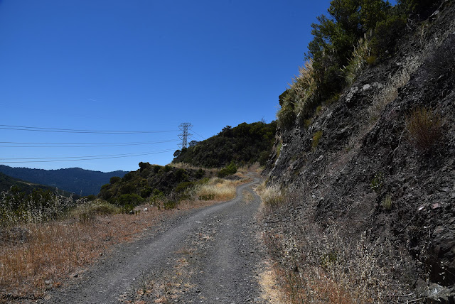
I go every year to Mitchell Canyon to see the spring bloom. The lower loop is a short and easy hike, and it is very rewarding. I also hiked the waterfalls loop starting nearby at the Donner Canyon Trailhead. This time I wanted to summit the lower of the Mount Diablo double peak - the North Peak. I could get there from the main park entrance but I chose the northern route because I thought there would be more shade on the trail. The day would be a hot one.

2021 was a drought year, and by the end on May all the annual plants were completely dry. Mitchell Canyon, which is normally full of wildflowers had much bloom last spring. There was some bloom, however. Most of it of perennial plants for which the season was longer.
 |
| Pitcher Sage |
The bottom section of Mitchell Canyon Trail I hike every spring and I wrote about here a couple of times before. This hike I I was going on beyond my usual turning point. Way beyond it.
 |
| Mitchell Canyon Road |
Beyond my usual turning point the trail continues level for a short distance and then starts ascending at a mild grade. The buckeye trees growing along the lower part of the canyon were in full bloom. These trees look so lovely and smell so nice it's hard to believe that they're toxic.
 |
| California Buckeye, Aesculus californica |
Mitchell Creek would normally run still at this time of year but the winter of 2020-2021 was a non-winter and there was no rainfall. By the end of May its lower part was already bone dry so I didn't expect to see any water on my June hike. I was therefore surprised to hear the trickle of water. The sound beaconed me and I stepped off trail and went down to the creek to check it out. Indeed there was some water flowing there. Not much, but it was very nice to see. I followed the creek a little bit near the water, but when I saw that I was getting far from the trail I backtracked and returned to the dry dirt road that was the Mitchell Canyon Trail.

It was my first time on that part of the trail and I was surprised to discover a cave dug out in the rocks to my right. It looked man-made, and I wondered what it was used for.

Still on the lower part of the trail, I was moving from shady to sunny patches. The more exposed areas of the trail had chaparral-like bushes but comprised of riparian plants such as willows and wild grapes. There were many clematis vines climbing on everything. The clematis were past their bloom by then but their fluff ball fruits were very pretty too.
 |
| Clematis |
Of the bushes that did bloom, one of the most common was the sticky Monkeyflower with its bright orange blossom
 |
| Sticky Monkeyflower |
The trail left Mitchell Creek and was climbing up steeper now. The trees were left below, save for a few pines, and I was walking through chaparral. The sun was getting higher and I paused to drink some water.

Bright red Indian paintbrush plants in full bloom decorated the trail side. This is one wildflower I never miss to notice, and not only because of its bright color - it's a uniquely arranged one - the color isn't on the flowers themselves but on the accompanying leaves.
 |
| Woolly Paintbruash, Castilleja foliolosa |
I didn't see too many birds on this hike and most of those I did see I couldn't get a good photo of. The most common bird I saw there was the scrub jay, and one of them did sit long enough for e to take its picture.
 |
| Western Scrub Jay |
I identified my destination, up and away. I had walked about two miles and the North Peak looked far away still. I had plenty of time though, and I wasn't in any hurry.
 |
| The North Peak |
I stopped for another water break in the flimsy shade of a pine tree. To my surprise I saw a little monster grinning at me from a crevice in the tree trunk. I have mixed feelings about leaving painted stones around. On one hand, these are cute and often pretty, but on the other hand they don't really belong in nature. I guess an occasional painted stone here and there doesn't do any harm but I wouldn't want to see too many of them too frequently.

I was surprised to see some water in Mitchell Creek but I wasn't surprised at all to see the upper creeks bone dry. Even after a rainier winter the upper creaks would have likely been dry in June.

I turned north onto Meridian Road and moved on, gaining altitude with each step. The sun gained altitude too and getting right over my head. Shade became even more scarce. My general direction was south so I also had the sun in my eyes and had to keep them down so to not get blinded. The trail ascended in switchbacks so each turn I alternated the overheated sides of my body.

But looking down has its own benefits too, such as the sight of a pretty peeling bark of the Manzanita bushes.
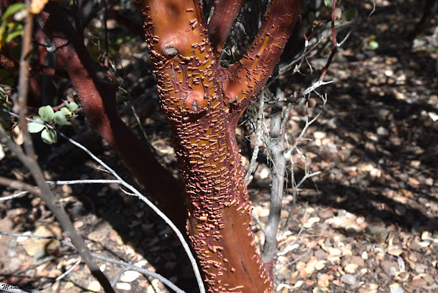 |
| Manzanita, Arctostaphylos sp. |
The day's heat brought out the lizards. There were many lizards out, sunning themselves on rocks or tree branches. They didn't bother running away as I passed them. I guess I'm not very a threatening person.
 |
| Western Fence Lizard |
Mount Diablo it at the north edge of the Coulter pine growth area. These pines are not very big among their genus but they do boast of the most massive cones. On that hike I saw some modest-sized trees laden with a good yield of cones, and wondered how those thin limbs carry all that weight. Coulter pines don't cast much shade however, and although I was walking through patches of pine groves, I was still mostly sunned.
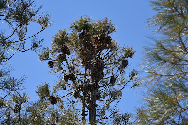 |
| Coulter Pine, Pinus coulteri |
That part of the trail rises pretty quickly and soon I was quite high and had terrific view to the north over Suisan Bay. The bay itself was a bit lost in the haze but what really grabbed my attention was the striking line between the vegetation zones of the open grassland (on top ) and the dense chaparral (below). The border was a ridge line but both areas were facing east and I guess that the proximity to Mitchell Creek and possibly a different, more most retaining soil are the reasons for this difference.
That's the kind of sight that can only be seen from afar. When I walked inside that canyon I couldn't tell any of this.
 |
| Suisan Bay |
The near-sight is also very rewarding. Along my path the coyote mint was blooming, and its sweet fragrance filled the air. Large bees were busy collecting pollen from the lilac-colored flowers, ignoring me completely (which was a good thing).
 |
| Coyote Mint, Monardella villosa |
From Deer Flat Road I turned a connector trail leading to Prospector Gap Road. This was a narrow footpath of a steep grade which was mostly exposed to the sun.

The trail had relatively few switchbacks but it did go through some greener areas with vegetation that was more lush. Poison oak was a common along that trail and in between there were some other wildflowers blooming.
 |
| Harvest Brodiaea, Brodiaea elegans |
On the more exposed parts I got a better view of the Mount Diablo summit and of the North Peak to which I was going. It looked considerably closer now, but still far away. I was walking fairly slowly and didn't feel the need to stop for rest, only for brief hydration pauses. So up I went. treading slowly and surely uphill.

I saw the morning glory blooming in full glory near the trail, although it was no longer morning. There are several species and subspecies of morning glory in that area and I'm never absolutely sure which one is which, they're all so very similar. I think I got this one right.
 |
| Morning Glory, Calystegia purpurata |
The trail curved directly east and to my relief I was all of a sudden going through tall vegetation, under more serious shade. I was surprised to hear human voices behind me - until then I was completely alone on the trail.

I walk slow so after a short time I was passed by a small group of young adults that looked very fit and very happy. We greeted each other and the went on up the trail, leaving me in their dust but with the company of some gorgeous butterflies.
 |
| California Sister Butterfly |
When I came out of the thick vegetation once more I found myself much closer to my destination. There was still some distance to go but I have done much of the uphill part. I was happy to have done one of the steepest segments in the shade.
 |
| North Peak |
I reached the saddle between the Diablo Peak and the North Peak. There was a five-way intersection there with Prospector Road continuing straight down to the east side of the park. A narrow trail turning south was leading to the main Diablo summit. Near the trail I came up on was Prospectors Trail, another one that was leading down and the one I would eventually descend on. To the north was a wide dirt road leading to North Peak. A short distance after I started on the North Peak Trail I passed that group of young adults as they had sat down for a lunch break. We greeted each other again and I moved on quickly because the group made considerable noise. When I was far enough I turned around and took a photo of the Diablo summit. A year before I had ascended it from the south entrance on a full day hike up and down. It was just as hot then, and a much longer route. It was also enormously rewarding. I saw so much bloom on that hike that I was compelled to post about it in two consecutive blogposts.
 |
| Mount Diablo Summit |
I didn't see as much bloom on my hike to North Peak, but the wildflowers I did see were very beautiful, and I was glad to see them.
 |
| California Buckwheat, Eriogonum fasciculatum |
On this part of the trail I run into a few hiker parties on their way back from North Peak. Most of the time however, I had the trail to myself.
 |
| North Peak Trail |
The foothill penstemon I knew from previous hikes on Mount Diablo and I was happy to see it again, at peak bloom.
 |
| Foothill Penstemon, Penstemon heterophyllus |
The view form this trail was spectacular. I was very high above my starting point. I could see the Mitchell Canyon entrance, recognizable by the ugly scar of the quarry, way down below. It would be a long way to get back there.
 |
| View northwest from the North Peak Trail |
Just before the summit there was a trail segment that was the steepest yet. Going up there wasn't much of a problem but I could foresee the challenge of getting back down on it because of the loose gravel that rendered it very slippery. As if to prove my concerns, a small party of hikers coming down from the peak were having difficulties going down that very segment of trail.
 |
| North Peak Trail |
The summit itself didn't look all that impressive. Pristine it certainly wasn't, because of the huge antenna on top and a few accompanying buildings. Right by the antenna was an observation platform with a narrow metal staircase leading to it. On the platform were two hikers - a father and son. Observing social distancing, I waited for them patiently at the bottom of the stairs.
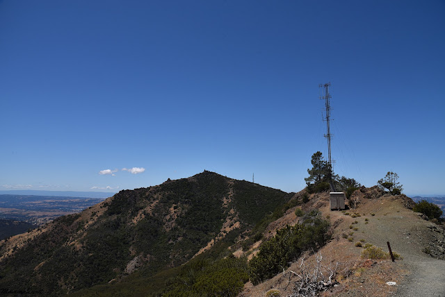 |
| North Peak Summit |
The wind was very strong up at the summit. I had planned to have my lunch break at the top but the wind was very unpleasant.
I chatted a bit with the other hikers after they descended from the platform. They told me that they intended to go up the Diablo summit as well. They asked me if I was going to do that too and for a brief moment I was nearly tempted to do that. I was however, limited with time and so I dropped that idea. Summitting both peaks in one hike would take the entire day for me, so it would have to be on another day.
 |
| lonely pine half way up the stairs to the observation platform. |
The views from the peak were magnificent. I didn't stay up there very long though. For one, the wind was whipping wild. I had to hold my hat down and my hair was blowing into my face and quickly becoming a tangled mess despite me having tied it. Also the group of young hikers that had passed me earlier on the trail and then I passed them as they were having their lunch break had finally arrived at the bottom of the staircase and were waiting for me to vacate the observation platform. I therefore settled for a few quick shots all around and promptly descended the stairs.
 |
| View east into Round Valley Wilderness from North Peak |
I didn't linger in the summit area. I found a less windy niche to sit for lunch, them I promptly continued my hike, now heading back down. On the way I passed some of the summit building and near one of the structures I saw this weird face painted on what looked to me like an old fuel tank. I will not share here whose face it reminded me of but leave that to the reader's imagination.
 |
| "I Just Seen A Face ... " |
I went down the steep gravely trail segment with much less difficulty that I had expected. I walked down slowly and didn't need to go down on my bottom. At the bottom a pretty lizard waited for me, posing nicely and patiently until I took enough photos.
 |
| Alligator Lizard |
At the saddle trail junction I chose to go down the eastern Prospectors Trail and not the one I originally came up on. It wasn't the shortest way down but I wouldn't be repeating the same path, and maybe I'd be seeing different things.
 |
| Blue Butterfly on Gumweed |
That trail was much wider than the one I had ascended on, and also much more exposed. I did get to see some different sights, including this ash-throated fly catcher (thank you, Pappa Quail, for the identification).
 |
| Ash-throated Flycatcher |
Naturally, my hike down was much quicker than my ascent. This trail was also much easier to hike and I quickly reached the less steep, lower slopes of the mountain.

Part of Meridian Road I had to repeat though. There by the trail side I found once again a few two-lobed clarkia flowers and had the opportunity to get better photos of them because the lighting was more favorable.
 |
| Two-lobed Clarkia, Clarkia bilboa |
I left the Meridian Road trail after a shorted distance than I had hiked on on the way up - I chose to continue my descent by the Donner Canyon/Black Creek route rather than go back on Mitchell Canyon Road. Again that was the choice of hiking a loop rather than backtracking the same trail I had hiked up on.

More to the east, with less moisture and vegetation, the trail leading down to Donner Canyon and Black Creek was very exposed and the vegetation was thick chaparral for most of its length. Many of the chaparral bushes were still blooming, including the magnificent chaparral pea.
 |
| Chaparral Pea, Pickeringia montana |
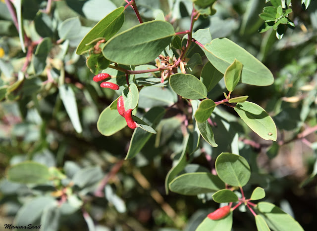
The manzanita bushes were well past their boom season of course, but their dark red branches were enough to add nice color to the hike. They were also tall enough to provide a little shade, which I was much grateful for.

When the view opened u a bit I had a good look down Black Creek, where I was heading. Both slopes were covered with perennial vegetation but it was nearly all chaparral with only a few trees here and there. On my way there I couldn't see the bottom of the canyon but I was sure that it was bone dry. I then chose to go down to Black Creek rather than go all the way east to Donner Canyon
 |
| View on Black Creek |
When I reached the canyon bed I found the creek dry as I expected, but the immediate riparian vegetation was much greener and richer than I had thought it would be. I guess that there was moisture retained in the soil after the creek had run dry and that the steep eastern and western slopes protected the creek bed from drying too quickly.
 |
| Black Creek |
As soon as the trail grade got milder my gate increased to nearly a gallop. I didn't stop at all on the way down save for brief hydration pauses. I was getting close to the Donner Canyon trailhead, where I've gone on the Diablo waterfalls hike about three years before. I needed to get to Mitchell Canyon however, and so I exited Black Creek and took the connecting trail leading back to Mitchell Canyon. The connector took me through a pretty oak savannah area on a relatively level ground.

Large turkey vultures circled the sky above. I love watching their unique lilting flight, or glide,that is very distinct from other gliding large birds. They look very graceful up in the air.
 |
| Turkey Vulture |
There was one bird of the human kind up above too, and I envied it a little. It must be really fun to hang-glide like a vulture in the sky.

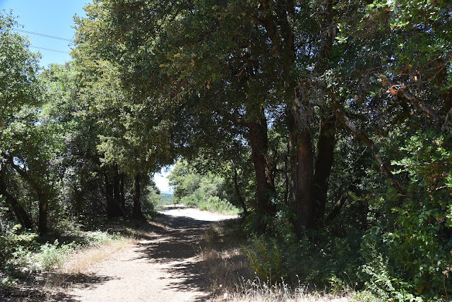
At the lower elevation the oak trees were large and very impressive. I never get tired of admiring them. They also cast much better shade than the thin Coulter pines of the higher elevations, but at that point I wasn't about to stop and enjoy that shade. I quickly descended the last bit of connector trail directly into the Mitchell Canyon staging area. There I took my shoes off and changed to sandals - my feet were sore from the strenuous hike. My first stop after exiting the park was at a coffee shop to relieve the heat with some nice ice coffee.

That was the last of my local training hikes before my big Mount Shasta hike. I felt fit and ready to take on the big volcano of the north now. There was one more thing left for me to train for and that was altitude acclimation. For that I would go on the following week once again to the High Sierra, to my favorite high area of Mineral King.