Date: December 28, 2024
Place:Valley of Fire State Park, Las Vegas, Nevada
Coordinates: 36.488345, -114.528567
Length:2.1 miles
Level: moderate
"The Fire Wave" is the biggest geological attraction in the Valley of Fire State Park in Nevada, and of course we were going to see it on the day of our 2020 winter vacation that we dedicated to this park. After hiking the Mouse's Tank and the Rainbow Vista trails we arrived at the trailhead area of The Fire Wave in the early afternoon.
 |
| Our hike as captured by my GPS |
The staging area at the of The Fire Wave had more than one trail starting there. The geological feature of The Fire Wave wasn't visible from the trailhead. What was visible from there was a huge massive wall of reddish rock that ended sharply on its south tip. A wide sandy trail stretched from the staging area to that rock mass. We gathered our stuff and started down the trail, following other park visitors who drove over to see The Fire Wave.

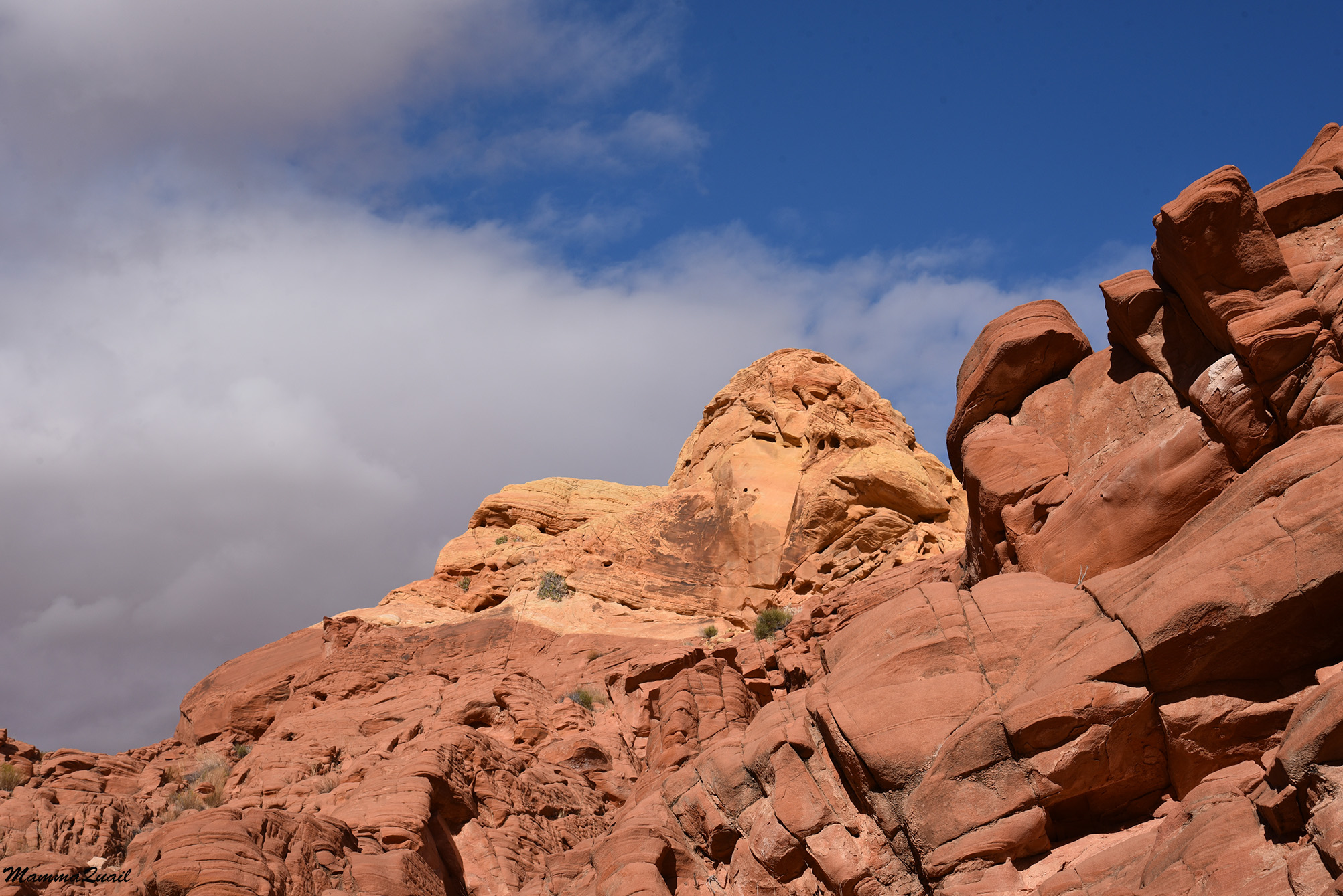
Toward the southeast the sky looked mostly clear with only a few fluffy clouds up above. A look to the west showed a very different sky that was heavily clouded, as if a storm was gathering. The patches of sunlight kept moving with the clouds and the openings between them, illuminating different features and monuments at each glance.

From a close distance the massive rock looked much less straight and wall-like. It looked more like loosely attached pillars of rock. Of course it is the other way round - it is a single rock mass that is splitting into pillars with the erosion forces.

The trail circumvented the rock wall on the south then continued in the southeast direction. A cloud covered the sun as we curved around and the light shone on a distant red hill and the faraway mountain range.

While I admired the view Pappa Quail found a bird - a little sparrow that was picking seeds from a dry plant nearby.
 |
| Sagebrush Sparrow |
The trail left the sandy plateau and now we were walking on reddish and pinkish rocks platforms with thin layers that were crumbling in the edges.

We ascended a mild-sloped rock dome and from its top the view opened up to reveal the jumble of incredibly colorful and very jagged rock scenery. The trail wasn't marked here, but it was very obvious where to go because of the erosion line of the multitude of feet that walked there before us.

Among the numerous desert shrubs that dotted the rocky surface I saw one that looked strange and unfamiliar. I think I saw one like it in one of my previous visits to Death valley National Park but I couldn't recall the name. What was interesting about it was the orientation of its leaves - the way they hugged the stem, turning their underside surface out into the elements, thus protecting their upper side's stomates from releasing too much moisture into the air during transpiration.
 |
| Utah Mortonia, Mortonia utahensis |
Ravens followed us (or other hikers) from the parking area and Pappa Quail captured one of them on camera. None of them got too close to us, I guess they knew they wouldn't get anything to eat here.
 |
| Raven |
Turning the curve on top of the rock dome we saw that we did stray a bit from the actual trail - below us was a marker pole and a bunch of people that were walking down an eroded path. We made our way back to the trail and followed it down to the depression below.

The Fire Wave was down there, but there were a bunch of people sitting on top of the rock feature, so I turned my attention to regard the hill we just came down from. It had a lovely sine wave pattern of exposed colorful layers which I thought were very beautiful. The rock waves seemed to be emerging from under a small mass of red rock on the right side.

Eventually I did turn my attention to the centerpiece feature of this trail - The Fire Wave itself. Most people came down from it but there were still a few other visitors on it. Seeing another group of people was now making its way down the trail towards The Fire Wave I gave up on the possibility of taking a people-free photo of this rock.
 |
| The Wave |
The Fire Wave is a smooth buttress of thinly layered white and pink sandstone that creates the effect of a very elaborate cake frosting. It was smaller than what I'd imagined but impressive nonetheless.
 |
| The Wave |
Pappa Quail and I stayed below the feature but the chikas did take the opportunity to climb it for a few moments despite my grumbling about the erosion damage that climbers cause. After they came down we started exploring the surroundings of The Fire Wave, which were very beautiful on their own right.

The sun came out momentarily, illuminating the colorful rock pillars, layers and domes. In the desert the landscape is angular, not rounded by frequent rains. The surface is not covered by vegetation - the very bones of the Earth are exposed in all of their beauty.

Some of the rabbitbrush shrubs were blooming and I took a moment to appreciate these hardy plants and to wonder what animal would pollinate them in the dead of winter. These are not hummingbird-atracting flowers and there were no insects about - it was too cold for that.
 |
| Rabbitbrush |
Next to The Fire Wave was another rock feature of the same layer pattern that also had some holes and arches. We sat down for a quick snack break and discussed what to do next. We could go back to the trailhead and do some more sightseeing or we could continue - the trail seemed to go on into a wash a bit further down.

I looked back in the direction we came from - a the rock mass poked through the skyline behind the pinkish layered rock dome. From this angle it reminded me of a scene from the original Star Wars movie. I half expected little Jawa people emerging from it with some dust-covered, run down droids for sale. A string of hikers stretched along the path we came on.

I looked down to the wash. Some people were coming from that direction but it looked mostly empty. I argued that we could use some more walking and we agreed to go down the wash and see what we'll find down there.

We started walking inside the wash in the downstream direction, which was westward. The wash cut through the bedrock, leaving low rocky banks with beautifully exposed fine sediment layers.

I am not a geologist, but I could see two types of layers: thick layers and thin, fine layers. The large layers represent a very long geological time period of relatively similar conditions resulting in a particular type of rock. Within the thick layers, the finer, thin layers represent shorter periods when conditions (like ocean depth or temperature) varied only so much - enough to make distinct layers but not a different rock type.

Some of the finer layers were very elaborate and stunning in their beauty. Seeing such rocks really make me wish I knew more geology.

We passed through the layers that were what The Fire Wave was made of. The layers were continuous but not at the same altitude. The difference was, of course, the result of the contortion of the layers by earthquakes and continental rising.

The rocks captivated me and soon I was well behind the rest of my family who have already advanced far down the wash. I picked up my pace and rushed after them.

For the most time we walked under the clouds but whenever the sun came out, even momentarily, the colors of the desert rocks really came alive.

A bit further down the wash the washbed changed from gravel to fine grained sand. The rock layers in this part of the wash were more even and horizontal too.

Then, all of a sudden, we were inside a canyon. Not a high walled canyon, but a narrow canyon nonetheless.

Further on the canyon narrowed so much that the washbed width was enough for only one foot. We had to walk slowly, carefully placing one foot in front of the other and occasionally leaning or bracing against the canyon walls.

The canyon walls grew taller but the narrows became a bit less narrow now. The wash bed was once again gravel rather than fine sand. We walked slow, enjoying the feeling of walking through a beautiful desert canyon, if only for a short distance.

I was amazed in fact, at how quickly the wash was changing its appearance in every few steps. A bit further down the wash, the canyon walls receded abruptly and we found ourselves walking through a part of the wash that resembled a wave much more than the celebrated Fire Wave feature.

Then the canyon narrowed again, this time with a different layer pattern. This perhaps, was the one part of the hike where I took most photos,
trying to capture the feeling of walking through this bit of canyon.
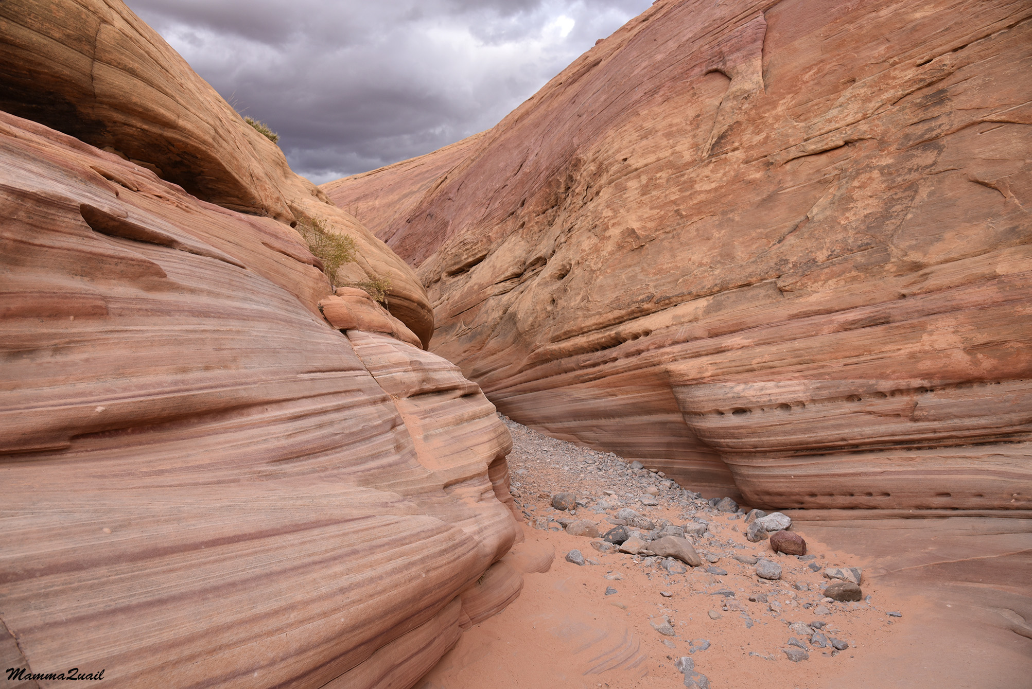
All and all, I think the canyon part of the wash was less than half a mile, but it was the part of the hike that I liked most.

We reached the main park road and faced another choice to make - should we go back along the road or cross and continue hiking through the wash on the other side?

We didn't see any trail marker. There was no trail by the road either, and no road shoulders that would allow an easy and safe walk back to the staging area where we were parked. On the other hand, the wash continued on the other side of the road with obvious evidence of heavy foot traffic there. The choice was easy enough - we crossed the road and resumed hiking westward along the wash, hoping that the path going back would be clear enough to follow.

The wash continued on the west side of the road in a very similar appearance to the eastern part, but much less narrow with less defined segments.

The composition of the rocks flanking the wash was changed too - it looked more like the colorful hill that we came down from to The Fire Wave earlier on the hike.

The wash kept changing appearances and we started looking for the exit - the trail that'll take us back north to the trailhead.

Meanwhile we kept following the wash and the numerous footprints in the sand of people who walked there before us.

Every now and then a small tributary wash connected with the one we were walking in. Up a particularly short one on the side of what looked like a dry cascade rock, was a nice size barrel cactus - the biggest yet that I've seen in The Valley of Fire park.

The cactus was too distant for my camera so I asked Pappa Quail to take a closeup photo of the cactus with his birding lens.
 |
| California Barrel Cactus, |
When the trail fork came up it was just as obvious, although there was no trail marker there either.The trail basically ascended a side tributary wash. The footprints also continued westward with the main wash - going there would have taken us to the Seiser Arch Trail.

We stopped for a short break and then resumed our hike going north - up the tributary wash, in the hope that it'll take us where we needed to go.

A particular mass of rocks grabbed my attention - they looked more like a mosaic or like jigsaw puzzle pattern rather than the nice layering of the neighboring rocks. The almost vertical lines extended through two rock layer color. They could be cracks caused by an earthquake, but if so - how come the nearby rocks weren't affected? I'll have to ask a geologist about it.

Things became a little less comfortable when we had to leave the wash bed due to thick vegetation that blocked our way. Thankfully the path up the side of the wash was clear enough and not too hard to follow.

At this point however, I took the lead. We were ascending towards a large butte ahead that looked like a few pillars stuck together. The trail was heading straight towards it and since we didn't have a map of the park we didn't know at the time where the trail would go from there - left or right of that butte.

As we git closer the trail became once again easier to follow - we were back inside the wash which was now shallow and sandy. For some time it looked as if we would be going to the right of the large butte, between it and another rocky protrusion on the right side if the wash.

Somewhere around this locale the elder chika found another sagebrush sparrow, and her mood brightened.
 |
| Sagebrush Sparrow |
When we reached the large buttes we saw that the wash continued straight ahead between the two, but the trail took a sharp turn to bypass the left butte on the west. We stood there for a moment admiring the colorful rocks and Pappa Quail said that he was getting hungry because these colors reminded him of strawberry banana ice cream.

Meanwhile the elder chika found another little bird - a Say's phoebe that perched on a ledge of 'banana' rock.
 |
| Say's Phoebe |
I looked backward at the bit of trail we just ascended on - the rocks did look like scoops of fruity ice cream.
 |
| View backward |
The sky remained mostly cloudy throughout the rest of the day but every now and then the clouds parted and direct sunlight hit the rocks. The effect was stunningly beautiful - the rock colors came alive in the light, especially with the backdrop of the gray sky.

Once again we walked inside a wash - a shallow tributary fork that cut through the top red layer of rock. It was a fairly easy walk now and we were going pretty much directly north.

Once again I paused at the high point and looked back to the path we just ascended. The moving patch of sunlight now illuminated the desert below with all of the colorful rock protrusions and the crevices between them. If this landscape was ice cream, then it was topped with delicious-looking cookie crumbles.
 |
| View Back Down |
Directly west of us was a jumble of large buttes, each of a different color. I was both glad and sorry that our trail wasn't leading there - it looked like if would be both exciting and challenging to move on or between these hills.

We were on high ground now, fully out of the wash, and walking on a reddish sand dune. Here it was challenging to see were the trail was because the footprints were all over the place, so we simply kept moving north, expecting to see the staging area soon, perhaps past that butte on our right hand side.

The sand is also home to certain desert creatures. I spotted n active burrow under a bunch of dry grass in the sand. I haven't seen its inhabitant but it looked like a well maintained burrow that was being used.

The trail appeared again near a low dome of white rock and we continued our hike northward. Although we had no direct view of the parking lot yet, my navigator indicated that we were very close to it and that there wasn't much further to walk.

Going around the dome was the last bit of the trail before seeing the end and the time I did indulge myself, walked up the creamy white rock, and admired the fine layers and the eroded round holes.

Like a half-sunken skull, the holed rock bade us farewell. We finished the hike of The Fire Wave and the wash behind it. Although it was a fairly short distance hike, it was probably the most interesting and beautiful trail we hiked in the Valley of Fire State Park.

The Fire Wave itself is pretty and certainly worth the walk there. The rest of the trail however, was no less beautiful, with the canyon narrows being my favorite part and the ice cream buttes being Pappa Quail's favorite. When we reached the parking lot we saw that there was still daylight time left, enough for another short hike, so we continued down the road to the White Domes Trail.