

Date: November 26, 2021
Place: Death Valley National Park, Lone Pine, California
Coordinates:
Length: 8.5 miles in and out
Place: Death Valley National Park, Lone Pine, California
Coordinates:
Length: 8.5 miles in and out
Level: strenuous
By the end of our 2021 Thanksgiving break I got pretty restless. Having had mostly drives or short, easy hikes, I was yearning to do a more serious trail. I also knew where I wanted to do that hike and that was at the heights of Panamint Ridge, an area of Death Valley National Park that I haven't been to for about 20 years. Thankfully my family didn't object much and so on the last full day we had at the park we drove up to the mountains bordering Death Valley on the west.
The way up the mountain splits off hwy 190 and follows the ridge line. After the initial ascent the road goes through a few fairly level areas. We happened to see a feral donkey munching on vegetation by the road side and we stopped to take photos. The donkey appeared alone but we figured there might be more around because there were piles of donkey dung everywhere along the road.
 |
| Feral Burro |
The highest mountain of Panamint Ridge is Telescope Peak, at elevation of 11,043 ft. Going up there has been on my mind but it would have to be on another time. That day our destination would be Wildrose Peak, a trail fitting better our family's ability and the time we had.
At the trailhead there was a line of seven old stone kilns that were used to make charcoal for the mining facilities in the area. My understanding is that the mountain was much more forested before the charcoal operation.
 |
| Wildrose Kilns |
The Wildrose Peak trailhead is right behind the kilns. After a quick inspection of the structures, we headed up the trail.
 |
| Our hike as captured by my GPS |
The initial ascent is about a mile of a mild grade slope. There were a few other hikers on that trail but not many, and the weather was just perfect.
 |
| Wildrose Peak Trail |
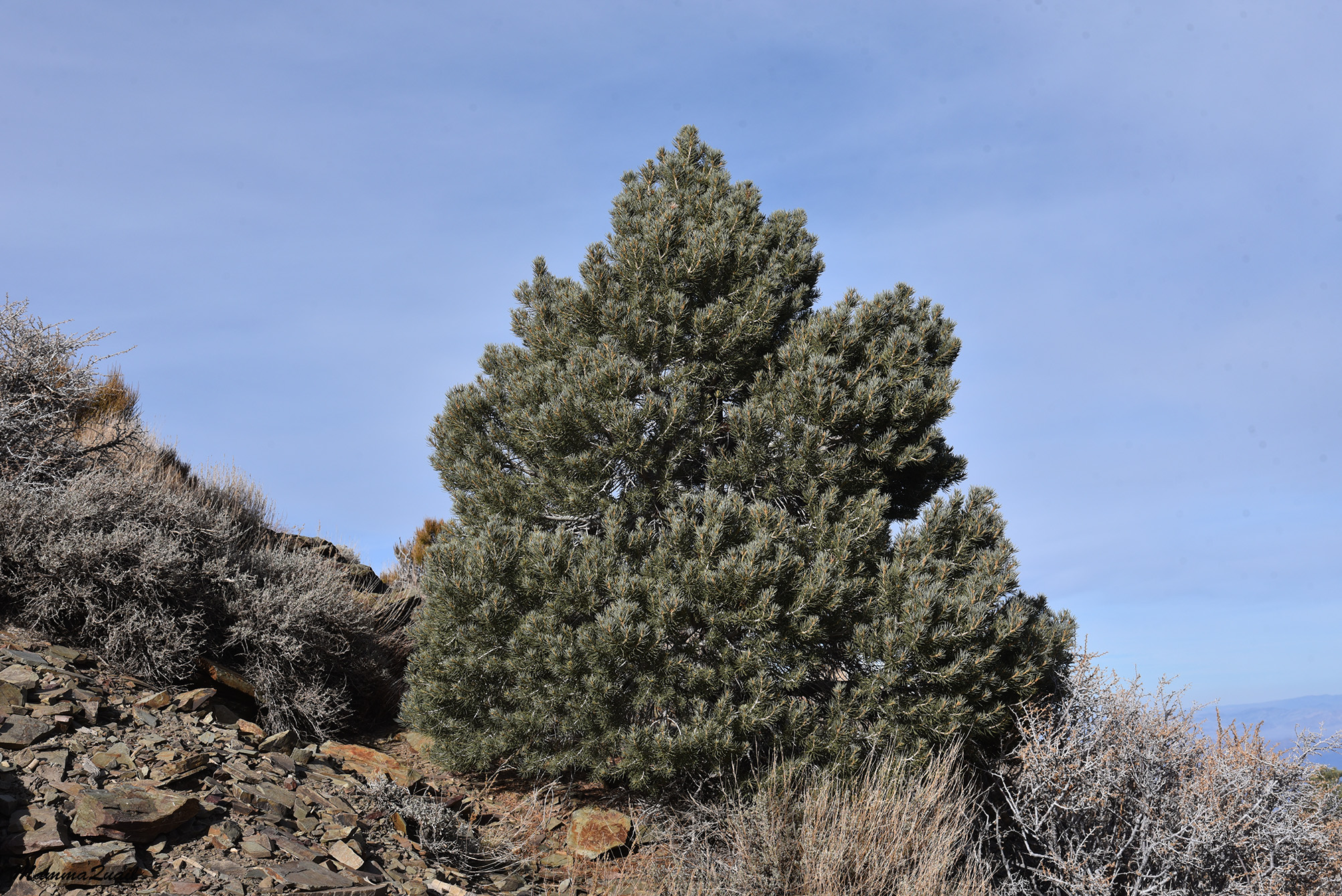
I didn't expect to see any wildflowers on this trail so late in season, but the trees were definitely something to look at and write about.
 |
| Utah Juniper, Juniperus osteosperma |
The trail curved around the mountainside and the view to the west opened up. Just below us was the high plateau of the Panamint Range. Behind it way below, lay Panamint Valley, bordered on the west by the Inyo Range. The highest mountain range on the horizon was the mighty Sierra Nevada.
 |
| View west from the trail |
An exposed rocky ledge jutted out of the mountain side. The trail stretched right above that ledge. So far the trail was fairly level and, knowing how high we needed to go still, I expected the rest of the trail to be considerably steeper.

The rocky ledge provided some rally nice view points. The nicest of these view points was occupied by a couple who claimed it as their romantic spot. We didn't bother them, just kept on moving.

 |
| Wildrose Peak, zoomed in. |
After curving east the trail got considerably steeper. It didn't take long for us to slow down as we toiled uphill. Occasionally Pappa Quail and the elder chika would stop and listen to the birds chirping in the trees but for the most part they didn't see the little feathered singers.
 |
| Wildrose Peak Trail |
The birds they did see didn't cooperate with the camera and would stay hidden behind the branches. After some patient stalking This jay was captured on camera.
 |
| Woodhouse Scrub Jay |
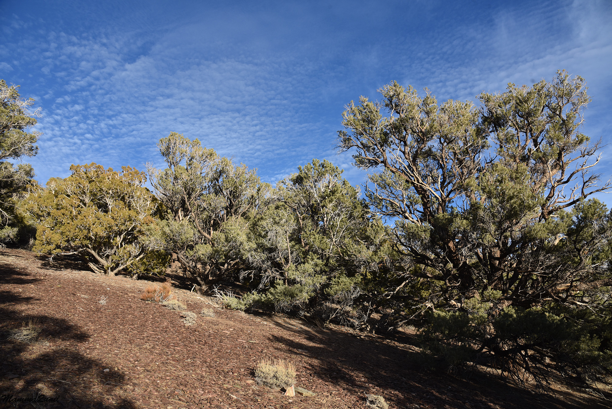
One great thing about desert hiking is that the geology is exposed to the eyes and not covered with alluvial soil and vegetation. Sans wildflowers and sweeping views aside, the colorful rocks are the prettiest thing along the trail. Knowing their source and natural history is a different matter however. I admit my geology knowledge is very much lacking.

My expectations of the ascend were correct - after the initial level walk around the mountain contour there was the steep grade slope up the creek, a good effort climb. At the top of the creek trail part, we started having views east, of Death valley far below.
 |
| Death Valley view |
The 'saddle' at the top of the creek ascent was a good place to stop for a break. There were very pretty rocks there as well.

To the north stood Wildrose Peak. We were just under half way there and still had some uphill walk, although not as steep.
 |
| Wildrose Peak, broad view |
There were lizards out and about but they too didn't cooperate with the cameras. They were cute to look at.
 |
| Lizard |
 |
| View northeast from Wildrose Peak Trail |
The trail on the ridge leading north to Wildrose Peak was of a mild grade and we made good pace on it, not stopping much. Pappa Quail was keeping time and he kept reminding us that the day is short and that we needed to get off the mountain before darkness.
 |
| Wildrose Peak Trail |
I tried to pause less but the views were just spectacular. The plants too, even without flowers, were pretty and fascinating. The presence of pinyon pines also had us look for pinyon jays. We didn't see any of those birds there, but it did keep my elder chika attentive and alert.
 |
| Oneneedle Pinyon Pine, Pinus monophylla |
By the side of the trail I saw beavertail cactus covered with such dense thorns that it looked like fur. The cactus looked very shriveled and thirsty. As I write this post, almost a full year since this hike, Death Valley National Park is dealing with massive flash flood damage. I think of this cactus and the other plants - they got nearly an entire year's worth of water in a single event. That's the true desert - very unexpected.

The trail steepened again at last stretch leading to the summit. On the last bit what looked like the summit turned out to be false, and as far in the back as I was I could hear my chika's laud groan when she realized there was a bit more to go.

I was the last to reach the summit. Having done this hike about a month after a hard ankle sprain I was the slowest in the family and when I reached the summit everyone else had already taken the best seats and had all the snacks out of the backpack. A pile of rocks marked the summit, and a USGS marker was planted at the top.
 |
| Wildrose Peak Summit |
Pappa Quail allocated 30 minutes for our summit break. I would have liked to stay more and explore the area a bit, but I knew he was right - it was a bit over 4 miles down to the trailhead, and although it would be faster going downhill, it would still take us to sunset time. While we were discussing these things, the elder chika made the best use of our break time.

We had a great view to the east, into Death Valley and on the Amaragosa Range. On the day before we hiked at Shoshone, just behind that range. I pointed at the white flat at the bottom of Death Valley below and told Pappa Quail that I thought this was Badwater area.
 |
| Death Valley |
Pappa Quail used his powerful birding zoom lens and took a closeup photo of the area I pointed at. Sure enough, that was Badwater, the lowest place in the western hemisphere.
 |
| Badwater |
I turned my gaze to the west. It was harder to tell details of the view because the sun was now at the west, but I did search the ridge line of the Sierra Nevada and I thought I identified what I was looking for. I tapped Pappa Quail's shoulder and asked for another zoomed photo.
 |
| The Sierra Nevada Range |
Indeed it was - Mount Whitney, the highest mountain in the contiguous USA was visible from where we stood (to the left of the photo below. I thought it was wild that from where we were at the summit of Wildrose Peak we could see both the lowest place in America and the highest place in the contiguous US.
 |
| Mount Whitney (left) |
The wind had picked up and the air was chilling. It was time to begin our descend. Going down the peak and to the south we had Telescope Peak ahead. In the winter Telescope Peak can get snow-capped. I saw it more than once from below. I would love to hike up there and I will, one day.
 |
| Telescope Peak |
The way down was fast. I could probably go even faster if not for the lingering pain of my recent injury. As with the way up, I was bringing up the rear.
 |
| Wildrose Peak Trail |
I didn't take many photos on the way down. This was an in and out trail and most sights I'd already noted on our way up. Some sights however, look better in late afternoon lighting.
Once we dropped into the creek part of the trail our hike became a race with the sunset. Although facing west, the creek was deep enough to hide the sun and the trail became darker by the minute. On the other hand, the clouds became much prettier in that evening light.

We were blessed with one more patch of direct sunlight and an opportunity to see the sunset between the trees. The younger chika asked for a break, she was tired and her feet hurt. Pappa Quail wasn't happy but he too wanted a bit rest. The elder chika didn't want to stop so I gave her the car keys and she took off on her own down the trail while we rested a bit and watched the sunset.
 |
| Sunset |
The last mile or so of the trail, the part that curves south along the slopes contour we hiked briskly in the fading post sunset light. The trail was clear and obvious and I wasn't worried about having to walk the last bit in the light of our phone's flashlight apps (Pappa Quail reminded me that we didn't take flashlights with us). As it was, we didn't need any artificial illumination. The remnants of daylight were enough to see us through the last part of the hike.
 |
| After Sunset |
In fact, there was enough light still for my sensitive camera to capture one last image of the kilns at the trailhead. We joined the elder chika in the car and started back down to Death Valley.
 |
| Wildrose Kilns |
The post sunset light disappears much faster in the short winter days. Almost as soon as we made it back to Wildrose Road it was already pitch black outside. There were no other cars around - we were the last humans to leave the trailhead parking area and none of the campgrounds were visible to us. Our attempt to speed up our descent from the mountain was cut short when we realized that there were feral burros by the road side, way too close for comfort. We had to drive very slow for fear we might hit one of the donkeys. It was still early though, only around 7 pm when we arrived at Stovepipe Wells. Not feeling like cooking at the camp site that night, we stopped to eat at the restaurant there, and even used their shower facility. Tired but fed and clean, we made it back to our campsite for one last nigh before heading back home. This was the final and best hike of a very satisfying Thanksgiving break.
Very beautiful trees and views. The sunset pictures are amazing (but it is safer not to get these... getting off the trail before sunset)
ReplyDeleteOh, we were already pretty close to the end by the sunset. And there's some more light time after, enough to see the trail. It was a very lovely hike :-)
Delete