 |
| View up Baxtar Pass |
Date: June 20, 2025
Place: John Muir Wilderness, Independence, California
Coordinates: 36.845272, -118.297476
Length: 6.5 miles
Level: Strenuous
The federal agencies that manage the Sierra Nevada parks and wilderness areas have been instating trailhead quota system to limit the number of people that go into the wilderness and reduce their impact. Naturally, there are trailheads that are more desirable than others, one such being the Kearsarge Pass Trailhead. Having failed to secure a permit for Kearsarge Pass I quickly obtained a permit for the nearest wilderness entry point - the Baxter Pass Trailhead. I acquired my permit for that trailhead in haste and without the due research that I usually do before a backpacking trip. This trail had very few reviews and only a small number of them had mentioned that the trail was over grown and hard to find at time. What I found on the first day of my trip was that 'unmaintained' was an understatement. The trail was badly damaged, well overgrown, and in some parts, nonexistent. After a full day of struggling uphill in extreme heat I settled for camping on the east of the pass, at about 10,000 ft - about 2 miles and 3000 ft from Baxter Pass. I was so tired when I went into my tent that I fell asleep quickly and slept soundly through the night. When I woke up, the sun was already shining into the valley of Oak Creek.
I took my time, taking my morning routine with leisure. The morning air was a bit chilly but soon warmed up. I packed everything and hoisted my backpack. It was time to get going over the Baxter Pass.
The morning was a promise of a gorgeous day and I started my day's hike in high spirit. Ahead of me. to the west, was the way to the Pass, although I had no direct view of it yet. Almost immediately I had to straddle across a tree that fell over the trail. It was the first of many I'd have to bypass that day. The view ahead didn't show any of the obstacles laying ahead.
 |
| Kearsarge Pass Trail |
The trail continued along Oak Creek. It didn't take long before I hit the first challenge - the flood damage to the trail. I could see where the original trail was but there was no way to follow it. The next stretch was climbing over or around a jumble of rocks and piles of dead, fallen trees. Whenever I chose to go around an obstacle I needed to find my way back to the trail's line on the map.
 |
| Trail Damage |
Walking was easier after my path separated from the creek and its collapsed banks. Moving between fields if scree and rocky ledges I kept moving west, gaining altitude with each step.
Between the rocks bloomed a wonderful garden of wildflowers. Here at an altitude of 11,000 ft there was no sign of the desert plants that I saw yesterday in the area of the trailhead. Of all the wildflowers of the High Sierra, the one that probably symbolizes to me most my favorite playground is the Mountain Pride - the Penstemon newberryi.
 |
| Mountain Pride, Penstemon newberryi |
The Mountain Pride wasn't plentiful on the eastern side of the pass, though. The dominant deep pink was the Purple Mountain Heather, which covered almost every damp spot along the trail.
 | |
|
After ascending a steeper slope of scree I turned around and looked east, down to Owens Valley below. The valley looked very distant, like a different country. A world left behind. I assumed it was really hot there. Where I was it was nice and warm, and also breezy.
Scree isn't the best terrain for plants to grow on but there were a few groves of small pines and wildflowers were blooming in the soil that accumulated between the scree rocks.
 |
| Woodbeauty, Drymacollis lactea |
The scree slope I was ascending was easy enough to walk because it had a
well defined trail with convenient switchbacks. I was hoping the trail
would remain good for the rest of my ascent.
 |
| Baxter Pass Trail |
A couple hundred feet higher the trail leveled on a more solid rock ledge, and for a while I had an easy going hike on a reasonably good path.
 |
| Baxter Pass Trail |
Most of the trees along the trail were whitebark and lodgepole pines, which generally were small and appeared very weather-beaten. In contrast, the groves of foxtail pines were tall and looked very majestic. The foxtail pines are High Sierra trees and I was entering the heart of their home.
The information sign at the trailhead said that there were bighorn sheep in this area. It also said that they were elusive. Not surprising, I didn't see any bighorn sheep, but I did see evidence of their presence in the area in the form of scat. I looked around, but if there were any sheep there, they were invisible to me.
 |
| Baxter Pass Trail |
I reached the altitude where there were a few snow patches still, here and there. The exposed soil was very moist and in the rocky ledges were many seep areas, where water was seeping from cracks in the rocks. The damp soil in the seep area was covered in green vegetation and wildflowers. It was lovely to see.
 |
| Seep |
Tall groundsel dominated the seep area together with minute primrose monkeyflower, both of them blooming in brilliant yellow.
 |
| Tall Western Groundsel, Senecio integerrimus |
Interspaced with the rock ledges were groves of whitebark and lodgepole pines. Whitebark pine is generally small in stature, a high altitude tree. The pines were just beginning their bloom season with the male cones still reddish and closed and the female cones showing just a hint of development.
 |
| Baxter Pass Trail |
One of the pines was ahead of all the others - its male cones were mature and ready to release pollen. I shook a branch and watched with satisfaction the yellow dust cloud that it emitted. For a moment I thought of collecting that pollen - it is of high nutritional value. I ditched the idea though, because it involved taking off my backpack and rummaging it for a clean, empty bag to collect the pollen. I felt pressed for time and decided that I didn't need to spend more on pine pollen collection.
 |
| Pine, Pinus sp. |
After some time of a reasonably easy walk on a mildly sloped, fairly defined trail it was time to ascend another rocky mass. I could finally see the gap between the mountains where I knew was Baxter Pass, although I still didn't see the pass itself.
A new set of wildflowers bloomed in the cracks and crevices of these rocks. The crimson columbine I knew from much lower elevations - it is common also in the Bay Area.
 |
| Crimson Columbine, Aquilegia formosa |
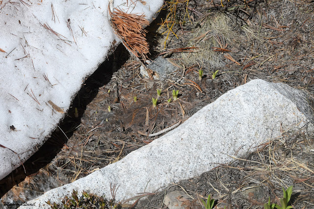
Some of the snow patches were right by the trail. It was old snow - hard and dirty, and it was in the process of melting. The edges of the snow were dripping freshly thawed water into the earth, and quick-responding plants were budding out of the recently exposed soil, ceded by the retreating snow.
A few tiny star-like pink flowers were at my feet. I recognized them to be of the bitterroot genus but I had to wait until I got home to identify the species. Next to the flowers is a large harvest ant, for scale, showing how tiny these flowers really are.
 |
| Dwarf Lewisia, Lewisia pygmaea |
Rush plants were also blooming in the seep areas below the large rock slabs. The rush bloom might not be as colorful or impressive but it is very pretty nonetheless.
 |
| Parry's Rush, Juncus parryi |
I met another familiar High Sierra plant friend - the western roseroot. I see them regularly on my Sierra Nevada mountain hikes.
 |
| Western Roseroot, Rhodiola integrifolia |
The trail neared a small tributary of Oak Creek. It was nice and shaded, and I decided it was a good place to sit for a short snack break and to refill my water bottles.
Western Labrador tea bushes lined the creek. They were in full bloom, and a lovely sight to the eyes. I took the time resting and appreciating the views.
After my little break I started ascending for real. I was there at roughly 11,000 ft and had at least 100 ft more to ascend. From that point on, the trail would only get steeper.
For a short distance the trail skirted around a large rock slab. I passed a few more snow patches and damp areas left by the melting snow couldn't be seen - it was covered with vegetation and lovely wildflowers.
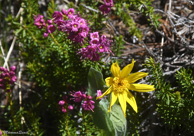 |
| Woolly Mule's Ears, Wyethia mollis |
I was taking smaller and slower steps now, and not only because of the numerous wildflowers. It was my second day out and I could feel well the effect of the altitude.
 |
| Western Bog Laurel, Kalmia microphylla |
Diamond Peak loomed ahead, big and sharp. I still didn't have a clear view of the pass but I knew it would be to the right of the peak.
 |
| Diamond Peak |
When I saw the blooming shootingstars I knew I was at the altitude where spring was just starting to make way to summer. This plant is one of the season's early bloomers.
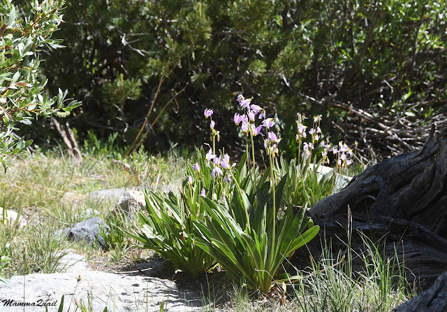 |
| Scented Shooting Star, Primula frangrans |
I was still seeing a lot of seep zones, and still plenty of the primrose monkeyflower matting these zones. Where these areas were beginning to dry out however, the seep plants were giving way to grasses and other, more dry-hardy plants.
 |
| Primrose Monkeyflower, Erhythranthe primuloides |
The trail was approaching the creek for the last time before turning hard right toward Baxter Pass. Going near the creek I had a flashback to yesterday's bushwhacking ordeal - the trail disappeared into a thicket of arroyo willows and I had to push my way through that thicket for a bit.
 |
| Baxter Pass Trail |
I didn't need to fill up more water so I said goodbye to Oak Creek and started the last part of going up to Baxter Pass.
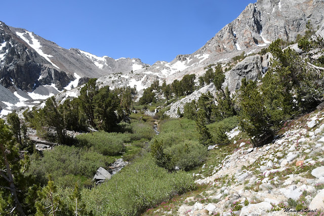 |
| Oak Creek |
On the map it looked like the trail is taking a sharp turn to the north. In reality that turn was a series of short, mild-sloped switchbacks through a sparse grove of small pine trees an a fairly stabilized scree slope.
 |
| Baxter Pass Trail |
A small bird was chirping in one of these bush-like pines. It was a Cassin's finch, a little songbird that is common up in the mountains.
 |
| Cassin's Finch |
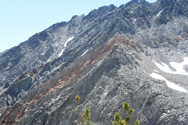
Going up the south-facing slope of the pass I had a great view of the ridge south of Oak Creek. Those slopes had still a good amount of snow patches on them.
The
place that I was at was level with some interesting features of the
surrounding mountains. The mountain to the south was mostly gray but had
a vertical strip of ocher-colored rock. Considering that these mountains are of igneous rock, I don't know what caused this unique coloration.
There were more snow patches along my path now. Old, snow, with the pink color of microorganisms growing in it. Where do these go when the snow finally melts, I don't know. It is yet another remainder of how life takes up every niche possible, even a very short-timed one.
The trail became rocky, and harder to follow. There was no marking at all, not even cairns. Usually I could tell where to go because it was easy to tell where it was easiest to climb. Sometimes I simply ascended what appeared to be the path of least resistance. On some of those times I had to readjust to where the trail became visible later on.
 |
| Can you see the trail? |
Once again the vegetation changed. I have reached the Alpine zone and there were no more large plants. The largest bush around was the wax currant, which was in full bloom at the time.
The plants that did grow at this altitude were low, very hardy plants, and very often noticeable only when I was right on top of them. One of the reasons that alpine plants are so small is the strong wind that often blow up there, with nothing to block its way. The breeze that followed me since morning was certainly getting stronger now.
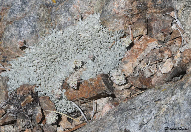 |
| Cushion Buckwheat, Eriogonum ovalfollium |
It didn't take long before I was missing the hard rocky climb, even if the path was harder to discern there. The last stretch leading to the pass was all unstable scree.
 |
| Baxter Pass Trail |
An insect flew by me and settled on the gravel. Not sure if it was a fly or a bee, I took a photo and circumvented the shiny, yellow insect.
It was also the altitude for the spreading phlox, which was just beginning to bloom at the time I was making my up to the pass.
 |
| Spreading Phlox, Phlox diffusa |
The higher I went up the scree slope, the thinner the trail was. For the most part I could see where the trail was, but in many places it was deteriorated. In some spots I needed to use my hands to climb to where the trail continued. The wind strengthened. It was no coming in sudden gusts of powerful
blows. Despite the direct sun and the time being close to mid-day I was
getting cold. I found a spot next to a large rocky mass that protruded
from the slope, where I was somewhat protected from the wind. I ate a
bite, had some water, and undid my backpack to find my base layer top
and don it under my T-shirt. I also changed into my warm hat, fearing that my regular sun hat would blow away in the wind.
From the higher vantage point I had a nice view of the bowl below Diamond Peak. There were a few snow patches there, but no lake.
I resumed my ascend up the scree slope. The wind was now my main difficulty - I had to make sure I was stable on my feet when the powerful gusts came because they were strong enough to knock my off balance. Considering how narrow and unstable the trail was, I had a real fear of being knocked over by the wind.
Large black wolf spiders reside in the Alpine scree zones. Most of them were too camera-shy but one did pose for a couple of seconds. These spiders weren't vulnerable to the wind.
 |
| Wolf Spider |
After a very slow, steady ascent I made it to a shallow depression where the trail continued less steep. I no longer had a steep drop on the side of the trail there, so I was less worried about being knocked over by the wind. The difficulty here was different - the trail was partially covered by snow.
As I made my way along the border of the snow patch I noticed a couple of birds poking at the snow ahead of me. Could these birds be ... well, neither of them cooperated with me. Every step I took, they would fly a bit further away. I took some photos, bit only at home when I enlarged the images on my computer screen I was able to ascertain that these were indeed rosy finches - the high altitude birds that I alone in my family of birders got to see.
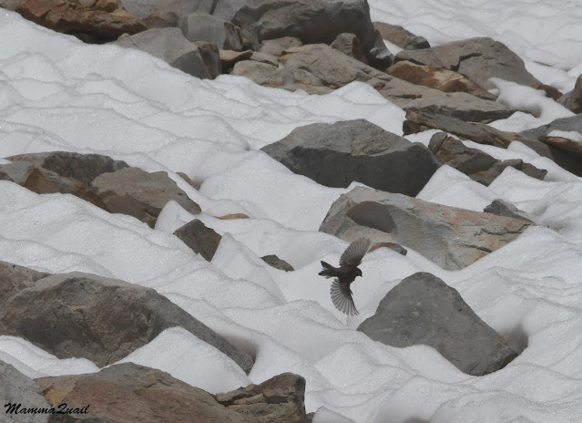 |
| Gray-crowned Rosy Finch |
I reached the top of the crest at 12,000 feet where I found out that I wasn't at the pass yet - there was one more slope to ascend to get there. There was a flatter area there where I saw many little Alpine wildflowers in bloom.
 |
| Cut-leaf Fleabane, Erigeron compositus |
Some of these wildflowers were lifers for me. Tiny, almost invisible, they thrived in between the scree rocks.
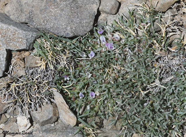
There were also wildflowers that I was familiar with from previous trips to the High Sierra, such as the gorgeous little dwarf paintbrush.
The little rock garden wouldn't have been complete without the mountain grasses that accompanied the colorful wildflowers. Except for the rosy finches, the spiders, and a few insects I saw no
other wildlife. I did see scat of marmots though, but not the rodents
themselves.
 |
| Spike Trisetum, Koeleria spicata |
I originally planned to have my lunch at the pass but the wind was strong and it was cold and unpleasant. I snacked a little bit, gave a goodbye look to Owens Valley far below, and then resumed my advance toward Baxter Pass.
 |
| View east to Owens Valley |
When I booked my permit I also checked the snow cover in the area and found it to be significant. Expecting to climb in snow I packed also crampons and an ice axe. On the couple of weeks before my departure however, an intense heat wave was in the Eastern Sierra and much of that snow melted away. Eventually I decided not to take the snow gear with me, hoping that what ever snow was left at the pass would be manageable without special gear.
 |
| Snow at Baxter Pass |
I was correct in my assessment. While I did have to walk in the snow a little bit, it was a fairly easy traverse and I didn't get any snow down my shoe.
Not in the pass snow patch, anyway. I made it to Baxter Pass, at 12.300 ft. It was beautiful, and desolate, and very windy. I didn't want to stay there more than a few minutes. It was time to descend now to the western side of the pass. My challenge now was to find the downhill-going trail because I couldn't see it anywhere.
 |
| Baxter Pass |
I'm stopping the account now because it's becoming too long for a single post. Continued on the next post.








That was a real challenge! I'm really impressed by your abilty to go through all this
ReplyDeleteThanks! Yes, I was impressed with myself too ... I didn't plan on this trip to be this challenging. It was supposed to be much easier.
Delete