
 |
| Hurkey Creek |
Date: November 22, 2023
Place: Santa Rosa and San Jacinto National Monument, Palm Desert, California
Coordinates: 33.680260, -116.681916
Length: 2.2 miles
Level: easy
The first hike we did on our 2023 Thanksgiving family road trip was in Idyllwild Regional Park, up Mount San Jacinto. From there we descended down towards the town of Palm Desert, where we had hiked numerous trails when we were in the area on the winter of 2012. At that time the chikas were small and the weather cold, and we were looking for bog horn sheep. This time I wanted to hike anew trail and I chose the Hurkey Creek Trail, which was basically an in-and-out easy hike near a running creek about midway up the mountain.
 |
| Our hike as captured by my GPS |
The trailhead was at the end of the local campground. We parked at the small day use area and started off on a lovely, easy sandy trail. There were a few other hikers there as well, but not many. Some of the hikers simply came from the campground, walking their dogs.
 |
| Hurkey Creek Trail |
It looked like the area was burned in a wildfire sometime in the past few years. The charred remains of many trees still stood erect along the trail and near the creek. The creek itself was not visible yet, but it was well marked by the yellowing arroyo willows that lined along the desert's water life line.

The birds were much more visible on leafless trees. In this case - leafless due to the fire. Pappa Quail and the elder chika immediately got to photographing the little birds in the bare boughs.
 |
| Pine siskin |
`some of these birds were quite common and very familiar to us from the Bay Area. Even so, they were lovely to see and to hear their chirps.
 |
| White-crowned Sparrow |
Then there were the birds that are of the desert and that we get to see only on road trips in the desert. The cactus wren welcomed us from the top of its perch.
 |
| Cactus Wren |
Eventually the trail neared the creek, which was running still, even so late in the dry season. The flow was gentle, almost unnoticeable.
 |
| Hurkey Creek |
For the most part the willows covered the water entirely, and the flow was visible only through the gaps in the riparian vegetation. It was lovey to see the fall colors here too, somehow it's even more striking when seen in unexpected places.
 |
| Arroyo Willows |
The area surrounding Hurkey Creek was even drier than the Idyllwild Park where we hiked earlier that day, but even there I found a plant that was blooming still. Not surprisingly, it was of the aster family.
 |
| Aster |
We continued at an easy pace along the sandy trail. The trail was mostly level, but ahead of us it looked like it might get a bit more hilly. Farther beyond loomed the mountains of the Santa Rosa and San Jacinto National Monument, all part of the San Jacinto range.
 |
| Hurkey Creek Trail |
Steady knocking sounds from a distant dead tree got the attention of my family birders. They got as close as they could to that tree and the rest of the distance was covered by their birding optics.
 |
| Hairy Woodpecker |
I don't know when did the fire happen in that area but the bushes were already well on their way to recovery. The trees however, were still too small to be noticed.

On the other side of the creek was a round hill that looked very pretty with the coat of white boulders and green shrubs in between. I was compelled to cross the stream and go climb it, but I resisted the temptation. Perhaps on the next visit, whenever it'll happen.

I stopped fantasizing about off trail boulder hopping and continued with my family on the designated trail.
 |
| Hurkey Creek Trail |
Our progress was slowed down whenever a bird was sighted in the bushes nearby. Sometimes it took a while to find a bird, especially if it was inside the newly grown vegetation. The scrub jay however, was quite conspicuous.
 |
| California Scrub Jay |
The California towhee also wasn't too shy and presented itself while following us with its gaze.
 |
| California Towhee |
Further up the trail was decorated with the rusty heads of the California buckwheat shrubs that had finished blooming earlier in the season and were now going to seeds.
 |
| California Buckwheat, Eriogonum fasciculatum |
Other bushes and vines were also in the fruit stage, long past their bloom time. Even without the flowers they looked very pretty.

We passed another water hole. I checked it out to see if I could find any animals in the water but I saw none. As soon as I finished checking out the water hole a couple of hikers passed me and went straight ahead into the water. I suppose this creek is even more popular on hotter days.

I was happy to see another plant in bloom - a yellow flowering shrub of the aster family that stood out in the fruiting shrubs scenery. Rabbitbrush doesn't usually get much attention from me but it did capture my eyes here because it was the sole blooming plant in the area.
 |
| San Bernardino Rubber Rabbitbrush, Ericameria nauseosa var. bernardina |
One of the nicest fruit heads I saw on this hike was that of the milkweed. Milkweed fruit isn't edible and doesn't have animal-attracting 'flesh'. The pods contains the dry seeds with their feather-like fiber parachutes. When the pod dries out it pops and the the seeds are carried away by the wind to a different location where they hopefully land in a germination-supportive place. The delicate fibers of the seed parachutes looked in the bright sunlight like angel wings.
 |
| Milkweed, Asclepias sp. |
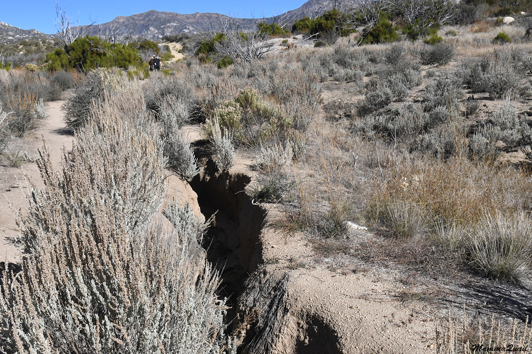
We reached the place where the trail crossed the creek, then continued north towards the mountains. The trail was no longer level. Pappa Quail wondered how long we would continue and whether we had a destination. I wanted to go a bit more to a place where we could have a view before turning around.

The trail was much less maintained past the creek crossing. A deep rut cut through the trail lengthwise, and we had to move to a parallel makeshift trail. Apparently this rut wasn't a new thing but an on-going canyon in formation.
The elder chika found a rock wren under the bushes. I took the chance to catch up with the rest of my family and continue a bit further to scout ahead.
 |
| Rock Wren |
Pappa Quail and the chikas sat down for a breather and hydration, and I moved ahead a bit until I reached a high enough point from which I could look ahead. I didn't see much change in the scenery ahead except for the topography, the elevation changes.
 |
| Santa Rosa and San Jacinto Mountains National Monument |
I returned to my family and sat next to them. We snacked a bit and had water, and decided mutually that this was a good place to turn about and go back to the car. I also took that time to check closely the nearby shrub, another rabbitbrush I believe, that also was fully in the seed - dispersing phase. The empty fruitheads after the seeds have flown away looked like pretty little stars.

While still on the high ground I viewed the mountains on the west, which were darker. I didn't know if that was because of the afternoon illumination or whether the rocks that made this ridge were in fact, darker. There also seemed to be more vegetation cover of the slopes to the west.

On our way back down the trail we had a great view southwest into the valley of Hurkey Creek. The yellow line of fall-colored willows marked where the creek was but I was impressed by the good vegetation cover of the east-facing slopes, indicating a good and reliable water source and retention ability.

We didn't stop much on the way back. After crossing the creek again it was merely a matter of striding back. I like to see things from the other direction as well though, and some things I saw only on the way back, such as this lizard in the photo below.
 |
| Common Side-blotched Lizard |
The trail neared the creek and for the rest of the hike we followed the yellow willows path. Soon their leaves would drop and the stand out color that marked the location of water to far away travelers would be gone.
 |
| Hurkey Creek willows |
Just before concluding our hike my family birders stopped for a cute little house finch that perched on a burnt tree branch.
 |
| House Finch |
Harkey Creek is a very nice trail, and it was a lovely easy hike we could do on our way down the mountains. After completing the hike we resumed our descent to Palm Desert where we found a nice place to eat before continuing south to Brawley and the Salton Sea.
It is indeed a nice trail. The fire at least made it easier to see the birds
ReplyDeleteYes, although there were fewer birds because of the fire ... A lovely trail nonetheless.
Delete