

Date: July 5, 2024
Sherman Pass Road, California
Coordinates: 35.990097, -118.366895
Length: 5 miles
Level: mildly strenuous
When I planned our 4th of July vacation this year I had my mind set on a particular trail - the Seven Teacups trail which leads to one of the most beautiful canyons in California, which I why I chose the south part of the Sierra Nevada as our destination. We stayed in California Hot Springs and on the morning of July 5th we went into the local grocery store to get some supplies and to ask about the trail's conditions. The attendants at the store were very nice and welcoming, but they also quickly quenched our enthusiasm about the Seven Teacups Trail. It was going to be a scorcher up there, they told us, and the trail was hard and completely exposed, all day long. The best chance to hike it, we were told, was to go there at first light, which meant not today for sure. We thanked them and drove up the mountain, talking between us about what we were to do. On the day before we hiked to Quaker Meadow in the north part of Tulare County and on the way south we drove near the Trail of 100 Giants grove of giant sequoia. Pappa Quail suggested we'd go and hike there. I, of course, loved the idea of hiking in the giant sequoia, but I thought it would be best to hike there on our last day of the trip, on our way back. Had a few trail options in my plan but first I wanted to see where the Seven Teacups trailhead was, and I also wanted to stop at the Johnsondale Bridge that spanned the kern River. By the time we arrived at the Johnsondale Bridge it was already intensely hot. We tried hiking a bit along the Kern River Trail but soon it became a triple digit torment and we turned back. The only place we could go to escape the heat and still go on a hike was up in the elevation, so we drove up to Sherman Pass, having selected the highest trail in the area - that of Sherman Peak.
The very top of Mount Whitney is visible from Sherman Pass but it doesn't look very impressive in the photo taken from there. A closer mountain that also had a very distinct shape was Olancha Peak.
 |
| Olancha Peak |
The weather was surprisingly nice when we arrived at Sherman Pass. It was a but early for lunch but we didn't want to hike up the mountain carrying a lot of food so was sat down to eat under a tree o the side of the parking lot. After lunch we filled our packs with water bottles and crossed the Sherman Pass Rd to get to the trailhead, and started walking up the trail.
 |
| Our hike as captured by my GPS |
The elevation gain of the Sherman Peak trail is about 2,000 ft. The slope however, stretches forward nearly all the way, through a light conifer forest comprised mainly of firs and pine trees, with a fairly light undergrowth.
 |
| Sherman Peak Trail |
The undergrowth included bunch grass and some Sierra penstemon that were blooming. Other than the penstemon and the grass, we really didn't see much else in bloom. This came as a bit of a disappointment because the road leading to Sherman Pass was looking like a garden road with all the wildflowers that were blooming on its shoulders.
 |
| Sierra Beardtongue, Penstemon heterodoxus |
The forest we walked through was pretty sparse in many places, with large clearings in between. Most of the clearings showed fine granite gravel soil with few, well-dispersed bunch grasses and other small plants. In a few, select places however, the clearings were taken over by thick bush cover, such as the chinquapin (which I was very happy to note was not blooming at the time - their bloom really stinks).
 |
| Sierra Chinquapin, Chrysolepis sempervirens |
A different species of penstemon was blooming there too, in the clearings between the trees. It is a species I have never seen blooming before, although I wasn't aware of that at the time.
 |
| San Bernardino Penstemon, Penstemon caesius |
Occasionally we came upon exposed rock formations. Nothing particularly spectacular but very pretty nonetheless. This rock reminded me a stack of pancakes, enough to get me salivating.

The trail was on a nearly constant incline, but shifted from short steep places to longer, milder sloped stretches. Some of the milder, more exposed slopes had a lot bunch grass. Above ground, the bunch grass looks exactly that - bunches of grass in small clumps, looking as if they were just planted there, expecting to expand and cover the entire slope. Below the surface however, the roots of these grasses are expanded and cover the entire area.
 |
| Bunch Grass |
Having nice open spaces within the forest gave me a good, clear view of the tree canopies. White fir made a good part of the forest but other conifers were prominent too. I spotted also some impressively tall, cone-laden sugar pines.

Tree shapes have always fascinated me, especially trees with clear 'personalities'. Also adjacent trees that form an interesting composition that pleases my eye. They don't have to be alive to have that beautiful effect.

A light-colored pointy buttress became visible through the trees. For a moment or so I thought this might be the Sherman Peak but Pappa Quail quickly pointed out that we haven't walked far enough to have this butte be our destination. He was right, of course. By then we had walked maybe half a mile and the trail continued straight on ahead. Sherman Peak would be further away behind this butte.
 |
| Sherman Peak Trail |
The day was growing hotter. The pleasant breeze that we had in Sherman Pass wasn't blowing between the trees in the lower part of the trail. The temperature was in the high eighties and we were sweating profusely going uphill. We made best use of the shaded spots we passed through and blessed every occasional cloud that blocked the sun, even momentarily.

Pappa Quail, who is sensitive to altitude, walked slowly ahead of me. When he stopped I thought that he wanted a break but he pointed at a place on the forest floor - a red snow plant was growing out of the ground there. Snow plants are early bloomers. They are named so because they often pop out while there is still snow cover on the ground. Well, there wasn't even a hint of snow where we were, and this plant was just beginning to bloom.
 |
| Snow Plant, Sarcodes sanguinea |
We were going steadily uphill and soon started to see some view in places where the trees opened up and the line of sight wasn't blocked by the ridge itself. The area mountains looked partially forested, with clearings that mostly looked like crumbling rock piles rather than smooth outcrops as seen on northern parts of the High Sierra.
 |
| View east |
About half way up we sat down for a break. We were both hot and sweaty and needed to catch our breath. The trail was about to get steeper, and it was a good spot to gather our strength.

The trail remained mild for some distance after we resumed our walk. We crossed a narrow forest clearing that was populated with low chinquapin bushes, some bunch grass, but also many little cushions of the tidy lupine which, to my absolute delight, was in full bloom.
 |
| Sherman Peak Trail |
It is hard to see from a distance if the Brewer's lupine is blooming. This lupine species is really low to the ground and its inflorescences don't protrude much above the plant itself. Moreover, the thick hair that gives this plant its silvery look, isn't the most contrasting background for its blue and white blossom. To get any decent photograph of these flowers I had to go down on my knees.
 |
| Brewer's Lupine, Lupinus breweri |
Easier to photograph, but nearly at the end of its bloom was the western wallflower. There weren't many of them up along the trail, which might explain why this plant's pods were not developed - it's possible there wasn't onther wall flower in the vicinity to cross-pollinate with.
 |
| Western Wallflower, Erysimum capitatum |
When the view eastward opened up again I got another look at Olancha Peak. The mountain, which was fully visible from the Sherman Pass vista point, was now half hidden behind a closer, lower ridge.
 |
| Olancha Peak |
The slope steepened a bit and we slowed our pace down accordingly. We were high enough now that wisps of mountain breeze drifted through the trees every now and then and alleviated the heat intensity for a few seconds. I used the slow pace to look for wildflowers, of which there were still disappointingly few.
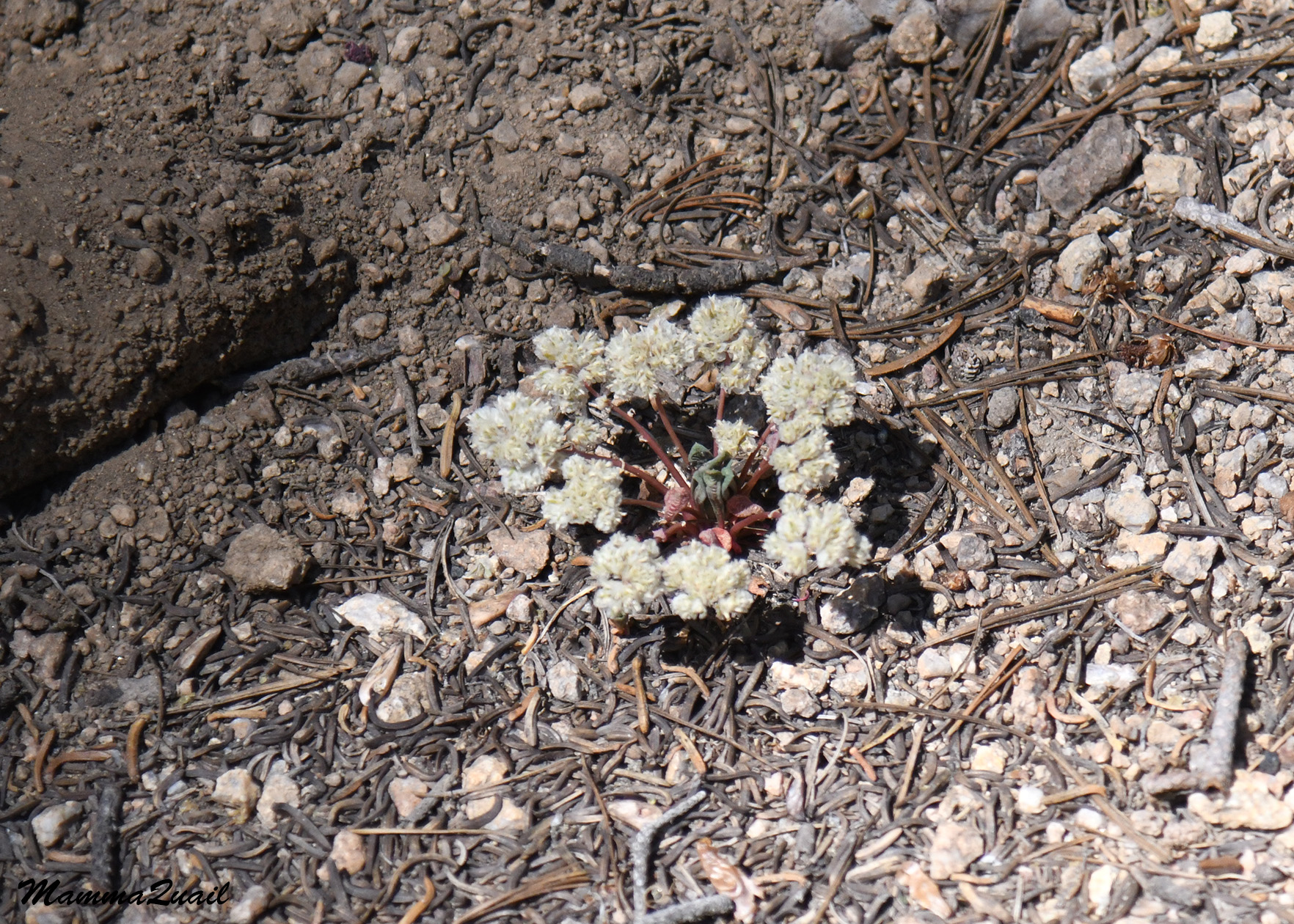 |
| One-seeded Pussypaws, Calyptridium monospermum |
I was however, seeing more and more species of blooming wildflowers the hight up the mountain we hiked.
 |
| Pinewoods Lousewort, Pedicularis semibarbata |
We found another snow plant. This one though, knew its time and was already done blooming and into the fruiting phase.
 |
| Snow Plant, Sarcodes sanguinea |
The trail steepened some more and the heat intensified. Shaded areas were fewer now, and farther between. The forecast for Sherman Peak was in the mid eighties but it sure felt well into the nineties.
 |
| Sherman Peak Trail |
The trail meandered through a few rocky places. In between the rocks I identified the woolly groundsel - one of my favorite Sierra plants. Most of the woolly groundsels were just at the very beginning of their bloom but I did see a few earlier individuals with inflorescences open enough to see the yellow flowers inside.
 |
| Woolly Groundsel, Packera cana |
Sherman peak came into view pretty suddenly: the trail curved a bit, the trees receded, and voila! there it was, nice and round, straight ahead of us.
 |
| Sherman Peak |
The trail however, stretched to the right of Sherman Peak. East of the peak the foot trail would meet the Sherman Peak 4X4 dirt road for the final ascend. Fr the time being, we were hiking a bit off to the right of the peak, going through low bushes of chinquapin, dogbane, and ceanothus.
 |
| Sherman Peak Trail |
The ceanothus was at the early stages of its bloom. I stooped over to sniff the flowers - the fragrance was still very mild and delicate.
 |
| Mountain Whitethorn, Ceanothus cordulatus |
The dogbane however, was in full bloom. Little butterflies and other insects hovered over the flowers but I didn't get a good photo of any of them.
 |
| Spreading Dogbane, Apocynum androsaemifolium |
The trail transitioned to the left side of the ridge and the view south opened up before us. The mountains on the south, considerably lower than the huge ridges of the Eastern Sierra, were pretty impressive nonetheless. They also looked much greener than I'd expected.
 |
| View west |
Little by little, we were rounding Sherman Peak from the south east. It didn't look like we had might higher to go up but that last bit would be much steeper, and the weather was very, very hot.
 |
| Sherman Peak |
The forest thickened, and for the time being we were blessed with some nice shade that eased the heat somewhat.

Now we had some view to look at as well. The mountains were higher there, but still nicely round and not half as rugged as the Eastern Sierra ridges.
 |
| View |
At last we were going up the Sherman Peak itself, and we huffed and puffed up the trail as it steepened. The forest thinned again on the slope and once again we were hopping from one shaded spot to another, taking frequent pauses to fan our sweaty faces and gulp some water.
 |
| Sherman Peak Trail |
It was on this part of the hike where I finally was seeing a nice wildflowers display. Of these, the most dominant was the mountain monardella. As usual, I became aware of these plant' presence by the the minty smell in the air before I even saw them.
 |
| Pale Mountain Monardella, Monardella odoratissima |
The gorgeous bloom of the mountain monardella attracted many butterflies, most of them swallowtails. The swallowtail butterflies were the most camera-cooperative wildlife we saw on this hike.

Other insects too partook in the bloom celebration up Sherman Peak. Bees and flies were also interested in the blooming monardella, and also in other wildflowers such as the penstemon.

The top of Sherman Peak looked like a pile of crumbling rocks, just like the tops of its neighboring peaks that we saw on our way up. There were many dead or failing trees in the higher part of Sherman Peak, but there were also many young firs and pines growing between the rocks.

In some spots the ground was completely taken by the young trees, like a forest nursery. The forest was definitely regenerating.

When we reached the Sherman Peak 4X4 dirt road Pappa Quail turned to me with an accusing look, saying, we could have driven up here??? Yes, we could have. But then we would have missed on the hike and of all the sights we've seen along the way.
 |
| Sherman Peak Trail |
The last part of the ascend was on that dirt road, and there was no shade available. There were however, paintbrush shrubs in bloom.
 |
| Wavyleaf Paintbrush, Castilleja appelgeti |
At the end of the road we found a small weather station with a closed cabin. Pappa Quail sat down at the front of the cabin in the small mid-day shade it cast. I dropped my backpack next to him and went to explore the summit area a bit.
 |
| Roundleaf Snowberry, Symphoricarpos rotundifolius |
A few steps away I yelled back to Pappa Quail to come over. He groaned a bit but did come to see what I was fussing about. Well, a Sierra columbine in full bloom is definitely something to fuss about! The only place I've seen it before was on one of my early backpacking trips in the Mineral Kind area, and even there it was a good distance off trail and in the middle of a bit of a precarious rock climbing section. For Pappa Quail it was the first time seeing this columbine.
 |
| Sierra Columbine, Aquilegia pubescens |
After being duly impressed with the columbine Pappa Quail went back to sit in the shade, and on the way he took a nice close up photo of a beautiful swallowtail butterfly that enjoyed the blooming monardella on the summit.
 |
| Anise Swallowtail |
I continued my little exploration of the summit area. The summit itself was a pile of rocks with a lot of chinquapin growing between them. Perhaps I didn't officially 'summit' Sherman Peak , but I decided to pass on the pleasure of scrambling up those rocks. I had a great surround view from where I was anyway.

The first thing I looked for and was delighted to see was Mount Whitney. i could barely see its very tip from the Sherman Pass vista point but from Sheran peak I could see its entire ridge line. It was familiar now, like a friend, now that I had already been up there at Mount Whitney's summit. This also meant that I've probably seen Sherman peak when I looked southwest from the summit of Mount Whitney, but clearly I didn't identify it at the time. I still can't identify it, when looking at my photos from that trip.
 |
| Mount Whitney View, northeast |
There were other prominent peaks looming on the eastern skyline. I looked at them longingly, wondering when I'd go backpacking there next.
 |
| View northeast to Mount Langley |
Sherman Peak is a bump on the eastern side of the Kern River watershed. The lower area between Sherman Peak and the Western Divide that runs along the Eastern Sierra ridge is a beautiful terrain with great backpacking trail options. In my mind, I was already creating my future Sierra Nevada trip, and who knws, it might be right there in that wonderful view.
 |
| View north to Farwell Gap |
An enlarged image of the Farwell Gap area shows the bowl at the top of Florence Peak. I haven't seen it, having hiked on this peak's north side.
 |
| Florence Peak |
I moved around the little weather station cabin, where I had a nice view to the southwest. The mountains there were lower and more round, as expected in a place that takes more weathering and less tectonic uplift.
 |
| View southwest |
I noticed a human settlement far below, but I couldn't tell which one that was. I could only hope that they're all are either in the water somewhere or indoors with the air conditioner on. It was pretty hot up Sherman Peak but with the summit breeze it was tolerable. Far below it was a real scorcher.

I sat with Pappa Quail for a while, and then anther couple of hikers came up the trail. We chatted with them for a few minutes, then it was time for us to begin our descent down the mountain.
 |
| Sherman Peak Trail |
We quickly found the turn to the hiking trail and started carefully down the dusty, often slippery slope. Although we were going slowly we did, as expected, go down much quicker. We didn't need as frequent breath-catching pauses, nor did I take as many phots as on our way uphill. We sweated about the same though - once we were back in the trees the good breeze was just about gone.
 |
| Sherman Peak Trail |
All and all we didn't see much wildlife on this hike. There were a few birds, and all the other animals we saw were insects, mostly butterflies and bees. I did notice some anthills on the way but all appeared dormant. It was on the way down from the peak when I actually saw active ants, and that one spot was the only place I saw ants on this hike.
 |
| Amazon Ants |
Returning on the same trail we hiked up n gave me the chance to take more photos of the same things I did earlier, but in different lighting. The afternoon light was better for the blue flowers such as the San Bernardino penstemon.
 |
| San Bernardino Penstemon, Penstemon caesius |
I was also noticing things in the scenery that I missed out on before when I was straining to go up hill while squinting sweat droplets out of my eyes.

Specifically, what I noticed on the way down was that not all the bare rocks were in crumbling piles. I saw a single solid granite dome way down in the valley below, a little reminiscent of the large domes in the Yosemite area.

Once below the butte of Sherman Peak it was a quick and easy going down the mildly sloping trail through the woods. It was very hot still, and there wasn't any breeze between the trees, but we weren't exerting now.
 |
| Sherman Peak Trail |
We did pause for a bit though, when Pappa Quail saw a little wren hopping along a fallen log. I am always amazed at his keen sight that catches even the smallest movement of the most camouflaged little bird.
 |
| House Wren |
Walking fast downhill I took notice of landmarks that we passed on the way up, like this Brewer's lupine-full forest clearing, that was in full sunshine when we first past ot, and now was mostly shaded.

We passed the late blooming snow plant, the first snow plant we've seen on this hike and now also the last. I looked ahead to the valley below us and noticed more rock outcrops that protruded through the forest.

And of course, there was the pancake stack rock. When we passed that rock, now also partially in the shade, I knew we were very close to the end of our hike.
 |
| Pancake Rock |
Pappa Quail spotted another little gray bird - a Townsend's solitaire, which is I believe, a type of a thrush.
 |
| Townsend's Solitaire |
We entered a more dense part of the forest, with more pine trees than firs. Some of the pines looked gnarly, which might have been the effect of heave snow weight when the trees were young and bendable.
 |
| Sherman Peak Trail |
The final bit of the trail is a short steep drop to the Sherman Pass Road. Across the road, I then noticed, was another nice round butte, similar to Sherman Peak. I couldn't find the name of that butte, or even if it did have a name.
 |
| Peak across the road |
We were pretty tired when we got back to the Sherman Pass vista point and to our car. Pappa Quail looked at me and said that he wasn't up to do any more hiking in this heat. I took the wheel and we started driving down the long and winding road back to our cabin in California Hot Springs, to the air conditioner. Sherman Peak was a very nice trail to hike but the heat made it way more strenuous than it would have otherwise been. The next day was expected to be even hotter, and today we've hiked the highest trail in the area. What were we to do tomorrow?
Townsend's Solitare is a type of thrush. It's related to the Bluebirds!
ReplyDeleteThank you, I'll fix it.
DeleteVery nice views and flowers but the heat sounds terrible...
ReplyDeleteYes, the heat was pretty intense ... but we managed, and enjoyed the day out nonetheless. It beats staying indoors all day.
Delete