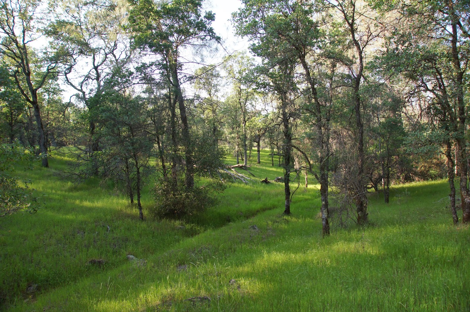
Wednesday, May 7, 2014

A Festive Spread at North Table Mountain Ecological Preserve

Date: April 21, 2014
Place: North Table Mountain Ecological Preserve, Oroville, California
Coordinates: 39.59555, -121.54164
Length: about 1.5 miles to Hollow Falls and back.
Difficulty: easy


Our original plan for spring break was to go south and see the bloom spectacle at the Carrizo Plain National Monument, but a sad phone call to the BLM field office in Bakersfield, just a few days before our trip, had informed us that there is no bloom there this spring. "We got less than 2 inches of rain," came the sad voice on the other side. "It didn't even green up."
I remembered that not long before someone had posted on the California Native Plants Society page a photo of a magnificent poppy field, taken at North Table Mountain Ecological Preserve. After a short discussion with Papa Quail we altered our plans and headed northeast to Oroville.
This is South Table Mountain, photographed from Table Mountain Rd. on our way north.
After a nice, quiet night at the Loafer Creek campground we set out to visit North Table Mountain Ecological Preserve.
The place is managed by the California Department of Fish and Wildlife. There are no officially marked trails there, just trails trodden by previous hikers. There are no proper trail maps available. The directions to the official parking area (with port-potties at hand) are online, but there's very little information beyond that.
Equipped with outdated USGS topo maps, a few sets of coordinates provided online by a fellow hiker from Davis, CA (Thank you, brthomas!), a few words of guidance from the rangers at the Lake Oroville SRA, and a newly purchased book about the Wildflowers of Table Mountain, we went exploring.

No poppy fields welcomed us. Perhaps they were already done for the season. I was hardly disappointed, though, because gorgeous carpets of blue patched with yellow and white checkered the green tablecloth that covered Table Mountain.

Grazing in a field of lupines
A large oak tree and an inconspicuous sign mark the trailhead. After so many people had trodden there before us, it was pretty obvious where we aught to go.

Table Mountain is so called because of its flat top. There used to be a plateau there, but water had curved and weathered the surrounding area and only the hard-rock covered mesa remains today. The top rock is volcanic: a lava flow that cooled on top of sedimentary rock. Spots of exposed basalt add to the colorful display.

The dark volcanic earth by the large oak was very muddy. At that point I didn't pay much attention to that. After a few steps on the trail, though, we were walking along a little stream that collected the water seeping out of the mud.
Table Mountain Meadowfoam, Limnanthes douglasii ssp. nivea
Right at the water source were flowers. Many flowers. White flowers.
Valley Tassels (Castilleja attenuata)
Yellow flowers.
Seep Monkeyflower (Mimulus guttatus)
And Purple flowers. A colorful spring celebration.
White-tipped Clover (Trifolium variegatum)
 Some were very small, but patches of them added a truly lively color to the green surroundings.
Kellogg's Monkeyflower (Mimulus kelloggii)
I took my time paying attention to each and everyone of them. Every now and then I raised my head and noticed that Papa Quail and the chikas were way ahead of me.

The sign at the trailhead warns hikers to stay a minimum of 300 feet from the cows. A bit challenging to follow when the cows graze right by the trail. Considering that the only time we've experienced any animal aggression on a hike was from a cow, we took the warning seriously and kept a respectful distance. As much as was possible.
I am the cow in the sky (lupine)
It is interesting how many of the plants grow in patches. In some cases, at least, that may be due to specific conditions, like this strip of little yellow composites that grow right at the border of the naked basalt.

These rock piles held some nice surprises for us:
Goosfoot Violet (Viola purpurea ssp. quercetorum)
I was happy to discover that the poppies weren't all done yet.
Frying Pan ( Eschscholzia lobbii)
The little stream flowed lazily between really shallow hills. Then, all of a sudden, it dropped.
First, only a little:

Then it disappeared altogether. We have reached the falls.


The small sign said Beatson-Hollow Falls.
A few other hikers were looking down the cliff. One of the said in a sure voice that this was Beatson Fall. Considering how long it took us to get there (mainly because I stopped every second to photograph one flower or another), we believed it.
Hollow Falls
We found a narrow, steep and slippery trail that led us down to the base of the waterfall. We sat there for a long while, enjoying lunch, the sound of water, and the flowers that decorated patches of the basalt cliff.
I noticed a newt that came to the surface a couple of times. It was very elusive, though. I had to settle for a photograph of the water bugs that rendered themselves to the camera with ease. 

I also checked the flowers that were blooming at the base of the fall.
Rock Phacelia (Phacelia egena)
And Papa Quail, as always, was looking for the birds.
Western Kingbird
After a while a second group of hikers descended down the cliff and we stretched out and got up back to the trail. After a quick discussion we decided to look for the Ravine Falls that were supposed to be northeast of us (had we been at Beatson Falls).
A patch of yellow Carpet
Very pretty on close up, too:
Yellow Carpet (Blennosperma nanum var. nanum)
We returned a little bit on the same path we came with. After spending all that time on individual flowers, I now looking at the bigger picture.  
A patch of Sky Lupine (Lupinus nanus)
Wherever the grass couldn't conquer the bare rock, this tiny yellow-flowering plant did.
A stonecrop patch
It really is beautiful on a close-up look:
Dwarf Stonecrop (Sedella pumila)
We saw a trail departing to the north and took it, hoping it would lead us to the Ravine Falls. We run into a couple of hikers that told us that the trail disappeared in a meadow, not really leading anywhere, but we continued on.
Kellogg's Clarkia (Clarkia arcuata)
I kept looking for more flowers. Some were very conspicuous, sticking out of the green grass.
Ithuriel's Spear (Triteleia laxa)
And some were small and unassuming.
Red Maids (Calandrinia ciliata)
The chikas were helping me. Here's one that they found:
Whitehead Navarretia ((Navarretia leucocephala)
Soon we found ourselves wandering aimlessly at a wide, mountaintop meadow, with no real idea of where we were. The cloud cover became thicker and the wind picked up. After a long search and a nice rest stop at a tiny creek that didn't really go anywhere, we admitted defeat and decided to head back to the car.
Not to say that we stopped looking for flowers, of course.
Purple Owl's Clover (Castilleja exserta ssp. exserta)
Or other wildlife, as a matter of fact.
Common Buckeye

We returned to the car, cold and with mixed feelings. Our main goal, to observe the spring wildflower spectacle, was definitely met, and overwhelmingly so (and I posted here only a sample: there were many more flowers there!). But it was disappointing not to have reached the Ravine Falls, despite having a map and the coordinates.
As it turned out, we never reached even Beatson Falls. The only fall we've been to was Hollow Fall. Having believed that it was Beatson Falls thew us completely off. A hand-held GPS would have help. But more so would be taking the words of other hikers with a grain of salt, no matter how sure they sounded.
Either way, now we have a good reason to visit there again soon. Although we would probably wait for a rainier year to see the waterfalls flow.
A patch of color: Poppy, Lupine (both sky and bicolor) and Clover
We returned to the car and stopped in Oroville for coffee and pastries (at Coffee Diem, very nice place). We weren't ready to go back to the campground and call it the day, so from there we continued to Potter's Ridge, at the north end of the Lake Oroville dam for another lovely hike. .


Tuesday, April 29, 2014

Loafing at Loafer Creek, Lake Oroville State Recreation Area

Date: April 20-22, 2014
Place: Loafer Creek Campground, Lake Oroville, Oroville, California
Coordinates: 39.526396, -121.447537
Difficulty: easy
Length: about 1.5 miles

Spring break is such a fine idea. What a great time to take the family for spring time exploration of California!
The bad drought has affected the wildflower bloom in most of California. Looking for places where we could still see the colorful spring spectacle we decided to go first to the Oroville area. We camped for two nights at the Loafer Creek Campground of Lake Oroville State Recreation Area.
A woodpecker larder
Loafer Creek Campground is sparse, shaded, and while we were there, was almost empty and very quiet. I assume that during summer it is more crowded. We were thankful for the quiet and the relative solitude.
Lark Sparrow
There were many little birds all over the place and Papa Quail was busy documenting them for most of our loafing time :-)
Oak Titmouse
There are some hiking trails around the campground. We arrived there early enough to squeeze in a little hike after pitching our tent.
Map portion scanned from Park's brochure. Our trail is labeled yellow.
It took some time to find the trailhead. I didn't mind at all: the weather was perfect and the area is beautiful and very lush.
Pacific Madrone (Arbutus menziesii)
Around the campground were velvet-green carpets of the non-native Hairy Vetch. It's and invasive weed, but a very pretty one.
Non-native Hairy Honeysuckle (Lonicera hispidula) visiting the non-native Hairy Vetch (Vicia villosa)
With all this green one might forget that this is a drought year in California. The elder chika found the evidence of previous rains: 

The trail took us through shaded woodland,

and through open meadows dotted with wildflowers.
White Brodiaea (Triteleia hyacinthina)
Most of the flowers I already knew from the Bay Area. I was happy to see them.
White Globe Lily (Calochortus albus)
Some were new to me.
Valley Checkerbloom (Sidalcea hartwegii)
The sun was going down and we were only half-way of the loop we were on. At some point we crossed a dirt road, which was not labeled on the map but seemed to go in the direction we needed, so we took it. Sure enough, it led us right back to the campground.
Sky Lupine (Lupinus nanus)
We stayed at Loafer Creek for two nights. On our second day we went to explore North Table Mountain Ecological Preserve, where the spring wildflower spectacle has become a cause for pilgrimage for flower lovers from all over.
Chipping Sparrow at Loafer Creek Campground
But even out time at the campground itself was very rewarding. You can ask the other birds: they're there year-round :-)
White-breasted Nuthatch


Saturday, April 19, 2014

No More Bypassing the Bypass: Hiking at the Yolo Bypass Wildlife Area

Date: July, 2013
Place: Yolo Bypass Wildlife Area, West Sacramento, California
Coordinates: 38.563261, -121.636255
Link to map, at the Yolo Basin Foundation site. We parked at stop B and hiked around the ponds. Length of our trail: about 1.5 miles.
Difficulty: easy

The Yolo Bypass has been bypassed by us so many times on our way to and from Sacramento. We've seen the roadside sign. We knew it was there. We had the interest. It's just that ... Well, no good excuses here. Finally, last summer, we made the plan, picked up my sister K at West Sacramento, and  drove to the Yolo Bypass Wildlife Area.
Still flooded in July
We were the only people there. It was very peaceful. Would have been quiet too except for I-80 so close (and for two very chatty chikas in company).
So close, yet seems out of place: California's capital's skyline. 
I didn't expect to see many flowers there, and indeed, only a few species were blooming. But those few were all around. This one in particular:
Toothpickweed (Ammi visnaga), non-native
I was mesmerized by theses huge inflorescences, many of which were encased in silk shrouds and crawling with armies of tiny red bugs that I didn't identify (yet). I liked the intricate look of the mature inflorescence that has gone to seeds.
Toothpickweed (Ammi visnaga), non-native
It was hot and sunny, and the trail side was decorated with little sunshines of its own:
Common Sunflower (Helianthus annuus)
The low yield of flowers was expected at this time of year. Out main goal was to see birds. Of these, there were plenty,
White-faced Ibis
both above:
Caspian Tern

And below:
Western Meadowlark

Park of the area is cultivated. Rice is a crop compatible with wetland wildlife.
A growing rice field at the Yolo Bypass Wildlife Area
And when the field is empty, the flooded mud attracts shore birds.

They aren't very conspicuous, these little guys. So here's a close-up:
Western Sandpiper
The water in the fields is manages through an array of canals. These too are home for birds, most commonly, egrets.

During hunting season (fall), much of the area is closed for hiking. There are lists of how many water fowl are hunted there during the season. When we were there the ponds were largely empty. Nothing but a few mallards here and there. Great for reflection photography, though ...

Tule and cattail are the habitat of many little birds that are mostly being heard rather than seen. Occasionally, though, we got lucky.
American Goldfinch, male
And not always just with birds.
White Cabbage Butterfly
Common, but pretty nonetheless: the ever-present cowbird. Even without the cows.
Brown-headed Cowbird, male
We took out time walking around the ponds, enjoying the company and the discovery of a new place. After the walk we did on of the auto tours to explore some more. The potential of this place in terms of wildlife viewing is huge, we were simply visiting during summer, which is the slow season there. There's less water and much fewer birds. And it is very hot, too. In fact, I was slow to write this post because I was hoping to return for another visit this winter, which didn't happen. Still, we had a very nice walk around the ponds there, and we did see quite a few summer birds. And even some flowers. All and all, it was a very enjoyable summer hike.
Swainson's Hawk


Sunday, April 13, 2014

A Mountain of Gold: Summer Hike at Montaña De Oro State Park

Date: August 31, 2013
Place: Montaña De Oro State Park, Los Osos, California
Coordinates: 35.273892-120.885550  
Length: about 3 miles
Difficulty: moderate

When the first spanish explorers sailed along the coast of California saw the coastal hills covered with sting bloom of California poppies they were so impressed by the glorious sight that they named the place Montaña De Oro: Mountain of Gold.
Oats Peak-Reservoir Flats-Islay Creek loop. Map segment scanned from MdO SP brochure. 
The trailhead to Oats Peak is behind the visitor center. We hoisted our afternoon packs and started uphill.


There was no gold on the mountain in September. From far the hill looked dormant-gray but all along the trail there were quite a few late summer bloomers.
Sticky Monkeyflower (Mimulus aurantiacus)
And their hard-working pollinators.
Cabbage White Butterfly

At that point, all of the morning's cloud cover had dissipated completely and the sun was bearing down on us mercilessly. The ascend wasn't all that steep or long, but the heat made us stop for breathers frequently. I didn't mind. There was plenty to observe on these short breaks.
Dwarf Chaparral Broom (Coyote Bush), Baccharis pilularis
There were many lizards about, enjoying the heat and energized by it. Many of them were out in plain view, happily yielding to the camera. I chose to post this, a bit obscured, photo because in this one the  lizard's bright blue belly shows.
Western Fence Lizard
We didn't have time to go all the way up Oats Peak, and the heat was too intense anyway. We took the left split and continued up and over the hill on Reservoir Flat Trail.
Cardinal Catchfly (Silene lanciata)
On the eastern side of the hill we had a great view of Oats Peak and the meadow below it, surprisingly green.

Extending beyond the meadow and between the hills - Islay Creek, still intensely green and very inviting. On my next visit I'll hike it :-)

The trail descends into that valley and continues on eastward. We turned left on Islay Creek Trail and started looping back westward.
Hummingbird Trumpet (Epilobium canum)
Lupines always make me smile. They are hardy plants, inhabiting a wide range of areas and climate zones and can withstand harsh conditions. Lupines are of the earliest species to repopulate disturbed devastated areas, such as post-eruption volcanos. With their nitrogen-fixing bacteria symbionts they fertilize the soil and pave the way for other plants to grow.
Not to say that Montaña De Oro is a harsh place ... I was simply happy to see lupines blooming so late in summer. 
Summer Lupine (Lupinus formosus)
As we descended into Islay Creek Trail we went under the overhanging boughs of Treebeard :-)

Lichen on an oak tree
Along the creek the trail is a tunnel inside thick vegetation, mostly shaded and very nice.

A relief from the September sun: Ilsley Creek Trail
If to judge by the tweets, many birds agreed to it. We stopped to observe this chickadee that was busy harvesting seeds and didn't mind us watching its acrobatics.
Chestnut-backed Chickadee
The trail follows the creek until it emerges from the hills and opens up to the campground area.
Common Aster (Aster chilensis)
It was right there at the (very busy) campground that we encountered this papa quail parading about in the open without seeming concerned about anything, including a bunch of children biking noisily around. The rest of his family, we soon discovered, was hidden in the bushes as one would expect of normal quails.
California Quail, male
We observed that quail for some time, then driven by the heat down the road to the parking lot, stopping momentarily to say hi to this cute goldfinch in the thistles.
Lesser Goldfinch, female
Although the trail we hiked was not difficult we were exhausted by the heat and were ready to call it the day. I would love to go back to Montaña De Oro anytime, but given a choice I would probably opt for spring/early summer. Either way, I'd recommend this park