Wednesday, September 21, 2016

If This Is Devilish, What Does Heaven Look Like? A Hike to the Devil's Postpile and the Rainbow Falls


Date: August 13, 2016
Place: Devil's Postpile National Monument, Mammoth Lakes, California
Length: 6 miles
Level: moderate

Several years ago we decided to go on a road trip along the southern part of California Hwy 395. One of the places we visited was Devil's Postpile National Monument. It was one of many other sites we had visited on that trip and I have very few memories from that visit. This summer I had the chance to go there again - and this time I was focused on creating unforgettable memories.
Devil's Postpile NM is a small area west of the town of Mammoth Lakes, east of Yosemite National Park. The monument features an ancient lava bed that crusted in the form of hexagonal pillars of basalt. This formation is amazingly beautiful and awe striking and I cannot imagine why anyone would give it a devilish name.

We were getting to the end of our August Sierra Nevada road trip with Grandma Quail and Papa Quail's nieces that were visiting us this summer. We arrived at Mammoth Lakes after having to change the car tires, following our adventure at the Ancient Bristlecone Pine Forest the day before. Arriving in late morning after the long drive from Bishop, the parking lot at the Mammoth Adventure Center was already full and we had to find a spot along the road and walk up to the shop where we bought our bus tickets.

There is no car access to the Devil's Postpile, unless with a special permit. There is an all day shuttle that runs back and forth from Mammoth Lakes to the National Monument and the adjacent Reds Meadow Resort. The bus has 10 stops in that area, with trailheads leading into the forest and down the river. We got off at the Postpile stop where we listened to an introduction given by the ranger, filled our water bottles and started down the trail south to the famed rock formation.
The river that runs through the Devil's Postpile National Monument is the middle fork of San Joaquin. It isn't very big there, and in most places quite shallow. It does support some nice riparian vegetation such as groves of willows.

The trail follows the river downstream, southward. For the most part the trail is far above the river but it does start at the water level and I took the chance and went down to feel the water.
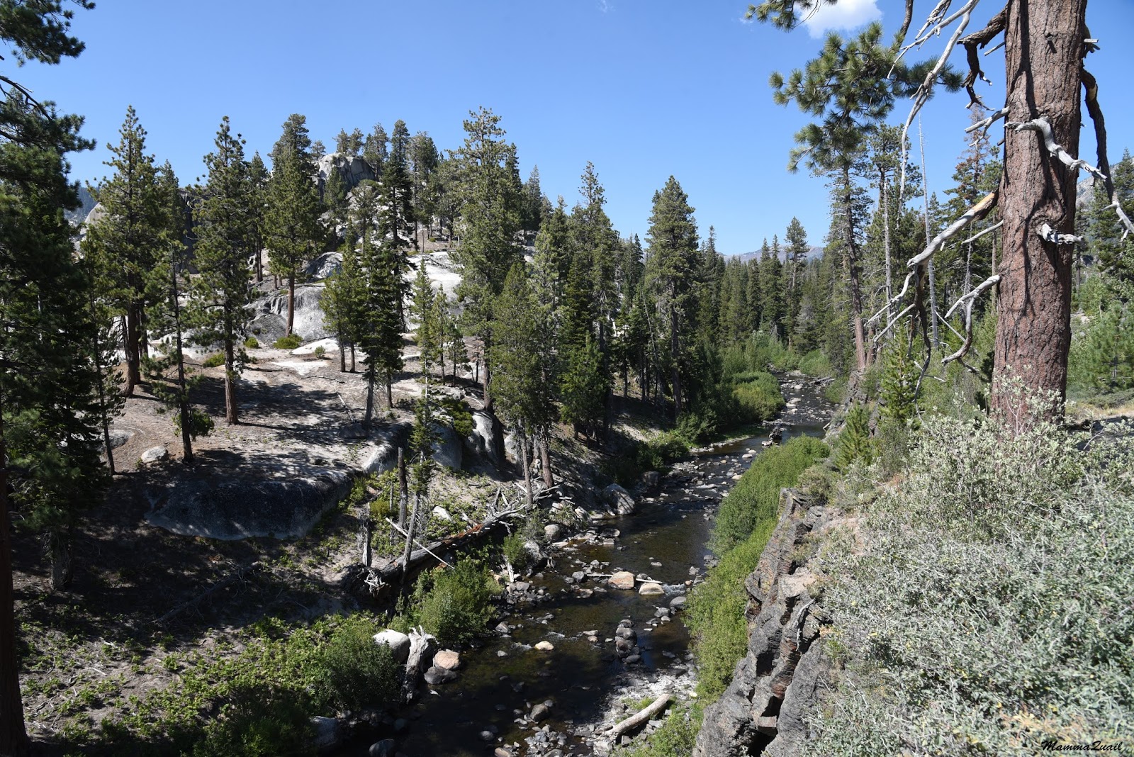
San Joaquin River, middle fork. 
We went on down the trail, passing a few sign boards with information about how the Postpile  formation came to be. Then we got to an intersection and had to make a choice.
The Postpile is surrounded by a small loop trail. To get to the top of the Postpile we had to make a right turn and climb uphill. Some in ur little company argued a bit but Grandma Quail tipped the scale by vocally remembering how beautiful it was up there when she'd been there last.
So we hiked uphill to the top of the Postpile and sat down on the flat hexagons.
Bassalt hexagons under a manzanita cover
The hexagons form when lava cools down slowly and the newly solidified basalt cracks along the lines of least resistance. 

Those cracks are fine nursery spots for seedlings. And seedlings can grow into saplings. And trees. Big trees. And the tree roots join the other elements that widen the cracks between the hexagonal columns, eventually separating them.


After our break on top of the Postpile we had a little debate after which everyone else except for me and Papa Quail's eldest niece went back down the same trail came up on. Me and Papa Quail's niece continued on and completed the loop, meeting the rest of the family at the bottom of the Postpile.

This area used to be part of Yosemite National Park but in 1905 it was made public to allow for gold mining and other prospecting in the area of Mammoth, and only after the efforts by early conservationists including John Muir the postpile was protected as a National Monument.

The top of the Postpile is very beautiful but the view from the bottom is absolutely stunning. While basalt hexagons aren't all that rare, the formation seen at that National Monument is vey impressive. The stacks of the basalt pillars capped with Jeffrey pines and the pile of broken posts that flaked off the stack give the place the feel of an archeological site.

The broken posts reminded me of ancient greek structures I've seen, only without the carvings and statues. 

After joining the rest of the family we hiked up little, and then continued south towards the Rainbow Falls. The ranger at the small visitor center had suggested that we take plenty of water with us and it was a very good advise because the day was hot and the hike was mainly in the open.
We were hiking through a thin pine forest that had many clearings with many little pinelets growing around large fallen logs.

Those clearings are the outcome of the great Reds Meadow Blowdown on 2012 when a wind storm with gusts measuring over 100 mph uprooted many trees in the valley.

The open forest areas promotes the growth of shrubs and herbaceous plants. Although quite late in summer, many of them were blooming still.
Rabbitbrush (Ericameria bloomeri)
It was a hot day and my young chika wasn't feeling het best. We made slow progress along the dusty path. I kept breaking forward at a faster pace and then stopping to appreciate some flower or another until the rest of the group caught up with me.
Wire lettuce (Stephanomeria sp.)
I usually don't pay much attention to grasses. The local grasses at the Devil's Postpile, however, really stand out in their beauty and unique look, unlike the common grasses of the Bay Area, many of which are old-world imports.

Not catering for bugs or birds, the wind-pollinated grasses don't normally show interesting colors or shapes. Yet, their delicate spikes have a fairy-like beauty that attracts the eye and the camera lens.

Every now and then the view opened up and we could see the mountain tops that surround the National Monument. The mountains call me and I go to them. Physically, whenever I can. Mentally - every day.

We sit down once more - my little chika says her stomach is upset. Everyone else seems affected by the heat. I am restless, walking in circles around them. When everyone gets up from the log they were sitting on I get a chance to take a closer look at the plant that was blooming near it.
Short-leaved Alpinegold (Hulse brevifolia) 
Swallows were zooming through the air over the river vegetation. Photographing swallows in flight can be very challenging, it is much better to catch them while sitting in the tree.
Violet-green Swallows
We passed the turn to Reds Meadow Trail, the trail we were planning to take on our way back. South of the trail intersection there is a direct view to Mammoth Mountain. The view is unhindered by any trees: a vast emptiness stretches between: it is the aftermath of the big Rainbow Fire from 1992. That fire was so intense it consumed the soil seed bank. It's been 24 years since and the forest hasn't regrown yet.
Behind the devastation area is the bald top of Mammoth Mountain.
Mammoth Mountain
Further south the trail to Rainbow Falls crosses the John Muir Trail, a large, scenic backpacking trail along California's mountainous backbone. A few backpackers walked along that trail and I felt envious. It will be a while before I'll be backpacking again. In the meanwhile, I'll settle for beautiful day hikes such as this one.
Fireweed (Chamerion angustifolium)
More people packed the trail as we neared the falls. Many of them arrived on the same trail we did, coming from the postpile. Many others came down the Reds Meadow trail.
The human inflation didn't seem to bother the small forest rodents. In fact, I think they were hanging around the trail on purpose.
Least Chipmunk
At last we made it to the Rainbow Falls. The small observation balcony was packed with people and I had to wait patiently to get a clear view of the falls.
Rainbow Falls
There is a short trail leading to the base of the falls, and on our last visit there we had gone down it. This time, however, the trail was closed for maintenance.
We sat down at the balcony for a snack break. A local squirrel was running between the people, begging for treats. While many people took the chance to photograph the little critter, I am glad to say that at least while I was there, no human shared food with it.

Feeding wildlife is bad for them. They get habituated on human food and keep approaching humans to get it, which endangers them. It also endanger humans, as many of the Sierra Nevada squirrels are hosts of the Plague pathogen. Plus, human food isn't suitable for them and can compromise their health. (Come to think of it, most of which people call 'food' isn't quite suitable for humans either ...)

So, no feeding of wildlife, please! No matter how cute they look and how intensely they beg.


After we had are time at the Rainbow Falls came the question of what's next. We could go on to the Lower Falls that were about half a mile downstream,  For most of our party that was a no question at all - Grandma Quail and one of the nieces announced that they aren't going any further. The chikas immediately said they'll be going back too. Papa Quail's elder niece said she'd like to go on. Papa Quail sighed. He gave me his GPS and started back up the trail with his mother, daughters, and younger niece.
Me and Papa Quail's elder niece continued on to the Lower Falls.

The trail continues south along the river. Dense riparian vegetation separated us from the water, but on the other side of the trail it was dry soil and mostly open view.  A good location for lupine shrubs to grow.
Silvery Lupine (Lupinus argenteus)
Flowers weren't the only colorful sights along the trail - there were ripe gooseberry fruits too. They reminded me of happy holiday ornaments, hanging from the branches like that.
Sierra Gooseberry (Ribes roeslii)
This trail segment is only half a mile long. As we were nearing the Lower Falls the trail got closer to the river and we could seed the other bank and the rising granite slopes. Trees were growing there in the cracks f the massive granite slab. Large trees, widening the granite cracks. Trees are a weathering force to be reckoned with.
San Joaquin River, middle fork. 
The Lower Falls are south of the National Monument Area. A small brown sign notified us that we were entering the Ansel Adams Wilderness.

I was surprised to see how many ferns were growing there, in such an open, and seemingly dry area.

We arrived at the top of the falls. A man carrying a large camera and a tripod was coming up from below. He informed me that the area is full of people and said that if I wanted to get a people-free photo of the falls I should go up the opposite slope. I thanked him for the tip and he moved on.
The view south of the lower falls. 
I tried following the photographer's advise, but the opposite slope was steep and slippery, and proved too challenging for me.
The base of the lower falls was in deed very crowded. There were people sitting all along the pool at the bottom of the falls. Many people were also swimming in the pool, climbing on the surrounding rocks, and even sitting on top of the falls. I had managed to find a brief people-free moment and photographed the falls. And even this photo is cropped.
Then I forgot all about getting the 'perfect image'. I shelled off all I could stopping short of creating provocation, and hopped into the water myself.
Papa Quail's niece settled for just dipping her feet in the pool - the water was very cold.
It was very cold for me too. I swam to the falls once, touched the slippery rock, then headed back out of the pool.
The Lower Falls
The swim was very refreshing, and in the heat of that day, was a true treat. We sat there for a little while, but then it was time to head back up the trail.
Indeed - not a moment later than when we were back on top of the falls, Papa Quail called me to find out where we were at.  (I was surprised to find out that there was cellular reception there!).
Heading back out of the lower Falls. 
Wishing to reconnect quickly with the rest of the family, Papa Quail's niece and I rushed up the trail. We wanted to get to Reds Meadow Resort before their little shop closed: the niece was thinking of ice cream, I was thinking of cold beer.
So I didn't take nearly as many photos on the way back north. But I did like this clump of pines on the trail up.

We made it back on time to meet everyone, get our treats, and take the shuttle back to Mammoth lakes, where we would stay the final night of our trip.
It was my second time at the Devil's Postpile National Monument. I remember very little from my first visit there. This time, however, I documented as much as I could. It is a lovely place, and I much recommend going there when it's open.
The Rainbow of Rainbow Falls

Many thanks to members of the California Native Plants Society for their help in identifying plants!


Saturday, September 10, 2016

Visiting the Oldest: The Patriarch Grove of Ancient Bristlecone Pines


There are many places in California that look outlandishly beautiful. The Ancient Bristlecone Pine Forest is no doubt one of these places. I was fortunate to be there several times already. this post is about my latest visit there with my family, Grandma Quail and Papa Quail's nieces last August. 
 

Date: August 12, 2016
Place: Ancient Bristlecone Pine Forest, Big Pine, California
Coordinates of Schulman Grove: 37.385581, -118.178912
Coordinates of Patriarch Grove: 37.527341, -118.198014
Length: Two  1/2 mile loops
Level: easy*
* Altitude: 11,300 ft


The second phase of our family summer road trip was at the Eastern Sierra region. After a long day in which we spent a few annoying hours in traffic jams at South Lake Tahoe, hiked the beautiful Hope Valley Wildlife Area, drove down Monitor Pass, and took a dip in Buckeye Hot Springs, we ended up in the town of Bishop, the big city of Inyo County. We had big plans for the following day: to go up the White Mountains, hike at the Ancient Bristlecone Pine Forest, and hopefully see a Pinyon Jay - a bird that Papa Quail would very much love to add to his list of photographed sightings.
The first wildlife we saw there, however, was a golden-mantled squirrel that was hanging out right by the parking lot of the visitor center at the Schulman Grove.
Golden-mantled Ground Squirrel
The Schulman Grove of the Great Basin Bristlecone Pine is the lower (10,100 ft) of two pine groves that were arranged for visitors. There is an education center there, built brand new recently after the previous one was burned down by arson.
Rabbit Brush (Ericameria nauseous), near the Schulman Grove Education Center
Papa Quail and I had hiked the Schulman Grove before and we planned to do a short hike there this time too, with Grandma Quail and the nieces. But when we entered the education center to get a map we found out that there soon be a naturalist talk so we stayed for that.
The naturalist told us a great deal about the bristlecone pines and their environment. He told us of dendrology - the science of timing past events and climate changes based on tree growth rings. He also told us of the bristlecone pine sex life, of which we found evidence growing on nearly every tree.
I listened closely to the talk. The chikas soon drifted off, looking at other things, and Papa Quail was soon off too - he saw some birds and followed them.
Grey Flycatcher, Patriarch Grove
As this place is unique for plants, it is also unique habitat for animals. Not that any of the animals we've seen there was endemic, but we did see some species there that we've never seen before.
Cassie's Vireo, Schulman Grove

One of these animals was the Uinta Chipmunk, which is common throughout the Great Basin but in California it lives only in that White Mountains corner of the State. I probably wouldn't have been able to tell but the naturalist was kind enough to identify the chipmunk fir Papa Quail. It is the only chipmunk species that lives there.
Uinta Chipmunk, Schulman Grove

The naturalist talked about many bristlecone pine topics, including this species sex life. As he talked, he pointed and I photographed.
Like all other pines, the Great Basin Bristlecone Pine trees bear male and female cones on the same tree. The male cones are small and clustered at the end of the branch. They produce copious amounts of pollen and release it to be carried by the wind.
Male cones of the Great Basin Bristlecone Pine 
The female cones are larger and fewer than the male cones. In their first summer they are open to receive the pollen and then they shut off and go into winter dormancy as the rest of the tree.
1st year female cones ofGreat Basin Bristlecone Pine
After coming out of dormancy in their second summer the female cones grow and the seeds develop inside. The cones are covered with resin to protect them from those who can't wait to have their pine nuts.
2nd year female cones ofGreat Basin Bristlecone Pine
An average tree produces thousands of seeds each year but only few of them will germinate. From those that germinate, even fewer will survive their first year.
The naturalist pointed at a small pine twig that was poking from the ground between some old cones. Papa Quail pointer his camera there too.
"This," said the naturalist, "is a 10 years old bristlecone pine."
I should probably add (for the benefit of scale) that the cones of this species are nowhere near the size of e sugar pine cone.

It takes many years for a bristlecone pine to become tree-size. They only grow 3-4 months a year. The rest of the time they lay dormant. 


The talk took a while and it was nearly lunch time when it was over. At that point it was clear to us that we won't have the time to hike both the Schulman Grove and the higher, Patriarch Grove. So we de decided to pass on hiking the Schulman Grove again and drive right away to the Patriarch Grove.
The Road to the Patriarch Grove is a dirt road covered with loose sharp rocks. The naturalist warned us to drive slowly to avoid getting a flat tire. He told us that they get 2-3 of these each week.
White Mountain - the road north to the Patriarch Grove
We heeded the naturalist warning and drove very slowly. It was a beautiful day and the views from that road are spectacular. 

There were also quite a few wildflowers in bloom along the road - mostly shrubs. We halted occasionally for Papa Quail to take a quick shot through a rolled-down window.
Pine Indian Paintbrush (Castilleja applegatei)
It took us a long time to get from the Schulman Grove to the Patriarch Grove. Not only was the driving slow, but we also had plenty reasons to stop along the way. One of those reasons was a lone feral horse that was grazing by the roadside. The horse didn't seem bothered by our presence. He raised his head and flicked his tail a few times, but other than that he simply kept on grazing. Later we were told by the naturalist that this horse is a fugitive from one of the ranches in Nevada, east of the White Mountains. Each winter the horse would come down to the ranch to be fed and every summer he would take off westward and cross into California to roam the mountains. 
I only wish I could do that. 

Everyone was famished when we finally arrived at the little Patriarch Grove parking area so we started our visit there with a picnic lunch. 
There are two short loop trails at the Patriarch Grove and we had hiked both of them. The first one we hiked was the Cottonwood Overview Trail, leading up to a small peak east of the parking lot. 
Our hike on Cottonwood Overview Trail as captured by Papa Quail's GPS
We were at the Patriarch Grove only once before, several years ago when the chikas were little. It rained that day and we were already tired after having hiked at the Schulman Grove. I did a quick hike by myself on that hill loop trail while everyone else remained in the car and dosed off. 
On our latest visit, however, we had the most beautiful weather we could hope for. Sunny and warm, and no wind. No one remained in the car this time. We packed the picnic leftovers back in the car and headed onto the trail up the hill. 

The trees in the grove are nicely spaced, allowing much room for the little plants to grow between them. Some of these plants are truly unique to that area, like the White Mountains Buckwheat with its outstanding crimson inflorescence.  
White Mountain Buckwheat (Eriogonum gracilises)

The little plants were also well spaced, nestled in the gravel. Other than the standing out buckwheat there were other, softer colors decorating the mountain surface. I was walking with my eyes on the ground, trying not to miss (and certainly not to step on) any little bloom.
Clokey's Fleabane (Erigeron clokeyi)
These minute mountain plants are beautiful to see, but the center stage is reserved for the stunning bristlecone pine trees. 
Most of the trees there are not actually ancient, most ranging from round saplings to a few centuries old. Here is a (relatively) young bristlecone pine near the trail that didn't seem to be affected much by the elements:
Great Basin Bristlecone Pine (Pinus longavea)
Grasses are so common everywhere that they are almost transparent to my memory-capturing camera. But up there at the mountain-high where there are very few plants, everyone stands out. And when there are so few and in such a unique habitat, identification becomes much easier.
Spike Fescue (Festuca kingii)
I, who had spent the previous week backpacking at the high elevation Mineral King area, hopped lightly on the uphill trail, while all the rest of the family trailed behind me.

The view from the hilltop was no less than spectacular. Too bad the air wasn't as clean and a murky haze tainted the view. Still, we enjoyed the vastness that stretched 360 degrees around us.
To the northeast grew the rest of the grove - nicely spaced bristlecone pines, dark conifers dotting the pale earth of the mountain.
Bristlecone Pine Forest
Fewer trees grew on the eastern side. As I looked eastward I noticed a point of intensely bright light shining miles away. It was so intense, like a little sun that made a landing on Earth.
Papa Quail immediately knew what that light was - a solar tower. With his zoomed photo image and the calculated direction and distance he was able to also identify which one. We were looking at the Crescent Dunes Solar Energy Project - a bombastic 'green' power plant that contributes most to the environment by incinerating unfortunate birds that fly through the mirror-focused sun-heated air around the tower.
Crescent Dunes Solar Plant
As we came down the hill the trail took us near some really twisted looking trees. Environmental conditions on the white mountains are harsh and many of the older trees are partially dead. Unlike animals, trees continue to live as long as they have intact strip of bark from roots to foliage. While parts of the tree succumb to the harsh conditions and die, the living part of the tree continues to grow and thrive, shielded to some extent by the dead wood mass it's still attached to. 


And these partially dead trees are very beautiful and impressive to look at.


As we made our way back to the parking lot I looked back at the hill. Such a beautiful and unique place it is. I hope to go back there again soon.

Patriarch Grove
We had a quick break and then I pushed on to the second loop - the Timberline Ancients Nature Trail. On this loop, I was told, was the Patriarch Tree - the oldest tree in that grove and the one after which the entire grove was named.
Our hike on Timberline Ancients Nature Trail as captured by Papa Quail's GPS
This track doesn't involve any climbing and now wide views distract from the magnificence of the nearby trees.

For a trail among the ancient trees it featured many much younger pines, all growing vigorously.

A few bird calls - and Papa Quail was off to follow the caller.
Black-throated Grey Warbler, Patriarch Grove
Further down the trail we found the older trees. Pines of this species can live for millennia, and the harsher the conditions they got in the longer they live and gnarlier they look.
 

And as old as they may be, they are still reproductive, producing cones.
1st ab 2nd year female cones
Each tree in that grove was more impressive than the other. One of the hardest things in writing this post was selecting a handful of images from the multitudes I've taken on that hike.
Ancient Bristlecone Pine (Pinus longavea)
The Great Basin Bristlecone Pine is almost a monoculture in the 9000-11,600 ft elevation range on the White Mountains. I was surprised to learn from the naturalist at the Schulman Education Center that there was one more pine species that grows (barely) in that area - the limber pine. I found a few along the trail - all of them looked small and stunted. Under these environmental conditions it cannot compete with the bristlecone pine. It can't even grow to full size.
Limber Pine (Pinus flexilis)
Almost every step along the hike (and the previous one too) I saw this little yellow composite: it was in peak bloom at the time of our visit.
Alpine flames (Pyrrocoma apargioides)
The Timberline Ancients loop is also very short and without noticing, we were at its end. Right before we stepped back into the parking area we met the Patriarch - the oldest tree in that grove.
(And Papa Quail's niece wondered why did we have to hike the entire loop just to see the this tree when it is right by the car ... )
The Patriarch (Pinus longavea)
I recognized it immediately. I didn't even need to see the plaque that was posted on its other side. For a change, I was well ahead of the others, so I had a few good minutes to quietly appreciate this magnificent being without interruptions. I approached it, caressed it, and yes, I hugged it. And who wouldn't?
A look up the Patriarch Tree 
What I do not understand is why this wonder tree was named The Patriarch. After all, it was bearing female cones. Yes, at 4000 plus it is still reproductive. How's that for impressive!

The rest of the family caught up with me and we all circled The Patriarch and admired it thoroughly, until one by one our little group dispelled and moved back toward the car.
Just as we were pulling out of the parking area Papa Quail noticed a mountain bluebird standing on a nearby dead tree.
The first time we've seen mountain bluebirds was on the White Mountains. We've seen them on several occasions since but here was an opportunity to finally get a good photo of this pretty bird.
Mountain Bluebird, male
And Mrs. Mountain Bluebird also dropped by to pose:
Mountain Bluebird, female
On our way down from the Patriarch Grove we noticed a couple of hawks circling the sky. Papa Quail asked to stop and left the car with his camera.
One of the bonuses of mountain birding is that you also get to see the bird from above :-)
Red-tailed Hawk, Juvenile
It was getting later in the afternoon and the sun was right above the Sierra Nevada, and as we exited the Patriarch Grove area we were driving west, facing that wall of granite that stood between us and the mild California Central Valley and coast.
A view of the Sierra Nevada from the White Mountains
We stopped a few times on the way back, mainly to photograph some shrubs in bloom - the same I've seen when going up but didn't stop for then.
Desertsweet (Chameabatiaria millefolium)
Some were quite familiar to me, like this lupine. It was probably the most common shrub there that was still in bloom.
Silvery Lupine (Lupinus argenteus)
And it wasn't the only publish-blue bloom there. The mountain monardella, however, wasn't blooming much at the time.  I was happy to see it (and smell it) nonetheless.
Desert Mint (Mountain monardella)
On the way down to the Schulman Grove I drove much faster, trusting that the car won't get a flat. And it didn't - not on that drive.
Approaching the Schulman Grove of Great Basin Bristlecone Pines. 
We arrived at the visitor center again about 10 minutes before closing time and immediately hogged the naturalist, showing him pictures and asking for his help in identifying the animals and plants we've seen. I don't feel too bad about it because he was most eager to help us, and even directed me to where I could see some of the other wildflowers he had in his little picture notebook that were still in bloom.
Soda Straw (Angelica lineariloba)
Of the plants the naturalist directed me to I only got to see the Soda Straw. Eager to see a Pinyon jay, Papa Quail wished to take a look in the Grandview campground area.
The campground is at a considerably lower elevation than the bristlecone pine area. There are no bristlecone pines there, but the common Pinyon Pine-Utah Juniper community that is characteristic of the Great Basin mountain ranges.
On our first visit to the White Mountains we had camped there. Our elder chika was then the only chika and she was 18 months old. Papa Quail and I were busy pitching our tent, and when we finished and I turned to look at my daughter I found her standing by  the nearest juniper and stuffing her mouth with its cones.
Needless to say I got panicked . But she didn't choke, and later I found out that juniper 'berries' aren't toxic. Still, it was a frightening experience.
Utah Juniper (Juniperus osteosperma)
But returning to our latest visit there last August, we took off on one of the dirt roads that extended from the campground deeper into the forest in search of pinyon jays I drove the car through some rough rocky part of the 'road' and it was there that we got the flat tire.
And it was there that we discovered that the jack that arrived with the car when it was brand new didn't really fit it. We had to get a rock underneath the jack to get the needed lift and even with that we had to dig some under the tire.
The whole ordeal took us over an hour, during which the chikas and even their cousins got into fights and ceaseless nagging. Needless to say by the time we were out of there on out spare tire we were all exhausted and not interested at all in chasing the pinyon jay any more.
Pinyon Pine (Pinus monophylla)
We made it back to Bishop in time for dinner and bed. On the following morning Papa Quail got the car fixed at one of the local tire shops and then we checked out and drove north to our next destination: to the Devil's Postpile National Monument.


Many thanks to members of the Birding California group for their help in identifying the birds, and to members of the California Native Plants Society for their help in identifying plants!