 |
| Calero Reservoir |
Date: May 6, 2021
Place: Calero County Park, San Jose, California
Coordinates: 37.174634, -121.761347
Length: 10 miles
Level: moderate
Taking seriously my commitment for a rigorous training regime before going on the Mount Shasta expedition, I decided to schedule at least one strenuous hike each week before that. I was glad to have my friend join me on several of these. When she could join, I would plan the hike in the South Bay, making it easier for her to return home on time for her duties. Calero County Park was ideal for us: great location with good terrain with plenty of elevation changes. It was also on my wanna go there list for quite some time, having passed it so many times on my way to and from Uvas Canyon County Park.
 |
| Our hike as captured by my GPS |
I met my friend at the parking lot and with little delay we got going on the trail. I had planned a long loop that will take us near the reservoir and up the hills. This time we had plenty of time for the long trail I had planned and didn't need to rush it as we had done on our previous hike in Briones Regional Park. It was a lovely day, sunny, and with little breeze. We started at a good pace.
 |
| Near the trailhead |
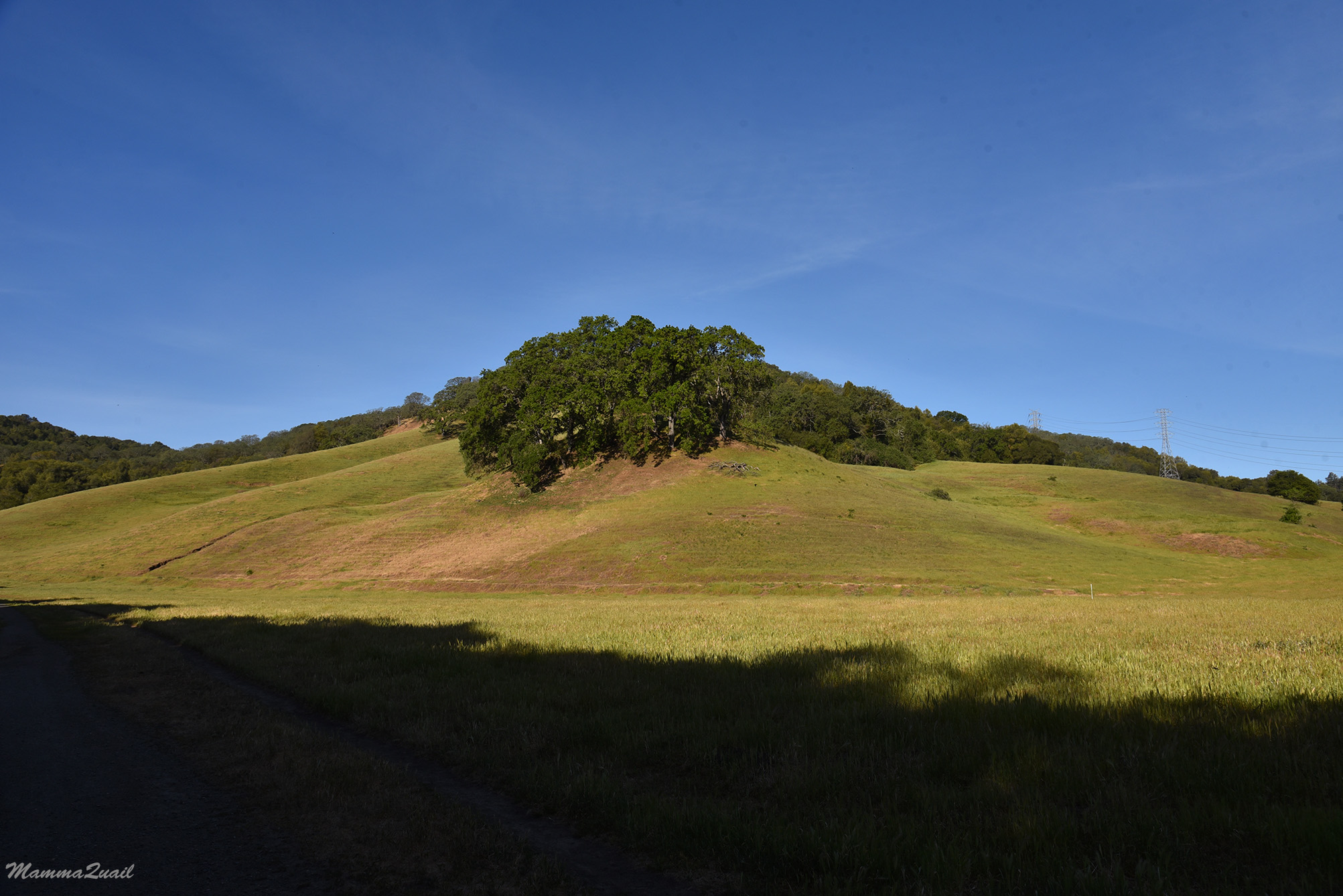
The coast live oaks are great trees to look at, especially when they are standing alone and have enough space to develop their unique shape and 'personality'. We saw many of inspiring oak trees along the trail, in dense areas and alone.

Right from the start we were noticing wildlife. The easiest to see of course were the stationary ones, such as the trap spiders. The traps, at least. I assume the spider was inside.

Soon after we saw a cute little bunny hopping near the edge of the trail. These cottontail rabbits are common in the area but they are very skittish and I don't get to see them all that often. This one too soon disappeared in the vegetation.
 |
| Cottontail Rabbit |
My friend had told me numerous times that she likes best the open hills landscape. She had loved our hike at Briones Regional Park despite our tight time and now she was totally happy with the open views of Calero County Park.

Early May is the best time to see the buckeye trees in full bloom, when they look like great white-candled chandeliers, their sweet fragrance fills the air, and the buzzing of their numerous pollinators dominates the hike's soundtrack.
 |
| California Buckeye, Aesculus californicus |
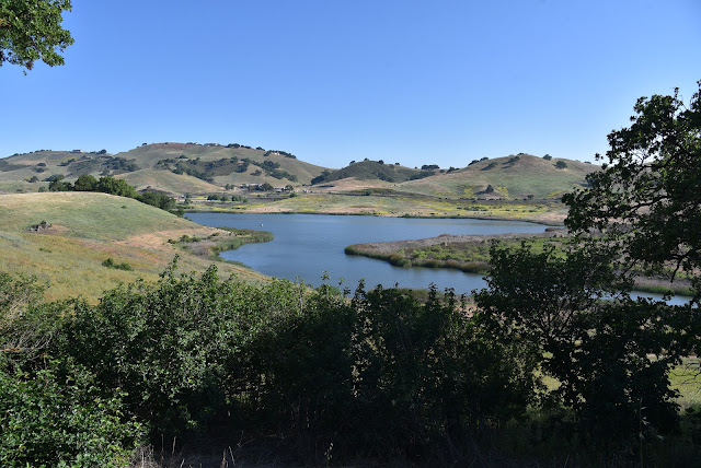
We were nearing Calero Reservoir. We had decent view of the lake but our trail never got near the water. There was a trail leading down to the shore but we remained on the upper trail and didn't go down to the lake.
 |
| Calero Reservoir |
We were too far to see any waterfowl in the lake but we did see terns flying overhead, and I even manage to photograph one of them.
 |
| Caspian Tern |
As we turned the curve Mount Umunhum came into view. Less than two weeks before I saw it on my Almaden Quicksilver hike and now it was beaconing me again. I told my friend that one of our next hikes we should go there and she agreed with me. I've hiked there with my family before but only on the downhill direction.
 |
| Mount Umunhum |
The trail meandered along the curves of the lake and eventually turned south and uphill away fro the water. The open grassland cover of the south-facing hillside was already turning dry and yellow.

On the other side of the trail the green lingered longer and there were some wildflowers blooming still. Not many though. The bloom was really weak last spring.
 |
| Bugle Hedge Nettle, Stachys ajugoides |
A couple of turkey vultures circled the sky above us, coming really close at times. For some time they seemed to be following us, but flew away after I reassured them that we were not about to expire any time soon.
 |
| Turkey Vulture |
Turning east the trail plunged into a oak-forested area. It also got steeper and we were finally getting the workout I was hoping for.

It looked like at some point earlier the ground was very muddy. When it dried the earth cracked into polygons. A single caterpillar was making its way through that 3D jigsaw puzzle, determined to get across the trail.

Although most oaks we've seen at the park were live oaks, there were plenty of impressive-looking valley oaks as well. We paused under a shady oak to drink some water and catch out breath before moving on eastward.

The reason for the weak bloom display last spring was the dry winter that preceded it. Of what did bloom, the dominant color was blueish-purple. I read somewhere that many same-color wildflowers bloom simultaneously and attract the same type of pollinators. The most common pollinator I've seen on this hike were bumblebees. There were many of them all over the place, all appearing heavy-laden with pollen. Constantly on the move, they weren't easy to photograph, but I did manage to capture one as it was feasting on the blue witch solanum.
 |
| Blue Witch, Solanum umbelliferum, and a bumblebee |
Another blue beauty Ive seen on that hike was the larkspur (named so after the elongated spur-looking nectary at the base of the flower, evolved to fit the long tongue of bees). There are many species of larkspur in the area and they're all too similar to one another for me to identify the species.
 |
| Larkspur, Delphinium sp. |
We curved northward for about half a mile and from that view point we could see the lake far below and further on the eastern horizon the bump of Mount Hamilton, easily identifiable by the white domes of the Lick Observatory on its summit.
 |
| Mount Hamilton |
We curved south again and after some distance of walking on the height of the hill we descended done a relatively steep grade back into a forested area.

Many of the yellow composites bloom later in the season. May is a transition time and we saw some yellow composites on our hike.
 |
| Woolly Sunflower, Eriophyllum lanatum |
At the bottom of our descent we had a surprise: a little pond with a neat rest area including a picnic table under a wooden shade, and an information board with a description of the wildlife that can be observed in the pond and vicinity. It was the perfect place to sit for a lunch break. We didn't see any of the wildlife depicted in the information board but we did hear a deep, mooing sound that came across from the pond area. We had a lengthy discussion about the sound's source - I thought it was a cow in distress and my friend thought it was too regular to be an animal and suggested a malfunctioning piece of machinery, such as a broken pump or something like that. In hind sight I think both of us were wrong and that this sound came from a bullfrog in the water.
 |
| Fish Camp Rest Site |
After our break we continued on eastward, once again in an open oak savannah, to my friend's delight.

Te bloom color that dominated that trail segment was white, and of these, the morning glory was the most common. At the end of the hike I had so many good photos of morning glory that it was hard to choose one for this post.
 |
| Hillside Morning Glory, Calystegia collina |
The yarrow is also a very common white bloomer. It is so common and bloom on such an extended season in fact, that although I photograph it on nearly every Bay Area hike, I very rarely post its photos anymore. While the yarrow is now a passing-by regular for me, the checkerspot butterfly isn't.
 |
| Butterfly on Yarrow, Achillea millefolium |
Clarkia flowers are also very common in the Bay Area open grassland and there were several species of them blooming at the time. I often see them growing in significant size patches but last spring they were much fewer and most of them looked more stunted than I remembered from previous springs.
 |
| Graceful Clarkia, Clarkia gracillis |
We continued southeast. After some up-down undulations the trail leveled. The day turned out to be a hot one, and we welcomed the shade of the oak trees whenever our path took us through the forested areas.

Under the trees I saw the botanical highlight of the hike - the white globe lily. Last spring they bloomed later than usual, and after seeing their buds attenuated for nearly a month it was a pleasure to finally see them in bloom.
 |
| White Globe Lily, Calochortus albus |
Further down the trail we run into (almost onto) another surprise - a large gopher snake that has spread itself across the path. I Frequently see them sunning themselves on hiking trails but this one was in the shade. It seemed healthy and well fed, and eyed us cautiously as we observed it and took photos. We admired it for a few long minutes and it didn't budge that entire time, only flicking it's tongue every now and them. Eventually we bade it farewell and continued on the hike. I hope that the numerous bicyclers we'd seen in the park were paying attention to the trail and avoided running over snakes.
 |
| Gopher Snake |
The trail was descending again at a mild slope. Once again in the open we saw more clarkia flowers, of a different, wine-colored species.
 |
| Purple Clarkia, Clarkia purpurea |
At the bottom of the hill we met with a wide, north-south trail and we turned north to complete our loop. There were many bicyclers on that trail and they were moving fast. We had to keep watching out for them and sometimes move quickly to the side.

Sometimes a color makes it to the flower's name without it being very accurate. Nearly all of the blue dicks flowers I see are pink.
 |
| Blue Dicks, Dicheostemma capitatum |
Around the curve we met another local resident - an alligator lizard. This one did dart away as soon as I raised my camera. Thankfully it paused long enough for me to capture it.
 |
| Southwestern Alligator Lizard, Juvenile |
An odd one out - a relatively early bloomer yellow composite species. We were there in tine to see the last of the mule ears in bloom.
 |
| Coast Range Muke Ears, Wyethia glabra |
On that northward part of our hike I got to see some pine trees here and there. These were native gray pines and they stood out nicely among the varying shades of broad-leaf trees's green.

We closed our loop and started walking up the little connector trail that we started on, the one that would take us back to the parking lot. Little harvest brodiaea flowers peeked through the dry, yellow grass.
 |
| Harvest Brodiaea, Brodiaea coronaria |
On the final stretch of trail we came upon a group of red-winged black birds that filled the air with the sound of their trills. As we approached they all flew away except for one brave male who hanged by the trail side and shouted at us as we passed by. Eventually he too had left.
 |
| Red-winged Blackbird |
We made it back to the parking lot, said goodbye and drove off. It the time I had already booked the permits for my first backpacking trip of the year to Ohlone Wilderness, planned for less than two weeks away. I tried to tempt my friend into joining me but to no avail. We would have one more rigorous day hike before that backpacking trip though, and to a very different area: to the redwood forest of Purisima Creek Open Space.
Thanks to my darling, Pappa Quail, for identifying the tern!