Sunday, October 28, 2012

From Cherry Lake to Lake Eleanor - The modest side of Yosemite

August 26, 2013 update:
Sadly, all that beautiful area I've written about below is now gone. Over 180,000 acres of forest, and the wildlife for which it was home are burnt to ashes. Goodness knows how long it will take for the area to recover.
I look at the photos from our trip there 6 years ago and cry.


Place: Cherry Lake, Stanislaus National Forest, California
Trailhead coordinates: 37.9830, -119.9041
Hike date: July 1, 2007
Difficulty level: easy to moderate.

After giving up on booking a camp site in Yosemite for the summer, we decided to go to Cherry Lake campground in Stanislaus National Forest, two miles west of the border of Yosemite National Park.
Cherry lake is accessible via a long and winding, narrow mountain road, connecting it to California road 120, west of Yosemite. We arrived there at noon on Saturday, settled in a nice camp site and spent the rest of that afternoon on the beach.
Cherry Lake in the morning - view from the dam. 
By evening, the campground had filled entirely with campers, all of whom preferred to remain by the lake on Sunday. We packed our backpack and drove east, over the dam.
The trailhead to Lake Eleanor is on the dirt road that goes along the east shore of Cherry lake. We left the car there after hiding all of our extra food in the bear boxes, and headed east.

A lizard by the trail. 
Soon, the trail enters the Yosemite Wilderness. There's no booth and no gate keeper there. Just a rusty gate, already open, and a sign reminding hikers about the rules of the place. We walked through the gate and between large conifers and low manzanita shrubs.


Although just 4 years old at the time, the older chika walked admiringly well. I carried her little sister on my back and Papa Quail carried all of our water and food. We walked slowly.
Mid summer is an excellent time to see the bloom of the Sierra Nevada mountains. At that time I had an inferior camera, and most of my close up photos didn't come out right. Still, I managed to get some nice photos of some of the flowers we've seen.
A pink carpet
This one surprised me - I had never before seen a bi-colored lupine. And never since either.
Lupine


Winecup clarkia


Charming centauri
Douglas' monardella
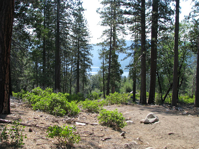
After about a mile of hiking we got our first view of Lake Eleanor, down in the valley. 
Lake Eleanor
A little further down, and the dam became visible:


Lake Eleanor, like Cherry lake and the other lakes in that region, are all man-made and a part of the Hetch-Hetchy water system that leads drinking water to the residents of the San Francisco Bay.
The trail to lake Eleanor is only 2 miles long but it was a hot day, so when we got all the way down, we took advantage of our seclusion and went into the water for a refreshing swim.
Lake Eleanor, a view from next to the dam. 
The water was so clear, we could easily see the fish and underwater plant growth where we took our dip.
Fish in lake Eleanor
We did exit the water in some haste when we spotted a snake swimming right next to us. It didn't stick around for a photograph, though. 
This pretty butterfly though, did stay put long enough: 
California sister butterfly
We sat by the dam to dry out and eat our snack, and then I packed the young chika on my back and we started climbing the same trail back west.
Allium
One last look on Lake Eleanor. I hope one day to go back there, and continue beyond, deeper into the Yosemite wilderness.
Lake Eleanor
Going in and out on that trail sums up to about 4 miles. It was a beautiful hike in a gorgeous area, and we had a perfect weather too. It gives one a complete peace of mind.


Monday, October 22, 2012

The Best Kept Secret in Hayward: the Whispering Creek Trail of Don Castro Regional Park


Place: Don Castro Regional Park, Hayward, California
Coordinates: 37.69251, -122.05465
Date of hike: 10/2/2012
Difficulty level: easy

Don Castro Regional Park, which is located at North of Hayward next to I-580 is well known for its swim facility. The swim facility attracts many people each summer. Many others use the numerous picnic sites, or go fishing in the lake that's behind the swim area.
However, not many know that Don Castro Regional Park also has a hiking trail. I too, discovered it by chance, looking at the park's pamphlet while waiting with the chikas to enter the lagoon. The trailhead is well hidden behind the Whispering Creek picnic site, east of the parking lot. Its beginning is visible on the lower said of the lawn, going eastward between the eucalyptus trees and the blackberry bushes. Quickly enough, the blackberry is replaced with catttails.

Cattails by the trail
The trail curves around a low field of cattails that in my previous visits was flooded with water. Maybe it's the season or maybe it's sedimentation, but this fall the ground looked dry and only the abundance of wetland vegetation gave evidence of water close to the surface.
I did meet the water littler further, past one solitary picnic area, where the trail came down near San Lorenzo creek.
The creek in that area is wide, full,and slow moving. It is completely shaded with trees and is accessible in only a few points where the lower vegetation has been trampled down by people and dogs. Otherwise - it's all nettle, ivy, berry bushes and poison oak. 

San Lorenzo Creek
The deep, cool shade feels great in a hot, sunny day. The almost still creek, completely shadowed by arching boughs reflecting in the water, green up and down, reminded me of an enchanted forest from a fantasy book. I could almost imagine little forest fairies rowing their leaf-boats down the creek.
Fallen leaves accumulated mid-stream.
Early fall in the East Bay. Everywhere around the annual plants are dry and deciduous trees are shedding their leaves but here spring reigns still.
A teasel in bloom
There's a fresh minty smell alongside the creek. Here's its origin:


I continued on the wide trail along the San Lorenzo creek up to the bridge and crossed it to the south side, going on the Whispering Creek trail. The area there looked much drier and summery buth there were still quite a few berries to be found.


A spider lurking in the middle of its web:

The trail crosses a small, flowing tributary. A low board bridge allows for crossing without wetting the feet. I found it easy to simply jump over the trickle.


 A local Cyperus in full bloom:

And a thistle shedding its seeds. An interesting mix of the seasons on display.

The trail makes a small rise and comes right by the lake, on it's south side. The lake is surrounded by lush cattails and tule grass. A patch of water lilies spread on the surface.

Eucalyptus is fairly common in this park. This one fell into the water some years ago but remained alive. Its branches now grow upward from the partially submerged canopy. 


The dam which makes the lake - part of the flood control dam system in the East Bay.


Near the dam the trail gets really close to the water. I went down to get a closer look at the horsetail shoots in the shallows:

There I found this caterpillar munching away:

The trail goes up onto the dam, on which is the entry road to the park. On previous visits I took the road back into the park and finished the hike there. This time I crossed the road and continued onward, downward. There, at the bottom of the trail, I discovered a magical corner: the little collection pool at the bottom of the dam's chute.


It appeared almost wild, and completely overlooked. Sadly, it also appeared neglected, with trash items littering its shore.
The trail continues around the pool and across the creek. The map marks the crossing as 'seasonal'. At the end of summer there was no problem crossing it.

San Lorenzo creek, below the dam.
The crossing point is the most lovely part of the trail. Wild, clean, lush and very much alive. I sat there for some time, soaking in the sound ... of a waterfall:


Sitting there, listening to the water and not seeing hardly any evidence of human activity save for the trail, it was almost possible to forget that I was, in fact, in the midst of a large urban area. Almost. If not for the constant noise of I-580 coming from just a few yards away.

The source of the waterfall is, of course, the chute from the dam, but the chute only became visible to me when I went down to the pool again, on it's north side.
From the pool there's a steep but short climb back to Don Castro's parking lot. The entire trail is just short of 1.5 mile. A perfect hike for a lunch break from work or for a weekend stroll with the children. A spot of lovely nature nestled right within the city.

Saturday, October 13, 2012

Bird haven: Colusa National Wildlife Refuge


Place: Colusa National Wildlife Refuge.
Coordinates: 39.1719 -122.044

American white pelicans (May 2008)
This post is not about hiking. There is only one foot trail there, and it is less than a mile. I do include it, however, because we quails love birds and a place that has so many of them is always worth telling about. This post is all about wildlife we've seen in Colusa - at least those we've got good photos of.
Great blue heron on a log (May 2008)
We discovered this place when we took a long trip along interstate 5 and were looking for a place to stop and stretch our legs. The little green square on the road map caught my eye and we went inside, Ever since, Colusa National Wildlife Refuge (NWR) has been a pilgrimage site for us. We always go there whenever we take a trip that goes, even vaguely, in that direction.
Common moor hen (May 2008)
Colusa's refuge is part of the Sacramento NWR complex, along the Sacramento river. These were founded to provide a safe haven to all kinds of wildlife, but to migratory birds in particular. These refuge areas are small islands of almost wilderness in a vast sea of farmland. Over the blooming mustards to the east looms the hazy silhouette of the Sutter Buttes.
Sutter Buttes over blooming mustards (May 2008)
Our first visit to Colusa NWR was late in the spring of 2008. Most of the refuge area was still flooded and in the first pool across the bridge we had our first ever sight of Cinnamon teal.
Cinnamon teal (May 2008)
Just before the bridge over the first canal there is the trailhead of the little trail that goes along the canal. The canal was populated mostly with plants, that 4 years later I remembered to photograph too:
(May 2012)
We didn't see many birds there, but plenty of cotton tail rabbits hopped before us as we walked.  We also saw some lizards. Here's one that stayed to pose:
Western fence lizard (May 2008)
We quickly finished our little hike and returned to the car. The main path in Colusa NWR is dirt road for vehicle use only. Visitors are not allowed to leave the car as to not disturb the wildlife. We had to photograph through a rolled down window and remind the chicas in the back to remain quiet during the slow drive along the 3-mile car loop.
Black-winged Stilt wading in a flooded field (May 2008)
Northern shoveler (May 2008)
Some of the areas had already dried out. In one of those dry fields we had a glimpse of color. After waiting patiently, it came out from behind the reeds - a ring-necked pheasant. This pheasant isn't native to America but was brought from China through Europe to be hunted.
Ring-necked pheasant (May 2008)
Swallow tail (August 2008)
We returned to Colusa NWR later that summer and found the place nearly completely dry. Still, there was plenty to see. These pelicans, for example.

American white pelican (August 2008)
The muddy fields supported a number of sickle-beaked birds - white faced ibis.
White faced ibis (August 2008)
The next set of photos is from last May. We saw many Jack Rabbits sitting or hopping about.
Black tail Jack rabbit (May 2012)
A turtle basking in the sun (May 2012)
Where there's water - there's life. A pair of Killdeer roaming a vegetation island. 
Killdeer (May 2012)

Ready to cross the road - American bittern. 
American Bittern May 2012
Already crossing the road - a mourning dove.
Mourning dove (May 2012)
May is a good month for breeding Here's momma mallard hiding behind her brood.
Mallard female and ducklings (May 2012)
I just love the sight of wetland. So lush and rich with life! 
May 2012

With all the bird and rabbits roaming around, we were bound to see their predator. One of them, anyway. 
Prowling Coyote (May 2012)
And in the pool at the entrance we saw this rusty pair. Maybe the same from four years ago, who knows?
Cinnamon teal (May 2012)
A sign post is (almost) as good as a tree (at least when it comes to being an observation point.) 
Western Kingbird (May 2012)
The best time to visit there is during winter and early spring. Most of the refuge is flooded and the place is teeming with life. Ironically, the only time we were the area during the right season we visited the main Refuge of the system - the Sacramento National Wildlife Refuge, which is not only bigger, but has a proper hiking trail. Sacramento NWR merits its own blog post.

I am posting this now because bird migration season is upon us! Soon the rains will flood the fields again and it would be time to go on another trip to bird haven :-)