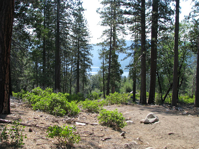
Sadly, all that beautiful area I've written about below is now gone. Over 180,000 acres of forest, and the wildlife for which it was home are burnt to ashes. Goodness knows how long it will take for the area to recover.
I look at the photos from our trip there 6 years ago and cry.
Place: Cherry Lake, Stanislaus National Forest, California
Trailhead coordinates: 37.9830, -119.9041
Hike date: July 1, 2007
Difficulty level: easy to moderate.
After giving up on booking a camp site in Yosemite for the summer, we decided to go to Cherry Lake campground in Stanislaus National Forest, two miles west of the border of Yosemite National Park.
Cherry lake is accessible via a long and winding, narrow mountain road, connecting it to California road 120, west of Yosemite. We arrived there at noon on Saturday, settled in a nice camp site and spent the rest of that afternoon on the beach.
 |
| Cherry Lake in the morning - view from the dam. |
The trailhead to Lake Eleanor is on the dirt road that goes along the east shore of Cherry lake. We left the car there after hiding all of our extra food in the bear boxes, and headed east.
 |
| A lizard by the trail. |
Although just 4 years old at the time, the older chika walked admiringly well. I carried her little sister on my back and Papa Quail carried all of our water and food. We walked slowly.
Mid summer is an excellent time to see the bloom of the Sierra Nevada mountains. At that time I had an inferior camera, and most of my close up photos didn't come out right. Still, I managed to get some nice photos of some of the flowers we've seen.
 |
| A pink carpet |
 |
| Lupine |
 |
| Winecup clarkia |
 |
| Charming centauri |
 |
| Douglas' monardella |
After about a mile of hiking we got our first view of Lake Eleanor, down in the valley.
 |
| Lake Eleanor |

Lake Eleanor, like Cherry lake and the other lakes in that region, are all man-made and a part of the Hetch-Hetchy water system that leads drinking water to the residents of the San Francisco Bay.
The trail to lake Eleanor is only 2 miles long but it was a hot day, so when we got all the way down, we took advantage of our seclusion and went into the water for a refreshing swim.
 |
| Lake Eleanor, a view from next to the dam. |
 |
| Fish in lake Eleanor |
We did exit the water in some haste when we spotted a snake swimming right next to us. It didn't stick around for a photograph, though.
This pretty butterfly though, did stay put long enough:
 |
| California sister butterfly |
 |
| Allium |
 |
| Lake Eleanor |


המקומות היותר נידחים של הפארק הענק והיפהפה הזה. טוב להכיר דרכך :-)
ReplyDeleteFunny, really. I chose to do my first Yosemite entry on this part of the park. I think the valley gets enough attention already :-)
Deleteמקסים ונפלא ונהדר
ReplyDeleteו...בגיל 4 הילדונת שלך כבר הלכה 4 מייל? מרשים!
Well ... some of the way she did do riding on her daddy's shoulders. But at her age it's not considered cheating :-)
Deletenice views of the lake :-)
ReplyDeleteThanks!
DeleteVery very nice blog site. So sad that the still expanding
ReplyDeleteRim Fire (160,000 acres),still expanding, has entirely burned
up this pristine area.
I've seen morning smoke from The American Fire in Nevada city.
Thank you for your words! Yes, this is very sad, all that loss. I just hope that the fire-conditioned ecosystem there is sturdy enough to spring back from the ashes. Will take a while, though.
DeleteEnjoyed your pictures and description. We did the same kind of hike a few years ago. Came back and backpacked in for camping on the peninsula. Came back twice more with our canoe and were able to Explore the other end. We had snakes along our shorelines too --a sign of a healthy aquatic ecosystem. The osprey and bald eagles probably liked them too :). I want to go back, but I know it will be painful to see the burned forest. sad for now. Regrowth will take years.
ReplyDeleteThank you! I'd love to go backpacking anywhere in the high Sierra. Gotta wait till the children are old enough, though. I do plan to go back to that area next summer: although it would be sad to see all the devastation, annuals bloom ought to be spectacular, assuming the seed bank in the soil has survived.
DeleteNice post. FYI lake Eleanor is the largest natural lake in the area. The dam was added later to control flow.
ReplyDeleteThank you, I did not know that!
DeleteGreat post! Thanks for the information!
ReplyDeleteThanks :-) I'm glad you found it useful!
DeleteAnyone been there recently? I have not gone in years, since before the big Rim Fire. Has it recovered yet?
ReplyDeleteI have, about 3 weeks ago. The burnt area is wide and very few trees left between 120 to Cherry Lake, but green with herbaceous and shrubs. The area about 2-3 miles near Cherry Lake itself was not burnt, I was glad to see that. It seems that the fire was contained just before reaching the campground.
Delete