I was fortunate to visit
Carrizo Plain National Monument twice this spring, just over one month apart. That one month made all the difference in the world. On my last blog post I wrote about the Overlook Hill and the Soda Lake Trail. This post has no hike but a narrative with photos of the drive around I did after that hike, which my accounts of these visits would not be complete without.
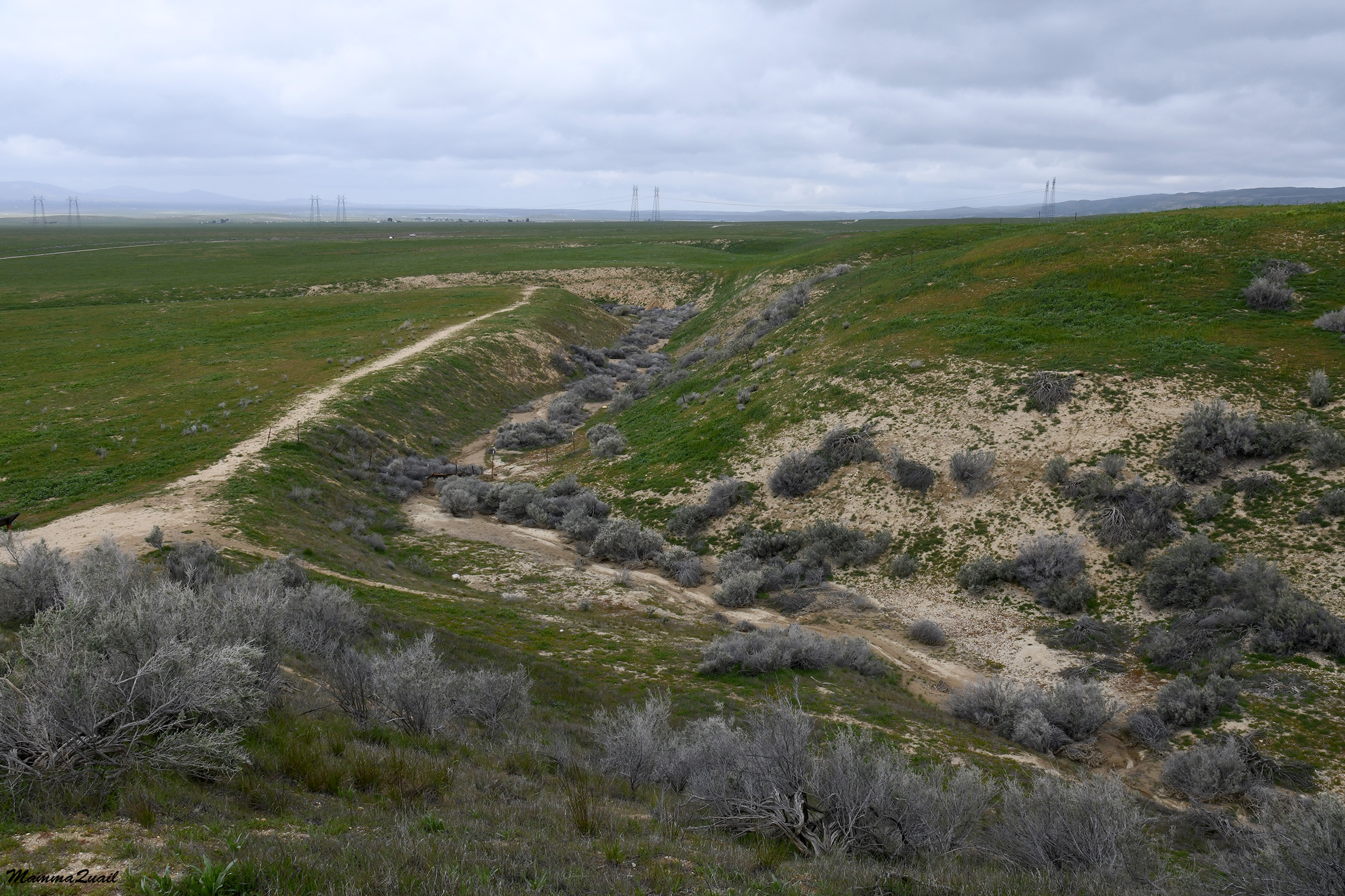
On my March trip to Carrizo Plain I was alone and I intended to camp at the Shelby Campground in the park. There was plenty of daylight still after my Soda Lake hike so I decided to go up to Caliente Ridge Trail and check out the conditions there. I wanted to be sure that the dirt road leading up to the trailhead was passable. In addition, there was still snow up the ridge and I thought it would be nice to see it up close.
 |
| Caliente Ridge, March 4 |
Something small and brown was moving across the green field. I looked through the lens and saw it was a fox. Of all the photos I took of that fox, the best image was when it paused to do its business. I'm glad that foxes don't read my blog.
 |
| Fox, March 4 |
The contrast of the looks of those fields with what I've seen only a month later was stunning. There was no fox, but there were lots and lots of people. And flowers as far as the eyes could see.
 |
| April 8 |
Early on March there was snow still at the heights of Caliente Ridge. The road was not gated but it was very difficult to drive. The dirt road, which was not the best even on my previous visit there, was now muddy and in many places rutted deeply. It was an exhausting challenge to ascend all the way up to where the trailhead was. I tried going a bit further, but on the ridge there were also snow patches on the road and the mud was very deep and slippery, and I decided it wasn't worth the effort and turned around.
 |
| Snow on Caliente Ridge. March 4 |
I didn't drive back down however. Along the dirt road there were a few pull out areas which improvised disperse campsites. On my way uphill I saw some campers in the lower sites and I decided that I too, should stay and camp up the ridge. That'll save me the grueling drive uphill again tomorrow, or so I thought. I settled in one of the higher disperse campsites and used the fading daylight to pitch my tent and to gather some firewood. I cooked dinner and ate solemnly while watching the glorious sunset.
 |
| Sunset. March 4 |
Sometime during the night the wind started blowing, and by dawn it was whipping so hard that the tent kept flattening and bouncing back, hitting me each time. I worried that my tent would eventually break so I dressed up quickly (a real challenge inside a tent that keeps dropping every few seconds). I gathered my things and got out into the morning chill and a fog so dense that I couldn't see more than a few yards ahead. I quickly took the tent down, shoving everything into the trunk without even folding the tent or rolling up my mattress. The wind was so brutal that I had to struggle to keep upright myself. Without any delay I started my drive downhill. There was no Caliente Ridge Hike for me that day.
An hour later I stopped at the KCL campground to roll my sleeping pad and fold my tent. A soft hoot from the nearby eucalyptus grabbed my attention, and I was very excited to find an owl there, staring down right at me!
 |
Great Horned Owl, March 5
|
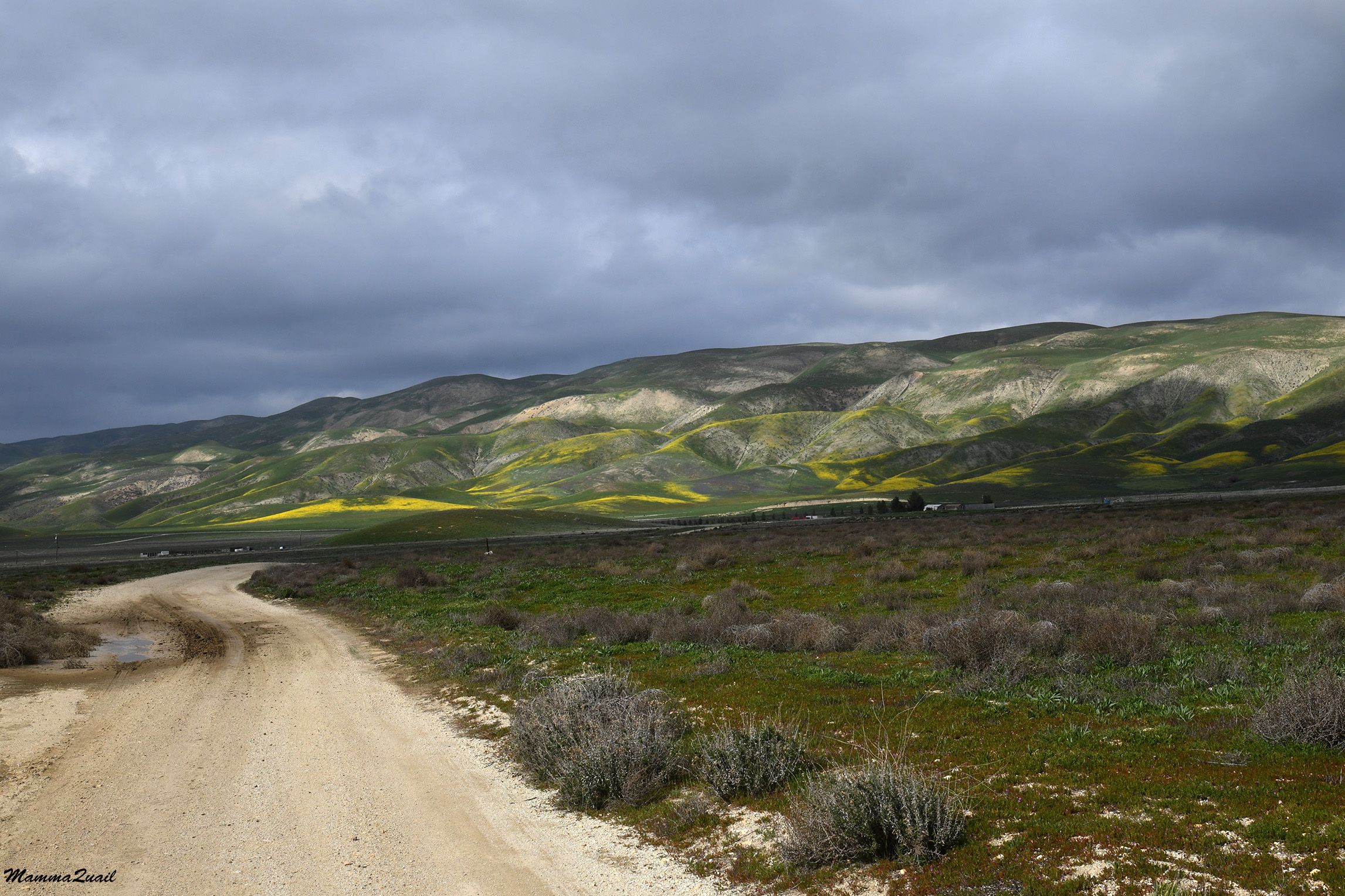
I didn't get to hike the Caliente Road Ridge on my April visit either, but that was because my chika was still in a bad mood after the Soda Lake hike and didn't want to hike. We did however, drive up to the Ridge Trail and continued a bit north to the dirt road. The view northeast from the ridge was wonderful. The entire soda lake and the blooming Temblor Range behind it took my breath away.
 |
View Northeast from Caliente Ridge, April 8
|
Although no longer muddy, the road up Caliente Ridge was still pretty damaged, forcing me to drive very slowly and carefully. There were also many other cars going up and down that road, and more than once we had to find a creative way to pass next to each other. Occasionally we stopped so I could take a closer look a wildflowers by the road side.
 |
| San Joaquin Blazing Star, Mentzelia pectinata, April 8 |
Right on the ridge I stopped to look down the other side. To my amazement, I could still see some snow on the top of the Sierra Madre Mountains on the west. The foothills below were burning yellow with wildflowers. It was simply spectacular.
 |
View West from Caliente Ridge, April 8
|
Perhaps some of that yellow were the flowers of the Ericameria bush. I suspect though, that the yellow carpets were most likely the hillside daisies.
 |
| Interior Goldenbush, Ericameria lineariflora, April 8 |
My chika said she was hungry. and I found a place with enough pullout space to get park the car of and we sat down for a light picnic lunch. All around us bloomed desert candle plants. I've only seen these lovely flowers in Carrizo Plain National Monument.
 |
| Desert Candle, Streptanthus inflatus, April 8 |
The road continued down to the valley on the west. Another time I might have tried going down there, but our time on this visit was limited and the chika wasn't too open for explorations so after our lunch we turned around, back on the Caliente Ridge Rd. I was driving very slowly, taking in the tapestry of flowers covering the west-facing slopes.
 |
| Caliente Ridge, west-facing slope, April 8 |
Going down the road on the east side back ti Carrizo Plain was a very slow business, not only because of the road condition and the incessant uphill traffic, but also because of the multiple flowers blooming right there by the road. Whenever I could I would pull over to give them due appreciation.
 |
| California Poppy, Eschscholzia californica, April 8 |
Most of the wildflowers I already knew but occasionally I'd see something different. I'm not sure which species is the Phacelia in the photo below.
 |
| Phacelia sp. April 8 |
Even very common wildflowers that I seen every spring in many places in California seemed more festive here in this desolate National Monument.
 |
Sky Lupine, Lupinus nanus, April 8
|
I stopped for a bird hopping by the road. It was a horned lark, one of many I've seen in this park before, even earlier that day. This one, however, seemed unbothered by us, perhaps because we were inside the car.
 |
| Horned Lark, April 8 |
Back on March 4th there were very few people around. On the other hand, there were plenty of wildlife. Besides the fox and the owl, I also saw a herd of elk on my drive south on Soda Lake Road.
 |
Elk, March 5
|
They weren't very close to the road but on that trip I had also the strong lens and I could zoom in better from a distance.
 |
| Elk, March 5 |
When alone and without time pressure, I like to explore side roads. I did so also on my March trip, trying to avoid any seriously muddy roads. On one of those instances I came close to an early blooming field of Great Valley Phacelia.
 |
| A Patch of Great Valley Phacelia, March 5 |
 |
| Great Valley Phacelia, Pgacelia ciliata, March 5 |
A month later the purple carpets covered great areas of the plain. Not having an aircraft I could only appreciate it from a sharp angle.
 |
Great Valley Phacelia, April 8
|
A bit further south I came close to a patch of hillside daisies at the beginning of their bloom. These flowers too make huge patches of color when they peak.
 |
| Common Hillside Daisy, March 5 |
They are great companions of the Great Valley Phacelia. The combination of purple and yellow is one you'll never catch me wearing but I love seeing it in flowers.
 |
Common Hillside Daisy, Monolopia lanceolata, March 5
|
Both the Great Valley Phacelia and the Common Hillside Daisy were at peak bloom on my April visit at Carrizo Plain. There were huge carpets of them as far as the eye could see. It was marvelous.
 |
| Great Valley Phacelia and Common Hillside Daisy, April 8 |
On the south east side if Carrizo Plain, just below the Temblor Range, there's a ridge of low hills called Elkhorn Hills. Between Elkhorn Hills and Temblor Range there's another dirt road that stretches north to south, called Elkhorn Grade Road. Numerous traverse dirt roads, some marked and some not, connect Elkhorn Grade Road with Soda Lake Road. On my March trip, many of these traverse roads were too muddy to go on, so I crossed over on one of the roads near the south end of the National Monument. On my April visit I chose to go on that road again, despite the others being dry. I remembered there was a nice viewpoint on the way, and sure enough - I had great view of the bloom on the usually very arid Elkhorn Hills.
 |
Elkhorn Hills April 8
|
The traverse dirt road that I crossed on goes up the Elkhorn Hills and down the other side. This road, like many others in the park, is not very good for regular cars. My chika dropped har eyes to the floor as I charged up the steep grade with my battered SUV at the top of the hills. At the top was another nice vista point, looking over Temblor Range and the plain in between. I had to stop there and take that sweeping view all in.
 |
| Temblor Range viewed from Elkhorn Hills. April 8 |
I was glad that no other car was making its way west as we dropped down the steep road to the east. All the way down I saw a few milkvetch shrubs and I had to stop again - I've seen them before, but never at peak bloom. They were simply gorgeous.
 |
Diablo Lockweed, Astragalus oxyphysus, April 8
|
I turned left on Elkhorn Grade Road and started driving north along the Temblor Range. Back in March there was very little bloom but the Temblor Range all green, a very unusual look for it. A thick cloud was hanging over the mountains, allowing only an occasional ray of sunlight through.
 |
Temblor Range, March 5
|
The looks of the that normally very arid mountain range was completely turned when I saw it again in April. Finally I could leave behind all the bad feelings I had from seeing the people trampling the flower fields earlier that day by Soda Lake. I let go of everything, looked with admiration at the mountain bloom and breathed in their ethereal beauty.
 |
| Temblor Range April 8 |
The intensity and composition of the bloom changed as we moved north along the road. Occasionally I'd stop or go toward the mountains on one side road or another to take a closer view.
 |
| Temblor Range, April 8 |
Back in March when I drove along Elkhorn Grade Road I had to go through mud puddles and over many holes. One of the holes was too big for even my car to go across, and there was no way around it. I pondered what to do for a few moments. I didn't want to go back but there was no going forward as the road was. Eventually I remembered my snow shovel in the trunk. I took it out and spent about 15 minutes filling the hole with dirt and gravel that I dug out of the sides of the road. When it was filled enough for my car to go across I was all sweaty and panting. I took a few moments to recover, and to look at the few early wildflowers that bloomed near the road - the very first goldfields.
 |
| Common Goldfields, Lasthenia gracilis, March 5 |
When I came upon that same place on my April visit I saw that others have done work to full that hole, and there was no issue driving across it that time. I did stop however, because there was a large patch of cream cups blooming right by the road.
 |
| Cream Cups, Playstemon californicus, April 8 |
Tucked inside a deep gulch was an old ranch with a rotted corral and a few half collapsed buildings. I drove there because the mountain right above it had a lovely bloom of Phacelia and poppies. I thought I heard people walking there but I couldn't see them. There was a barb wire fence between the road and the blooming mountain. I admired the bloom but then turned around and went back to the car where my chika was waiting patiently, and drove back to Elkhorn Grade Road.
 |
| April 8 |
Elkhorn Grade Road goes roughly along the the line of the San Andreas Fault. Near the north end of Carrizo Plain National Monument there is a lovely geological site where the fault's action is vividly seen and that's the bend of Wallace Creek. It's a location I visited a few times before and
even wrote about it here. On my March trip I stropped there and hiked that trail again, including a walk all the way up to the base of the mountain. I compared the photo of the creek's bend from this trip to the one I took in January of 2023 from the same spot (in the link above) and I'm amazed at the similarities and the differences.
 |
Wallace Creek, March 5
|
Right by the creek bend I found some early blooming wallflowers.
 |
| Wallflower, Erysimum capitatum, March 5 |
I thought to hike there also on my April visit but by the time my chika and I arrived there we found the parking area full and overflowing. A busy line of people stretched from the parking area to Wallace Creek bend. A at one my enthusiasm was deflated. The chika too preferred to move on. I did take a chance while we were there to take a close up look at the fiddleneck plant at the edge of the huge and vibrant field of these little orange flowers.
 |
Desert Fiddleneck, Amsinckia tessellata, April 8
|
The short distance between Wallace Creek and the 7 Miles Rd outside of the north boundary of the park has the Temblor Range right in the front view. It is very tempting to stop at every curve and look.
 |
| Temblor Mountain Range, March 5 |
Needless to say, we also stopped there in our April trip.
 |
| April 8 |
Already outside the park's area, on 7 Miles Road, I had to stop again for a final appreciation of the developing superbloom. All that wet winter it was anticipated, and at the timer of my March trip I was not sure I'd be able to see it at its peak. As it turned out, I did go, but I also had to deal with the anxiety of the human crowds. Carrizo Plain is a magical place. I love it when it's dry and the geology is bare, but when it's green and blooming, it is a place to write fairy tales about - inspiring.
 |
March 5
|
After my March visit I tried hiking around Avenal but the building storm erupted and I went on to the Pinnacles National Park instead. At the and of the April visit my chika and I continued on our way to Mammoth Lakes. The day after we got to see the magnificent desert
super bloom at Red rock Canyon State Park, an awe-striking event of its own right.


This is simply beautiful. The wildlife pictures are great too
ReplyDeleteIt's an unusual place. Normally there are very few people there so animals thrive.
Delete