Friday, August 17, 2012

A Little Volcano in a Big Desert: Ubehebe Crater.

Place: Ubehebe crater, Death Valley National Park, California
Coordinates: 37.01420, -117.45356
Date: October 12, 2011
Level: easy. 

Death Valley National Park is one of my favorite places in California and if it hadn't been a full day's drive away from my home, I'd probably visit it more often. Ubehebe crater is located at the north region of the park, a bit removed from the more visited parts of Death Valley. I don't know how many people would drive all day just to see Ubehebe, but if you do travel to Death Valley National Park, it is definitely worth visiting. I have visited Death Valley National Park three times already, and Ubehebe twice. The photos presented here are from our latest visit, in October 2011.
Ubehebe is a large crater in a volcanic field. Its age is unknown but estimated to be no older than 8000 years. There are several adjacent, smaller craters, but Ubehebe is the largest of them, about half a mile in diameter.
There is a 2-miles loop trail that goes all around the crater's rim, with and option to go down to the bottom of the crater. 

Ubehebe - an almost full view
Despite the barren appearance, the area does get some precipitation. Little salt flats are what left when collected water evaporate.

A small salt flat on the slope of Ubehebe
Desert weathering creates a jarred-looking scenery. The big crack on the valley floor is a deep wash. Normally it is dry, but when rain comes it can flash-flood. 
I just love to see the colorful rocks and the light-shadow patterns of the cracked landscape.
A dry wash jarring the arid valley floor.
The top part of the crater wall, beautifully patterned with little run-offs, like an artistic knit-work hem.
A close-up of the crater wall.
Ubehebe is deep in the desert and we visited there in October, after a long summer and before the rains. We didn't expect to see much greenery there, and sure enough, there wasn't a lot. But there was some.

A brave desert survivor.


The dark soil was dotted with small, leathery leaf rosettes.The reddish-pink color is that of carotenoids and flavanoids that protect the plants from excess radiation. Naturally, desert plants would have more of these pigments. Enough to override the chlorophyll's green.


Hairy leaves

These leaves are also pretty hairy. The white hair cover serves to reflect back excess sunlight and also to limit transpiration and conserve the plant's precious water.
It being October, we didn't expect to see any flowers, but we did! Here is a pretty composite bush - a velvet turtleback. It is small and its flowers are tiny. Still, it added a jolly splash of color to the dark volcanic soil.

Velvet turtleback (Psathyrotes ramosissima)

As did this pretty pink: 

Bigelow's monkeyflower (Mimulus bigelovi)

Animals are found there year-round but what we've seen mostly were shy lizards, too quick to photograph. We were lucky to come across a red-tail hawk lurking in the bushes. This is the darkest form of this species that I've seen. 


Soon enough it got tired of our attention and took off. 
Taking flight
There are several craters in the area of Ubehebe. Here is a smaller one.

One of Ubehebe's neighbors
The walk was easy. There are no major height changes on this trail and the circular path allows a wonderful view of every corner of the crater. There is a trail that leads inside but the chicas were already tired so we didn't get to the bottom of it.
If, no. When you go there - make sure to bring lots of water and sun protection.  I will also add that although our visit was in mid-October, it was still (not very surprising) very hot. The best time to visit Death Valley is in late February - early March, when the temperatures are more welcoming and, if it is a rainy year, the desert will be carpeted with wildflowers.
So don't forget your camera! 


Monday, August 13, 2012

An Underground Anecdote: the Subway Cave

Place: Subway Cave, Old Station, California
Date: 10/17/2011
Cave at 40.680876, -121.424136. 
Length: about 0.5 mile in and out
Level: easy (requires flashlights). 

We've had frequent visits to Lassen Volcanic National Park but only recently became aware of the Subway Cave - an ancient lava tube just a quarter mile north of the 89/44 junction in the town of Old Station, less that 15 miles north of the entrance to Lassen Volcanic National Park. If you are in the area, particularly if you have children with you, make sure to visit this place. It is very cool :-) 

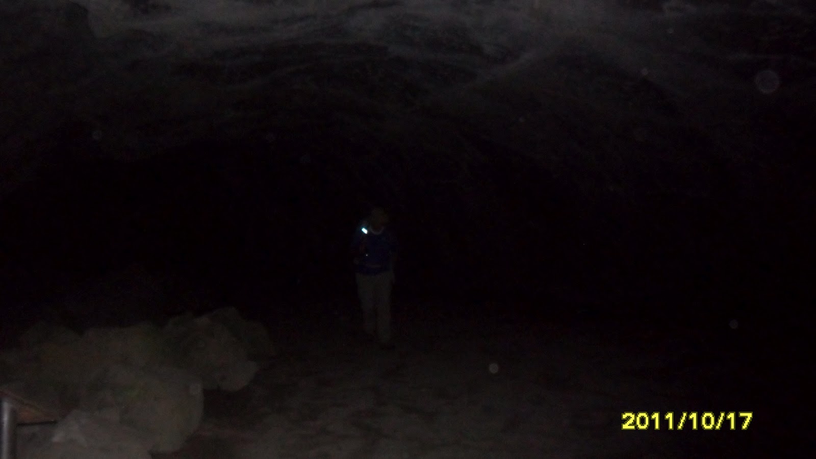
Venturing into the darkness. 
This cave is part of the Lassen National forest, which offers guided tours there on summer weekends. On our first time there, we joined this tour and enjoyed it much. The ranger had extra torches (we brought our own next time around) and pointed out to us the earthquake cracks in the cave wall, a lava bubble that solidified upon popping, plant roots emerging through the cave ceiling and talked about the area's geological features. 

This cave was formed during an eruption 20000 years ago, when the edges of a lava flow crusted and solidified, while inside the lava remained hot and fluid. When the inside flow emptied out, the cave walls remained. 
This cave is wide and fairly tall. There is only one spot were we needed to stoop a bit, but most of the time we could walk erect with ease. Also, the bottom reasonably even, without any surprise holes or drops. 
Because it is underground the cave is fairly cool too. A very refreshing coolness on a hot summer day. However, it is not a bad idea to bring a sweater or a shawl. 
Waiting for the subway to arrive. 
This cave is pretty long but only part of it, about 1/3 mile, is open to the public. Because there are no ceiling holes or vents, it is very dark throughout, so be sure to bring flashlights.

A single ray of light piercing darkness.
There is an exit on the other side and one can chose to either go back through the cave or along the above-ground trail (from which, sadly, I have no photos. Nice shrubbery, though.)
All and all, it is a wonderful 30-45 minutes stop, and the children absolutely love it!

Credit where credit is due: the photos in this post were taken by our friends who joined us on this trip. 


A Beautifully Disturbed Land: Cinder Cone, at Lassen Volcanic National Park


Place: Cinder cone, Lassen Volcanic National Park
Time: almost every year since 2000 :-)
Trailhead at 40.5687, -121.2977
Length: about 4 miles
Level: Moderate to base of Cinder cone. Strenuous including the climb.

The photos in this post were taken during several trips there and, therefore, they show different seasons and lighting patterns. 

Lassen Volcanic National Park is one of our hottest places for camping and on-foot exploration. We also love to show off this part of beautiful California to our numerous visitors from across the continent and from overseas. We hiked many regions of this park and are never tired going back there, again and again. One of the hottest spots for us in this park is Cinder Cone, located near Butte Lake, in the north-east part of the park.

Butte Lake, view to the east. Photo taken by a friend who was hiking with us.
The trailhead is near the boat launch of Butte lake, in the day use area of the Butte Lake campground. Getting there is by a 6-mile long dirt road (forest route 32N21) turning south from hy44, outside of the park.

Fall colors along route 32N21. Photo taken by a friend who was hiking with us.
The trail stretches southwest with an easy ascend, beginning alongside the Fantastic Lava Beds, then diverging into the woods. It is easy two miles to Cinder Cone, walking on soft, sandy cinders between neatly spread out Ponderosa pines.
An easy walk. And then the trees open up to reveal ...
"Are we going to climb that???" were the words of my father-in-law on our first visit to Cinder Cone.

Standing 750' tall over its surroundings - Cinder Cone. 
This is the most perfect cinder cone in California. It is thought to be the product of two successive eruptions during 1650. This lava vent spewed enormous amounts of lava, causing devastation in an area that stretches between Butte lake in the north and Snag lake in the south. This area, now named the Fantastic Lava Beds, can be seen in all of its majestic beauty in this satellite photo I took from Wikipedia:

Cinder Cone and its lava beds as seen from space. Photo taken from Wikipedia
Yes, we did climb it. Back then in 2001 and four more times since, the last one in October 2011. The steep slope and the soft cinders gravel make the ascend a really gruelling one. It is so strenuous that it is truly surprising to find out that all in all, it takes just about 45 minutes to get up there. In fact, both our quail chikas have made their first way up on their own two feet at age five. It does help to have older friends along, though, for the moral support :-)

Cinder Cone trail. Photo taken by a friend who was hiking with us.
Making the slow turn around Cinder Cone during the ascend reveals the snowy Lassen Peak to the east.

Lassen Peak, 10462 ft tall. Last eruption: 1917.
The first thing I do after finally getting up there is to sit and recover. Then it is time to look around. The view is absolutely stunning. Looking south-east one can see all the way to Snag Lake and the peaks beyond. Just before Snag Lake there spreads the devastation area, covered with the crusted Fantastic Lava beds. It is interesting that even though the eruption happened nearly 400 years ago and that volcanic soil is a very fertile one, there is almost no vegetation growing on those lava beds. The reason is, of course the harsh weather conditions in this area, which slow down forest recovery to a crawl.


At the foot of Cinder Cone there are The Painted Dunes: low hills of fine cinders spotted with circles of mineral-containing soil. The dunes are dotted with pine trees that look almost bonsai-size from above. This is the place to mention that although very tempting, it is absolutely forbidden to leave the trail and go climb these dunes. With the extremely slow weathering happening in this area, every foot print or tire mark remains there for a very long time indeed. Lesson learned the hard way: on the dune face near the trail there are tire marks over 30 years old, like a mark of Cain.


The devastation area stretching all the way to Butte Lake to the north-east.
North-eastern view from Cinder Cone.
After looking at the view I take a closer look at the rim. Cinder Cone has a double rim and a simple crater (and not a caldera, as I previously thought, because it was created by a simple eruption).

The double-rim crater of Cinder Cone.
There are some pine trees growing on the rim, small and stunted as bonsai.

A small pine tree on top of Cinder Cone.
There's some other vegetation there, sparse and small.

Fall colors on top of Cinder Cone. Photo taken by a friend who was hiking with us.
On my first trip up there at 2001, and also on the last one ten years later, I found the energies to go down the little trail that leads into the crater. There, at the silent maw of the volcano, there is a pile of rocks. I laid on my back and looked up at the circle of blue skies surrounded by the crater walls and thought about Jules Verne :-)
The crater of Cinder Cone. Photo taken by a friend who was hiking with us.
There's no need to take the same trail down because there's a second trail on the southern side of Cinder Cone. Last October we took the southern trail down and circumvented Cinder Cone to its north on our way back to Butte Lake (which does, by the way, provide nice swimming on a hot summer day).
West Cinder cone trail. Photo taken by a friend who was hiking with us.
This hike is about 4.5 miles long, and the only strenuous part about it is ascending Cinder Cone itself. The entire hike took us (with young children and lots of time taken to appreciate the view) about six hours (not including the drive there). I've hiked Cinder Cone five times now, and I'd just as readily do it again. It's worth every drop of sweat, trust me.


Thursday, August 9, 2012

To boldly go: hiking at Frenchman Lake.


Date: May 27, 2012
Place: Frenchman Lake, Plumas National Forest, California
Trailhead at 39.9018, -120.1735.
Difficulty level: moderate.

Here I share what we did on our second camping day at Frenchmen Lake. To read about the first day click here.

By morning the rain was gone and the cloud cover seemed harmless so we went on a hike. Following the recommendation of the campground host we looked for the trail marked on our map (the forest service multi-use map) as 24N01, which is one of the many utility dirt roads that criss-cross the forest. We tried to follow one lead that tuned to be false and found ourselves wandering between the trees and between torn apart camp sites of an old campground that was once there. We saw some lovely mulesear flowers in bloom.

Mulesear on the forest ground
Eventually we gave up and joined the main gravel road that goes alone the lake and headed toward Crystal Point - a pretty peninsula with a nice sandy beach.

Lake view from the gravel road
 There were quite a few fishers there, enjoying the beautiful beach.

Fishers at Crystal Point
 There were also many beautiful birds, including a small group of white pelicans and this lovely male blue bird.  Here are some of the birds we saw at Crystal point:
Pelicans huddling
Mountain bluebird, male.
Casiin's finch, male
A yellow-rumped warbler
 And the crown jewel: a bald eagle circling above.

Bald eagle
When we came out of Crystal Point we saw the other end of our elusive trail and desided to hike it back to the campground. The trail soon climbed up on the hills and the signs that we saw along the way were labeled 81 and not the label we saw on the map. The trail, however, followed the contours seen on the map so we continued.
Panoramic view of the lake from way up high on the forest trail.
 Doubt did creep on us every now and then but we continued onward. It didn't help that the little chicas and their friend kept whining, To distract my my mind from the whining I photographed this artistically pretty fallen tree.

A beard of green lichen covered the top part of the trunk.
Eventually, after several worried discussions and twice scouting forward we found the trail junction leading down toward the campground. When we came down we found that the trail goes through the disperse camping area and meets the road a bit south of the main campground, and that is why we missed it going out.

Altogether, the hike was 5 miles long and took us (at child pace and including many breaks) about 4 hours. Very pretty hike.

We stayed one more night at the camp site. That night there was no cloud cover and the expected frost did come. We woke up to a frosty morning that soon gave way to a beautiful, warm day. We ate breakfast, had a little stroll by the lake and then broke camp. Our friends headed to Sacramento to visit relatives and we decided to take a detour through Colusa and visit the National Wildlife Refuge there, a place that became a regular pilgrimage site for us, bird loving quails. Colusa National Wildlife Refuge, however, merits its own blog post.

So until then, have a wonderful hike!

Monday, July 16, 2012

Lost in the woods: Camping at Frenchman Lake


Place: Frenchman Lake, Plumas National Forest, California
Campground at 39.9018, -120.1735. Driving time from Oakland, CA: about 5 hrs. 
Date: May 26, 2012

Memorial Day is the time when citizens and residents of USA pay their respects to people who lost their lives in defense of the nation. Having a Federal day off work also allows families to spend more time together. For many years now, our quail family have been taking advantage of this long weekend to go camping outside of our usual radius of 2 hours drive from home to a trailhead. We have our hot spots: campgrounds we go back to every now and then, but usually we go to new places, where we've never been before. This time the dice fell on Frenchman lake, in Plumas National Forest, in the north-east region of the Sierra Nevada mountains, about 10 miles north of the town of Chilcoot.

Camping in the mountains this time of year can be weather-challenging. A forecast predicting precipitation on Saturday caused us to replace the swimsuits with snow suits and pack extra blankets.

We left home on Friday evening, with the idea of getting a head-start on the road and not spend to much of Saturday's day light driving. I don't know if it was due to improved road conditions or due to the high gas prices that might have caused many people to refrain from travel, but there was no traffic problem at all. In less than two hours we reached Sacramento where we booked a hotel room for the night. With the chickas already after dinner and a bath, and in their pajamas, all that was needed was to carry them to bed.

Easy traffic on Saturday morning brought us quickly to Truckee, where we turned northward onto Hy89. After a few miles we found a nice spot to stop and let the chickas play in the fresh snow.

Light, new snow on the trees near Truckee
New spring growth braving the snow


The chickas art work :-)


After that short break we continued northward to Sierraville where we turned right on Hy49 . This region ia a flat valley between nestled between the main range of the Sierra Nevada and the Plumes mountains to the north. This flat valley, still at high elevation, has the look and feel of a tundra and is used primarily as cattle-raising farmland. Many birds enjoy the grassy plains and cow pies as well, and we stopped several times to photograph them.

Red-wing black bird


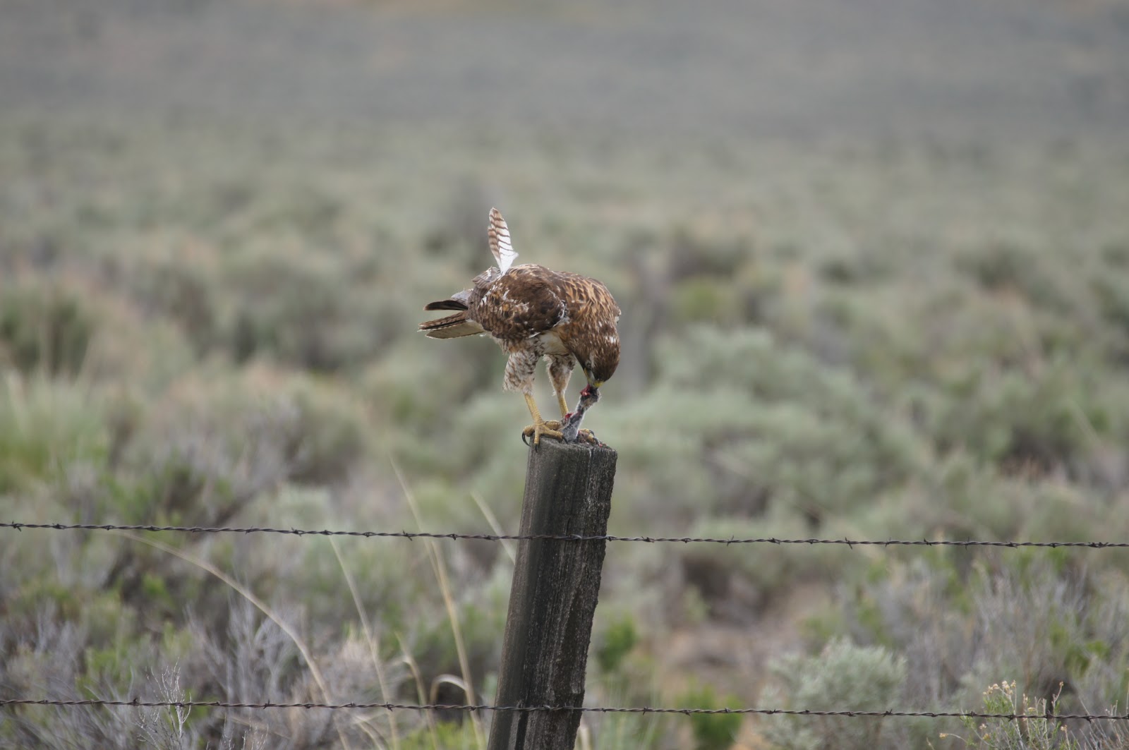
A juvenile red-tail hawk

The hawk was busy with its latest kill:


Right on Hy70 and left in Chilcoot, onto 284 (North) brought us back to the mountains, but these are mountains of a different kind - volcanic. I had not known before that the area north of Chilcoot was volcanic and was awed by the impressive basalt walls that stand erect on both sides of the road.

Basalt pillars
We arrived our campground and the weather arrived with us, prompting us to set up the canopy before the tent. It was a strange weather all that day - a minute or two of intense precipitation (rain or small sized hail, but no snow), followed by a hour or so of dryness. Clouds came by in patches, and in between we had periods of bright and warm sunshine.
We met the first interesting wildlife right by the camp site:

This silk ball is a home for many caterpillars whose species I do not know.


One of the inhabitants straying away from home

The bush itself was a pretty sight.


Soon our friends arrived as well and we set up the tents and went to explore the campground area. This included climbing on the near by volcanic rocks, a home to many violet-green swallows.

The beautiful terrain overseeing the campground
One of the local residents: a violet-green swallow.
The children enjoyed climbing up and down the rocks, reconnecting with their inner monkeys. I was much slower getting to the top, but the view from there was worth all of my efforts.

Frenchman Lake, a view to the North-West


Then the rain started again and we descended from the rocks.

Rain ripples in a rock puddle
Later that day we explored the nearby lake and sat on the sandy beach of Frenchman Lake. The area is teeming with birds and Papa Quail was very happy indeed.

Western tanager


A chipping sparrow
A western bluebird, male


But the chickas were completely fascinated with a magnificent slik moth that they found on the ground by the trail. The poor creature was dying and it was touching to see the children nurturing the moth as best as they could. Later, when it was finally dead, they gave it a proper burial ceremony.


The intermittent rain continued into the night, which is why, I assume, it wasn't as cold as predicted. Sunday was still somewhat chilly and overcast, but without rain. So we went on a hike. Because this post is long enough, I leave the hike to be the subject of my next post. Ciao!