Friday, August 23, 2013

Slow Season My Foot: Wildlife at the Bolsa Chica Ecological Reserve

Date: August 21, 2013
Place: Bolsa Chica Ecological Reserve, 3842 Warner Avenue, Huntington Beach, California
Difficulty: easy 

My summer vacation in Southern California is not yet over. I am writing this post in my hotel room, using my raw images. I am hurrying this post along, urging my friends and other readers in the area or those who plan to visit Orange County, to go and visit this lovely nature spot.

"It is the slow season now," said the docent at the interpretive center. Well, for a slow season, the place turned to be very rich with wildlife indeed.

We met with friends at the interpretive center and started hiking south on the Lower Mesa trail.

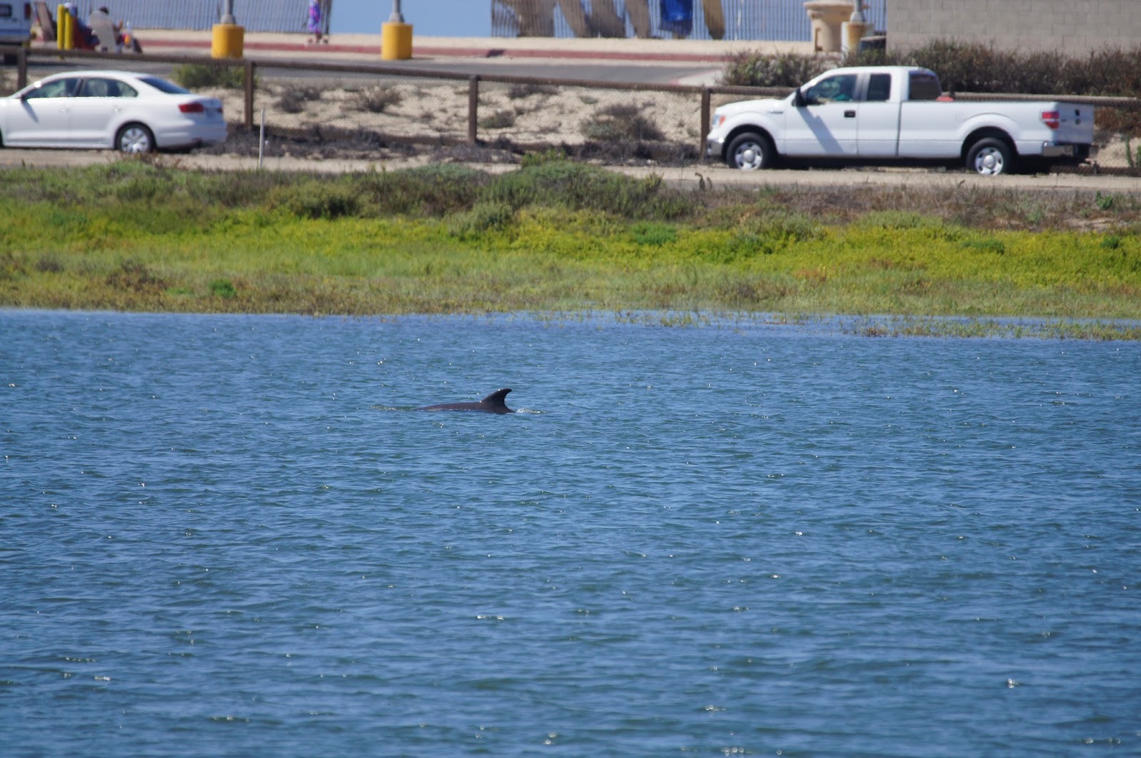
Almost immediately we had one unexpected wildlife encounter: two dolphin swimming lazily in the slough water.
(Common) Dolphin in the Bolsa Chica slough
A pacific Brown Pelican flew overhead. One of many we saw that day.
Brown Pelican
Bolsa Chica Ecological Reserve is owned by the State of California, but all of the restoration, maintenance and educational activity is done by the Bolsa Chica Conservancy nonprofit organization. Scientists from area universities do their research there as well.
The trail goes along the edge of the mesa: or the higher, flat dry land to the east, and the flooding area of the salt marsh wetland to the west.
Great Egret

It was high tide when we started out hike.
The slough at Bolsa Chica Reserve, The thin dark blue stripe far in the back is the ocean. Hwy 1 is in between.
Over the last 150 years California lost over 91 percent of its wetlands to agriculture and development. Bolsa Chica Reserve was founded to save what little is left of the coastal salt marsh wetlands, a unique and important habitat for many plant and animal species.
Least Sandpiper

Some of which are quite rare.
Southern Tarplant (Centromadia parryi ssp. australis) 

Hot and dry August, yet many plants were still blooming:
Bush Sunflower (Encelia californica)
Nearly all the blooming plants were yellow.
Bladderpod (Isomeris arborea)

A close-up of the bladderpod. It is so named because of its puffy bladder-like fruit.
Bladderpod (Isomeris arborea)

The bladderpod is home to the colorful Harlequin bug:
Nymphs of Murgantia histrionica (Harlequin bug) on the bladderpod plant
No everything there was yellow, though. 
Seaside Heliotrope (Heliotropium curassavicum)
A close-up of the Heliotrope's pretty, star-shaped flowers:
Seaside Heliotrope (Heliotropium curassavicum)
However, most of the plants that were not submerged were rusty brown or bone-dry. That's August.
The airways were very busy, though. There were many gulls in the air.
Ring-billed gull
And a few terns too:
Elegant Tern, adult, breeding.

Bolsa Chica was one of the fortified coastal areas during WWII. The remains of cannon rings and bunkers tell this part of the place's history. This base has gone to flowers since, as it should. Even if prickly ones.
Coastal Prickly Pear (Opuntia littoralis)
When we reached the Bolsa Pocket Canal where some of the military remains could be seen we had to make a choice, and we chose to continue along the canal rather than the Inner Bay. All the area north of the canal called the Bolsa Pocket, is a magnificent wetland.
The Bolsa Pocket area. 
We saw numerous herons and egrets there, but were really excited to find the Reddish Egret, which is a new species for us.
Reddish Egret
It was a beautiful sunny day, but very windy. The water rippled constantly and I couldn't get a good reflection image. It is so beautiful that it's easy to forget all the human development which surrounds it.

Human activity, such as oil pumping, just east of the Bolsa Chica boundary:


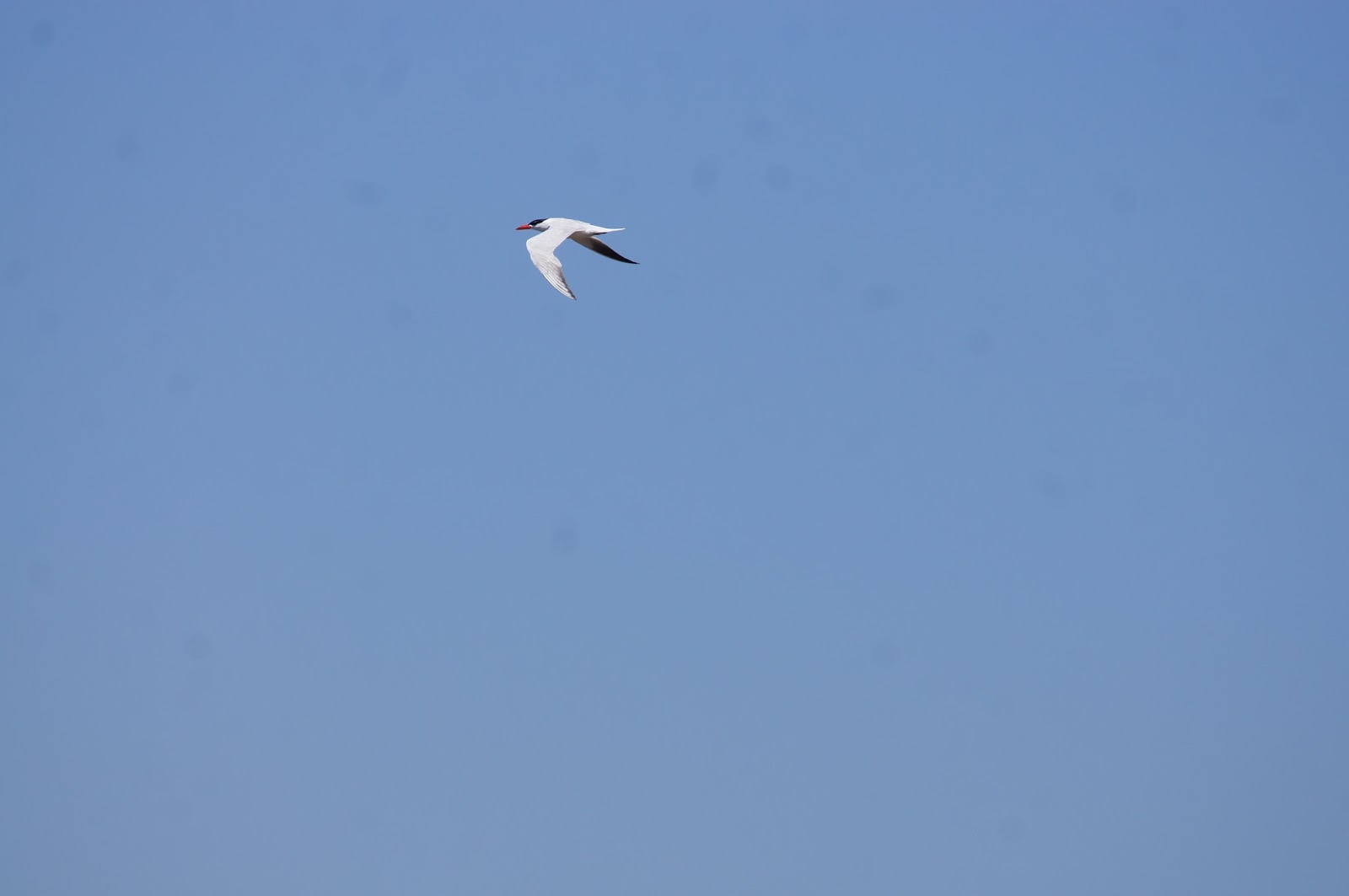
The bridge at the end of the canal trail was closed so we had to turn back on the same trail. Still, there were more birds to see in the air:
Caspian Tern, adult, breeding
Or in the water:
Willet
The tide was receding as we were walking back and shore birds came to wade in the exposed mud, hunting for worms and other mud critters. We saw willets, dawitchers, sandpipers, curlews and other, not yet identified shorebirds. There were many of them digging in the mud but I liked this picture best, as it shows the beauty of the slough in low tide:

The dry land also provided new encounters:
Loggerhead Shrike
We walked about three miles altogether in the reserve. We walked very slowly and easily. The children were very happy sighting birds and also took the initiative and collected trash along the trail to dispose of properly at the trash bins at the trailhead.
We returned hungry and went for lunch. The rest of the afternoon we spent at the Bolsa Chica State Beach where, despite the strong wind, we had great ocean time. Papa Quail stayed dry and kept his camera busy. Here are some of the birds he photographed at the beach:
Shorebirds at Bolsa Chica State Beach
Where gulls make prominent presence:
Heermann's Gull
Gulls performing aerobatics in the wind:

The pelicans kept perfect formation despite the wind:

Perhaps a new encounter for us: Red-necked Phalarope.
Red-necked Phalarope, adult non breeding.

I just love the reflection of the birds in the wet mud.
Sanderling, adult, non-breeding.  
It was a perfect way to finish a perfect day. If only we didn't have to travel through the traffic jam of I-405 to our hotel in Van Nuys ...

In short, if this is what the slow season at Bolsa Chica looks like, we are sure to visit there again during winter to see the place during peak season. That's a promise.


Monday, August 5, 2013

La Pastorale: a Dreamy Walk to Mirror Lake

Date: June 17, 2013
Place: Mirror Lake, Yosemite National Park, California
Trailhead coordinates: 37.7394, -119.5601
Length: from the shuttle stop in and out, about two miles.
Difficulty: easy


After the strenuous hike to Vernal Fall and a long lunch break we were ready for some more hiking. Easy hiking.
Mirror Lake is one of the most popular trails in Yosemite. It is relatively short and without any significant elevation change, and it leads a most spectacular place. All these make it suitable for families, lay hikers and anyone looking for a pastoral stroll.
Most of the walk is, in fact, on a paved road, on which only handicapped vehicles are allowed. Bikes, though, are in popular use there (though not all the way to the lake). We took the shuttle to the trailhead and continued walking from there.
Tenaya River
The Tenaya, much smaller than the Merced, is a very pretty river, and after coming out of the the Canyon into the valley floor is is flowing mildly through the reddish-hued granite.
Tenaya River
Just before the confluence with the Merced, the Tenaya river flows under one of Yosemite's signature landmarks: the Half Dome rock. The summit of Half Dome, 4,737 ft above the valley floor, is a very popular destination. There are two ways to ascend it: one is through a long hiking trail that goes by the top of Vernal Fall. The other is by climbing the sheer rock face.
Each time I visit Yosemite I look at Half Dome longingly. I have not ascended it yet. But when I will, (and I will!) it will by hiking.
Half Dome, a view from the trail to Mirror Lake
There were no climbers that day on Half Dome. At least, non that we could detect.


Tenaya slows down and spreads out under Half Dome. The area of Mirror Lake used to be part of a larger lake, and is now in the process of filling up with silt and, basically, becoming a meadow. In its earlier days, the park management was trying to keep Mirror Lake a lake by removing the silt. Later it was decided to let the natural process to go unhindered. Future generations may know Mirror Lake from photos only.
It still fits its name perfectly, though. Very tranquil, very clear, Mirror Lake indeed mirrors a perfect reflection of its surroundings. 
Mirror Lake
And ... there is also the meadow.
The growing meadow by Mirror Lake
And in the meadow: deer. Bold and nonchalant. They came very close, very convenient to photograph.
Mule Deer
Always present in Yosemite, the crowds. Actually, it wasn't that bad. Still, there were quite a few people there. Many were wading to and fro in the water as did I. As did the deer, completely unhindered by the massive human presence.
Deer in the water
Then one of them voided just a few yards from me. Although I was standing upstream I duly stepped out of the water.
After a minute or two, so did the deer.

It was a really nice and easy hike to one amazing, must see!, part of Yosemite. Although I've been there numerous times before, I can never have enough.


Friday, August 2, 2013

To the Top of Vernal Fall

Vernal Fall, a view from the side
Date: June 17, 2013
Place: Vernal Fall, Yosemite Valley, Yosemite National Park, California
Parking lot trailhead coordinates: 37.73568, -119.56578
Length: From Curry Village parking lot to the top of Vernal Fall and back is about four miles. 
Difficulty: strenuous

School was out in mid-June and summer camp would not begin for another week. A wonderful chance to go camping! Papa Quail could not come with us but I had made plans to go with friends. We had originally planned to go north but when I learned that my friends had never been to Yosemite, I changed the plan.
While Yosemite hasn't been the first National Park I visited in California (a special star to anyone who guesses which one), I did visit it many times. (But posted here only about Hetch Hetchy and Eleanor Lake). Yosemite is not represented well in this blog, because most of our serious hiking we did in our pre-chika days without proper cameras. In later years our visits to Yosemite would amount to showing off the park to our numerous out-of-town visitors, where we would visit the same 'must see' hot spots, over and over again. Our latest June visit was along the same lines.
Don't get me wrong: Yosemite is stunning any time of year, even at the hundredth visit. Even with the constant crowds.

This visit too we spent much of our time there sightseeing, but we also did some hiking. The trails we did are well known and there are many descriptions of them in books and online. Here I add my own experiences.

We parked at the farthest parking lot in Yosemite Valley, placed all of our food in the bear boxes, and headed on the trail towards Happy Isles. Across the bridge the trail splits left toward Mirror Lake and Tenaya Canyon. We took right, toward Vernal Fall.  
Almost immediately the trail starts ascending. Between the woods one can catch glimpses of the Merced River, down below.
Cascading Merced
The trail goes up and up for about 0.8 mile. We walked slow, encouraging the children along the way. At the observation bridge we stopped for a welcomed rest and a snack. There are restrooms there, and a water fountain. And most importantly: a distant view of Vernal Fall.
Vernal Fall, a view from the observation bridge.
People who come to Yosemite for brief sight-seeing usually don't even get this far. For many others, the observation bridge is a turning-back point. However, there are thousands of visitors in Yosemite everyday, and of those, many chose to continue on. So did we.
The granite mass that towers over Yosemite Valley.
This trail is also part of the John Muir Trail. It is also used by hikers who climb Half Dome the traditional way - with their feet on the trail. Either way, we were embedded in a long line of hikers who made their way up, and often had to squeeze ourselves to the rock to allow those coming down to pass.
A lovely place to grow roots
The trail between the observation bridge to the top of Vernal Fall is narrow and very steep, including many rock-carved steps. These steps are giant-size. I had difficulty ascending them. The chikas, particularly the young one, had to go on hands and knees more than once.
Vernal Fall, a view from the trail.
The trail is also constantly wet because of the mist from the Fall. (They don't call it 'The Misty Trail' for nothing :-) ). At some points it was so wet that I had to hide my camera inside my shirt to protect it. I had climbed this trail before on colder days when the wetness was very unpleasant. This time, though, we were blessed with a beautiful warm day, and the cooling mist was very welcomed.
It also produced a magnificent rainbow.
Rainbow at the bottom of Vernal Fall
The wet rocks under the mist were green with ferns and grasses.
Bracken
The final stretch to the top of Vernal Fall was very slow. The trail becomes so narrow that the multitude of hikers must go single file and squeeze hard to allow counter traffic to go by. There is sheer cliff on one side and the abyss, thankfully fenced, on the other. Our little group got separated and I found myself lagging behind with the little chika, helping her climb step after step.
We did it, eventually, and the view from the top of the Fall is absolutely magnificent.
Merced River, below Vernal Fall.
The top of Vernal Fall is fenced off to prevent accidental falls. Sadly, though, people do fall down Vernal Fall. We were there barely a week after the tragic fall of a young man who entered the river a bit upstream and got caught in the flow. A few days before that incident, it was two young children who were swept over the precipice. Needless to say, falling off Vernal Fall is always lethal.
The precipice of Vernal Fall
There are signs all over the place, warning hikers about the risk of swimming upstream of the Fall. The Emerald Pool, where the unfortunate fellow entered the water is about 150 yards upstream of the Falls. It looks calm and inviting, and after the grueling climb in a hot day I can understand the temptation to go in for a dip. I use this platform to spread the warning - this promised refreshment can, and has several times in the past, cost lives!
I extend my condolences to the families of the deceased.
Emerald Pool
The Merced River, which is the main river that run through Yosemite Valley, is fed from snow melt far in the Yosemite Wilderness. It runs year-round and its waterfalls also flow year round. Above Vernal Fall, about 2 miles upstream, there is also the Nevada Fall. Twice in the past we had been there, taking the nine-miles trail from Glacier Point to the Valley through Little Yosemite Valley where the Nevada and Vernal Falls are. On one former visit we climbed up the trail and made it to the bottom of Nevada Fall.
This time, though, we turned around at the top of Vernal Fall and headed back down.
The Merced River at the top of Vernal Fall
But not before I took a photograph of this lovely bush that was in full bloom:
Western Azalea (Rhododendron occidentale)
It has a fantastic, and very intense fragrance. I sniffed it for a long while. Not the one in the photo below, though.
Western Azalea (Rhododendron occidentale) entertaining a visitor
Going down was just a bit faster than going up. Once again we were slowed down by traffic, which was now even more busy than before. Once again I found myself lagging, having to assist the little chika down the huge rock steps.
At the bottom of the trail the children were so exhausted that we decided to take the Yosemite Valley shuttle back to the parking lot. I was exhausted too, which is my only excuse for getting off the bus at the wrong stop and all of us having to walk an extra mile at the valley floor back to our car.
The way down back to Yosemite Valley
Yosemite is one of the most visited parks in United States, second only to Yellowstone. There's very little chance, certainly not at the Valley, to enjoy solitude. With excellent reason Yosemite is also considered one of the world's natural wonders. No wonder we go back there every time with people who have never been there before. I am still getting feedback from our friends who thought it was the most amazing place they'd ever been to.
Appreciating Yosemite takes more than one day. Or one weekend. I have been there many times and still haven't seen enough. I strongly recommend to take the time and be there. Not just for sightseeing, but to actually BE there. To hike, to swim (where it is safe), to inhale the mountain air. To experience.
And I totally recommend this hike. Strenuous and crowded as it is, it is worth every second and every drop of sweat.