Friday, November 6, 2015

An All-Seasons Forest: The Alec Creek-Contour-Waterfalls loop at Uvas Canyon County Park

Uvas Canyon Upper Falls

Date: October 2015
Place: Uvas Canyon County Park, Morgan Hill, Califronia
Coordinates: 37.084501, -121.792897
Length: about 4 miles (including trail to Triple Falls)
Level: moderate

Last year I finished my hike at Almaden Quicksilver County Park with a visit at the park's museum and visitor center (highly recommended!), and chatted with one of the park naturalists. I asked her which of Santa Clara County parks was her favorite, and she said, Uvas Canyon, with musty eyes and a longing voice. Naturally, I had to check it out, and sure enough, it made it into my list of places to hike with my hiking group.

The first thing that welcomed me when I exited the car at the day use parking lot was a hefty madrone tree, laden with fruit.
Pacific Madrone (Arbutus menziesii)
Adjacent to the day use parking lot there is a large picnic area, very nicely shaded by a magnificent grove of large black oaks. The black oak, so named after its acorns, was a staple for the local Native Californians: the Amah Mutsun tribe.
Black Oak (Quercus kelloggii) acorn
I hiked there several times throughout the month of October, solo and with my hiking group. All the photos in this blog post are from those hikes.
My original plan was to hike up the Alec Creek trail only to the intersection with the Contour Trail. On my solo hikes, however, I couldn't resist the temptation, so I hiked all the way to the Triple Falls at Alec Creek, and then backtracked to the Contour Trail and on to the Upper Falls and Swanson Creek.
My hike, including the Alec Creek excursion, as captured by my GPS. 
I started the hike by ascending the hill on the Alec Creek Trail. Alec Creek Trail is a wide and comfortable dirt road. About 100 yards up the trail there's a large, green water tank. The water is pumped from an in-site well, and the water level marker was very low. On my first hike there I wasn't sure at all that there will be an water in the creeks.
Across the trail from the water tank there was a group of trees with a very distinct and beautiful bark: Tanbark Oaks. There were quite a few of them along the trail.
Tanoak (Notholithocarpus densiflorus) 
The incline is about half a mile long. Mostly under shade, but on occasions the tree cover parts and the trail is lit with sunshine. On one of the curves I noticed a bunch of bright red, succulent berries. They looked very attractive. I didn't taste any, though.
California Honeysuckle (Lonicera hispidula) berries
All along the trail I found little dark heaps of feces of an animal that feasted on other kind of berries. The highway poo, likely to have been left there by coyote (although raccoons and foxes were suggested as well as possible culprits).

On the sunnier parts of the trail I found the source of the poo berries: a California Coffeeberry bush.
Hoary Coffeeberry (Frangula californica ssp. tomentella)
Just before the intersection with the Contour Trail there is a nice vista point with a bench. The view eastward shows the route of the creek to Coyote Valley and the mountain range to the east. Mount Hamilton is a bit north of the visible skyline, blocked from view by the nearby hills.
View to the east
From far, the forest seemed healthy enough. On a closer look, however, the effects of the long drought were visible and poignant.
A dead pine
As I mentioned above, on my solo hikes I passed the turn to the Contour Trail and went on to Alec Creek. Curving around the south-facing slope, the trail broke into chaparral area. The photo below showed the distinct boundary of the south-facing slope (to the right), covered with dense chaparral, and the north-facing slope (to the left), covered with forest.
South-facing slope means more direct sunlight and less moisture. 
Entering Alec Creek, the trail plunges into a deep, and very dark forest. All of a sudden I felt a chill.
Alec Creek
In that area there is a grove of young redwood. Only young, because the older ones have been logged before the place became a park.
Coastal Redwood (Sequoia sempervirens) 
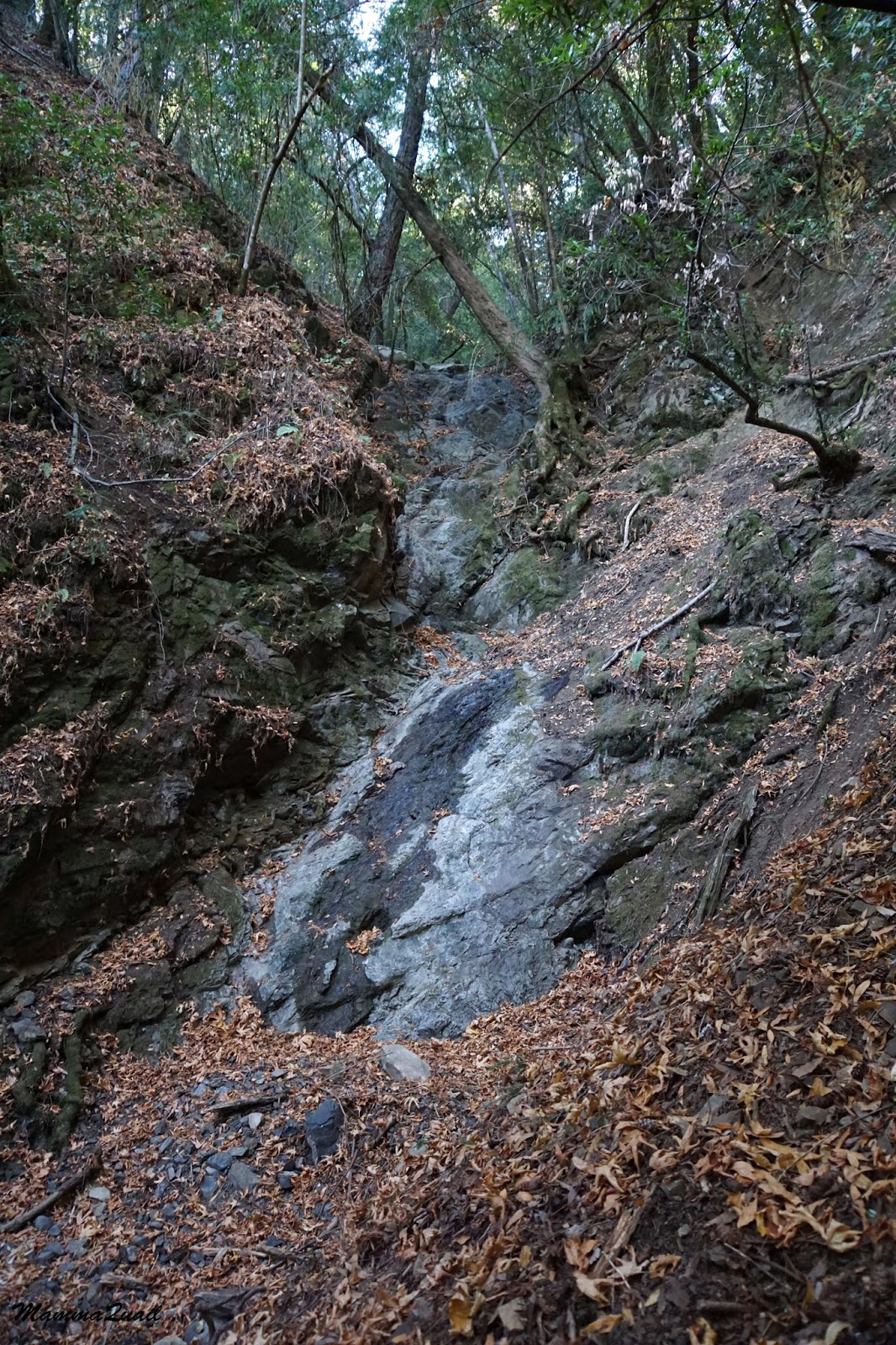
I arrived at Triple Falls and found them dry. Not completely dry - there was some moisture on the rocks, but there was no flow. I should go back there after a few good rains.
Triple Falls
The trail to Triple Falls dead-ends there so I turned around and walked back down Alec Creek. On my way I passed under tall laurel trees. So tall they were that they seriously competed with the redwood. I don't recall seeing laurel trees so tall anywhere else.
California Laurel (Umbellularia californica)
The ground was littered with fallen redwood and laurel leaves, as well as dropped laurel fruit. The fruit is edible, although there's very little to eat there, and that too is bitter. I read that the laurel nut can be roasted, ground, and steeped into a coffee-like drink. One day I'll try it myself.
California Laurel (Umbellularia californica) fruit
I returned back to the intersection with the Contour Trail and took the turn.
Contour Trail
This trail, as implied by its name, follows the contour of the hill with only mild sloping most of the way. The trail is tree-shaded nearly entirely, but at the few breaks in vegetation, I caught a glimpse of the Knibbs Knob Peak across the canyon.

Uvas Canyon County Park is a home to a fascinating forest comprised of rich variety of tree species, not one of them truly dominating the scenery. One of the tree species there is the Douglas Fir, some of which have reached a size that dwarfs even the local redwoods.
Douglas Fir (Pseudotsuga menzeisii)
The Douglas Fir I saw there were grand and majestic. On a closer look, however, I saw that many of them were unhappy, oozing resin from in ample quantity. This is a likely response to a wood-boring beetle attack.

The Contour Trail provides plenty of opportunities to see and feel the infinite aspects of Nature. One only needs to look. I chanced to look down at the base of one large laurel trunk, therefore I saw this beautiful moth sitting motionless o n the ground.

On one of the curves the trail dips shortly into a dry wash. A few undergrowth greens were hanging from the rocks, all very similar.
Fern
I assume there is an evolutionary advantage to having sprawled, pinnate leaves when growing under dark tree canopies.
Oregon Grape (Berberis aquifolium)
Right at the wash's corner I had my first sighting of water on that hike: a tiny puddle surrounded by mud. That puddle was there every time I was there throughout October: it is an active spring that's too week to flow beyond that puddle area.

Almost every park in the Bay Area has poison oak growing near the trails and Uvas Canyon is no different. There is, however, much less poison oak there than in other parks with similar vegetation communities. The examples of poison oak I've seen along the Contour Trail were hardly impressive.
Poison Pak (Toxicodendron diversilobum)
What was very impressive to me were the large numbers of pacific madrone trees I've seen there. I'm used to seeing its red back standing out here and there in Bay Area forests. In Uvas Canyon CP, however, there are lots and lots of madrone trees, their shiny, rust-colored back adding a special character to the forest.
Pacific Madrone (Arbutus menziesii)
I usually look at oak trees for artistic inspiration. But Uvas Canyon's madrone trees display some unique personalities as well.
Pacific Madrone (Arbutus menziesii)
There were absolutely no flowers blooming anywhere along my trail. I still looked down, though, and found other interesting sights, also morbid ones.
Final Rest
After a mile and some, the Contour Trail meets Swanson Creek. At the meeting point, the creek was completely dry.

A few yards below, however, the water was flowing openly on the surface. Not a big flow, but for 4 straight years of drought, it was nice to see the creek running.

The trail continues on the other side of the creek. There's no bridge there, just a few large rocks to hop on. On high flow times, the trail is closed to hikers.
A third more mile down and I was at the Upper Falls. Finally, a waterfall that flows.
Uvas Canyon Upper Falls
Upper Falls is the best place to stop and relax. The sound of running waterer, so rare here these days, has a wonderful effect on the mind.
From there on, the trail follows the creek downstream. About 50 yards below the falls the trail splits into two: the left is a wide dirt road that stretches high above the water. It is wide and comfortable, sunlit in more than one place, and the perfect trail to take if seeing reptiles is on the agenda.
Western Fence Lizard
I saw a ring-necked snake on that trail too, but it slithered away too quickly as I lifted my camera. The alligator lizard, however, stayed put so motionlessly that I wondered if to was dead. (It wasn't.)

Aligator Lizard
But up near the Upper Falls where the trail splits, the right choice takes close to the water. It is a narrow trail that crosses the creek a few times on narrow wood bridges. Narrow, shaded and uneven, and wilder. 


I didn't see any reptiles out on that trail. There was plenty of vegetation, however. Including the nicest specimen of poison oak I've seen at the park. 
Poison Oak (Toxicodendron diversilobum)

That trail runs much closer to the water and provides wonderful opportunities to appreciate the little cascades and the tiny ripping pools the create.


Both these trails form the two arms of the Waterfall Loop. They meet again and reunite a quarter of a mile downstream at the old, broken dam.


Uvas Canyon is one of the few places around the Bay Area where the creek still runs after the 4 long drought years. It is a wonderful place to visit any time of year, but makes a particularly good hike in the fall time, where everywhere else is hot and dry. I was amazed by how rich this park is. The diversity, the wildlife encounters, and the strong sense of wilderness, so close to San Jose's urban conglomerate, yet so distant in every other way. Uvas Canyon County Park is the perfect getaway for those who want to reconnect with Nature, and with themselves. 
Wild Turkey on a roof at Sveadal, near the park's entrance. 

Many thanks to members of the California Native Plants Society for their help in identifying the coffeeberry and the droppings :-)


Saturday, October 31, 2015

On the Old Volcano's' Shoulders: The Pinnacles Eastern Slope

December 2014

Dates: December 25, 2014 and April 14, 2015
Place: Pinnacles National Park, Paicines, California
Coordinates: 36.494948, -121.172994
Length: about 4.5 miles
Level: Moderate

The Pinnacles High Peaks hike I posted about recently is strenuous and wasn't suitable for my hiking group who are families with children, many of them pretty young. So I settled for taking them up to the mountain's shoulders, from Old Pinnacles half way up the High Peaks Trail and down Condor Gulch Trail.
The first time I hiked this trail was back in December of 2014. I was by myself then, trying out the trails I thought to take my group on. Having only one car at my disposal, I had to hike the entire loop and make it back on foot to Old Pinnacles, where I had started. When I returned with my hiking group we had one car parked by the Bear Gulch Nature Center so we were able to shuttle drivers back to Old Pinnacles to bring up the other vehicles.
The trail between Bear Gulch Nature Center and the Old Pinnacles that I hiked alone in December I wrote about in a separate post. Here I post about the upper, longer segment of that loop trail, and my photos are from both hikes: the one on December 2014 and the one on April, 2015. 

Old Pinnacles to Bear Gulch: The Blue-labeled Trail.
The first part of the trail is a mild walk south along the Chalone Creek. I recently posted about my December hike of this trail segment, but in April it looked very different: it was covered with wildflowers!
Wind Poppy (Papaver heterophyllum), April 2015
Of such a diversity of shapes and colors, it was wonderful to see!
Golden Brodiaea (Triteleia ixioides), April 2015
When I hiked this trail in December I was in a hurry. Last April, with my group, we took our time, walking at and easy pace. I could pay close attention to the flowers and other sights along the trail.
The trail along the Chalone Creek is mild and much of it is shaded by oaks and pines. It is an easy trail to hike, and it is very tempting to simply continue along the creek all the way to the park's visitor center.
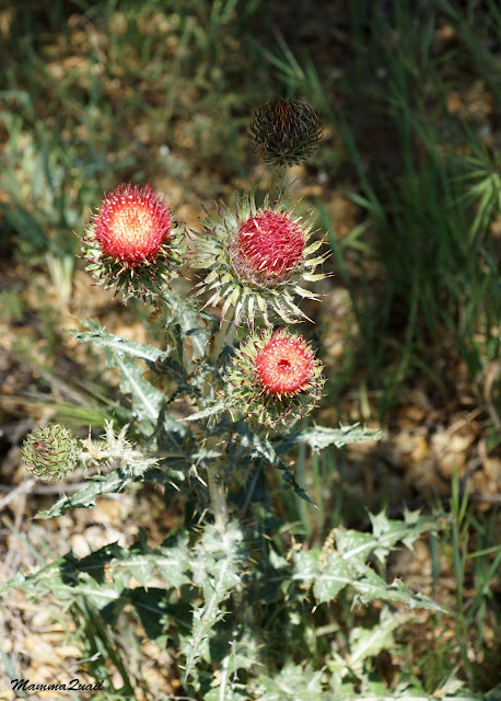
Cobwebby Thistle (Cirsium occidentale), April 2015
Looking back, some of the bloom had started already in December. The manzanita shrubs were in bloom then. By April, they were done.
Manzanita (Manzanita sp.), December 2014
After half a mile of easy walking we reached the High Peaks trailhead. Right by a good size patch of the scarlet bugler.
Scarlet Bugler (Penstemon centranthifolius), April 2015
From the first step, the High Peaks Trail proved to be a good workout. In addition, the tree cover disappeared, replaced by chaparral dotted with exposed rocks and scree, and an occasional pine tree.
A Rock Rook, December 2014
The vegetation along the trail was different, but no less beautiful. Early in April, chaparral wildflowers were at peak bloom.
Eastern Mojave Buckwheat (Eriogonum fasciculatum), April 2015
But some were already fruiting. In the case of clematis, the fruit is just as beautiful as the flower, if not more.
Chaparral Clematis (Clematis lasiantha), April 2015
We hiked up and up, occasionally stopping for a breather. Each stop I would find something interesting and share it with the group. Like the Pellaea fern, adapted to relative dryness with its thick cuticle, decorated the exposed slope areas.
Coffee Cliffbrake (Pellaea andromedifolia), December 2014
On my December hike I noticed small, red buttresses poking out of the ground underneath the chaparral chamise bushes. I found some close enough to the trail and stooped over for a closer look. They turned out to be budding Indian Warrior plants. By April they were already done with blooming.
Indian Warrior (Pedicularis densiflora), December 2014
he trail switchbacks back and forth along the less exposed north-facing slope. The rock face, wet from preceding rains, was wearing moss and lichen, and sheltering succulent dudleya rosettes.
Lanceleaf (Dudleya lanceolata), December 2014
Many lichen patches were as large as those rosettes.
Lichen, December 2014
The trail slopes for continuous 2 miles. Rock formations that I was looking up to I now was level with.
Rock Rook, December 2014
A grove of oaks shading the trail made me don my sweater in December but provided a welcomed respite from the heat on my April hike with the group.
Oak Passage, December 2014
The trail was leveling off at that point, which was also a welcomed relief for the straining youngsters in our group. I was glad that most weren't too tired to appreciate the colorful display of minerals and lichen on the rocks.
Volcanic Mosaic, December 2014
Up on the mountain's shoulders the trail turns the corner, switching from slope to a gentle meadow. In the most perfect spot in that corner: a single oak and the perfect vista point. It was there that I had my first real break.
Landmark oak, December 2014
To rest, to eat, to breath in the air and to imbibe the wonderful scenery.
View east, December 2014
It was in that spot that we had our group rest stop as well. What followed might have been the same in topography, but very different in appearance.
Upper Meadow, December 2014
And of course it would be. In the end of December, the entire upper meadow was bright green. So green, it made me want to run all over it, performing cartwheels and somersaults. I didn't, of course. And not just because I feared I won't be able to get back on my feet after the first attempt. Getting off the trail is forbidden for a very good reason: it is very damaging to the vegetation and the animals who depend on the health of these plants.
So I only somersaulted mentally :-)
So Green! December 2014
4 months later, on my April hike, the grass was turning yellow and the meadow was dotted with wildflowers. It was also sweltering hot and I felt more like taking a nap rather than performing bad gymnastics.
Mountain Clarkia (Clarkia unguiculata), April 2015
A little further up the trail I back in the Chaparral, and the air filled with the aroma of sage.
High Chaparral, December 2014
We stopped our ascend at the point where the High Peaks Trail meets Condor Gulch Trail. On my solo High Peaks hike I had climbed on the Condor Gulch Trail, but on my December solo hike, as well as on my April group hike, climbing was over. We took the time to rest and to appreciate the field of rock pillars, but then it was time to go down Condor Gulch.
Sitting on a Giant's Shoulders, April 2015
Being an old volcano that had multiple eruptions, the Pinnacles rocks are diverse in their mineral composition, grain size and solidity. As a result, they are also diverse in the rate of their erosion. The rock formations, therefore, are amazingly variable and immensely fascinating and tantalizing to the imagination.
December 2014
 A bit below the trail intersection there is a railed area, perfect for photographing the Pinnacles High Peaks from the eastern side. While group members were busy documenting the rocks with and without themselves in the frame, I was busy trying to get a busy butterfly on camera. 
Painted Lady, April 2015
Going down the Condor Gulch Trail comes as a big relief on the April hike. It was a hot day and the air shimmered in the heat. We were all ready to relax at the campsite or by the campground's swimming pool. 
On a cooler day: male gnats mating dance, December 2014
We didn't get very far before we arrived at a nice cluster of rocks that looked very inviting. Within seconds all the youths in the group were by the rocks, trying to climb them as high as they could to the cheering or frighted calls of their parents.
December 2014
It was only the promise of some pool time that peeled the youngsters off the rocks.
We continued down the trail, and I continued looking for more flowers.
Coyote Mint (Monardella villosa), April 2015
Down and down we hiked. In December I was racing against the sunset. In April we were trying to get in time to the swimming pool. Either way, gravity was on our side.
Pinnacle, December 2014
Condor Gulch Trail switchbacks down a south-facing slope. That means more direct sunlight, which in water-limited areas means less vegetation cover. Other than the occasional pine it was all chaparral. The biggest plant around were the manzanita bushes.
Manzanita Sky, April 2015
They are very, very beautiful, but not much for shade.
Manzanita Trail, April 2015
A large rock pillar by the trail marks the nearing Bear Gulch trailhead, where we were heading. The group passed it without a second glance. I, on the other hand, stood by it for a few long moments. It would be my last time on this trail for a long while.
Trailgate, December 2014
At the Bear Gulch parking lot all of the drivers squeezed inside the car that we had left there, and we drove off to Old Pinnacles to get the rest of the vehicles over. Then I sent everyone off to the campground, to have their longed for swim.
I remained a few moments more behind, looking at the family of acorn woodpeckers I had missed in December. They were very active and vocal. They have an excellent home in the Pinnacles, and I hope to see them again and again in the future.
Acorn Woodpeckers, April 2015
Back in December I had to continue hiking down Bear Gulch Trail to complete my loop. In April, my hike was concluded and I drove to the campground store, got myself a beer and went back to the campsite, where I laid back on a bench and relaxed while the rest enjoyed the pool.
The following day would be the last day of the group's camping trip, and we were to hike along the Chalone Creek, all the way to the Balconies.