
Place: Anza Borrego State Park, Borrego Springs, California
Coordinates: 33.13142, -116.30057
Difficulty: moderate
Not owning a hand-held navigator, I still find my way about using the old-fashioned method of consulting a paper map. In Anza Borrego State Park, one can acquire a 1:160900 map of the park with detailed roads, dirt roads, and more or less detailed foot trails. It isn't a topographic map though, a feature I missed greatly during our time there.
After finishing our hike in the Slot Canyon our next destination was to be the city of Brawley. I insisted on taking the long route there - via S-2 road and the town of Ocotillo and so to get a glimpse of the southern part of the park, which we didn't get a chance to explore on foot. We thought we had time for one short hike more in Anza Borroego before departing the park, and Papa Quail suggested the tiny Narrows Earth Trail loop that was marked on our map, just behind a bend on hwy78.
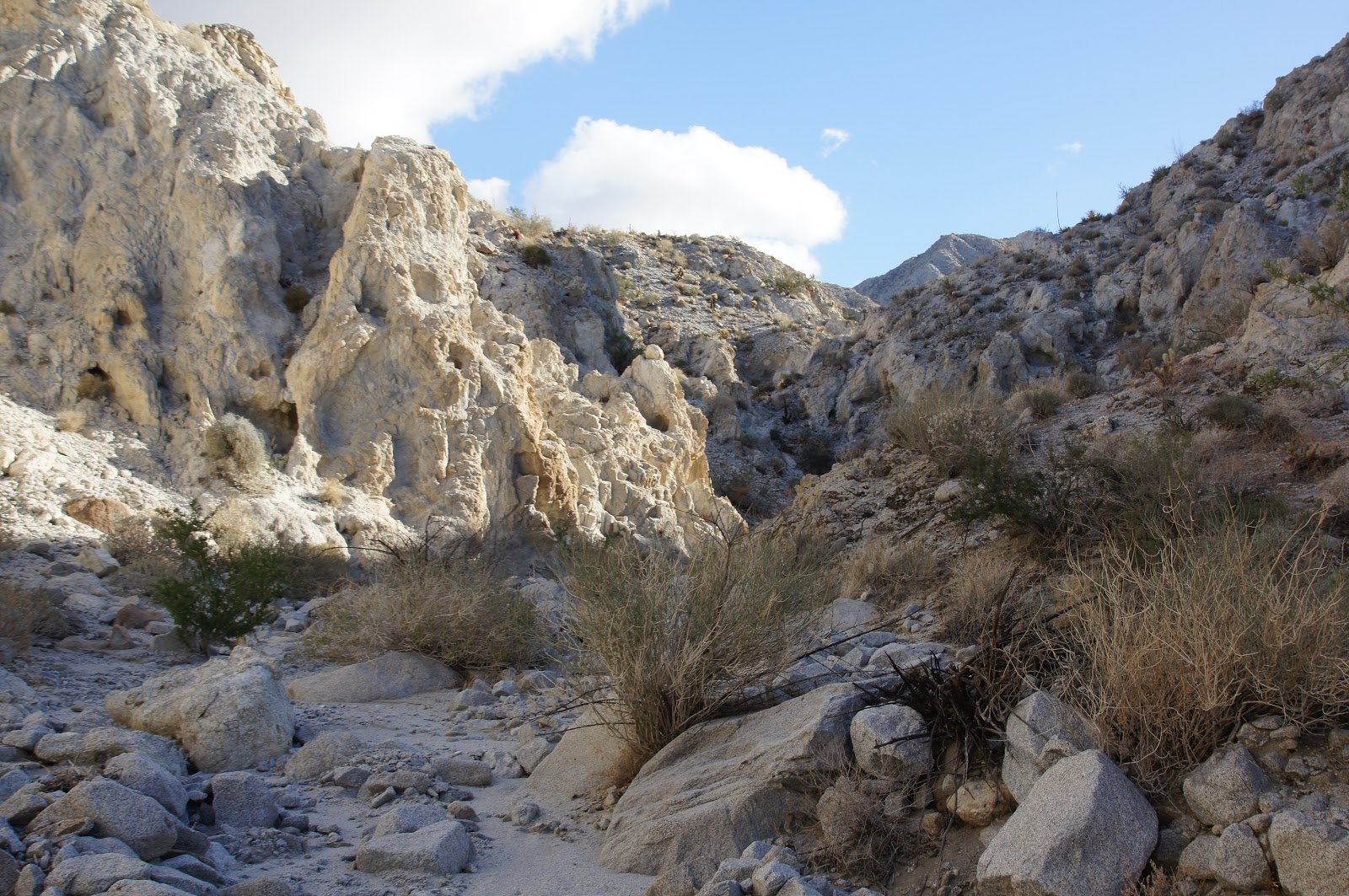
We estimated the stopping place as best as we could. When we exited the car we were welcomed by the wide and shallow mouth of a white-colored wash. Without much debate we started walking into the gaping wash.
 |
| Quartz Vein Wash |
 |
| Acacia trees decorating the Quartz Vein Wash |
The Quartz Vein Wash certainly looked unique. It was so white that where it wasn't shaded, sunlight reflected off its pale walls almost as intensely as bouncing of snow. This whiteness comes from the quartz, which is the most abundant rock mineral in the Pinion Mountains, where the wash originates.
We hiked slowly up the wash. Looking for the path that will connect us back to the main wash we kept pulling towards our left.
 |
| A pretty rock garden |
 |
| Agave pillar |
Unlike the Palm Wash and The Slot, the Quartz Vein wash gets canyon-like only in short segments and even then its walls aren't very tall or particularly straight. But either gently sloping or sheer, they provide an excellent growth turf for many agave, cacti, creosote, and other desert vegetation. Always very artistically set.
 |
| No end in sight. |
 |
| At points, the wash would appear canyon-like. |
What we did see, however, were droppings of Bighorn sheep that were relatively fresh. This sighting fueled our motivation and we kept on going up the wash, hoping to meet the elusive mammal that had left the incriminating evidence behind.
Although there was no 'real' hiking trail in this wash, for the most it was very convenient to walk. A bit of rock scrambling, but for the most it was walking in soft gravel, in a very gentle slope.
All and all, it felt as if we could continue at ease for a very long time. We couldn't, however, go on for much longer. Having planned on only a very short loop we didn't have enough water with us, and had no food at all. What we did have instead, were a pair of tired and whiny chikas, which at that point, had had enough of hiking for that day. So I left Papa Quail and the chikas to rest for a few moments and went on by myself for a hundred yards more to a spot where I could take a photograph of the mountains from which the wash has originated.
 |
| Pinion Mountains |
This was the last hike of our winter vacation in Anza Borrego State Park. They say that 2/3 of the Bighorn sheep population in California live within that park, but I didn't see any on them. They proved to be just like Yosemite's bears - everyone else sees them but me.
But we did see this golden eagle circling above our heads as we got back to the car :-)
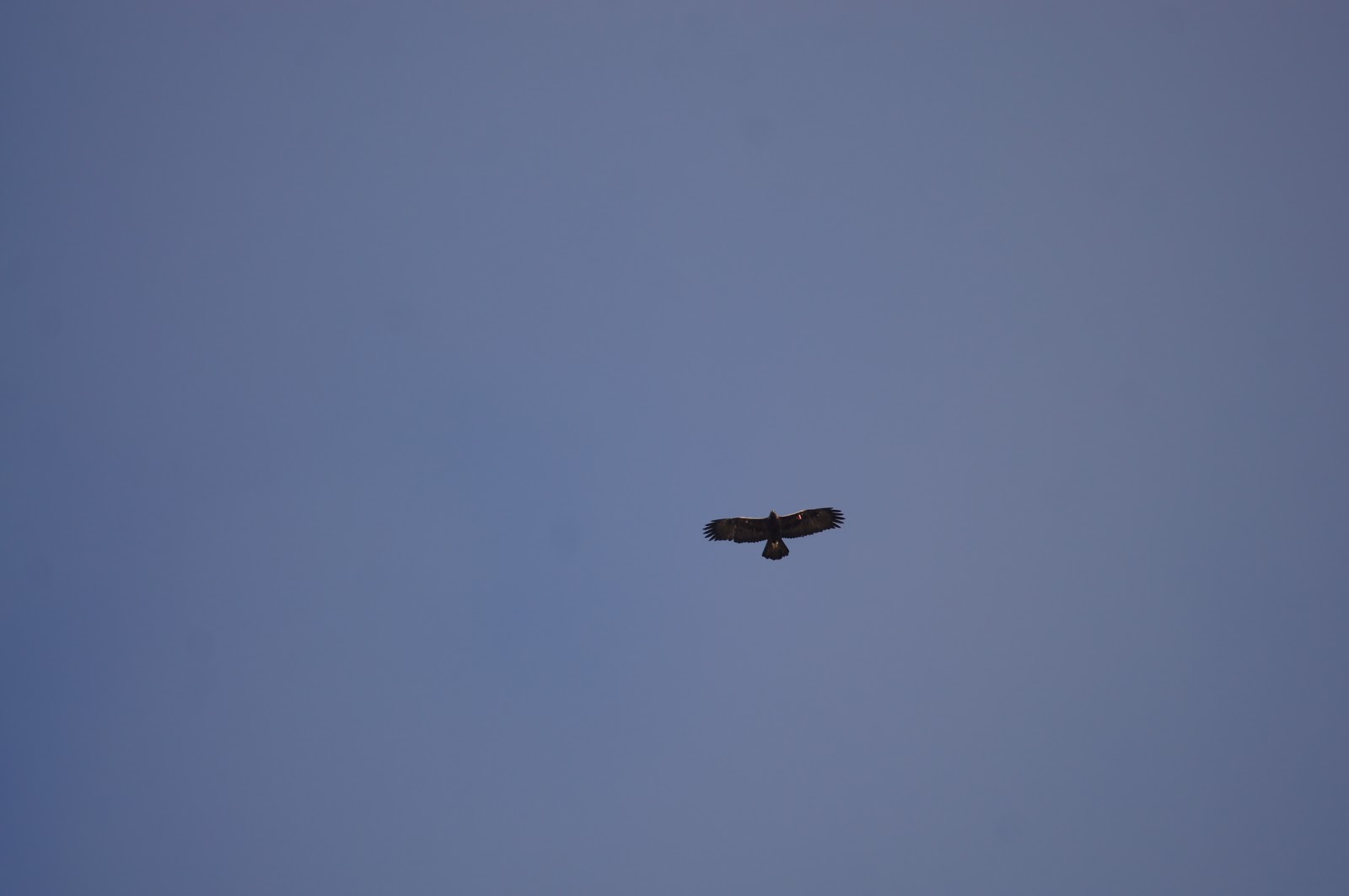 |
| Golden eagle |
we didn't see bears at Yosemite (or Yellowstone) either :-)
ReplyDeleteAh, but I've been there so many times! In Yosemite, I mean. I know it doesn't reflect in this blog but I visit Yosemite fairly frequently and I've never seen a bear there, despite all the warning signs.
Delete