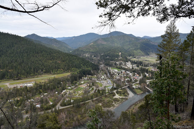
Place: Happy Camp, California
Coordinates: 41.780833, -123.386981
Length: 2 miles (in and out)
Level: Strenuous
The forecast of a chilly night that we got from the backpacker we've met on the Woolly Creek trail came to be. We found a nice campsite on the Klamath river bank just south of Happy Camp. We arrived there with plenty of daylight left to set up camp, cook dinner, and get a campfire going for a little but before the wind and the evening chill drove us into the tent.
In the morning everything was sunny and bright again. Between breakfast and breaking camp I managed to look around a bit and snap some photos of the area.
 |
| Pallid Serviceberry, Amelanchier pallida |
We went into the rangers station to get information about the local trails. I was specifically interested in the Grinder Creek trail, which is part of the Pacific Crest Trail (PCT). The ranger at the dest was very sweet. She was a native of Happy Camp and very happy to have lived there her entire life. Just like the ranger I've talked with on the phone before the trip, she too discouraged us from going on the PCT in that area and kept redirecting us to a small local trail named simply, "Town Trail". It is a short trail - only a mile one way, and it isn't a loop. It goes uphill to a pretty view point above the town.
 |
| Our hike as captured by Pappa Quail's GPS |
It wasn't quite the kind of hike I had planned for the day but the ranger was very persuasive and so we fount the trailhead and started uphill.
 |
| Town Trail |
 |
| California Gromwell, Lithospermum californicum |
They stopped and waited for me near a cute patch of shooting star flowers, making sure I wouldn't miss it.
 |
| Mosquito Bill, Primula hendersonii |
 |
| View down on the Klamath River |
The trail curved to the north and looking east in between the trees I saw a snowy peak, possibly the same peak we've seen the day before from the hike on Woolly Creek Trail.
The Klamath area experienced many wildfires in recent years, including the forest above Happy Camp through which we were hiking. As we ascended higher the fire scars became wider and stronger. The tree trunks were all black and many were dead. I did find one pine tree that survived, alone of all the trees in its vicinity. The bark that did not burn completely - that's where the living tree survived.
Pine forests have evolved to endure forest fires. Clearing forest patches of the old trees make room for the new ones.
 |
| Sugar Pine cone |
 |
| Pacific Madrone, Arbutus menziesii |
 |
| Manzanita, Arctostaphylos sp. |
 |
| Downy Woodpecker |
 |
| Happy Camp |
Going back through the burnt forest my birdwatchers found a hermit thrush sitting atop a charred log. The birds make do and some even do better in this environment.
 |
| Hermit Thrush |
Down, down, down we went. Much faster now, for gravity was on our side and also I didn't feel the need to stop and photograph the same things I have seen going up. 

I did make an exception of the blooming gooseberry bush that I had skipped on my way up. The season was nearly over for it but it was still red and beautiful.
 |
| Gooseberry, Ribes sp. |
 |
| Pacific Madrone, Arbutus menziesii |
Many thanks to members of the California Native Plants Society for their help in identifying plants!


Nice Sign... ;-)
ReplyDeleteI like the views, the trail.
A pretty little gem. I'm glad we were persuaded to hike it :-)
DeleteNice, but a little sad to see the fire marks
ReplyDeleteI cannot imagine how some of these places look like now with all these fires going on now :-(
Delete