
Place: Oregon Caves National Monument, Cave Junction, Oregon
Coordinates: 42.098794, -123.407731
Length: about 2 miles combined
Level: moderate (children under 42 inches are not allowed in the cave)
The rain that begun when we left the Klamath National Forest had followed us into Oregon. Although we did do a short hike to Hobart Bluff at the Siskiyou-Cascade National Monument, we looked for an alternative plan for the following day. My idea was to go underground and after dinner I did an online search and the closest place I found was the Oregon Caves National Monument. Pappa Quail convinced me that two hours drive is enough of a vicinity, pointing out that we really didn't have any other alternatives to hiking in the rain or sitting in the hotel room all day long. Thus we packed ourselves early in the morning and started weston a slow and foggy road over the Siskiyou Mountains.
The cave has regular guided tours and there's a recommendation on the website to book the tour in advance. Not sure when we'll get there we didn't. On our way there we passed a sign for a nature area. I didn't pay much attention to it (my mind was on the road) but Pappa Quail made a mental note of it.
When we arrived at the park we found that the parking area is a good walking distance from the visitor center and the cave. Not knowing how things worked there we walked up to the visitor center. There was no wait so we got tickets for the upcoming tour starting in about 20 minutes and Pappa Quail had to run all the way to the car and back to get a backpack and my camera (he wasn't planning on carrying his). Meanwhile I had my shoes wiped well (to prevent any transfer of a certain bat disease from previous caves I've visited). When the time came we gathered with the rest of the tour group outside the visitor center. The guide gave us an introduction and took us up the trail to the cave's entrance.
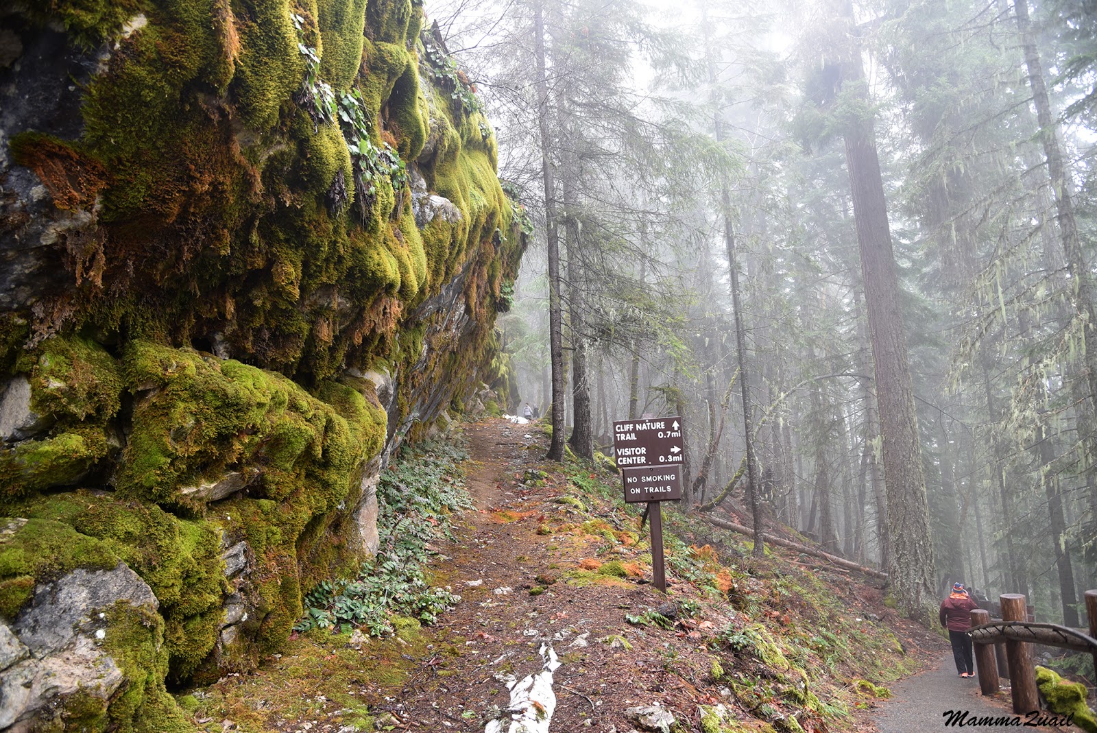
 |
| Access trail to the Oregon Cave |
 |
| The entrance of the Oregon Cave |
I was surprised that we were allowed to take photos inside the cave, and I made the best of it. My camera Isn't all that great in low light conditions but I took a gazillion photos and a few came out ok.
 |
| Draperies |
 |
| Little Brown Bat (that's it's real name), Myotis lucifugus |
The cave formed when over millions of years the rock was dissolved by the low concentration of weak carbonic acid in the water that seeped through from above. Holes, rooms, and halls were hulled in the bedrock.
 |
| A collection funnel of water samples |
 |
| Stalactite Ceiling |
 |
| Stalactites, Stalagmites, and Columns. |
 |
| Flowstone Formation |
The first explorers of the cave also were not keen on the preservation of its natural state and beauty. They collected pieces of rock formation, touched and killed the living rock (the skin oils block the water flow and stops the formation growth), and left markings and graffiti on the walls accessible to them. The most prominent one was left there by the geologist Thomas Condon and his students who explored this cave in 1884 and signed their names on a flowstone. The graffiti was later glazed over by the continuing flow and deposition of calcite, making it impossible to remove and leaving it visible for many years to come until it'll finally fade into stone.
 |
| Thomas Condon's Graffiti |
 |
| Rock Maze |
 |
| The Scream |
 |
| Draperies |

The flowing cream chamber was the highlight of the tour. After that we begun our ascend toward the cave's exit. The guide stopped at a couple more places to show us interesting bits. Once was a box with bones of a bear that fell inside the cave and died there. She mentioned that other animal bones where also found inside the cave.
 |
| Bear Bones |
 |
| Daddy Long Legs |
The chikas wanted to head down right away but Pappa Quail and me chose to hike. After some grumbling on the chikas side we started walking down the trail.
The rain seemed to have paused but everything was wet and the air was dense with clouds and mist. Moss was thriving everywhere - on rocks and trees.
 |
| Moss |
 |
| Fern |
 |
| Snow Queen, Synthyris reniformis |

We ascended slowly up the hill, arriving eventually to a nice vista point from which we could see only the nearest trees and a big gray cloud hanging over the valley below. There were some picnic tables and benches, all drenched, and pretty looking rocks. There were also a couple of other hikes wearing plastic ponchos over a summery attire. The elder chika chatted with them a little while Pappa Quail tended to the younger one who wanted to finish the hike already, and I was looking for little things of interest on the ground, such as snails (only saw one empty shell).

We found something else at the top that got the chikas more excited than anything they've seen earlier - there were snow patches on the ground! The chikas wanted to go and play in the snow but we didn't want them to stray off the trail. They settled for tossing a couple of snowballs at each other and then we continued on.

It was all downhill from there. In a good sense. Going downhill was on a much steeper slope and we had to take care not to slide on the muddy trail.

Also the rain intensified. The lichen-coated trees were dripping water, and the mist and gloom gave the forest the appearance of a Grimm Brothers tale.

I could imagine the Babayaga's hut between the trees ... Fining the witch's butter fungus growing on a fallen log only added to the atmosphere of an enchanted forest.
 |
| Witch's Butter |
 |
| Pacific Madrone, Arbutus menziesii |

We dove to the nearest town, fittingly named, Cave Junction, where we found a place to eat and think of what to do next. Then Pappa Quail suggested that we'd explore the nature area we've passed on our drive to the park. It seemed a good suggestion. After a good lunch even the chikas were fine with it. So off we went, to explore some more of Southern Oregon.
The cave is very impressive. The moss pictures are great!
ReplyDeleteThanks you! I love that cave too. It was certainly worth the travel!
Deleteimpressive views, very interesting cave! (but I'm glad we went the Bailey Cove trail...)
ReplyDeleteGot to save something for your next visit, right?
Delete