
Place: Sacramento River Bend Nature Area, Red Bluff, California
Coordinates: 40.318370, -122.188816
Length: 3 miles in and out
Level: easy
After our visit of the Shasta Lake Caverns it was then time to go home, but it was still early in the afternoon. Once again Pappa Quail was the motivator. He suggested we'd stop at the Sacramento River Bend Nature Area and hike there a little before continuing to the Bay Area. We expected a lot of bloom there, as we've seen on our last visit of that place.
I jumped on Pappa Quail's suggestion, but selected a different trail from the one we've hiked previously.
We arrived at the trailhead and looked around. The parking area was surrounded by large valley oak trees. Acorn woodpeckers were busy and noisy in these trees.
 |
| Acorn Woodpecker |
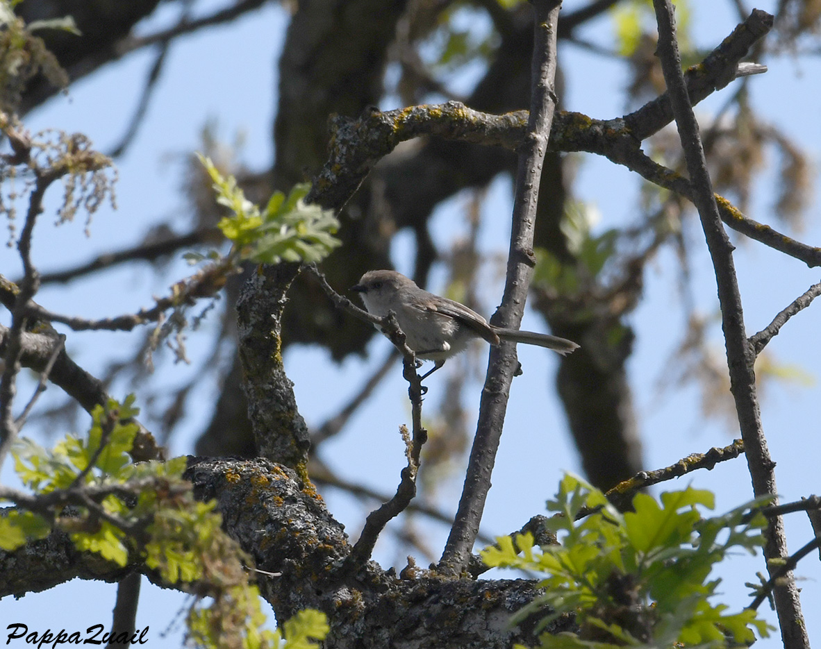 |
| Bushtit |

The Yana Trail follows the Sacramento River for a good distance. We didn't have the time to walk the entire length - all we wanted is to get an impression of the area.

In the field ahead I saw the sought after fields of wildflowers. I was disappointed to find that all of these flowers were invasive weeds - cabbage, mainly.
I was way more impressed by the looming snow-capped Lassen Peak and Brokeoff Mountain in the background.

Although I wasn't impressed by the cabbage bloom, I was happy to see those who were. The butterflies loved them.
 |
| Pipevine Swallowtail |
 |
| Pipevine Swallowtail |

At times the trail neared the river and we could get a better appreciation of the wide, fast moving flow.
 |
| Sacramento River |
 |
| Osprey |
 |
| Red-tailed Hawk |
 |
| Turkey Vulture |
 |
| Mourning Cloak |

The trail detached from the river and we were walking through an sparse grove of large oak trees. These were deciduous that had budded very recently and wore very bright, light green foliage. Between the trees large brown rocks lay exposed.

I saw little ponds locked between the rocks and approached to take a closer look. I thought I detected a move near the water but my eyes were too slow to catch what it was.

So I sent my elder chika to the pond. In no time she found the local resident - a California Red-legged frog.
 |
| California Red-legged Frog |

Paying more attention to the plants underfoot I noticed a few native species in bloom - the bright orange fiddleneck standing out between the cabbage and the vicia.

The fiddleneck attracted yellow butterflies. These were hyperactive - neither me nor Pappa Quail got a good close up of these. But the elder chika has a way with wildlife and she succeeded.
 |
| Clouded Sulphur |
 |
| California Red-legged Frog |
 |
| California Red-legged Frog |
As we headed back Pappa Quail turned around and took one of the his few landscape photos - of the magnificent Lassen Peak. In three months I'd be there again, and climb Mount Brokeoff. By then, only tiny patches would have remained of its white cap.
 |
| Lassen Peak (left) and Mount Brokeoff (right) |
We crossed the Sacramento river again on our way there and this time we stopped to appreciated the spring-swollen river.
 |
| Sacramento River |

I was rewarded immediately. While many of the herbaceous plants around were invasive, there were many California natives too. The California goldfield was most prevalent, and the yellow patches were dotted with little low brodiaea .
 |
| Dwarf Brodiaea, Brodiaea nana |
 |
| Butter n' Eggs, Triphysaria eriantha |

I did not dare, however, to get any closer to the water. I feared of sinking into the mud. So I looked around, appreciated the view deeply, then turned and walked back.

On my way back I took a few steps over to look at the water canal near the trail. There was no special bloom there, it just looked nice.

Back at the parking lot I saw that my elder chika didn't keep her resolve to remain in the car. She was busy looking at bluebirds and got some nice photos of these lovely birds.
 |
| Western Bluebird |
This was the last hike of the last day of our last spring break, in which we were on a very interesting and diverse trip. I am already planning the next one in my mind.
Many thanks to my friend Anenet who identified the wildflowers :-)
I did? wow, I didn't even know... ;-)
ReplyDeletejust wanted to add that the moth is not a moth but a butterfly of the Hesperiidae family.
and the bluebird is so nice! I'm sorry I missed it when we visited the area.
Yes you did :-) You published them in your blog, all I had to do is go look there ... You saved me the trouble of looking them up myself! I'll change the moth to a butterfly. Thanks!
DeleteThe 2nd shoty hike seems to be much nicer than the 1st one, even though it wasn't bad fro itself... The story of the natives is very sad.
ReplyDeleteThe second one is where I took Anenet :-) We could get much further on it then because the flood subsided. Yes, I liked that one better myself.
Delete