Tuesday, December 1, 2015

Finding Refuge at the Hayward Shoreline

Dates: November 11, 12, and 13, 2015
Place: Hayward Shoreline Regional Park, Hayward, California
Address: 3010 W Winton Ave, Hayward, CA
Length: 3.9 miles
Level: easy

Hayward Shoreline is one of the best places in the Bay Area to see wildlife up close. Mostly feathered wildlife, but others as well. Along the 9 miles trail that stretches from the Hayward Shoreline Interpretive Center (HSIC) in the south by CA-92 to the San Leandro Marina in the north there are sloughs, ponds, and restored wetlands and salt marshes that are year-round home to numerous species of local birds and an essential wintering grounds to many more species of migratory birds.
It is also a great recreational trail for hiking and biking, flat and easy, with great bay view and refreshing breeze.

Usually I hike the shoreline from the south and finishing the hike with a visit at the center. The hike I'm posting here is in the middle section of the shoreline, starting and finishing at the Winton Ave. entrance.
Our 11/13 Hayward Shoreline hike as captured by Papa Quail's GPS
The direct path from the parking lot to the bay is along the slough. A few green bushes, but mostly dry weeds separate the trail from the water. On one of these weeds: a black phoebe stands on watch.
Black Phoebe
Just ahead on the south side of the parking lot there is a low hill where the weeds were mowed short. The tire marks indicate that not all the mowing can be attributed to the geese.
Canada Geese
This slough, as well as others in that area, was opened in the 1980's to bring back the tide cycle to the bayshore. This was done as part of the bay wetlands restoration efforts.

I didn't expect to see any bloom at this time of year, but there was some. The California coastal region never fails :-)

The tidal water flows between the salt marsh sections via a system of sloughs and canals, moving from one to the other through pipe holes like the one at the bottom of this photo:

A little whirlpool forms where the incoming tide water flows into the pipe hole. The children watched with intense fascination.
This fascination wasn't experienced only by the kids :-)

Tidal water regularly floods the salt marsh areas, supporting the specialized plant life and the numerous birds and other wildlife that depends on the tidal cycle.
Willet
At the end of that slough there is the bay front. Any day there would be a few anglers standing there with the lines in the water. I was quite horrified to see how trashed that place is. I took some quick photos of the birds roosting on a rock pile off shore and then took off.
Siesta
I continued south along the waterfront, keeping the low hill to the east on my left and a narrow stretch of salt marsh in between us.

My first hike there was right after some rainfall and the view was nice and clear. By my later hikes the air has already gotten to murky to see anything on the horizon.
Mt. Tam overshadowing San Francisco 
The dominant salt marsh plant is the pickleweed. In the cool october time it was turning rusty-red: a perfect background for the ever-present egrets.
Great Egret
Wherever a great egret can be seen there is also the less conspicuous but no less spectacular, great blue heron. These magnificent birds same the same habitats and have so many resembling features that one is almost sure to see one where the other is seen.
Great Blue Heron
Also a very common sight in wetlands is the mallard ducks. Although not normally skittish, this pair swam away quickly when they saw me. Perhaps they wanted some more privacy.
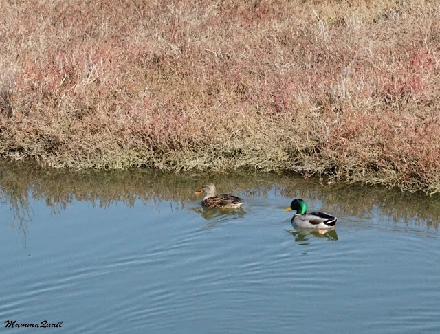
Mallard, female and male
The great egret ambushes its pray. The smaller snowy egret, however, likes to prowl, stirring the mud with its bright yellow feet and plucking whatever slithers between their toes.
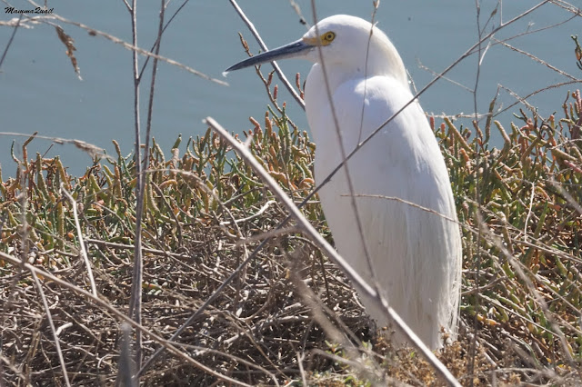
Snowy Egret
The trail curves around the low hill to complete the first loop. There, in the dry weeds, I heard a loud hiss. A normal person would probably have taken more distance but I always been a bit unusual about these things, and so I approached the sound and strained to see its source.
The source turned out to be a gopher snake: a gentle, non-venomous Bay Area resident that was mimicking the sound of a rattlesnake in an attempt to scare me away.
Gopher Snake
When it saw I wasn't going anywhere, the snake stopped hissing and just continued flicking its tongue to sniff me. The funny thing is, if it had remained quiet I would never have known it was there.
Eventually, of course, I did walk away, leaving the snake alone.
A smaler slough to my south was full with high tide water on my firs hike. On my last one, however, the tide was low and the exposed mud was like open table for sandpipers and other shorebirds.
4 Least Sandpipers and a Dunlin
The second, part of my hike traverses another restored salt marsh area. The levee that confined a salt pond was removed and the tidal cycle returned. Salt marsh vegetation was reintroduced and with it, returned also the birds.
Salt Marsh
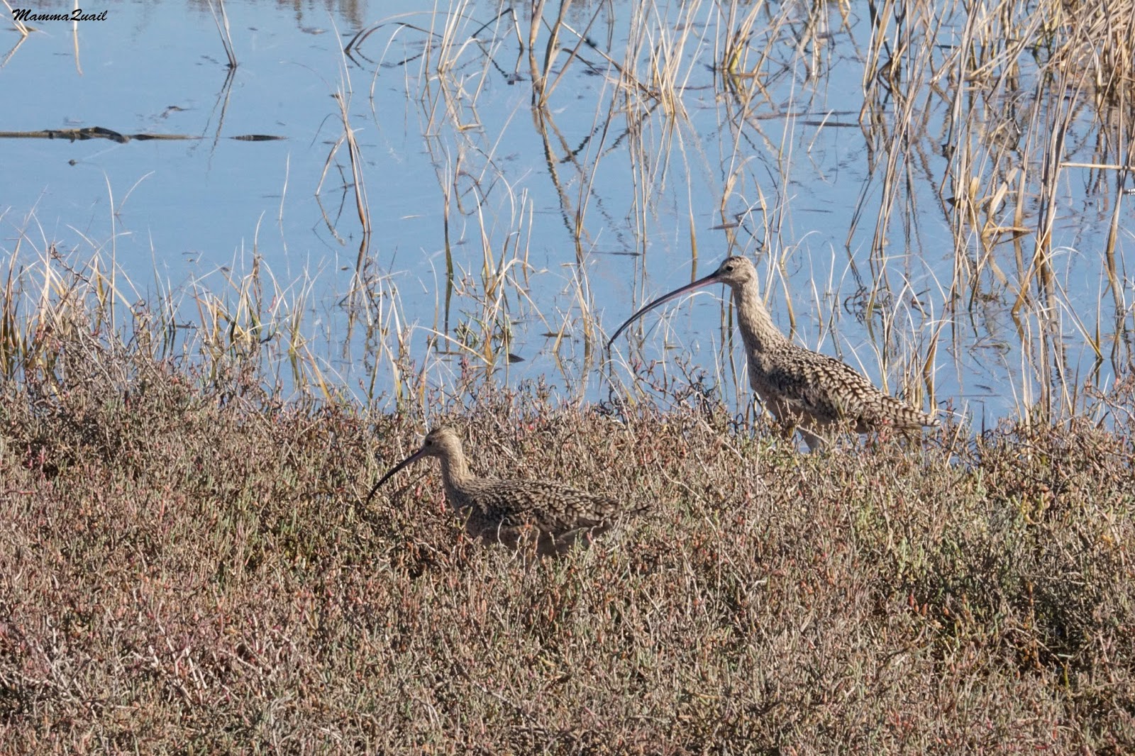
The one species I saw most in the salt marsh on my November hikes was the curlew: a large wader with an extra large beak.
Curlew
The trail goes on a long bridge that crosses the breached levee area and leads once more to the bay waterfront. On a clear day, as was on my first hike there, the San Mateo Bridge can be seen bulging above the water.
The San Mateo Bridge
On the third, least clear day hike, the peninsula was entirely invisible, completely hidden behind a curtain of murky air.
To infinity and beyond.
Clearer view right overhead: a couple of cormorants in commute.
Double-crested Cormorants
There, along the bay waterfront I saw another salt marsh plant, and it too was blooming.
Alkali Heath (Frankenia salina)
Curving back eastward, a large brown building comes into view a few miles south. This building, just off to CA-92 on the eastern side of the San Mateo Bridge, is the Hayward Shoreline Interpretive Center. I used to visit there often when we lived in Castro Valley and the chikas were little. I love that place and the wonderful educational work they do there with people of all ages. I have posted about it in this blog a while ago.
The Hayward Shoreline Interpretive Center
I waved at the building and turned north with the trail. There, swimming in another slough, were quite a few birds.
American Coot
More out toward the bay: a small group of ruddy ducks floating lazily on the calm water, hiding their bills under the wing.
Ruddy Duck, 1 female (left) and 2 males
Other, less sleepy ducks, were swimming in the slough. A large group of northern shoveler hurried away from me just when I lifted my camera. I managed to capture the slowest one.
Northern Shoveler, male
That part of the slough was apparently a very good feeding ground. Other than coots and various ducks there were quite a few grebes there, diving constantly in the water.
Eared Grebe
After properly appreciating all the waterfowl I continued north along the eastern segment of the loop trail around the marsh. Large 'islands' of smooth cordgrass patched the salt marsh area east of the trail. This grass is not native to California and is highly invasive - quickly taking over the restored wetlands and changing the habitat to exclude many species that depend on the open pickleweed grown tidal zone fields. Active efforts are taking place to remove and control the invasive cordgrass. 
Smooth Cordgrass (Spartina alterniflora), non-native and highly invasive
Lifting my eyes to look further away, much further away: the dome of Mt. Diablo towering to the northeast. I haven't been there in some time. As I walked along the Hayward Shoreline trail I was already planning in my head my next visit to Mt. Diablo.
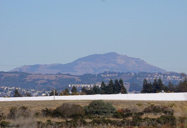
Mount Diablo
Cutting through the flooded wetlands was the dry, high-ground trail. Along the trail - many ground squirrels running between their squirrel holes. It felt like the trail sides are in constant motion.
California Ground Squirrel
Constant motion - and not only because of the squirrels. Little bush birds buzzed in the tall, dry weeds and the perennial shrubs. Many of them were sparrows.
The most common sparrow there is perhaps the white-crowned sparrow. Maybe common, but still very nice to see. And this particular individual landed right next to me and gathered bits of dry vegetation with complete disregard to my presence. This is how I got this wonderful view of its crown.
White-crowned Sparrow
Another species of sparrow I saw there was the savannah sparrow. I couldn't tell myself but my elder chika passed by as I enlarged the photo on my computer screen and blurted out the identification. I think she had memorized the entire Sibley guide :-)
Savannah Sparrow
Completing the loop and going on north in the direction of the Winton Ave. entrance: on the east side of the trail there are many rabbit brush and fennel shrubs, all were alive with warbler activity.
Yellow-rumped Warbler
The (slightly) higher ground of the hill, now to my west, supports bigger plants.  A single toyon bush near the trail stands out wearing its holiday-color fruit load.
Toyon (Heteromeles arbutifolia)
As I continued strolling along the trail a northern harrier swooped by. Also known as march hawk, this raptor is a common sight soaring over the coastal wetlands.
Northern Harrier, male
Osprey can also be seen about wetland areas. I didn't expect, however, to see one in the middle of a dry water waste compost pond. The water waste compost facility is fenced off east of the restored marsh and the osprey sat there and stayed put for the entire time. It didn't appear to be eating anything. I wonder if it was waiting for someone or something.
Osprey
An American pipit crossed our path and Papa Quail, who joined us for the 4H Hiking Project hike gave it a lot of attention.
American Pipit
But the meadowlark I saw on that very spot just two days before was no longer there.
Western Meadowlark
Just before reaching the park's entrance there is a small hill east of the trail and what seems like a vehicle trail that goes up it. I walked up there a little bit before I realized it doesn't really lead anywhere in particular. It did take me, however, close enough to that white spot I saw earlier on the bushes underneath: that was another beautiful raptor: a white-tailed kite.
White-tailed Kite
Coming back down and circling the hill on the official trail I had the strange feeling I was being watched ...
Canada Geese
I wonder who they report their human sightings to.

Just before exiting the park I heard a commotion near the slough I started my hike at. Looking there I saw two huge jackrabbit running, one chasing the other. The one that was running away took a dive into the bushes and the other one sat outside and flicked its ears.
Black-tailed Jackrabbit (Lepus californicus). It's actually a Hare. 
Not far from where the jackrabbit a tiny burt was chirping: a male Anna's hummingbird.
Anna's Hummingbird, male
I could stand there the whole day long and look at the birds but it was time to leave, and so I left the park and walked past the inner lot to the outer one where I had parked my car. On the way I was stopped by a noisy common raven who had an opinion (on what, I don't know) and stated it loudly.
Common Raven
As a go-away gift from the park: a small bird that's usually difficult to photograph - a ruby-crowned kinglet. It stood still just enough.
Ruby-crowned Kinglet
The Hayward Shoreline is a very good place for a walk or a bike ride, but it is a fantastic place to go bird watching and to enjoy wildlife. So close to the city it is, yet so rich with natural treasures. Easy, wide trails make it accessible to anyone, just keep in mind that dogs are not allowed in that part of the park, south of the slough where I hiked.

Monday, November 23, 2015

The Perfect Gift: Hiking the Pine Trail at Henry Cowell Redwoods SP

Pileated Woodpecker

Date: November 19, 2015
Place: Henry Cowell Redwoods State Park, Felton, California
Coordinates:  37.031863, -122.041874
Length: 2.6 miles
Level: easy

I planned a special surprise for Papa Quail's birthday. I convinced him to take a day off from work, arranged with the babysitter to pick up the chikas from school, and I took him to the redwoods. The surprise was a canopy zipline tour in Mt. Hermon but we arrived there nearly 2 hours early so we went hiking in the nearby Henry Cowell Redwoods State Park.
I visit this park frequently enough, but nearly always I hike in the old growth area near the main park's entrance. This time we went to the campground on the east side of the park and hiked the lovely Pine Trail that goes in a wide loop around the campground.
Our hike as captured by Papa Quail's GPS
We parked near the campground's entrance booth and immediately plunged into the woods. Redwoods are not the prevalent tree species on that side of the park. Much more common are the oaks. Most common oaks there are the live oaks but valley oaks are quite common there s well. I saw quite a few nice, large valley oaks with distinct personalities that had me stand still and gape. Some of them even fit in my camera frame.
Valley Oak (Quercus lobata)
Some segments of the trail were completely roofed with oaks boughs, transforming it into a living tunnel.

As we curved around and started going south the trail broke out of the trees and into chaparral. The soil in that area is sand and the vegetation is very different than at the west side of the park.

Common chaparral member in that area are manzanita bushes. I always love to see their deep red branches. On this hike they also glistened with morning dew, still hanging on the bark even so late in the morning.

We heard the knocking of woodpeckers. Not surprising, the most common woodpecker there is the acorn woodpecker.
Acorn Woodpecker
But Papa Quail kept his ears open and soon spotted a hummingbird who drew attention to himself with his high-pitched buzz-like call .
Anna's Hummingbird
It was a bright, crispy-cool morning. I didn't notice any insects around. Papa Quail, however, noticed a dead leaf that was flying about in a non-dead leaf fashion. When that 'leaf' came to a rest it was nearly invisible - it's camouflage was so effective! Only by seeing where it had landed Papa Quail could tell where it was. And only in the enlarged photo I could tell it was a butterfly.

We continued on. While our trail was in chaparral, the valley below us was fully forested. A multi-level forest of oaks and Douglas fir. And then, the bright red fruit-laiden Pacific madrone.

From the campground the trail mildly slopes up towards an observation deck that's up on the hill. Up near the observation deck the chaparral subsides and spaced, knee-high shrubbery takes its place. One of the shrub species is the silver bush lupine, pretty with its palm-like leaves even without blossoms.
Silver Bush Lupine (Lupinus albifrons)
The observation deck provides a great panoramic view all around. We stayed there for some time, looking in all directions, appreciating the views and looking for birds.

It is up there on the hill that the pine trees after which the trail is named are most prominent. There too it is apparent that pines can have an attitude as well :-) 
The Trident. 
I would never have seen it. Papa Quail, however, has hawk's eyes. He pointed at a bare tree and informed me that one of the branch tips was, in fact, a bird. A cedar waxwing, to be exact. It was quite far but after straining with the binoculars I could see it too. 
A Cedar Waxwing, on the right, near the top. 
It's all downhill from the observation deck. We headed down a mildly descending slope southbound, back into the forest.
Pine Trail south of the observation deck.
Not all the conifers up on the hill were pines. Some were Douglas Fir that can be almost as majestic as redwoods. Almost.
Douglas Fir (Pseudotsuga menziesii)
We walked briskly, keeping in mind that we had a deadline to meet. Still, there were too many interesting sights along the trail that I could not ignore. Like these galls, for example, which I previously seen on creosote bushes in the Southern California deserts.
Galls
Papa Quail too found reasons to stop. We heard bird calls and woodpecker knocks all around us. Sometimes we could see them too.
Hairy Woodpecker
While Papa Quail had is eyes trained on tree branches I had mine on the ground. Wet with recent rains, a carpet of lush moss covered every square centimeter that wasn't taken by higher plants.
Hair Moss (Polytrichum commune)
What area that wasn't overgrown with moss was taken over by lichen: a unique alga-fungus symbiotic organism.
Lichen
We curved with the trail again, heading back north toward the campground and the entrance road. For the first time in that hike we encountered redwood trees. Young and thin they were, but redwood nonetheless. All of the old growth trees in that area were logged during the gold rush and the development that followed.  Except for a small area of old growth trees by the park's main entrance, all the other redwoods in the area are under 100 years old.
Coastal Redwood (Sequoia sempervirens)
Because the redwoods there are so young and do not thoroughly shade the lower forest levels, other trees grow there too. Like the Pacific Madrone, for example.

We were nearing the end of our hike when a large bird flew by Papa Quail, and he followed it. When the bird came to landing Papa Quail uttered a single word, "Pileated," and hurried forward. 
My heart skipped a bit. For years we've been trying to see the pileated woodpecker, a magnificent bird that has proved to be very elusive. It isn't common in California, and while I did know that they've been regularly sighted at Henry Cowell Redwoods SP, I have never seen them there. 
I hurried after Papa Quail and looked at where he directed his camera. There it was: a male pileated woodpecker, standing high on a large, fruit-bearing madrone, feasting on the sweat, red berries. 
Pileated Woodpecker eating madrone berries.
Pileated woodpecker is the largest woodpecker in North America. It is the size of a crow. Still, it was quite far, and in between all the little branches, and it was hard to get a good quality photo. But then a wonderful thing happened: the woodpecker flew closer, landed on a tree right by the trail and posed!
Pileated Woodpecker, male
There couldn't be a better birthday gift for Papa Quail :-)


Many thanks to members of the California Native Plants Society for their help in identifying the moss!


Saturday, November 14, 2015

Nature's Reflections: Reflection Lake at Lassen Volcanic National Park

Date: June 7, 2015
Place: Lassen Volcanic National Park, Mineral, California
Coordinates: 40.536426, -121.562437
Length: about 1 mile
Level: easy

Reflection Lake is that body of water that's across the road from Manzanita Lake. Clearly visible, beautiful and inviting, and last June was the first time I hiked around it. All those times I visited Lassen Volcanic NP we (family only or with friends) we always hike around Manzanita Lake. On my solo visit last June, however, I dedicated a morning hour to Reflection Lake before moving on.
The trailhead is by the Loomis Visitor Center, by that of Lily Pond trail. I crossed the road and started  walking around the lake, counter clockwise.
My trail around Reflection Lake, labeled yellow. 
How Reflection Lake got its name is obvious from the first look. A bright spring morning is a good day to demonstrate it. The quality of the reflection, however, depends on the stillness of the water. On that June day there was much activity in the lake, and the surface was constantly rippled. So was the reflection.

I remember the previous time I looked upon that lake. It was in April (of 2014), but the place was deep in winter wonderland. The water was still the reflection was perfect.

Reflection Lake, April 2014
In June, however, there was much spring activity going on in the lake and outside it. On the lake's surface: a gaggle of Canada geese were floating gently to and fro.

Canada Geese
There were mallard ducks there as well. As I walked around the north shore I saw a flash of metallic green in the grass and a bright, beady eye that followed my every move.
Mallards aren't usually skittish birds but this one wasn't very tolerant. Although I wasn't close to him at all, nor did I make any threatening moves, he decided to slip into the water and swim away, adding more ripples to the vibrant lake surface.
Mallard, male 
I saw plenty of waterfowl there, but there weren't the only birds about. By the north shore there is an area of many fallen logs and many little brown birds (LBB) that were hopping on and between them. There were several LBB species there, but only the chickadees stopped long enough for me to get an acceptable photo.
Mountain Chickadee
Some of the fallen trees were over the lake, sectioning off little coves away for clear view. A perfect hideout for new coot hatchlings.

A little bolder, chaperoned by their parents, the coot chicks are out to explore. 
Coot
As I came around the northwest shore Lassen Peak came into perfect view over the lake.
Lassen Peak peeks
A few steps down the path and Chaos Crags pops into view.

All the way around the corner the south lake shore meets the road and the trail squeezes in between them. There I walked briskly, already thinking about my next hike - to Mill Creek Falls.
Sugar Pine (Pinus lambertiana) cone


Tuesday, November 10, 2015

Lilies in the Water: Lily Pond at Lassen Volcanic National park

Rocky Mountains Pond-lily (Nuphar polysepala)

Date: June 6, 2015
Place: Lassen Volcanic National Park, Mineral, California
Coordinates: 40.536426, -121.562437
Length: about 1 mile
Level: easy

Last June I visited Lassen Volcanic National Park to prepare for the camping trip that I planned for the following month. I was by myself but by no means alone: the park was alive with wildflowers, and the wild animals were all out and about, enjoying the early summer.
On the first day of my visit I hiked to Kings Creek Falls and Sifford Lake. It was early enough still when I finished my hike, so I decided to stop at the Loomis Visitor Center and hike around Lily Pond.

I saw several deer on my way. This one, however, made me stop. Then he walked slowly and very princely to the edge of the road and waited patiently until I took his photo. Then he walked away and I continued driving to the visitor center.
Prince of the Forest
After a nice chat with the naturalist at the visitor center from whom I learned about the planned closure of Kings Creek Falls access trail for the summer, I took on the Lily Pond trail. 

The trail begins across the road from the Loomis Visitor Center, and almost immediately disappears into an open forest of small lodgepole pines. 
Lodgepole Pine (Pinus contorta)
 The trees are far enough apart that the sunshine illuminates directly much of the forest floor. There isn't much of an undergrowth in this forest. There were plenty of lizards, though, basking in the afternoon sun on top of exposed rocks. 
Western Fence Lizard
There are two ponds marked on the map, and promptly I arrived at the first one, in which there were no lilies, just tall, green grass. That pond looked well on its way of transforming into a meadow.
Only a bit further, though, I arrived at Lily Pond, which indeed was covered with pond-lilies, many of them in bloom.
Lily Pond
The water was very calm and very dark. It reflected perfectly the trees overhead.

I started circumventing the pond, walking slowly. Movement in the large lily leaves caught my attention: a couple of mallards were rippling the water between the plants. The male was out in the open and eyed me cautiously. The female was well camouflaged under the large leaves. 
Mallards
The trail got nearer the water and I had better view of the pretty flowers. Not flashy like garden ponds water lilies, but delicate and shy, not widely open, and very pretty.
Rocky Mountain Pond-lily (Nuphar polysepala)
The pond isn't big. Although I walked very slow I was around it in a short time. Soon I left it behind me and continued through the forest.
Under the lodgepole pines: the snow plant candlesticks burning red.
Snow Plant (Sarcodes sanguinea)
Small birds were hopping between branches. When they stood long enough I identified them as chickadees. Then one of them dropped to the creek to take a bath.
Mountain Chickadee
It was a very leisurely hike. I walked slow, imbibing all the sights, sounds and fragrances. More trees, more birds, another clearing carpeted with new spring grass.

Lily Pond trail connects with Reflection Lake loop trail. At first I thought I'll hike both loops on th same hike but as I approached the trail intersection I decided to use the rest of the afternoon for better exploring the Hat Creek campground area where I was staying. I headed directly back to the visitor center, stopping briefly to say good evening to the cute squirrel that agreed to pose for a second and get photographed.


Lily Pond is also an interpretive trail with make signs and a brochure with explanations to match. It is short, easy and very interesting - the perfect hike for anyone but particularly suitable for little children. 

I went back to the campground and called it the day. I would hike around Reflection Lake on the morrow, before going on to Mill Creek Falls.