Date: September 17, 2016
Place: Yosemite National Park, California
Trailhead coordinates: 37.834501, -119.462970
Length: 11 miles
Level: Strenuous
I was very fortunate that is mid-September, three weeks into the new school year, I got one last opportunity to go hiking in the Sierra Nevada mountains before the onset of winter. Leaving the chikas in the excellent care of Pappa Quail I took off to the mountains together with my god friends G (who went with me to Arroyo Seco last spring) and Y (whom I backpacked with at Mineral King last August).
My mind was set on Yosemite National Park. I've been there many times before, but here was a chance for me to go beyond the usual highlights of the park. In particular, I wanted to explore some more near the Tioga Pass.
It was already nighttime when we had left the Bay Area. I had not managed to reserve any campsite at the park so I was going on faith, hoping to find one of the park's walk in sites available. When we arrived by midnight at the 120 gate, however, we were welcomed by a sign saying that all the park's campgrounds were full. We crossed the park along the Tioga Road all the way to the other side, where after some searching time during which I resisted all prompting from my friends to park on the shoulder and sleep in the car, we found the last available campsite at one of the Inyo National Forest campgrounds east of Yosemite.
It was about 2:00 am when we finally got to crawl into the tent. There was no discussion of an early rise - none of us was up for that.
We did sleep soundly and took our time in the morning to get ready. Therefore, it was nearly noon when we finally started on our trail.
 |
| Our hike as captured by my GPS |
 |
| Murphy Creek Trail |
As expected for mid-September, here was very little bloom to see. We did, however, see some butterflies about.
 |
| Tortoise Shell Butterfly |
On these granite clearings the trail would disappear and it wasn't always easy to figure out where did it continue on the other side. Sometimes it was a line of cairns that marked the way. In other places it was a single footprint of a previous hiker left in a small patch of gravel. And there were those places where I trusted my intuition. Luckily, it didn't fail.
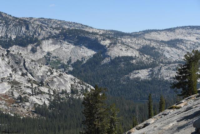
Whenever the forest opened up enough we could see the huge granite monoliths rising over the little creek we were walking along. Granite is granite - but a closer look would often show the evidence of the geological forces that had shaped the mountains we were walking on.
In the photo below - a white dike running perpendicular through the gray granite mass.
We were walking uphill for well over an hour before finally meeting Murphy Creek. The slope leveled somewhat and we took our first break, enjoying our time in Nature away from our daily worries.
It was there, along the creek, that we found a straggling lupine still in bloom.
 |
| Lupine (Lupinus sp.) |
We kept going up higher and higher and even though the slope was mild we were ready to take a longer break. I had originally planned to stop an the first trail intersection but coming to a pretty forest pond we all agreed that it was the perfect place to sit for a lunch break.
Despite the few straggling wildflowers we saw here and there, everything else was way into fall by that time. Evidence for that were apparent all around us. It shan't be long before the first snow now.
 |
| Autumn gold |
The continuous climb started to have its effect on us and our little company slowed down. It was a good thing that the view was now open wide because how can one be concerned about the pace when walking in the level of the sky?
The skyline was jagged with tantalizing peaks, many of which require special skills to summit.
 |
| View southwest: Mt. Clark (11,400 ft), about 11 miles as the crow flies, image taken in full zoom. |
There in that little meadow I saw the farewell greeting of the summer of 2016, now all but gone into memory.
 |
| Fleabane (Erigeron sp.) |
We turned the curve and saw a glitter far below - Lake Tenaya where we had started and where we would finish our hike.
 |
| Lake Tenaya |
Still, they were very pretty to look at, and seemed healthy and thriving.
 |
| Sierra Foxtail Pine (Pinus balfouriana) |
It looked like something that, given enough time, we would have had fun climbing.
A few meters up that wall grew a stunted and deformed foxtail pine. It must have been at least 200 years old, likely older, all gnarled and twisted by the elements, and still much alive and vibrant.
It reminded me of some of the Bristlecone pines I've seen in the White Mountains earlier last summer.
 |
| Sierra Foxtail Pine (Pinus balfouriana) |
There's granite and there's granite. Most if the granite we were walking on was the grainy type composed of bits of quartz, white feldspar, and black biotite. Every now and then, however, we saw other rocks which, while made of similar mineral composition, were obviously formed under different conditions. My geology is lacking but, hey, there's room for growth here :-)
 |
| Not the usual Yosemite Granite |
Two men passed us quickly from behind. They didn't have backpacks, but each carried an armload of dead and downed wood and they told us that they were camping by the lake. There was no collection of firewood there, so they went down to where it was ok to collect to gather their wood. Encouraged by their promise that the lake wasn't far off we continued on with renewed spring.
Pines are very beautiful trees, and the pines of the High Sierra are the most beautiful of all. Even their old, used up cones are pretty.
And wherever there are pine nuts there are those who would eat them. We encountered a small squirrel that was hopping about between the rocks, careful to keep out of full sight. I was happy to see a completely wild squirrel that observed people as a threat and not as a potential food source.
 |
| Golden-mantled Ground Squirrel |
 |
| Tresidder Peak |
 |
| Cathedral Peak |
 |
| Where did the sun go? |
We curved with the trail and suddenly we were walking through a red carpet - the best show of fall the Yosemite forest put up (I won't say for us but we certainly felt it was). The photo doesn't do it justice at all - the red was so intense and lovely! Despite being pressed with time we stopped to appreciate this beauty and to take photos. It wasn't a large area but it was definitely a highlight of that hike.
 |
| Red mats of Dwarf Bilberry, Vaccinium cespitosum |
 |
| May Lake |
 |
| Inch Worm |
 |
| The sun hiding behind Mount Hoffman |
At last, we were going down hill. Not so noticeably at first - at the south tip of May Lake we came upon a resort of permanent tents, huts, and other structures. The resort was already closed for winter but there were quite a few people hanging around there. Some were day hikers who had stopped to use the still available restrooms and water spigot, and others were obviously planning to stay for the night near the lake. We didn't stay there more than we needed to - we had 3 more miles to go.
As we left the resort area the trail dropped into a steep grade. All that altitude we had slowly gained for eight long miles we were now about to lose in three.
We were still high up when we cleared the trees and the view opened up to the south. At last we could see and appreciate Mount Clark in all its grandeur. That peak is now on my agenda for next summer.
 |
| Mount Clark |
From the distance we were at, however, we could barely see the line of cables with a pair of strong binoculars.
 |
| Half Dome zoomed close |
Indeed we had to rush, for the light was quickly fading.
 |
| Last sun rays in the tree tops |
Before long darkness was upon us. The trail from the parking lot to Tioga Road used to be an old road too that had fallen in disrepair, but was still wide and clear and easy to walk on, so I wasn't concerned about getting lost. We could still see the way clearly even in the dim dusky light.
My camera was sensitive enough to capture some photos even in that poor light, so I snapped a few shots on the stride. Some of them even came out in focus :-)
Finally we were in clear view of the road and of Tenaya Lake. Above the lake, Tenaya Peak was still painted with the last light of the dying day. We halted to savor the moment, then rushed down towards the road.
 |
| Sunset over Tenaya Lake |
We crashed wearily in the car. What ever plans we had for the rest of the evening were now moot. We filled up on water at Tuolumne Meadows and drove back to our campsite where we lit a fire, had dinner and crashed into our sleeping bags (after drowning the fire, of course).
I loved that loop trail. I wish that we had had more time to do it. That we wouldn't have had to rush our hike. But it was my first Yosemite hike away from the usual and expected in a long, long while, and I cherish it. And from that trail I've seen the potential of many, many more to come.
Thank you, Pappa Quail, for identifying Mt. Clark for me! Next summer we'll see it from up close :-)


Beautiful hike :-)
ReplyDeleteYou're lucky to be able to get there often...
I am! I am very lucky indeed! I should go there more often ...
DeleteLooks Beautiful :)
ReplyDeleteVery beautiful indeed :-)
Delete